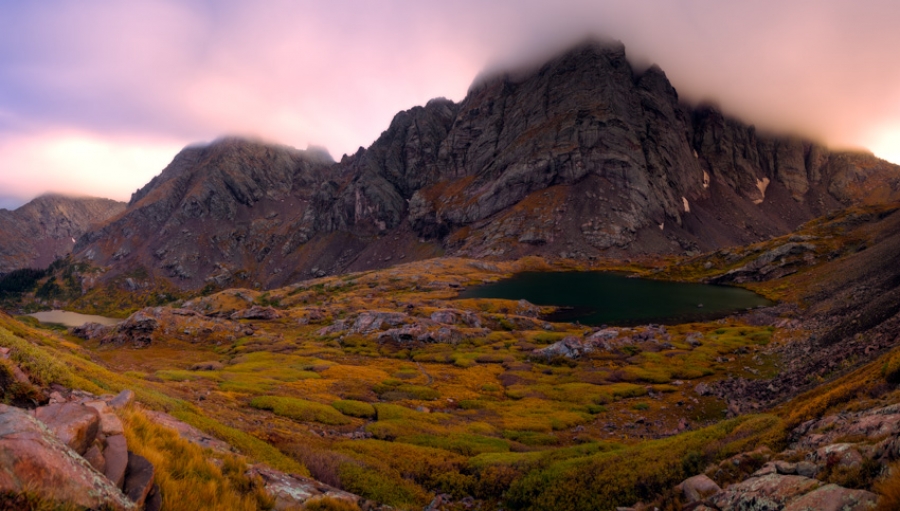
What an adventure! Never in my dreams did I think I would ever conquer the mighty Crestone Needle and Crestone Peak. After seeing them from two years ago, I figured I’d never have the testicular fortitude to attempt them. Here is Crestone Needle and Crestone Peak (right of Crestone Needle) as seen from the summit of Humboldt.
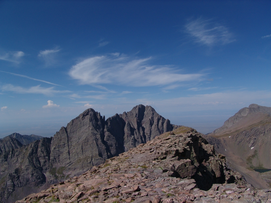
Alas – when I read my friend's itinerary for his mountain climbs back in April 2009, I saw the Crestones and decided it would be the best chance I’d get to give them a shot…
My friend Terry picked me up from my house at 5 AM on Thursday morning. We headed out for the long journey towards Buena Vista and eventually the small town of Crestone. The route Terry chose for these climbs was a rarely traveled backpacking trail from the west side of the mountains, up the Cottonwood Creek drainage.
The trailhead is on private property owned by the Manitou Foundation, a religious organization set-up to provide property easements for the purpose of religious worship and pilgrimage. Earlier this month, Terry was able to obtain written permission from the Manitou Foundation to park on their property and begin up the trail towards Crestone Needle and Crestone Peak. Below is a map of the route we ended up taking on our adventures.
We arrived at the trailhead around 10 AM after driving around the area looking for the proper place to begin our hike. Due to the fact that this trail is off-limits to the general public, trail maintenance has not occurred on the trail for many years. The trail was very primitive and at many points in our day we lost the trail due to having to hike around heavy deadfall (basically a ton of dead trees blocking the trail). In addition to the trail being very faint, the trees in this forest were covered in heavy moss and spider webs. The spider webs were getting all over us and getting in our face, making the hike up quite the annoying yet adventurous journey.
This was quite possibly the most intesnse bushwhacking, insane trail I've been on with a heavy backpack. At many times, the route was not visible at all, and the trail is lost easily. Take caution! The trail led us to a very pristine waterfall, one of many.
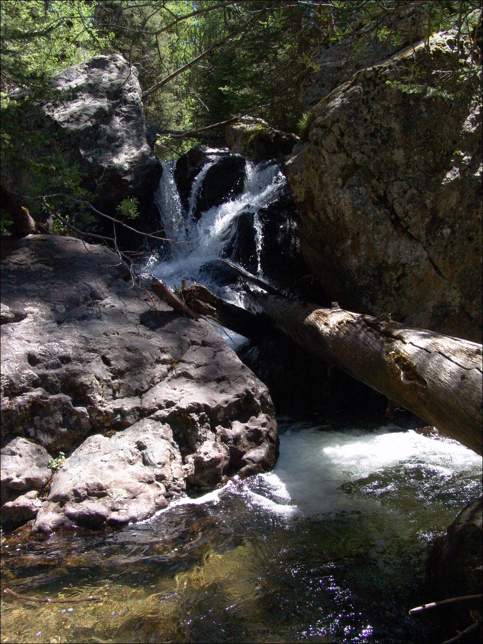
We scanned the area constantly for cairns in order to find our way. Unfortunately, a set of cairns led us up a very steep and rocky section that lasted for at least thirty minutes, but allowed for us to avoid some wet slab-like rocks that would have presented their own unique challenge. The rocky section was quite difficult given the fact that I had a 60 pound backpack on.
During our trek up the trail, I kept a close eye on my GPS, which has the TOPO! maps from National Geographic synced up with it. I monitored our position to ensure we were heading the right direction. As we approached a split in the trail that was critical to our route, I became nervous as the GPS showed our direction
heading up the wrong trail on several occasions. This resulted in Terry and I doing some bushwhacking through some heavily wooded areas and up a very steep gully towards our proper destination. Finally, our bushwhacking paid off when we found the proper trail leading up towards Cottonwood Lake
(where we had tentatively planned on making camp). Terry noticed that the trail we had found was the very trail we had left to do the bushwhacking, so it would seem that the trail splitting to the southeast was never revealed to us. After a very short time, we came to a very ideal campsite underneath a waterfall at the base of a large boulder field. At this point we had been hiking for 5 hours and decided we would camp here.
Here’s a nice 360 view of our campsite.

After setting-up camp, eating, and taking in some pretty sweet views of the waterfall right next to our camp (pictured below), I decided to take a quick hike up to see if I could get a sneak peek at Crestone Needle. (pictured below the flower). Seeing Crestone Needle brought some anxiety mixed with excitement to me, and I began thinking about the difficult climb we were about to attempt.
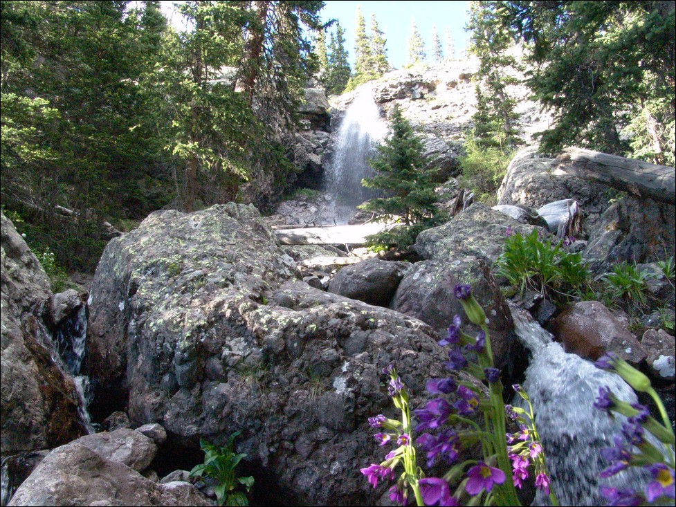
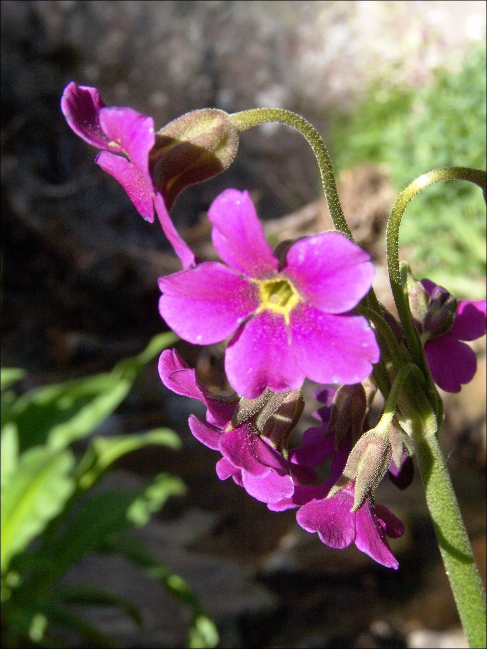
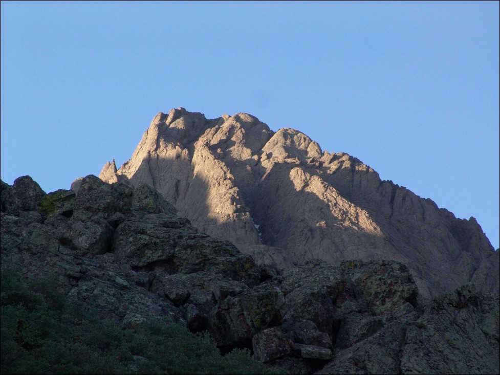
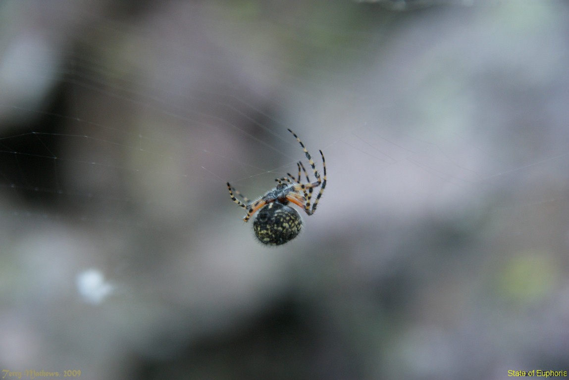
Terry set his alarm for 5 AM, which came way to soon given the level of exhaustion we had reached during our backpack up that crazy trail. We quickly ate breakfast and started up the steep trail above our campsite towards Cottonwood Lake. The trail was once again poorly maintained and poorly marked. We followed some cairns here and there up a large basin full of willows, spiders and steep waterfalls. Terry got a cool photo of one of ths high-altitude spiders we saw:
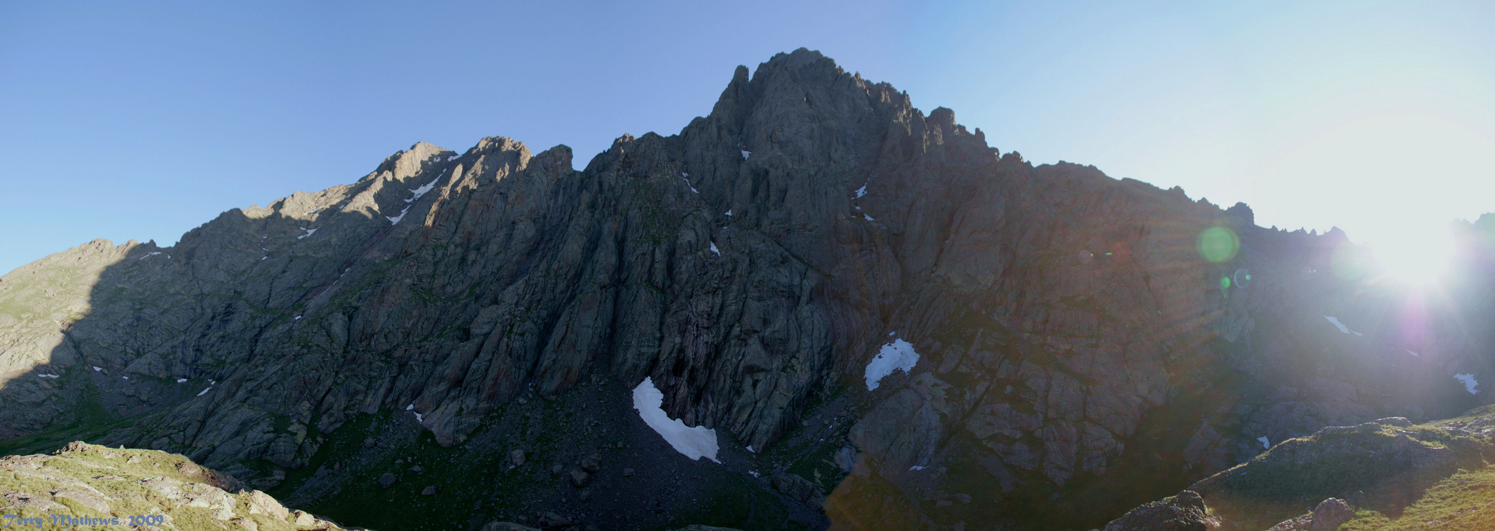
We decided to head east once we were quite high in the basin below Crestone Peak and Crestone Needle. About 3/4 of the way up the basin my daypack decided it would break, so I was forced to jerry-rig it so that it would still work. The shoulder strap ripped from the hip area, so I tied it to another strap coming up from the hip belt. Whatever works! We reached the top of the basin and realized we were quite high above the lake and that we would need to down climb to the trail leading up to Broken Hand Pass. Unfortunately the photos I took from this vantage point did not come out as intended; however, Terry got a great shot of the vantage we had of Crestone Needle and Crestone Peak:
Once we down climbed to the trail leading up Broken Hand Pass, we were able to get to the far east area of the basin and head up towards Broken Hand Pass. Terry and I felt sorry for the climbers that chose to climb these two mountains from the other side of the pass, as they would be required to climb up it twice for each mountain – ouch!
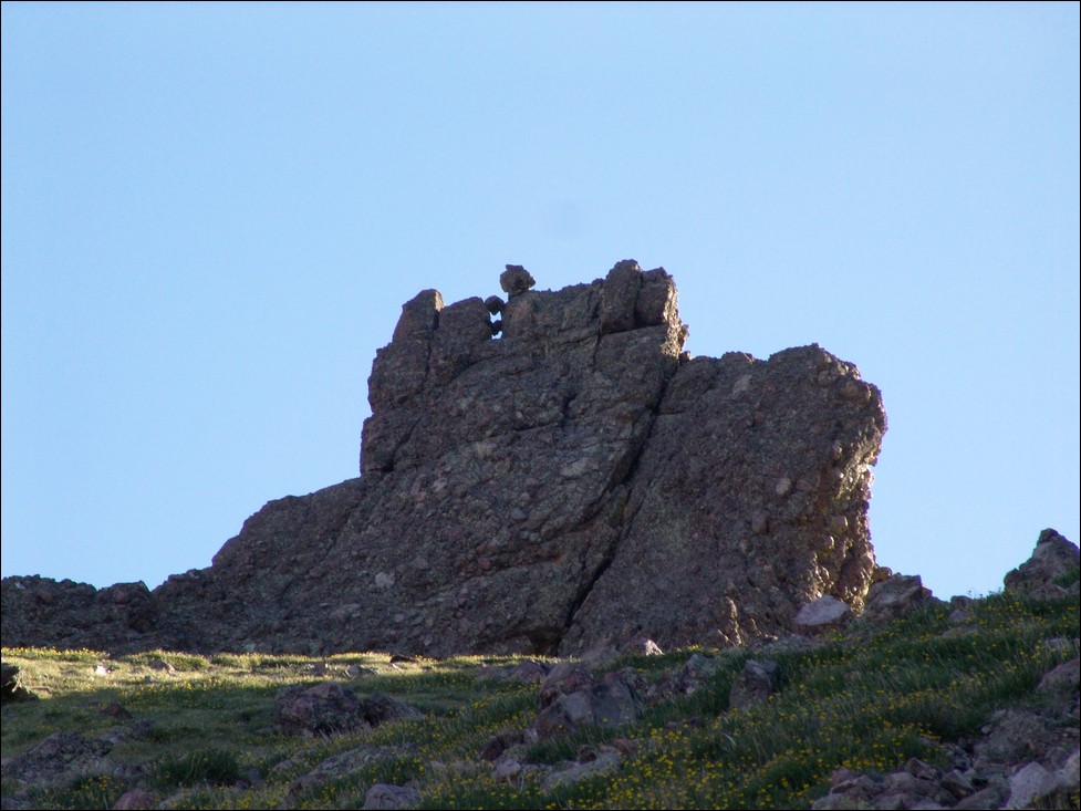
Climbing up Broken Hand Pass, one does not have to stretch their imagination too far to see why it is called Broken Hand Pass, as you can see a view of some rock that looks exactly like a closed fist that is next to what appears to be a second arm that has the hand broken off of it.
At the top of the pass, a large pulley system is set-up, with ropes and an intricate system of PVC pipes. Terry and I did not have much of a clue as to what this was for, but we later found out that day that the Rocky Mountain Field Institute uses the device to hoist large rocks from the top of the pass down the north side of the pass to fix the trail to prevent erosion.
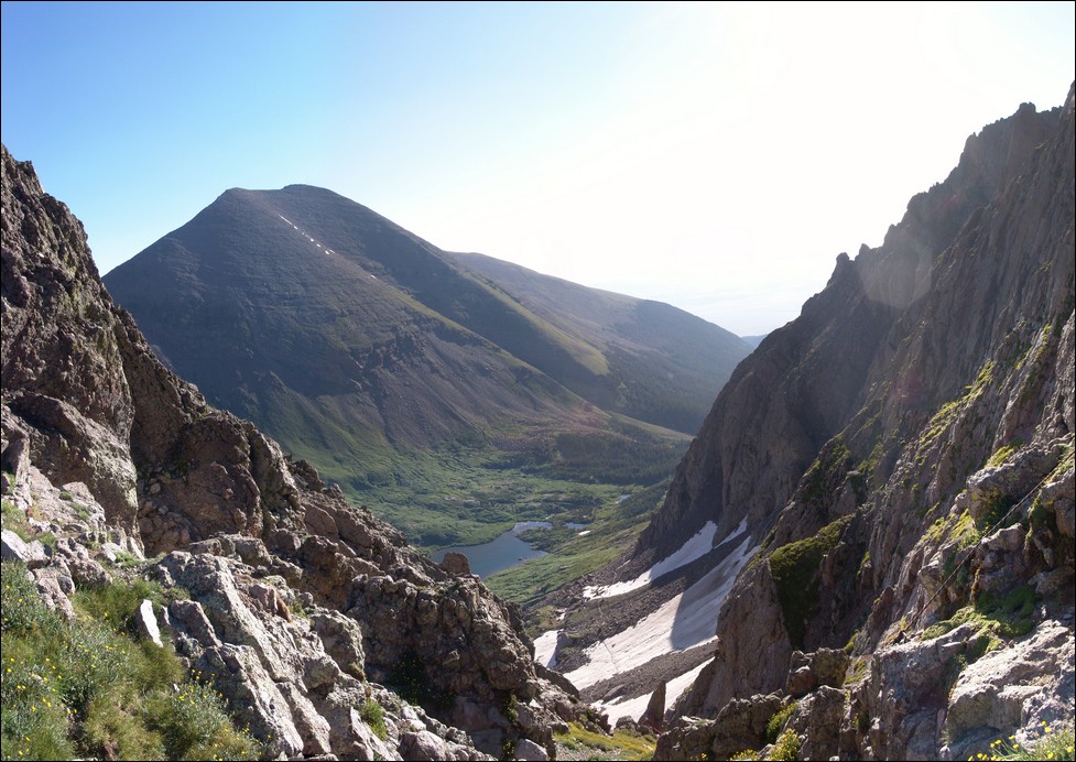
From the top of Broken Hand Pass, we were able to check out the lower South Colony Lake and Humboldt across the way. Here’s a nice panoramic photo of that view:
At this point, Terry and I decided it was a good time to don our climbing helmets, a first for me in all of my mountain climbing adventures. From here we could see Crestone Needle looming above us, taunting us with its intimidating rock formations that we would be forced to carefully scale.
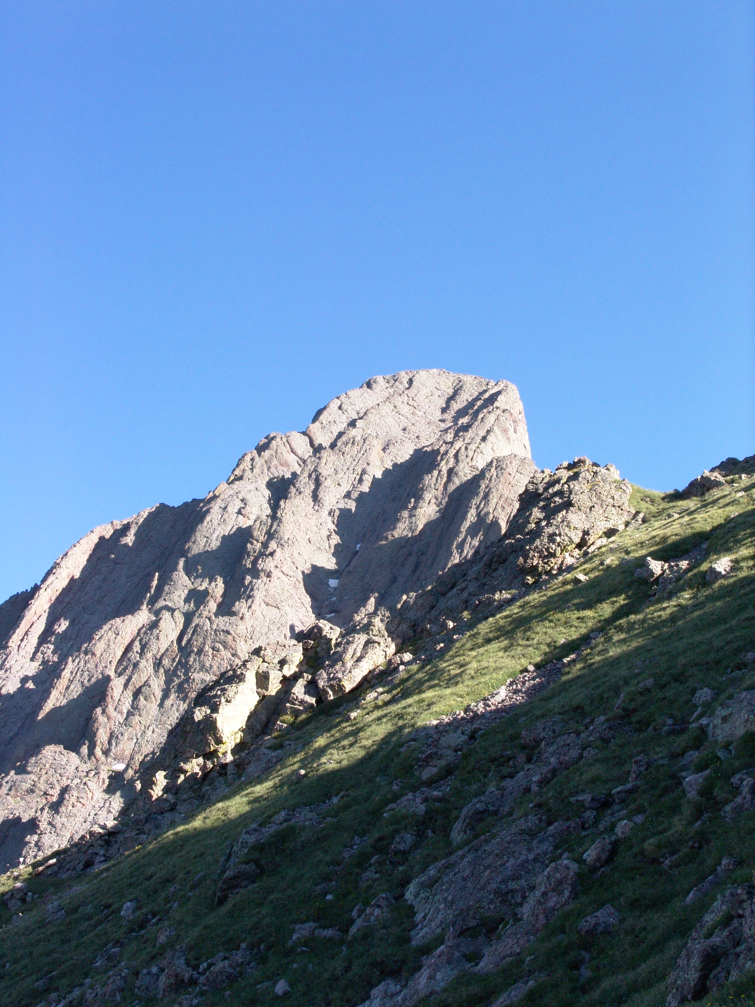
You can see two distinct gullies, one directly facing us, and another to its left, obscured by a rib running the length of the Needle. The standard route up the Needle takes you half-way up the east gully and then over the rib to the west gully and up to the summit. It sounds a lot more simple than it really is.
We followed the well-established trail over to the base of the east gully and started up. The rock on Crestone Needle is most impressive, a climber’s dream.
The entire mountain is made up of a mixed conglomerate of granite, quartz, and other rock. The rock had numerous large rocks cemented together making it quite easy to locate hand-holds and foot-holds for climbing. Here is a view up the east gully.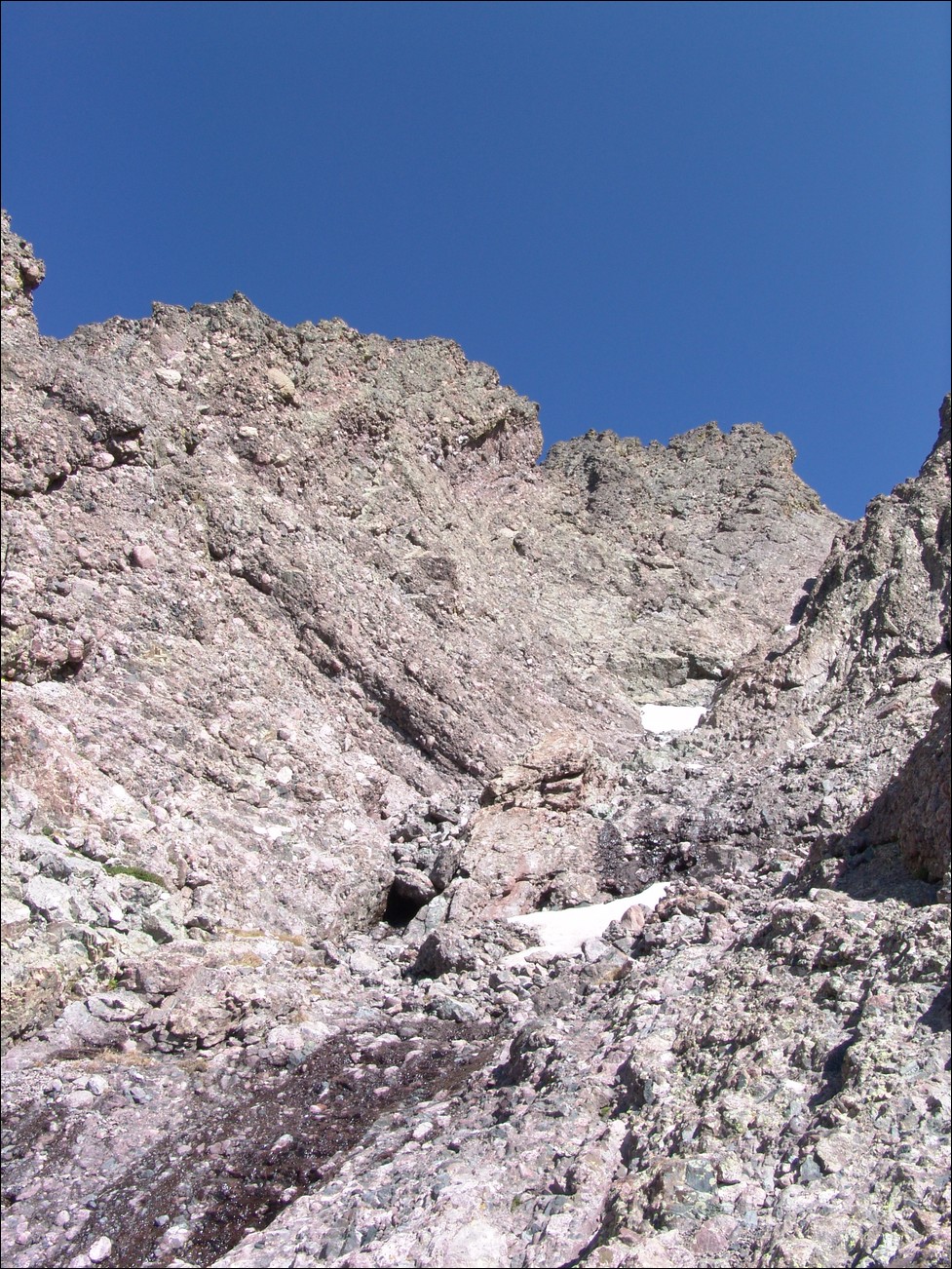
Terry and I were quite pleased with how solid the rock was and how stable the route seemed to be.
The hard part of climb was finally upon us – the transfer from the east gully to the west gully. The east gully takes you to a large dihedral with a large amount of snow at its base. We were forced to cross right at this snow over to the other side of the gully. This required a very unstable move by which we were forced to smear ourselves to the side of the wall, reach up, and push off and up at an angle to the more stable ledge just above the end of the dihedral.
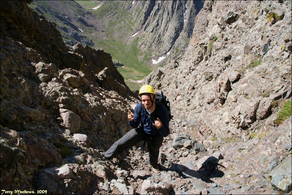
We scrambled up the side of the gully up to a notch leading over to the west gully. Here is a shot of me climbing up the west gully courtesy of Terry. You can tell that this was not a good place to be for someone that is afraid of heights.
I was able to take some nice shots combined into pano of the gully looking down towards the basin we came from to give you a good idea of the steepness of the climb.
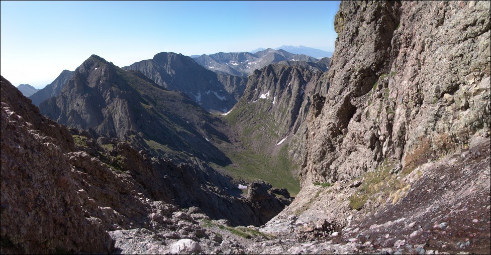
After climbing up the west gully for about 600 feet, we reached the summit block of Crestone Needle! I was very eager to gain the summit, so I passed
Terry and celebrated on top.
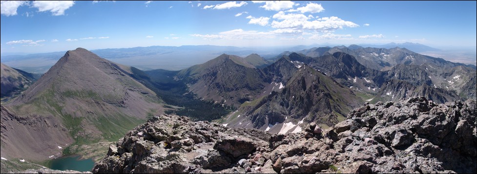
This was probably one of the most invigorating climbs of my life. Here’s a 360 degree panoramic photo from the summit. Apologize for some image quality issues...
I have since figured out how to use my camera... Colony Baldy and Humboldt can be seen on the left to the left of Terry. The southern Sangres can be seen in the distance including Blanca, Little Bear, and Ellingwood Point and of course the Sand Dunes National Park. At right are Crestone Peak with Kit Carson, Challenger Point, and Kat Carson to its right. Finally, Mt. Adams can be viewed at far right.

Here’s another pano to the north and northeast showing Crestone Peak, Kit Carson, Challenger Point, Mount Adams, Colony Baldy, and Humboldt.
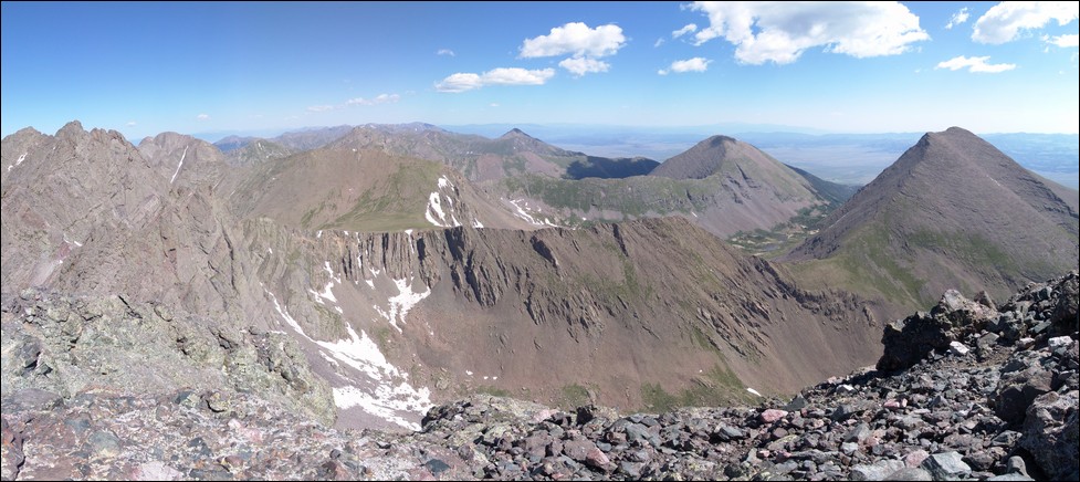
And another view north and northwest of Broken Hand Mountain, Milwaukee Peak, Pico Aislado and of course the Southern Sangres.
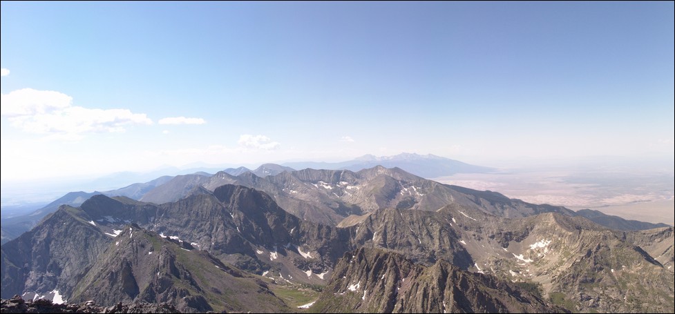
And yet another view of the upper South Colony Lake beneath Humboldt and with the Sangres to our south.
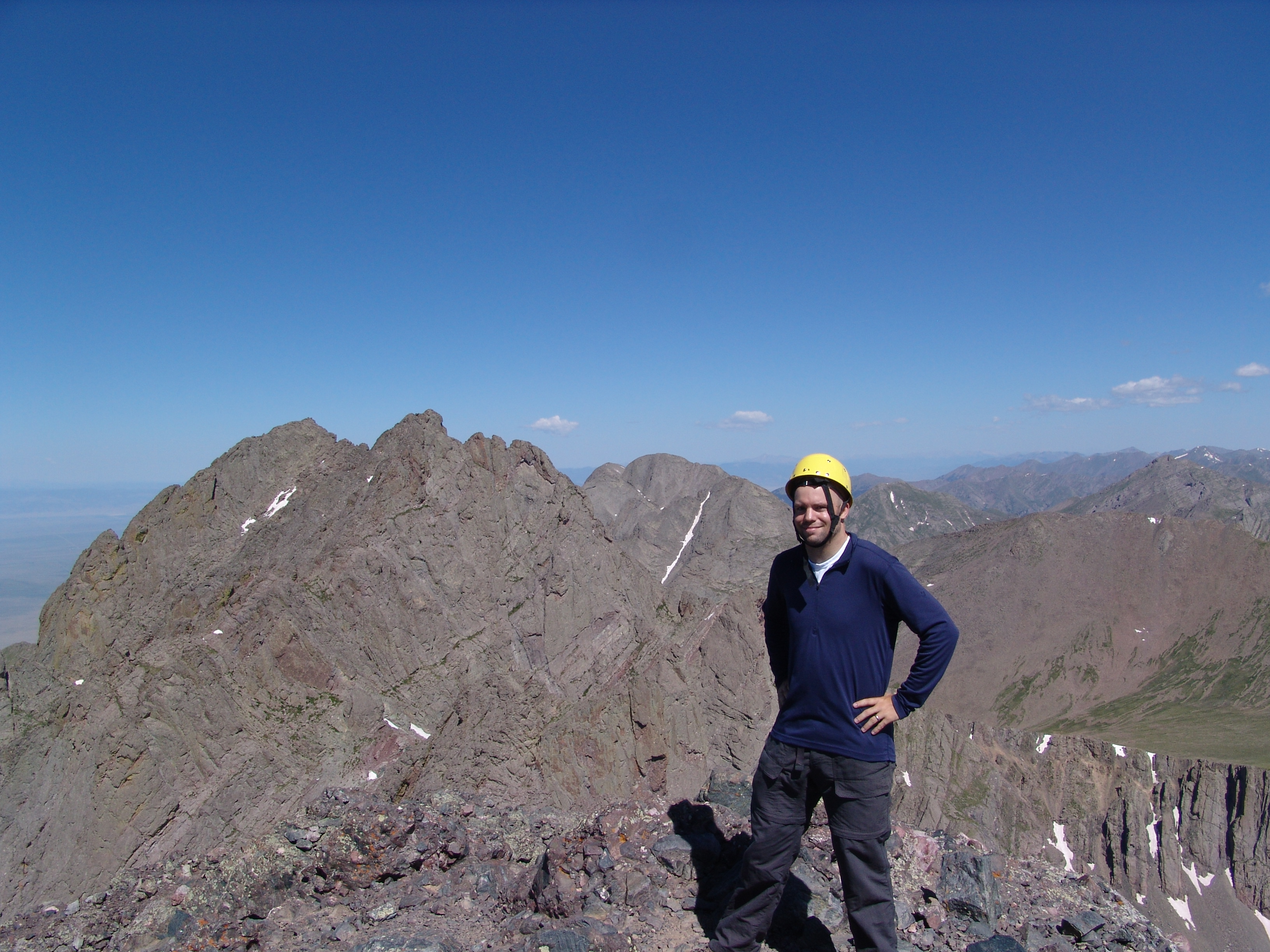
Terry was nice enough to take a shot of me on the top, with Crestone Peak behind me.
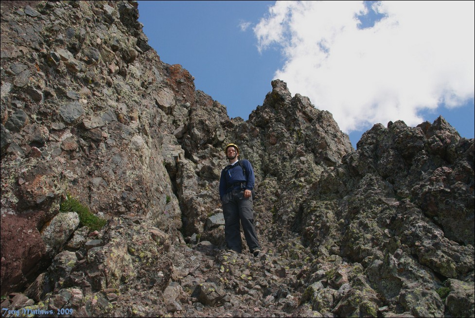
After spending about 30 minutes on top, we decided to head down. It was pretty cool having the summit of a 14er to ourselves. On the way down,
Terry snapped this shot of me looking up the west gully.
We were able to reach the bottom of the gullies without incident. The rock was super stable and I really can’t say enough good things about how fun this climb is.
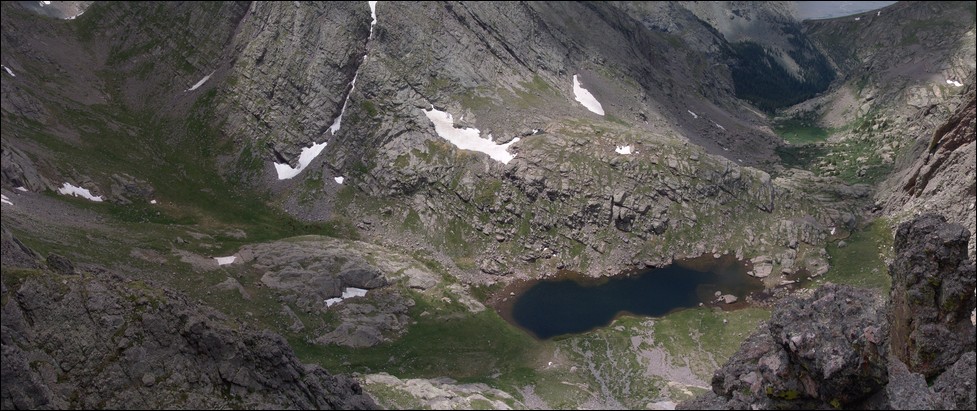
From the start of the gully section, I went over to a spot where I was able to look down upon Cottonwood Lake and the basin we climbed up from.
We climbed up from the basin on the right.
We got back down to Broken Hand Pass, chatted with the Rocky Mountain Field Institute for a bit, and headed down towards the lake. We passed a few people that had been on Crestone Peak and learned that we would indeed need our ice axes for Crestone Peak. Due to how tired we were, we decided that we would have to do Crestone Peak on day 3. We got near the lake and I decided to take some shots for this pano of our surroundings.
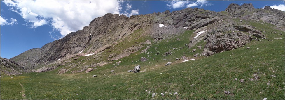
On the way back down the basin towards our camp, I decided to build some cairns to ensure we would be able to find the best possible route up the trail again in the morning. We made it back down to our campsite, ate, and went to sleep. We were both really tired and decided to get up an hour later the next day so that the sun would have more time to soften up the snow on Crestone Peak for our ascent.
Day 3 – Crestone Peak. We woke up at 6 AM and headed back up the basin towards Crestone Peak.
We followed my cairns and made great time, reaching the base of Crestone Peak at about 7:30 AM. There was a couple of groups ahead of us in the “red gully,” the standard route up the peak. Due to this, we knew that we would have to be cautious of rock-fall from above during our climb up.
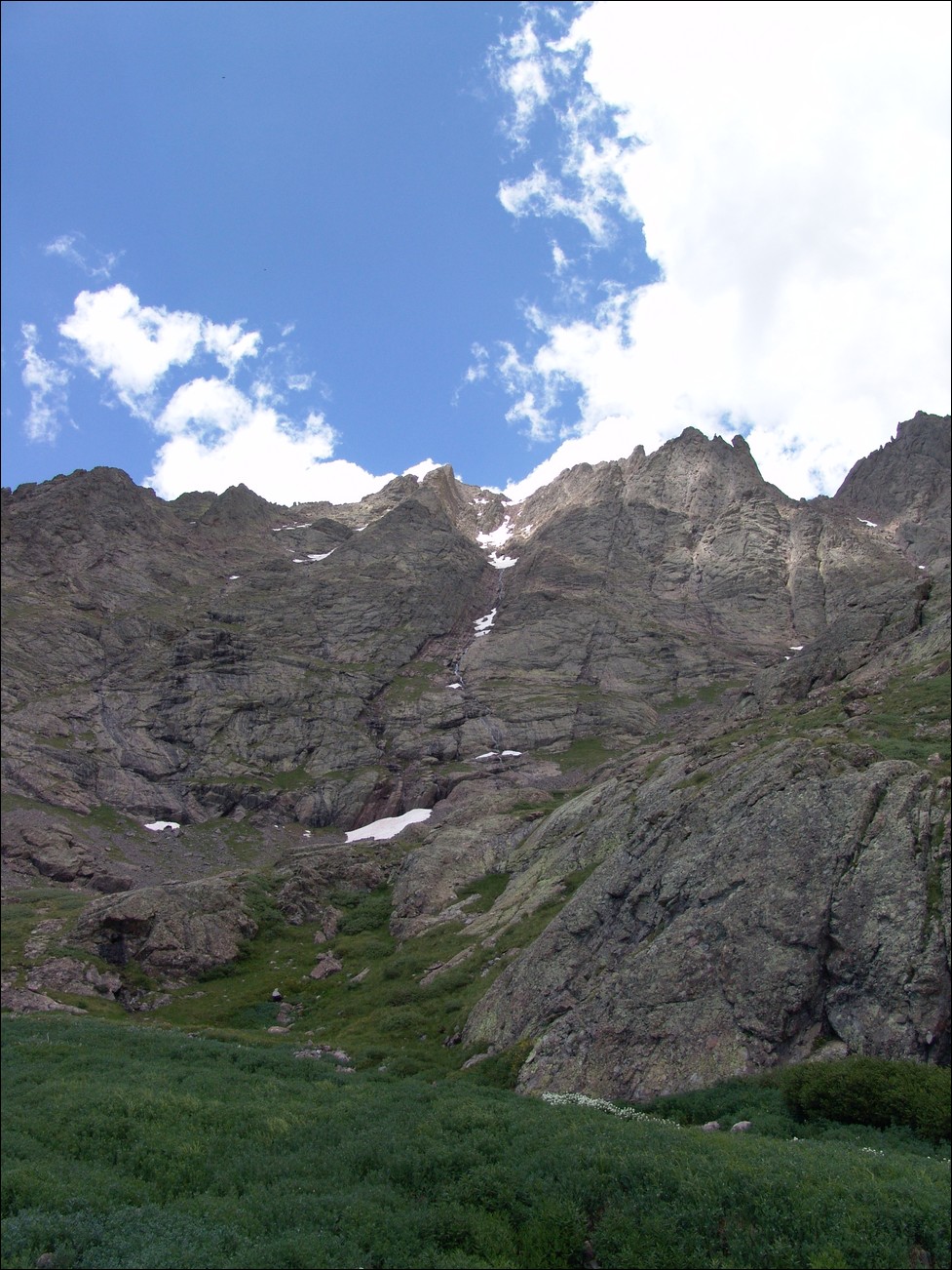
At the base of Crestone Peak, I took some photos for this pano. You can see the red gully running right up the middle of the mountain with snow lining much of the route.
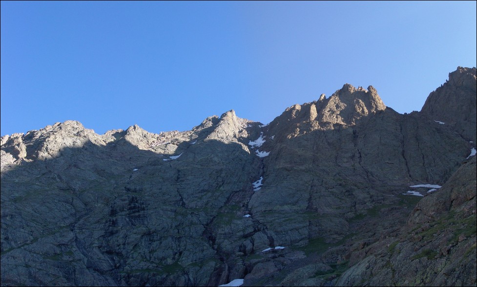
We started up the red gully, which was a tiring and difficult task. Right before we reached the main snowfield near the top, the group above us kicked down a very large boulder and screamed “ROCK!” It spun rapidly towards us down the gully. It passed about 20 feet away from us and Terry yelled below to warn those behind us coming up the gully.
The rocks falling down from above were fairly common, so we were forced to remain very vigilant going up.
We were able to avoid the first two snowfields but the third and largest we decided to go right straight up. We got out our ice axes and began our ascent,
with a group on our heels. Terry kick-stepped up the mountain slowing, driving his axe into the snow in between each step. It was an arduous but very fun process.
I was just totally excited to be using my dad’s ice axe for the first time. At the top of the snowfield, we were about 200 feet from the top of the gully. We made it to the top, avoiding the looser rock in this area in order to prevent us from killing those below us.
The pucker factor was not as high as I thought it would be despite the steepness and exposure, as seen by this shot Terry took:
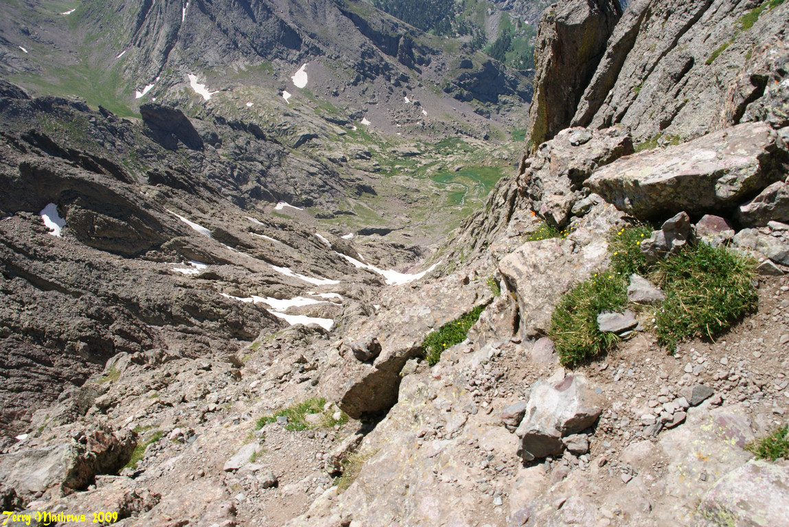
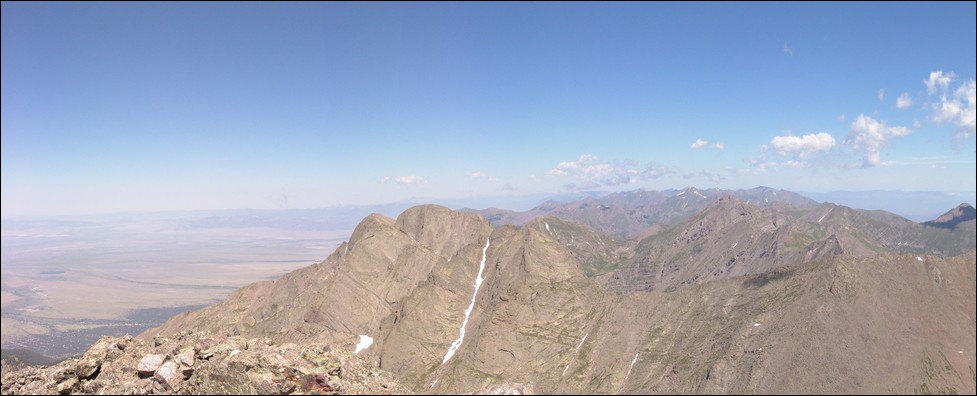
Once at the saddle at the top, it was a quick scramble to our left to the summit. From the summit, you gain pretty sweet views of Crestone Needle pictured at left of this pano.
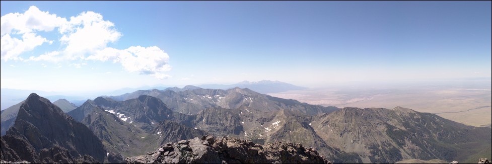
You also get some nice views of Kit Carson and Challenger, which would be our goals for next weekend.
And of course the obligatory summit pose:
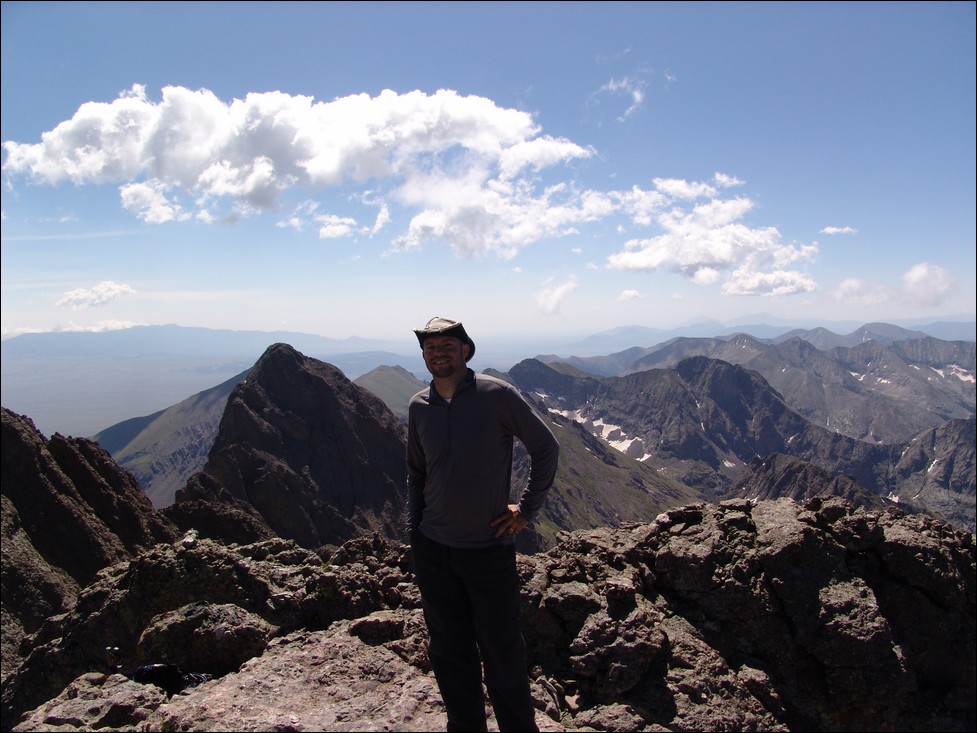
We spent almost an hour on top, most of which was in the company of several other climbers. We decided to head down as the clouds began to build near us.
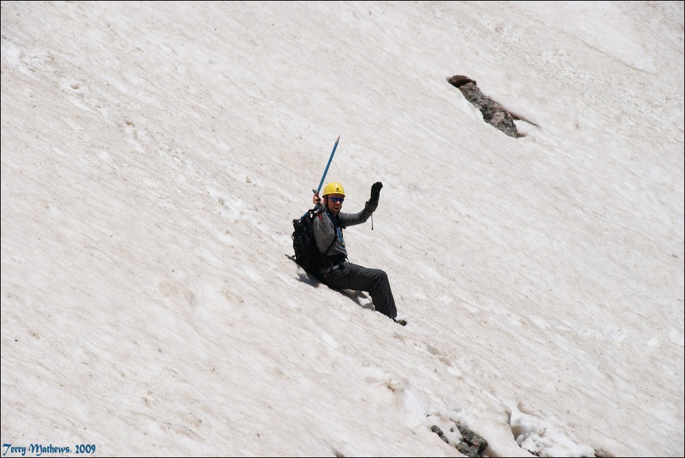
We decided to decent the snow, and I wanted to go all the way down the snow, while Terry departed the snow as soon as he was able. I really felt like the snow as soft and that there
was no risk of falling. I felt pretty comfortable about going down the snow, especially with my new best friend – the ice axe. Here’s a picture Terry took of me having a blast going down the snow.
We passed several groups going up and then stopped at the bottom of the red gully and beyond to take a photo of the basin, the peak, and the red gully above.
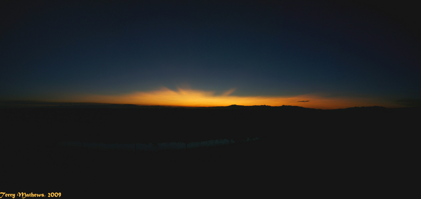
We slogged back down to our campsite and decided to pack-up and head back down the 3.5 miles back to Terry’s truck. It took us 3 hours to reach his vehicle at 8 PM and we left for Colorado Springs. Terry got some awesome shots of the sun setting to our west as we drove off into the sunset.
What a great trip, one I will remember for the rest of my life!


