Displaying items by tag: Star Trails
Maroon Peak and Pyramid Peak - finishing a goal 27 years in the making
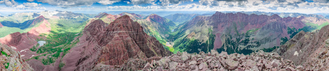
Two amazing summits; 11,060 ft. elevation gain, 21.5 miles... and a whole lotta' fun.
Introduction
Last year, I had plans to complete my long quest to climb all of Colorado’s 14ers. I had the calendar all lined up, trips planned, gear ready and my legs were in great shape. If all went to plan, I was to finish on Windom Peak after a long summer of knocking out some of Colorado’s toughest peaks. Unfortunately, as is so common in this sport of mountaineering and peak-bagging, those plans were interrupted. An unsuccessful attempt on Snowmass Mountain in June left me with one less weekend available. A complete re-arrangement of the calendar ensued and for the third straight year, my plans of climbing Maroon Peak and Pyramid Peak were delayed. However, this worked out to my advantage – as I had always dreamed of completing the 14ers on Maroon Peak and then on Pyramid Peak, which purportedly is one of the most difficult mountains as well as one of the most rewarding summits. Finally, my time had come to complete this incredible journey that started when I was six-years-old – the completion of the 14ers. Lots of hard work over the past 3 years have culminated in this moment.
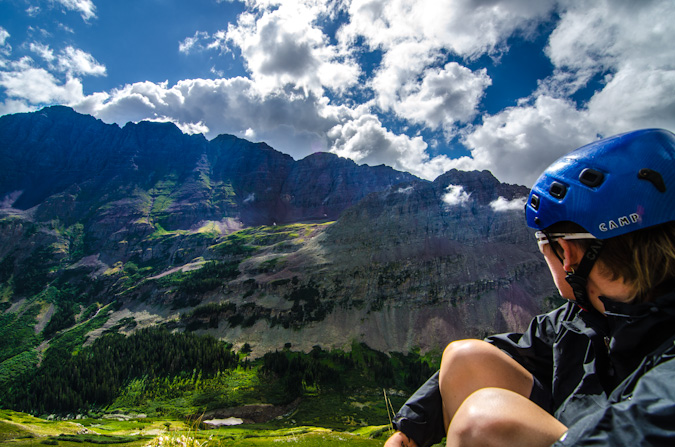
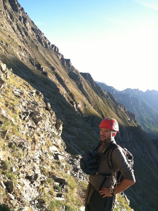
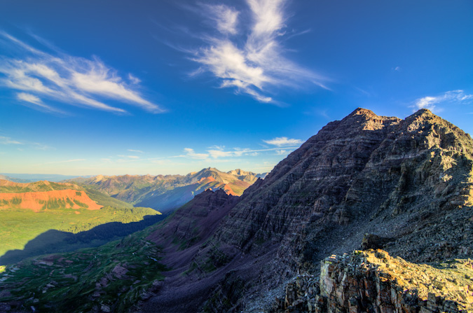
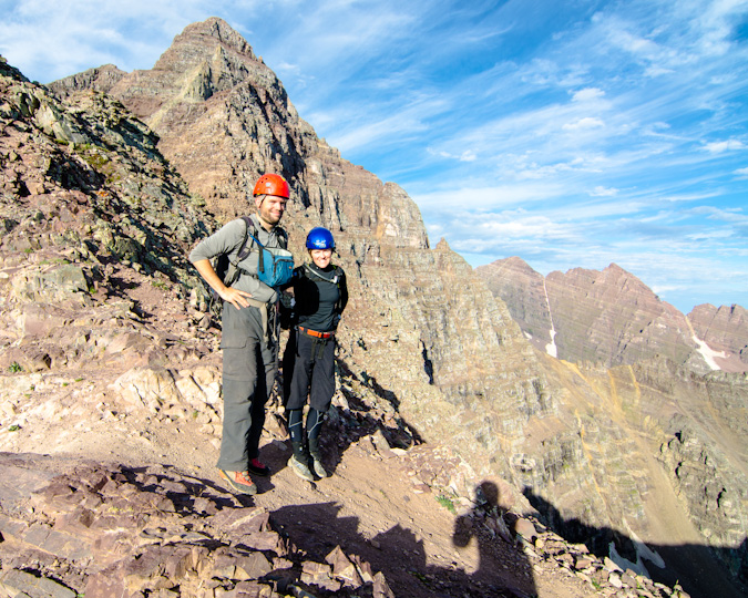
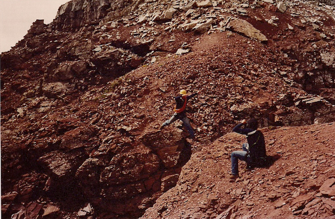
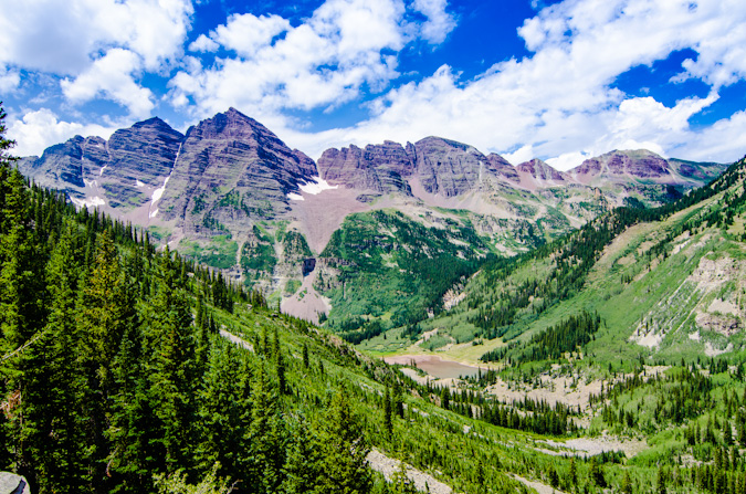
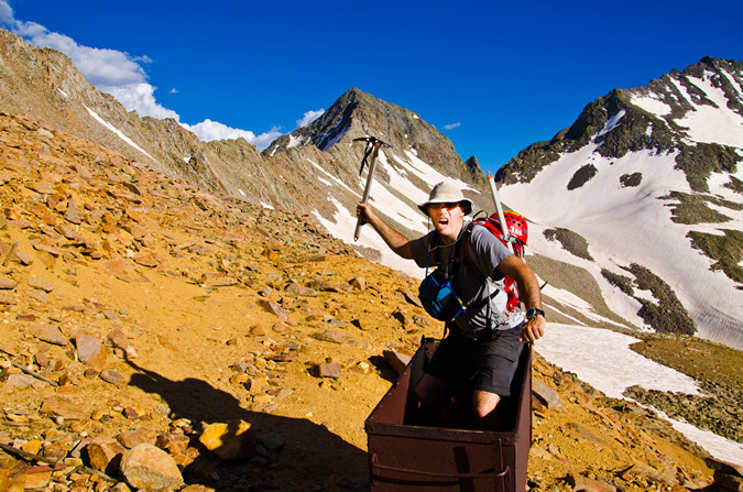
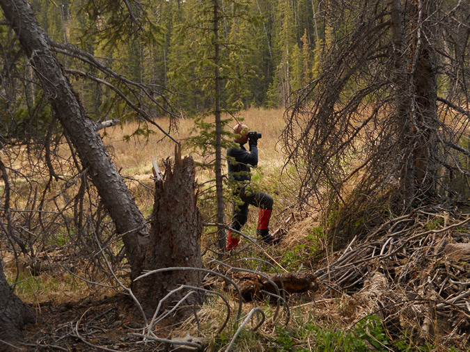
Ever since I was a child, I recall being mesmerized by the Maroon Bells, for both their scenic wonder and beauty and their dangerous mystique. My dad, Ray Payne, climbed the Bells back in August 1987 and returned home regaling his conquest with stories of incredible mountaineering feats (it must have sounded insane to my then 9-year-old ears) and near-death encounters with “The Deadly Bells.” Here's an old-school shot of my dad (yellow helmet) asending Pyramid Peak, rope in tow.
Per Wikipedia (and per my own witness of the sign), the term “Deadly Bells” refers to a U.S. Forest Service sign on the Maroon Lake access trail which calls the mountains "The Deadly Bells" and warns would-be climbers of "downsloping, loose, rotten and unstable" rock that "kills without warning". Sounds like my kind of mountain! Unlike other mountains in Colorado, the Maroon Bells are composed of metamorphic sedimentary mudstone that has hardened into rock over millions of years. This mudstone is weak and fractures readily, giving rise to dangerously loose rock along almost any route. This same mudstone is responsible for the Bells' famous and distinctive maroon color. The Bells got their "deadly" name in 1965 when eight people died in five separate accidents. Since then, many climbers have perished while attempting these dangerous peaks, including Spencer James Nelson in 2010.
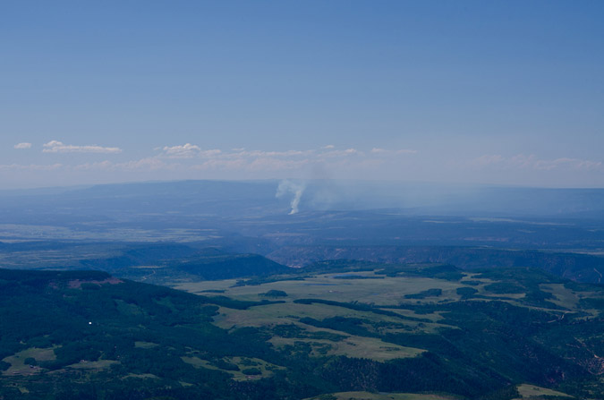
In fact, just before leaving for this trip, I had learned that there was a missing hiker on the Maroon Bells. This news had cast a shadow on the trip and I had hoped he was found safely. The hiker was a New York City Paramedic named Lenny and had not reported to work. It later turned out that he took a fall and perished on North Maroon and was found the very same day we arrived.
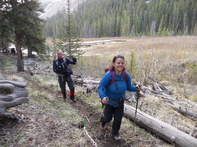
Given the danger factor and overall awesome factor surrounding the fact that I was planning to complete the 14ers on these deadly mountains, I was quite nervous the week leading up to this trip. I think I had started packing four or five days before the trip, which is uncommon for even me and my neurotic trip planning. To make matters even worse, the trip had quite a few loose ends on the logistics side of things – originally I had planned to head-out Tuesday night with my climbing partner, Sarah, we’d climb some mountains, and then our other climbing partner, Ethan, would join us at Crater Lake on either Saturday or Sunday. Then a few wrenches got thrown into the mix – Sarah found out she had to work a cycling event on Sunday, and Ethan would be unable to join us on Friday. To make matters even more interesting, my Jeep Wrangler came up with some mechanical issues the day before we were supposed to leave. It was not looking good for team Payne. I called Sarah and we finally worked out all the details. Ethan would not be joining us after-all, and Sarah could drive. Crisis averted.
I decided to backpack using my Osprey Talon 44 instead of my regular backpacking pack – the huge and insane discontinued Dana Design Terraplane - a monstrous 95 Liter pack. Instead, I opted for the smaller 44 Liter pack so that I would force myself to take less gear and food and hopefully save some damage to my knees, which were still recovering from the massive 45 mile trip Sarah and I took last year to the Chicago Basin. To round things out, I opted to also purchase a knee brace, in hopes of preventing pain and further damage on this trip.
Choosing camera equipment for a trip such as this was a challenge, especially given the fact that I wanted to keep my over-all weight low without sacrificing my ability to take great photos. So, I opted to bring my Gitzo carbon-fiber tripod (which is quite solid and somewhat heavy despite being crafted out of carbon-fiber), Nikon D7000, a few filters, a shutter release cable (for long exposures), and two lenses – the Tokina 11-16 f/2.8 and the Nikkor 18-105 VR f/3.5-5.6. This would give me the ability to shoot very wide shots and some versatility with a zoom in the 18-105.
Day 1: The drive in
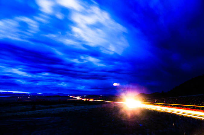
Loaded-up and ready to rock – Sarah picked me up from my house in Colorado Springs at 7 PM. We departed for our speedy adventure up Highway 24, which afforded us some pretty gruesome views of the damage caused by the Waldo Canyon Fire just the month prior. We stopped at the top of Wilkerson Pass to check-out the remnants of a thunderstorm there, hoping to capture some of that footage on film; however, all I was able to get was a long exposure of the cars driving through South Park below.
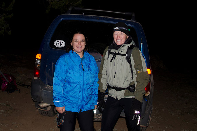
Thanks to some recon data provided by 14ers.com member Bill Wood, I knew our goal was to find the over-night parking lot just below the Maroon Lake trailhead. We found that lot at around midnight and prepared for what would become a very short 4-hour nap in the back of Sarah’s skinny pick-up truck.
Day 2: The backpack in to Crater Lake and an attempt on Maroon Peak
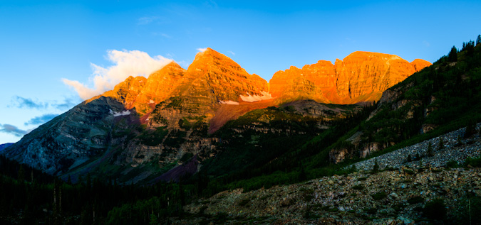
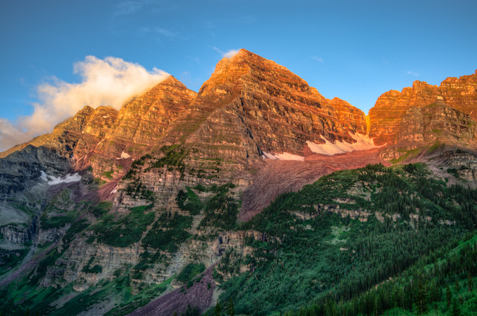
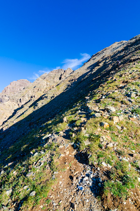
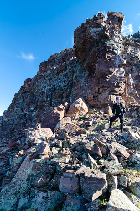
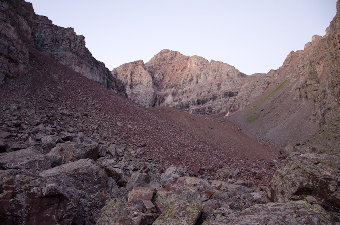
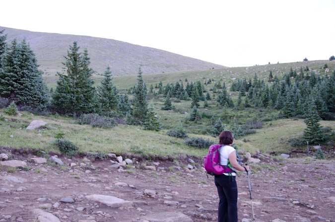
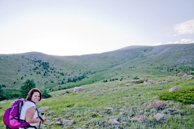
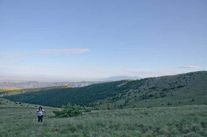
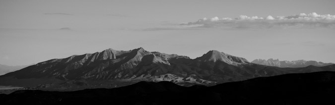
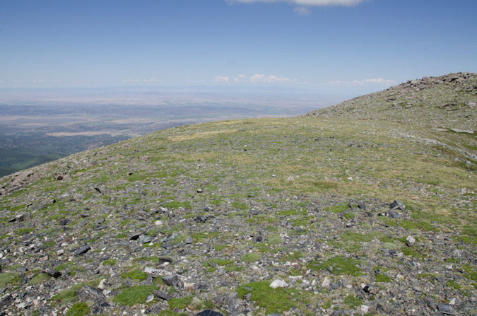
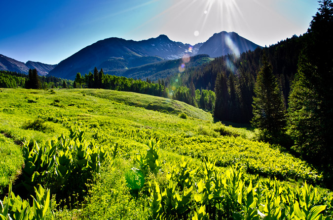
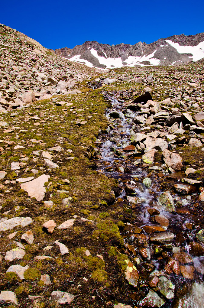
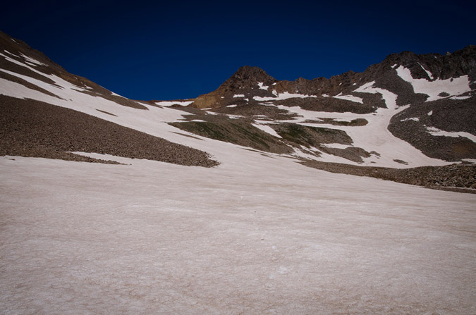
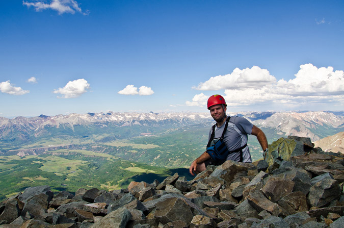
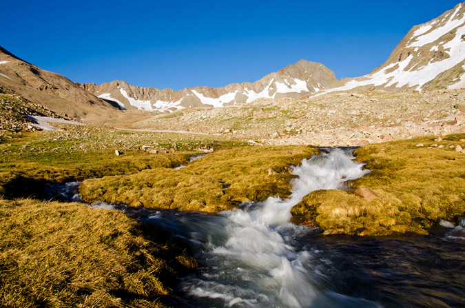
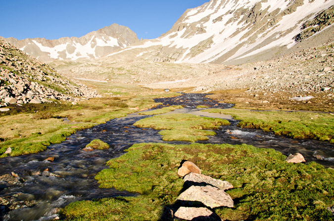
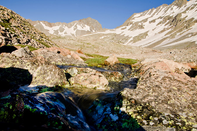
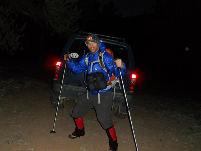
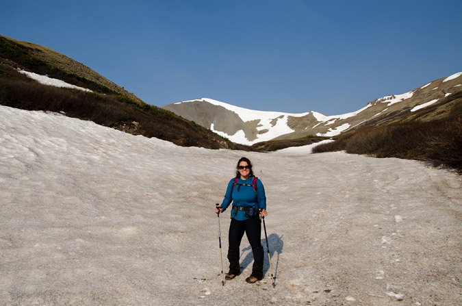
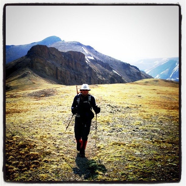
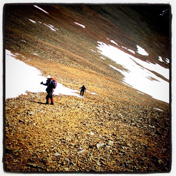
We were rudely awoken at around 3:45 AM by some guys next to us prepping for their hike, who were loud and even making jokes about how we were probably not too happy about how loud they were. Such is life at popular 14er trailheads, even on a Wednesday morning. We debated the night before about our intents and goals for this first day in the area, and decided to wake-up at a reasonable time (4:30 AM) to begin backpacking up into the basin to find a campsite, with the option to attempt Maroon Peak (weather dependent). We rose groggily from the truck and prepared our backpacks, which for me is always an interesting challenge with a large tripod attached. We began the hike in the dark and were passed quickly by a solo hiker looking to tackle Pyramid Peak by himself. Best of luck to that guy. The hike up towards Crater Lake was quite uneventful, and after a quick 1.5 miles, we stopped shortly before sunrise so I could quickly bushwhack up a hillside to photograph the Maroon Bells while the light was good. I did several versions at various focal lengths and lighting.
During this photo shoot, I made a nearly dire mistake when I switched lenses. I put my Tokina in my camera bag, which was attached to my chest. I forgot to zip it up, so when I leaned over, the lens rolled out onto the rocks. Fortunately, absolutely no damage was done. Close call!
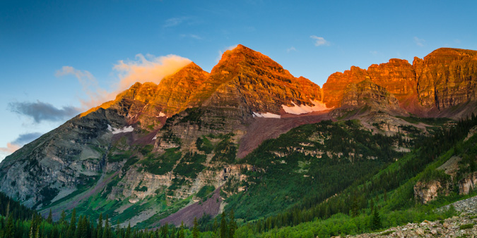
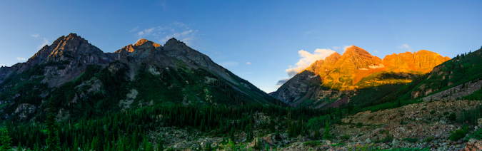
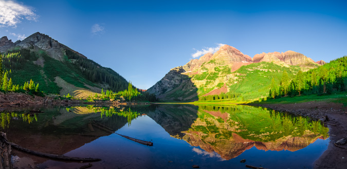
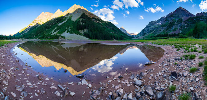
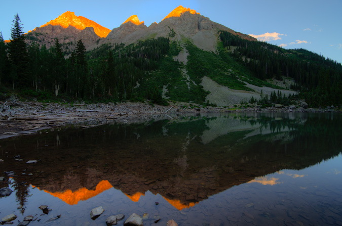
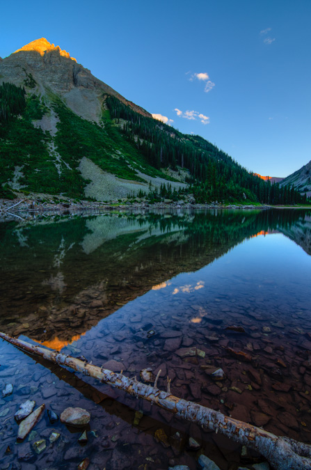
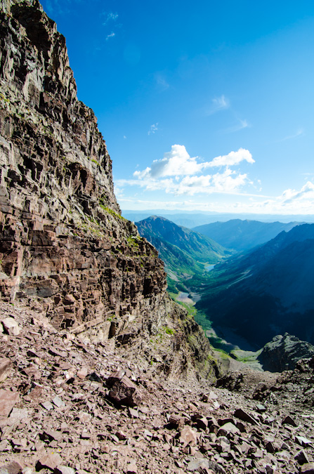
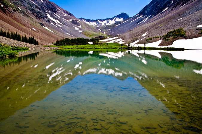
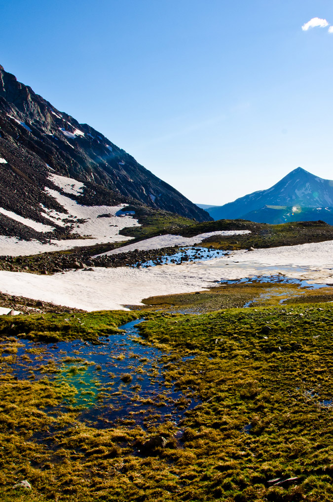
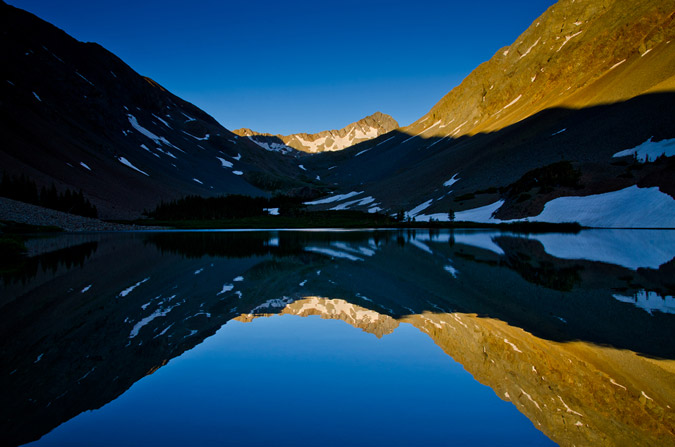
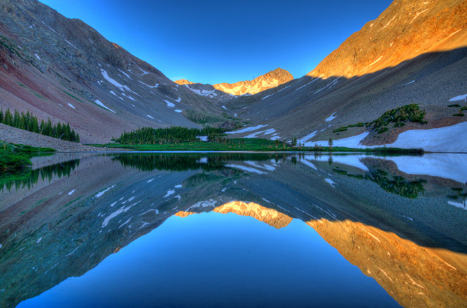
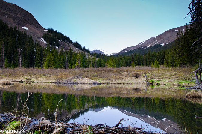
After shooting sunrise at the Maroon Bells, we made our way up the rest of the way to Crater Lake, where we would try to locate a campsite. Upon first arrival at the lake, the reflections of the Maroon Bells in the very still water and post-sunrise light were absolutely fantastic.
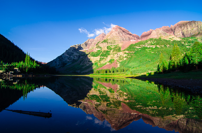
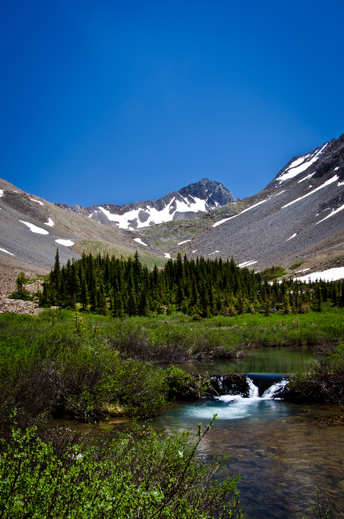
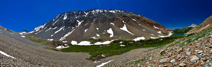
A wider view, including the Pyramid Peak massif:
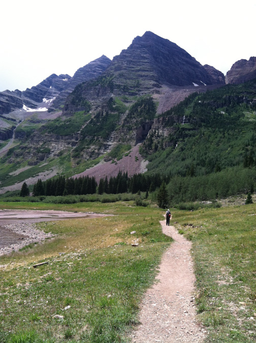
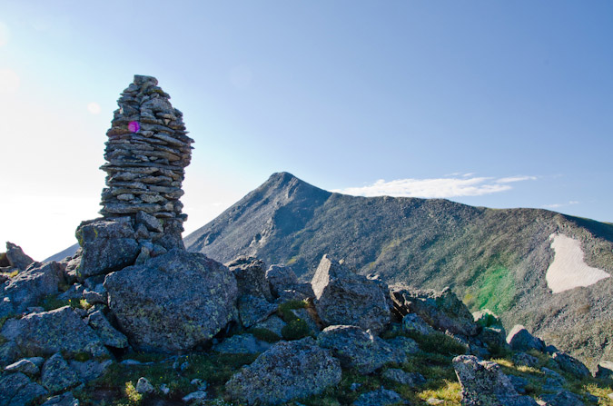
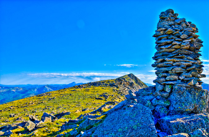
The search for a campsite was on, and I had been given some good tips from Bill Wood that we should shoot for campsites 6-11. We finally landed on campsite 9, slightly south and west of Crater Lake on a large hillside. Sarah later joked it was no wonder the campsite was open, because you have to hike up a hill away from the water to reach it.
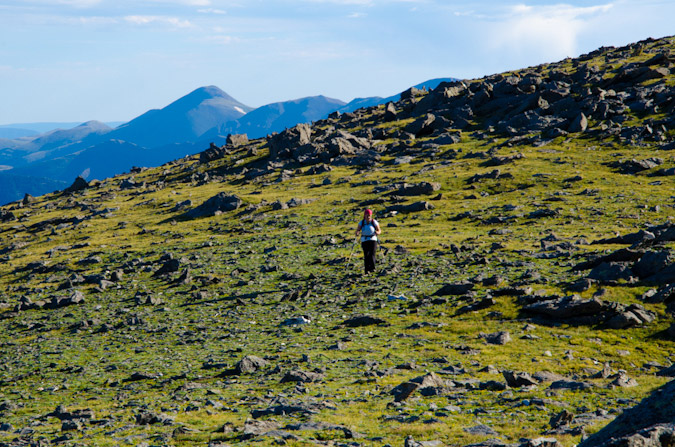
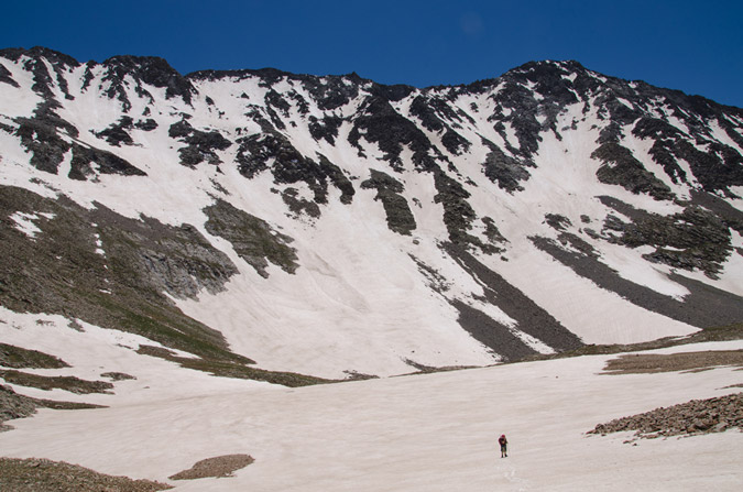
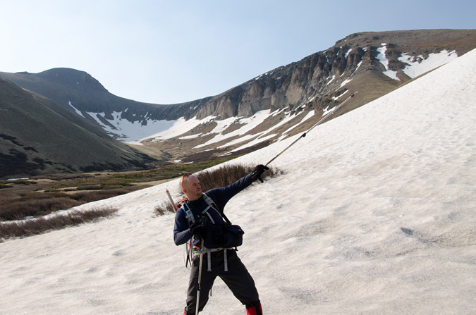
We quickly made camp, setting-up the tent and all of our stuff, and finally had summit packs ready by 8 AM. Not exactly the best start time for a 14er of Maroon’s caliber, but we thought we’d give it a shot either way, so off we went. We followed the trail quite a long ways up the valley to the south and reached the oh-so recognizable warped tree described by the 14ers.com guide.
After the tree, the real work was before us, and the Maroon Peak southeast slopes trail lay before us in all of its steep glory. The trail started quite steeply, much like the Manitou Incline.
We reached well above tree-line before my stomach started to really give me issues. I could not figure out why I was not feeling well, so we stopped at around 12,400 ft. This turned out to work out just fine, because weather was starting to build above, the clouds that were hanging low all morning had never really left. I later figured out that the culprit to my stomach issue was the Cliff Bar Builder’s Bar I had ate.
Sarah and I sat around for a bit, contemplating our options.
We had picked a pretty great place to stop. The views in all directions were great. We did not feel rushed at all.
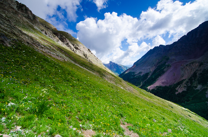
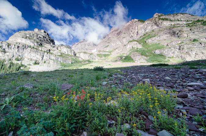
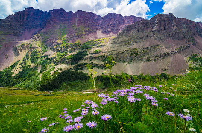
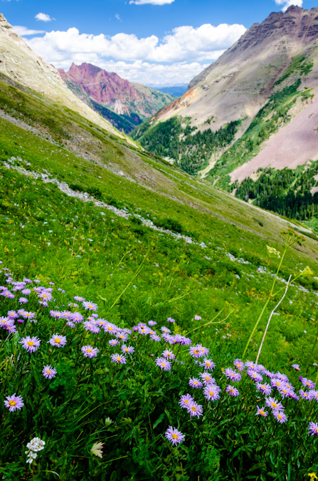
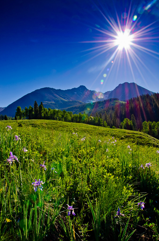
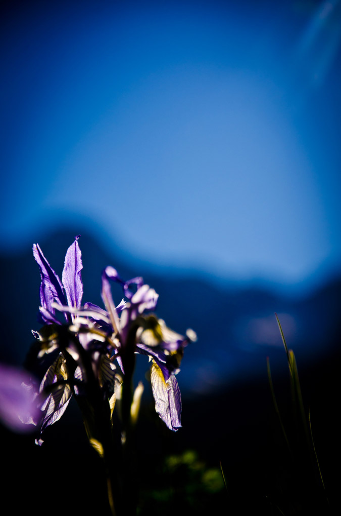
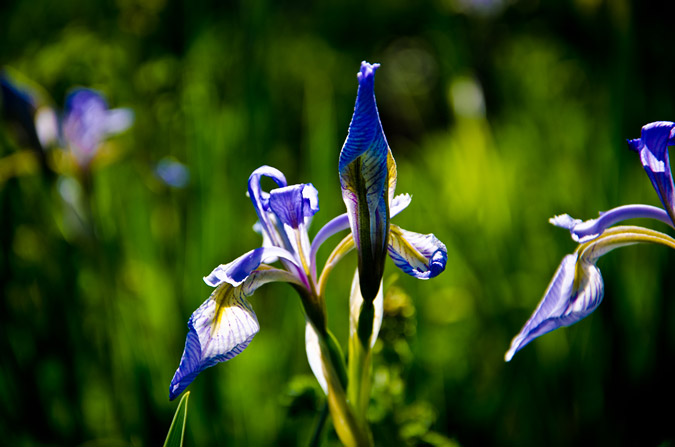
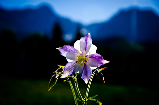
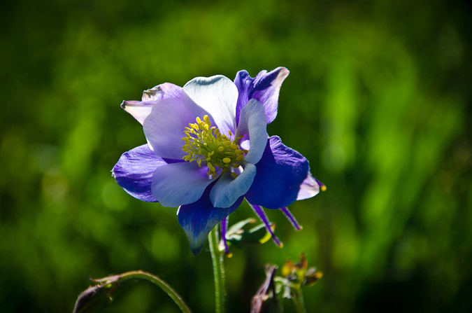
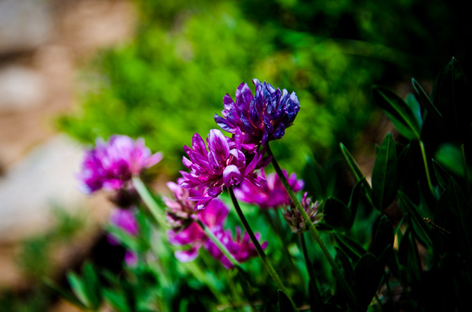
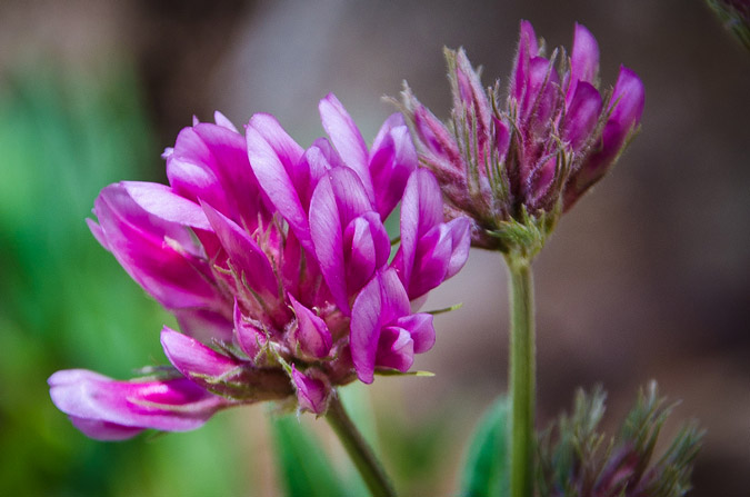
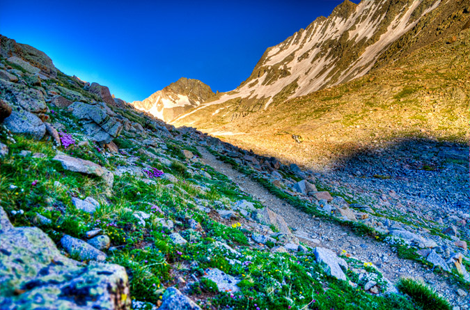
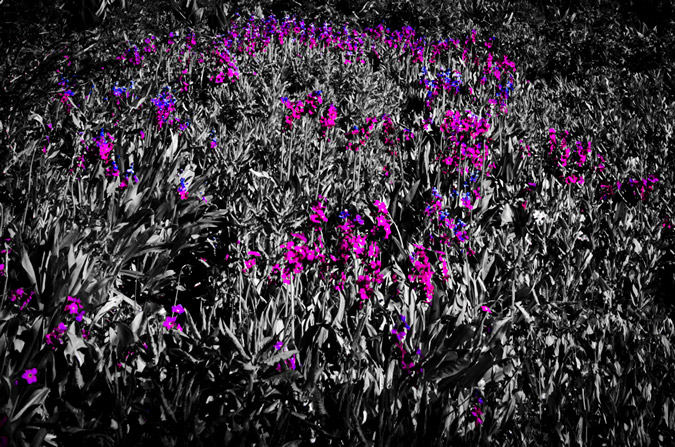
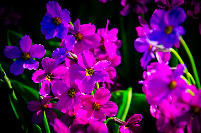
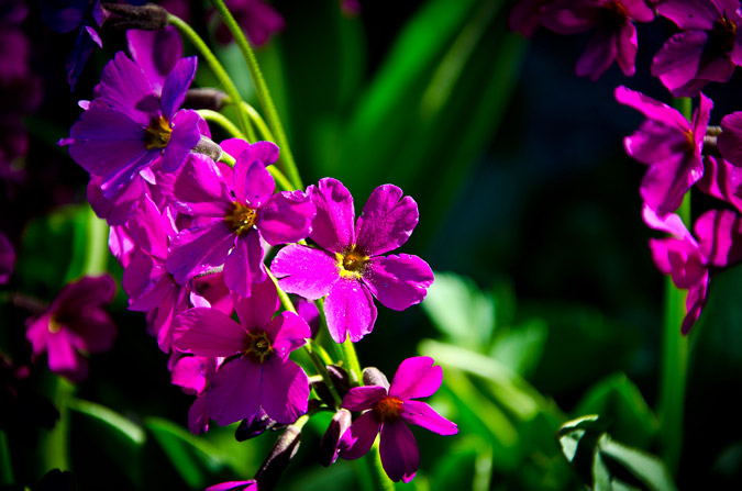
Even though my stomach was in pain, we found ourselves near a large meadow of wildflowers, which made for some fun photography.
It was a really cool spot, and since it seemed were not going to do any more climbing, I took the liberty of taking a ton of shots.
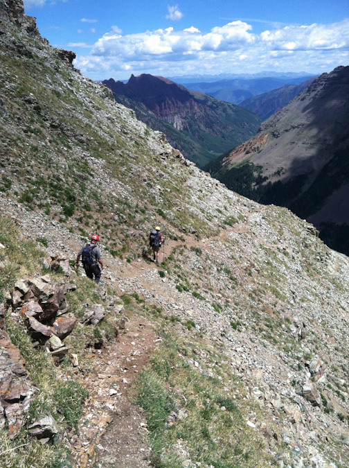
We headed on down and later ran into a group of three guys coming down as well. They were attempting Maroon as well and were turned back due to the weather just short of the ridge. These three guys were very cool, and we had a nice conversation about the area and climbing the Centennials. We all headed on down to the main trail, where we intersected two more hikers coming up to investigate the location of the Maroon Peak trail turn-off. This would not be our last encounter with these two guys, as we would later run into them twice more the following day.
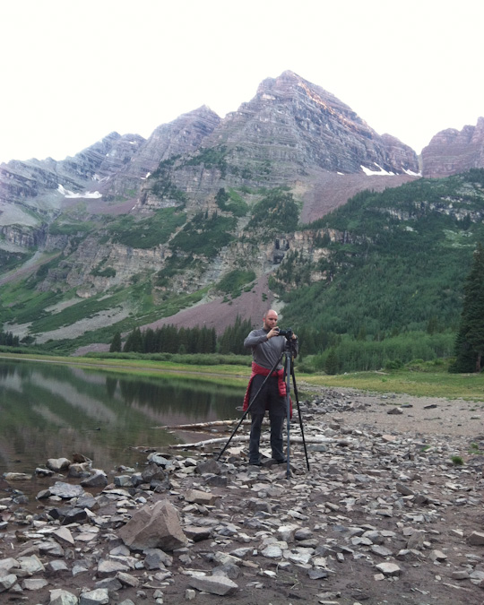
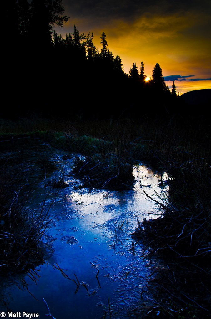
Sarah and I hiked back to camp and took naps. After our short naps, we cooked up some food and I prepared my camera equipment for a walk down to Crater Lake for sunset shots and later night photography.
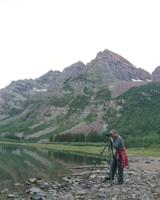
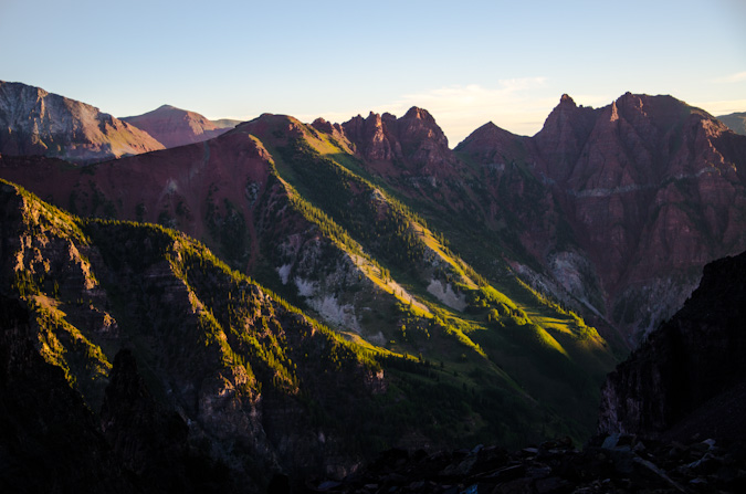
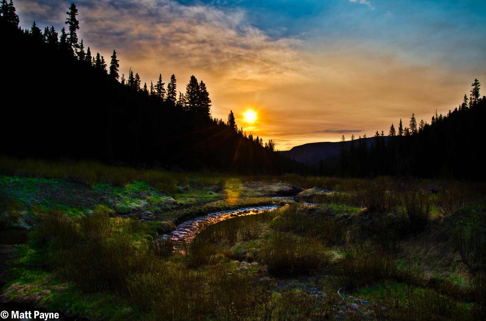
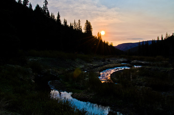
Upon arriving at the lake, I was immediately in my happy place, having many quite interesting landscape shots to attempt. I waited for the sun to set and the magic started to happen, lighting up the tips of the surrounding mountains to our East, which were part of the Pyramid Peak massif. I also tried out my ND filter and did some longer exposures of the clouds and Maroon Peak.
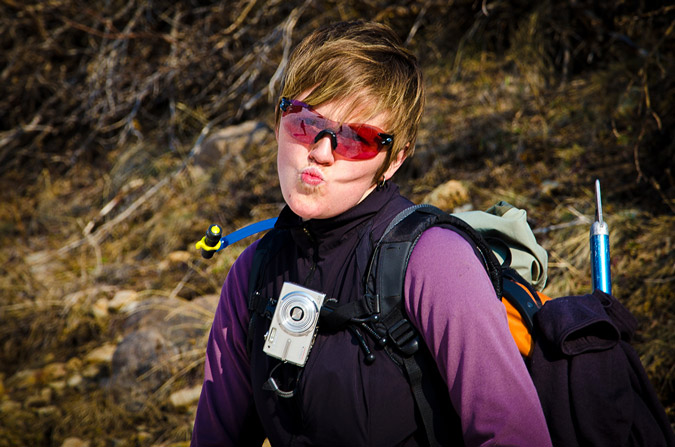
Sarah was able to sneak a shot of me geeking out on my camera.
Composing the shot...
The sun was setting and the light started doing its thing.
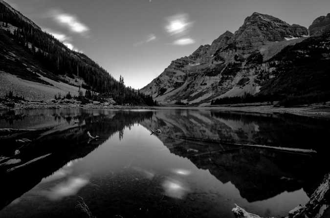
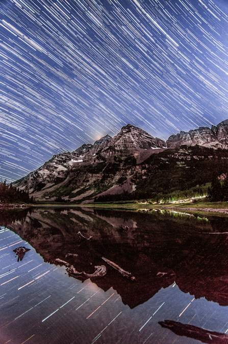
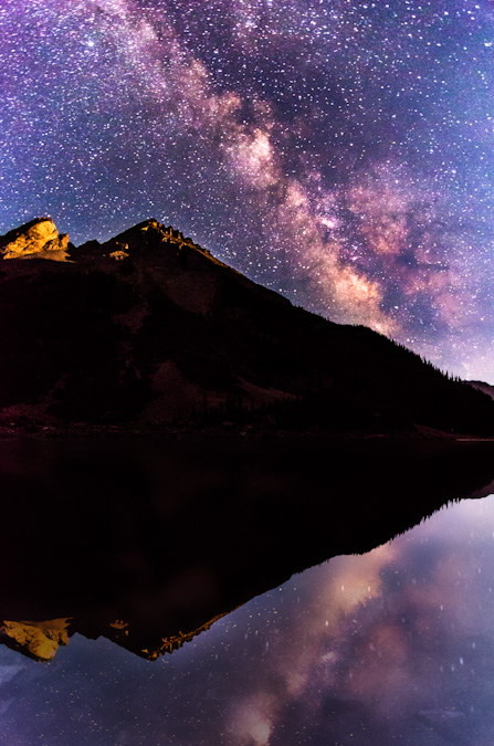
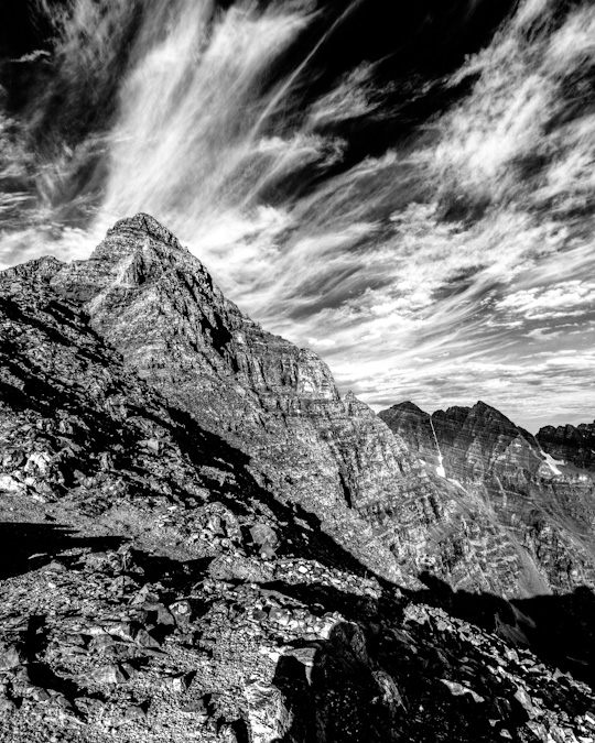
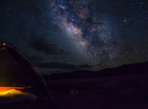
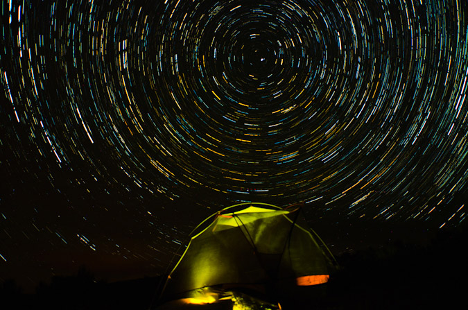
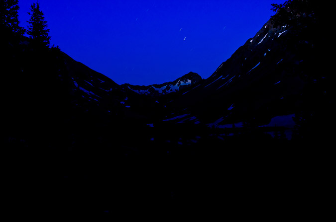
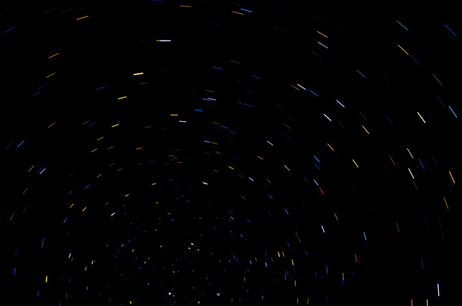
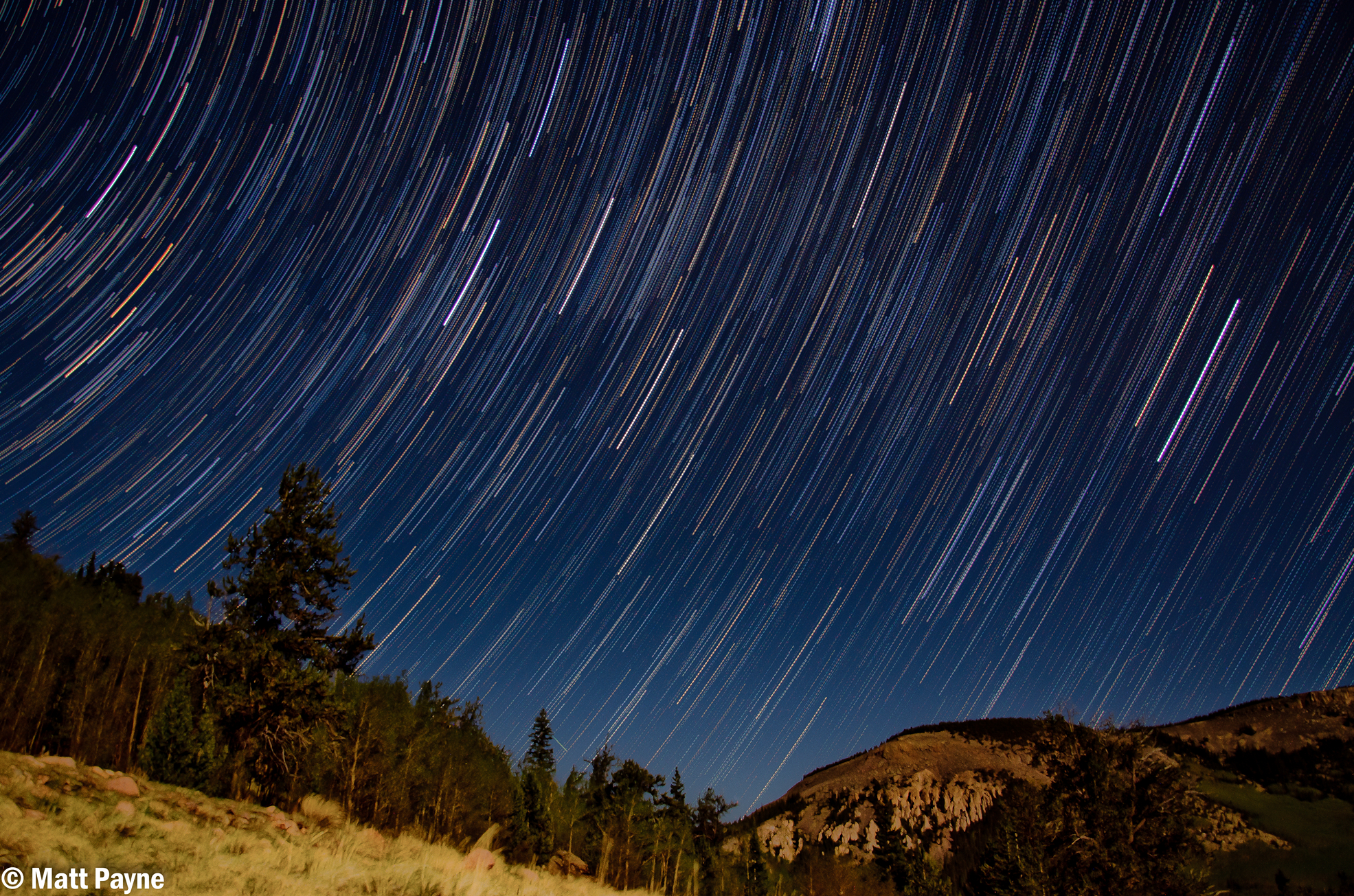
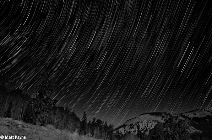
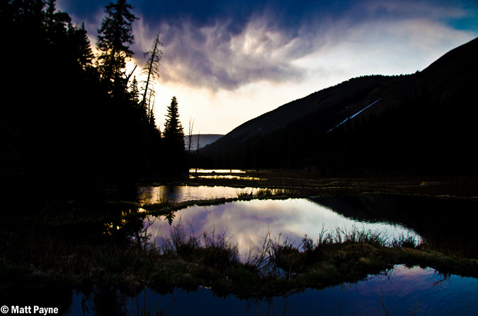
After the sun went down, Sarah went back to the tent to get some sleep. I stayed out and set-up for something I had been planning for a long time - star trails over the Maroon Bells, reflected in Crater Lake. This worked out pretty nicely, there was a group hiking in the dark up the trail and so my long exposures got their head lamps in the shot too, which I opted to keep in. The "break" in the trails is from my intervalometer stopping unexpectedly on me and me having to restart the sequence. Bummer! Still turned out great though, I think. You can see where the moon had just set over Maroon Peak's upper left cliff bands.
While photographing the star trails using the intervalometer on my camera, two sets of eyes appeared near me at the lake. I rose and walked closer to find two deer, one a quite large buck. I was both relieved and amazed. I’m not really sure how well I could defend myself against a mountain lion.
After shooting star trails above the Maroon Bells, I took advantage of the scene and clear night and took some fantastic shots of the Milky Way. My two favorite was this single shot of the Milky Way reflected in the lake, and the next one, which is a 9-shot panoramic of the Milky Way above the Pyramid Peak massif. Click on the single shot if you'd like to learn more or purchase it.
I just could not get over how clear the sky was!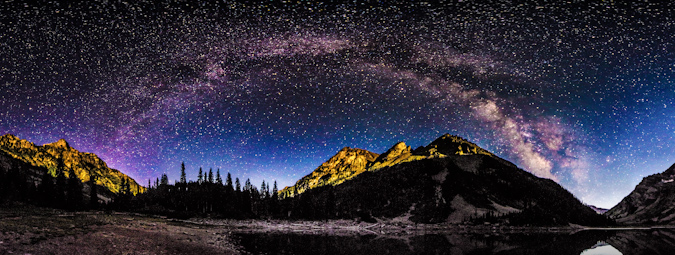
After capturing what I felt at the time were some great photos, I decided it was time to hit the sack, since our departure time for Maroon Peak was looming just a few hours away. I came back to the tent, where I found Sarah wide awake still. Apparently a field mouse had managed to find our tent and was crawling over the top of it, which kept freaking Sarah out. In fact, about 30 minutes later, the mouse bumped past the side of the tent next to Sarah’s face, which caused her to freak out and elbow me like she was trying to win a Karate match. It was awesome.
Day 3: Early start and successful summit of Maroon Peak - 14,156 ft.
Sarah’s iPhone alarm sounded off and sounded just like a self-destruct sequence, in fact, it was just like this YouTube video.
Mixed with my dream that President Obama had confiscated the valley we were in for national security reasons, and my head was all kinds of whacked out – too much, too early.
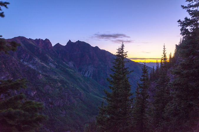
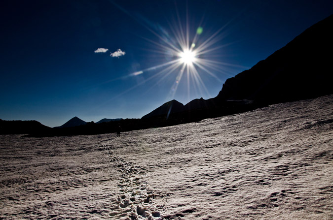
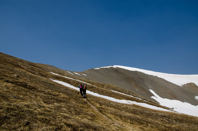
Nonetheless, we rose like zombies and hit the trail at a brisk pace at a quarter past 4 AM and head back up the valley to the Maroon Peak turn-off, in the dark. By the time we were working our way up the steep trail, the sun had begun to illuminate the mountainside and we were moving at a very steady pace.

Two of the three climbers from the prior day passed us quickly, having a deadline to meet – they were extremely fast – good on them! We kept our pace going at a good rate and eventually caught up with the two gentleman from the day before that were looking for the trail.
They were moving very slowly and had mentioned that there was only two others ahead of them other than the two we knew about – a photographer and their friend.
A photographer you say? This piqued my interest instantly. Who was ahead of me? Did I know them or of them?
The trail was one of the steepest I could remember. Exhausting, but a wonderful workout all the same.
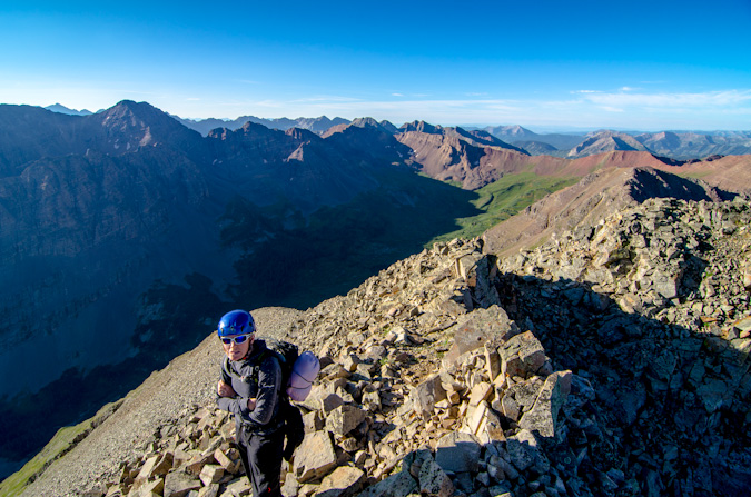
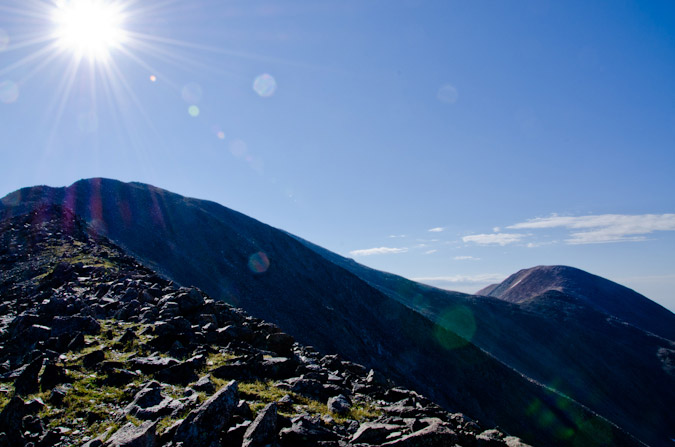
Before long at all, Sarah and I crested the ridge after 2,800 feet of grueling non-stop high angle grinding. As Bill Middlebrook describes on the 14ers.com route description, “Conquering the East Slope is a major achievement, but now the more technical terrain remains.” Indeed. Time to refuel.
Sarah had maintained an excellent pace up Maroon Peak so far and was kicking my butt. Did I mention that while I'm at home editing photos, she's out racing single speed mountain bikes? Yeah. Wonder who's in better shape?
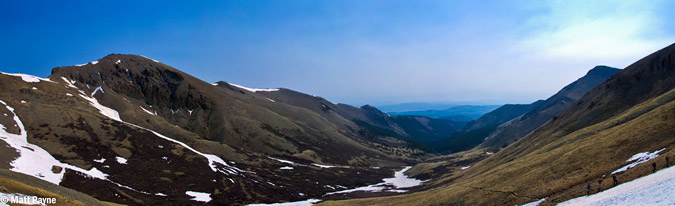
The remaining section of the ridge was more of the same; however, we had much better views of the surrounding area.
Once we reached the ridge, it was only a short section of maybe 400 feet to tackle before reaching the hard part.
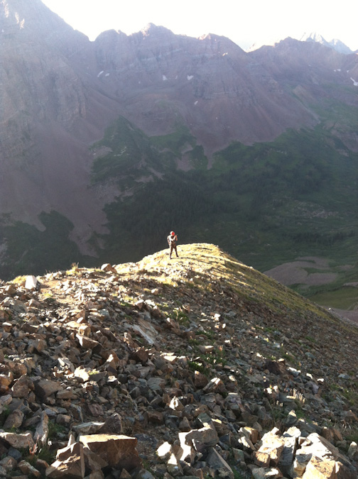
The ridge section was still fairly steep, but the excitement of seeing the rest of Maroon Peak's impressive face kept us moving quickly.
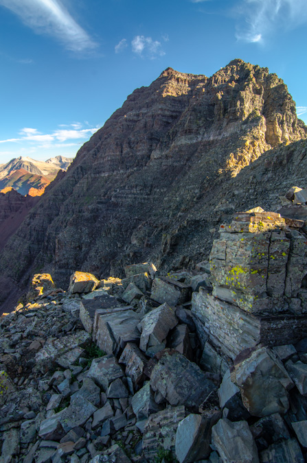
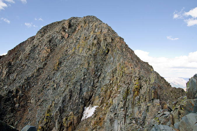
Reaching the crest of the final ridge was exhilarating as always, made especially sweet by the awesome visage of Maroon Peak, which loomed in front of us like a giant sentinel.
Sarah and I followed the rest of the route religiously, having had a bad experience off-route last year on Snowmass. We took a break for food, and I ate another Honey Stinger Waffle which was delicious – these things are the real deal. The fun begins.
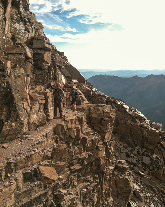
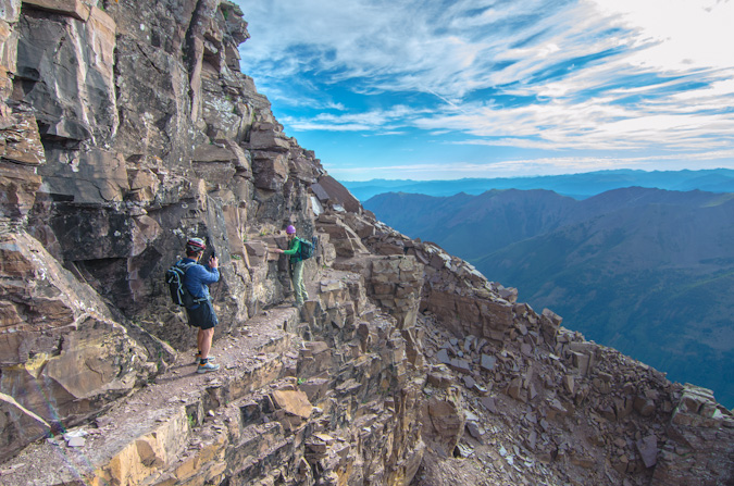
From the ridge crest, the route went very easily, much to my surprise and partial disappointment. I was expecting an epic class 3 adventure; however, Maroon Peak is more like class 2 with a sprinkle of class 3 in some lame locations. It looked intimidating as hell though.
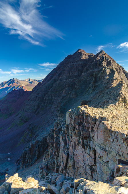
The trail is very obvious most of the route and there are actually only a few spots you need to actually make a decision and “climb.” That being said, the terrain was still quite dangerous and we were vigilant. The views... oh man. So amazing. Intense.
Shortly after entering the more dangerous terrain, we ran into the other companion of the two guys we had passed earlier. He wanted to know how far behind they were. He was not very thrilled to learn about their slow pace, but the weather seemed to be holding so I felt like they still had a shot.
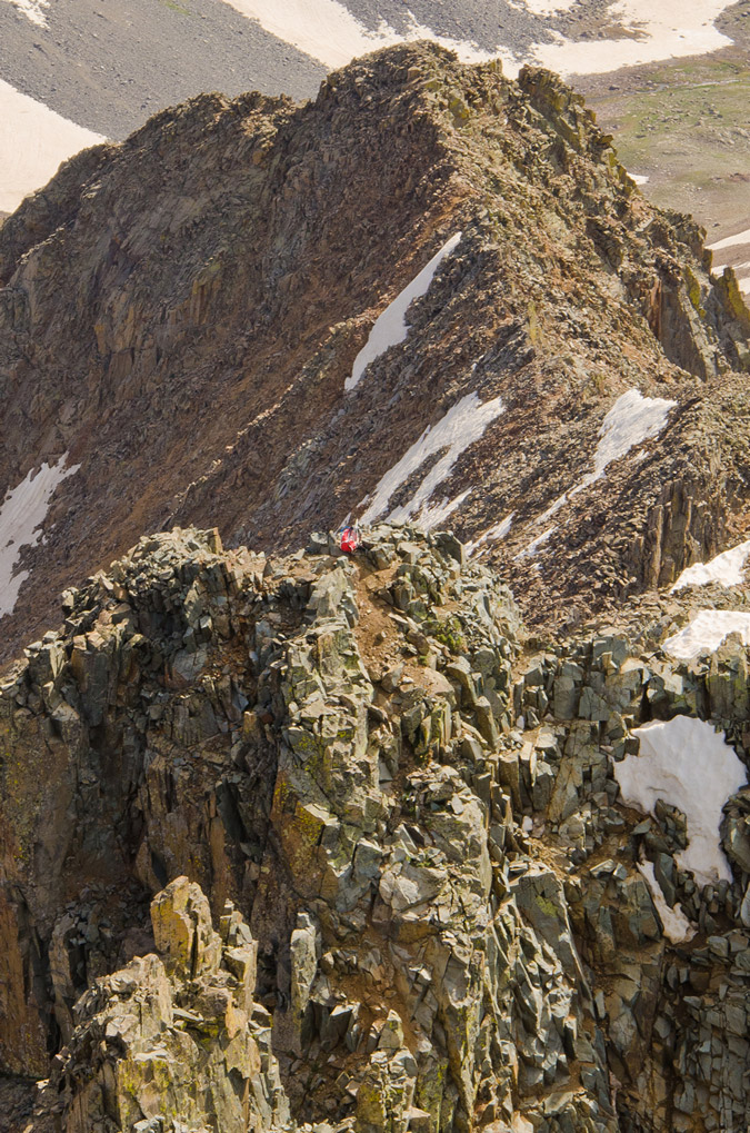
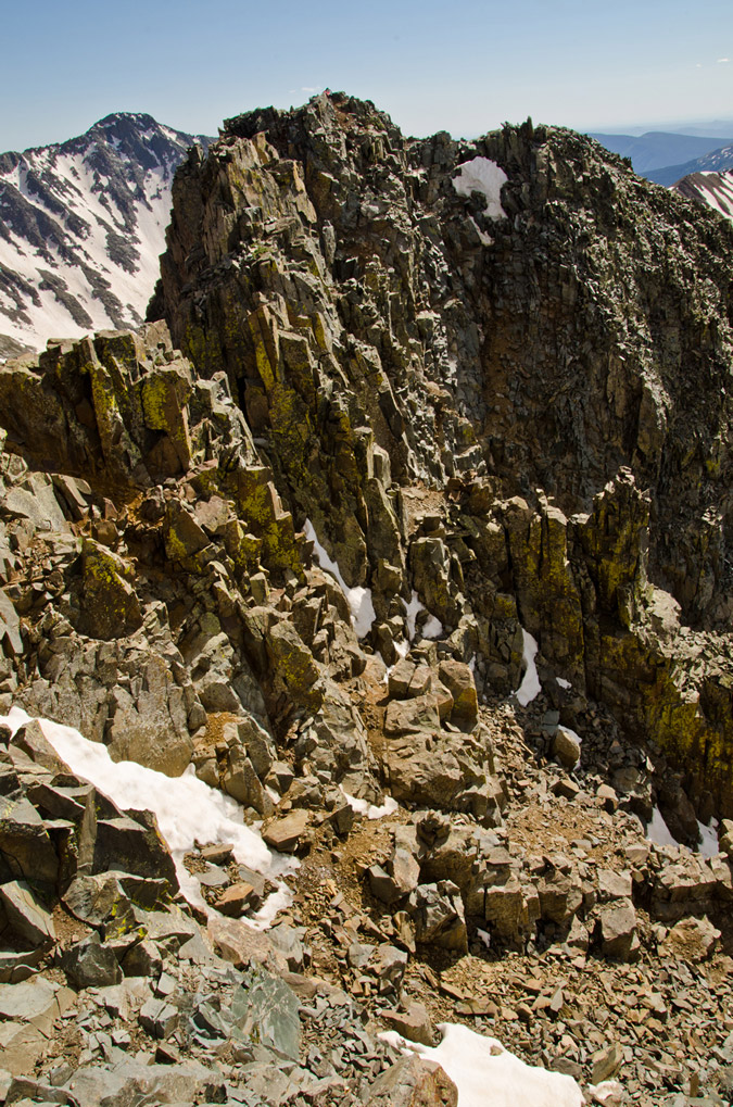
For the most part, the first section after the ridge involves following the trail up and over a bunch of small gendarmes near the ridgetop. As predicted, we found ourselves having to climb a small gully into a small and secluded alcove, which offered great views to the west.
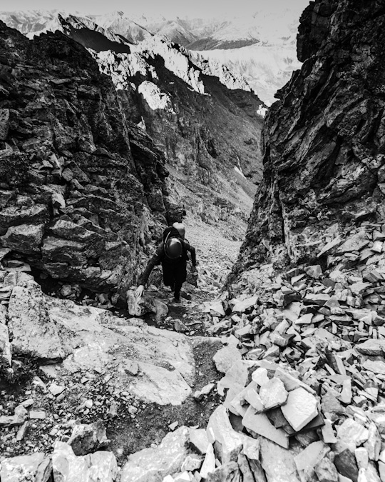
Just at the top of this gully rested our next problem - a small gully with great hand and foot holds heading up.
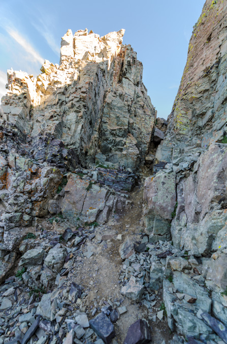
On the other side of this gully, parts of Maroon Peak were back in view. The route certainly did not look obvious from here, but it worked out.
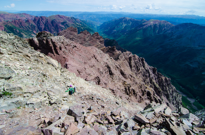
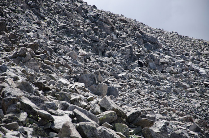
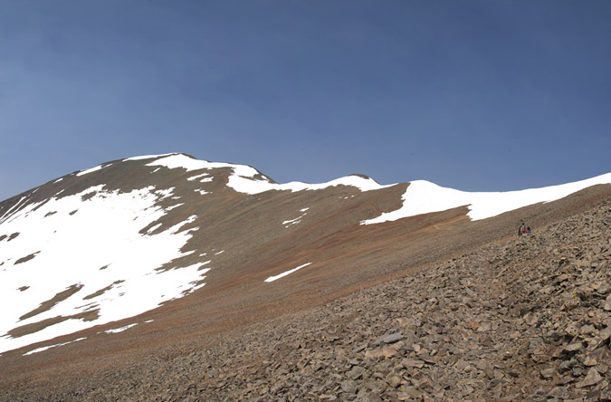
The most dangerous section was probably the set of gullies you can choose to ascend about 2/3 of the way through the route as pictured here.
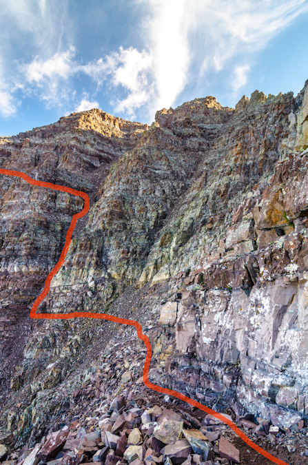
We chose to climb the second gully and then follow a ledge system to the left. I feel that under the right circumstances and a lot of climbers, this section could be quite dangerous due to rockfall. Most of the rest of the route seemed quite safe with the occasional ledge area that was exposed. It looks worse than it is, trust me. Here's a view from the top of the gully, looking back across where we had come from.
At this point it felt like a great time to stop and soak in the views. It does not get much better than this.
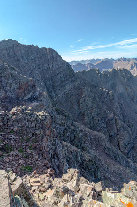
The rock features on Maroon Peak were quite remarkable and made for a wonderful hiking experience. There were many times where I kept saying to myself, "I'm really here, this is one awesome place!"
Looking up or down made you feel so small. The sheer ruggedness and steepness of these peaks is easy to appreciate.
The final stretch of the climb includes a large boring dirt and rock section that reminded me of Columbia Peak, meaning, it was fairly awful – the kind of stuff that goes two steps up and you slide one step down.
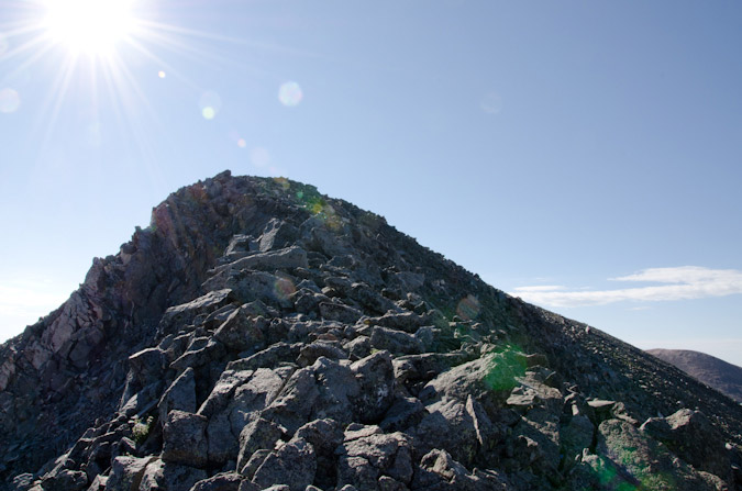
Once at the top of this area, you climb a really short but interesting ledge system onto the flank of the peak and follow a long series of quite solid and fun-to-explore ledges before reaching the final summit ridge.
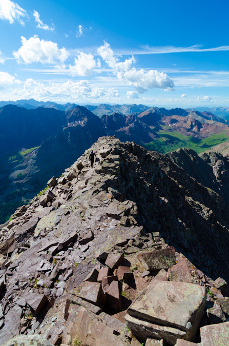
Pyramid Peak dwarfed Sarah.
Sarah, while only equipped with an iPhone, took some awesome shots on this trip as well. One of my favorites was this one she took of my near the summit.
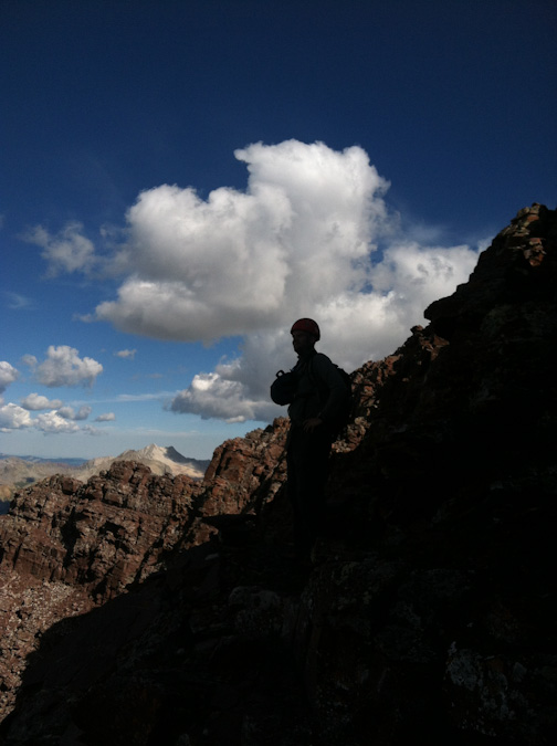
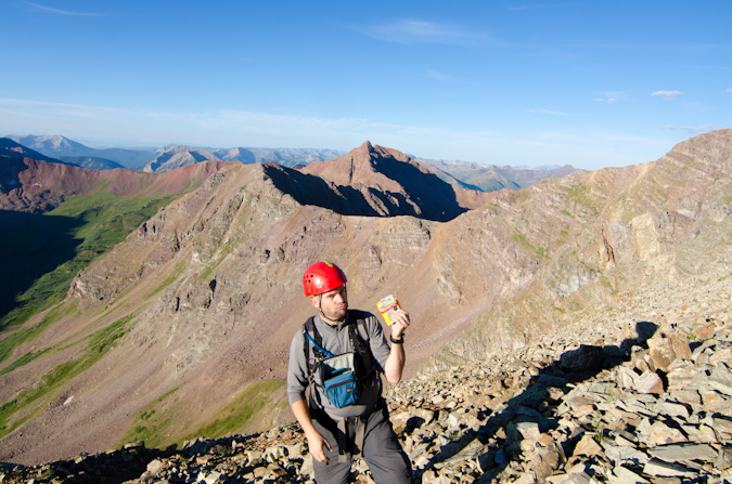
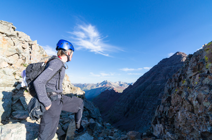
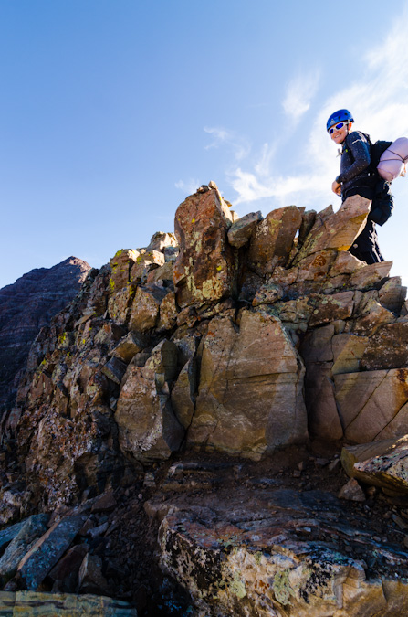
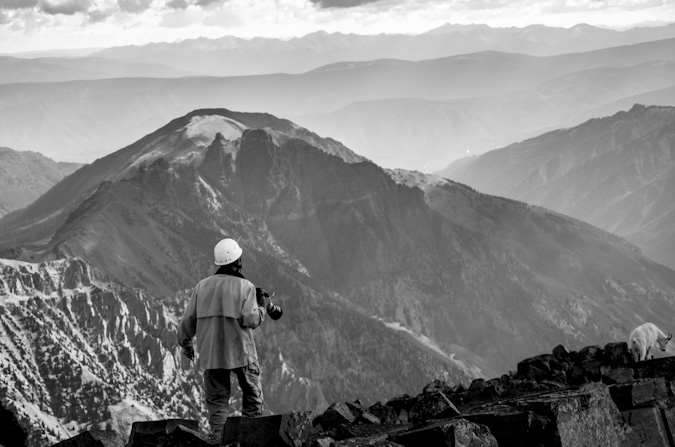
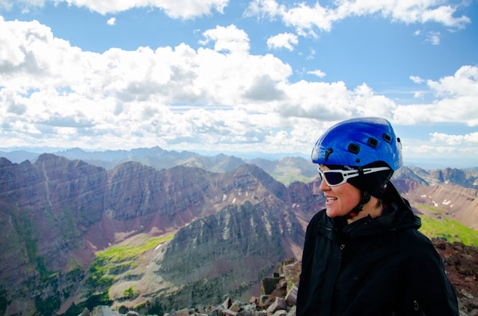
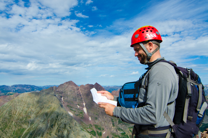
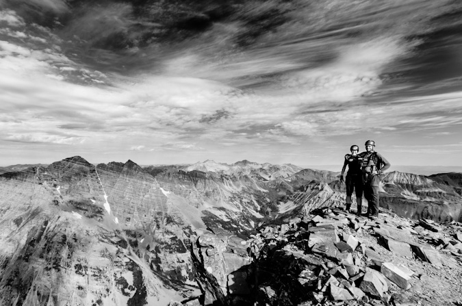
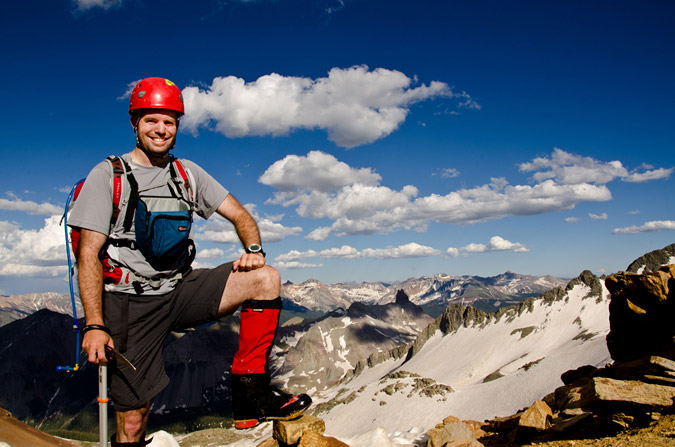
Upon reaching the final summit ridge, I saw a man with a yellow helmet on the summit, in fact, the same yellow Edelrid helmet my dad handed down to me and seen in the photos of him in this report. He yelled down at me that it “was a great photo” and to “stay put if I didn’t mind.” This must be the photographer we learned about. While I waited for the light to get right for him to take my shot, I took a high contrast shot of him and Sarah on the summit.
He then snapped off this cool shot of me climbing the final section to the summit.
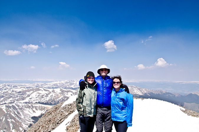
We got up to join him and he pulled out his business card. It was none other than the legendary Glenn Randall. Readers may recall Glenn’s name from an article I wrote earlier this year where I shared my thoughts on the twenty best Colorado landscape photographers. In fact, Glenn’s revered in the mountaineering-photography community as a pioneer, for, as he later explained to me, he has photographed sunrise from thirty-eight 14ers. This is a most impressive feat. Glenn explained that he was just on a recon mission today, because he was going to be doing Maroon Peak tomorrow as well to photograph sunrise from there. He was setting waypoints and familiarizing himself with the route. He had just done sunrise at Pyramid Peak the day before. Glenn’s dedication to this sub-set of photography is most impressive – in order to achieve sunrise on a peak like Maroon Peak – he would need to begin hiking at midnight and carry over 20 pounds of photography equipment with him to the summit. I was humbled to have met such a great photographer that I had modeled a great deal of my own personal work after.
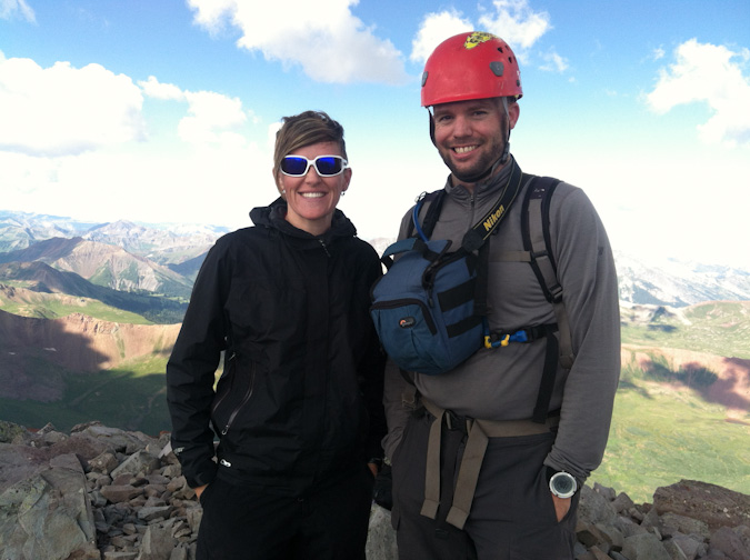
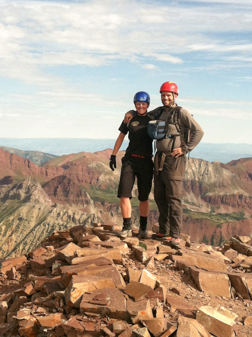
Glenn gladly took our photo with Sarah's phone.
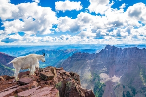
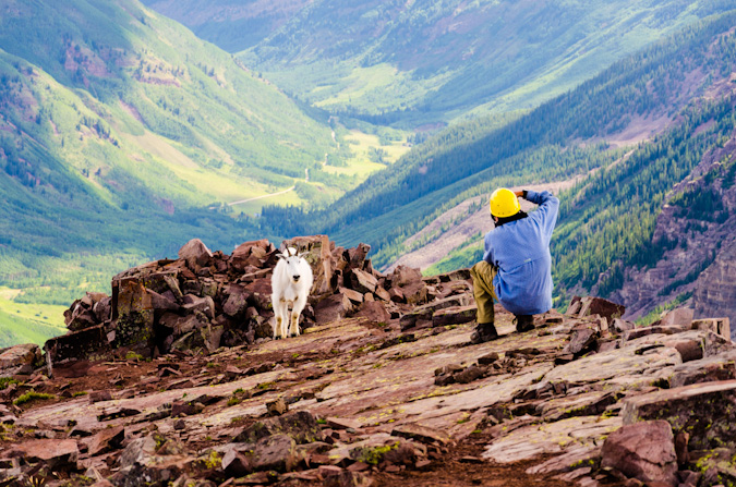
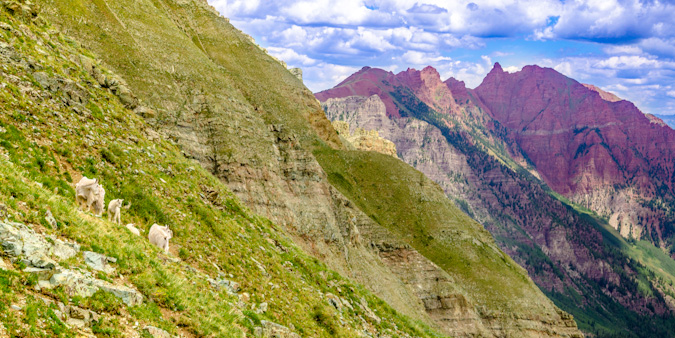
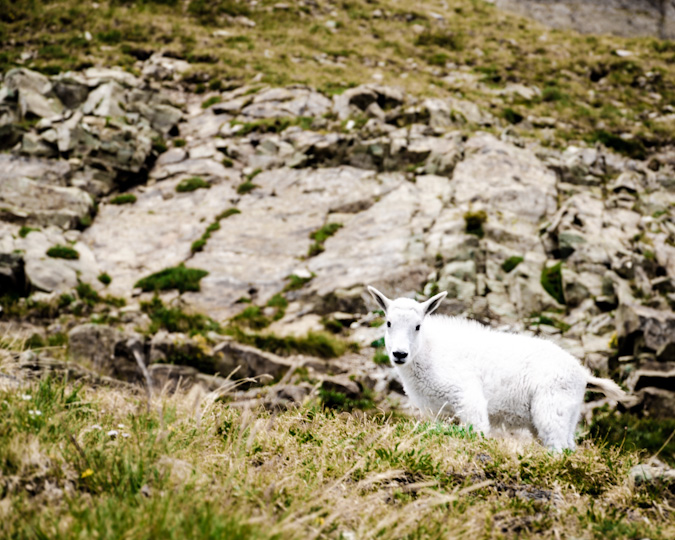
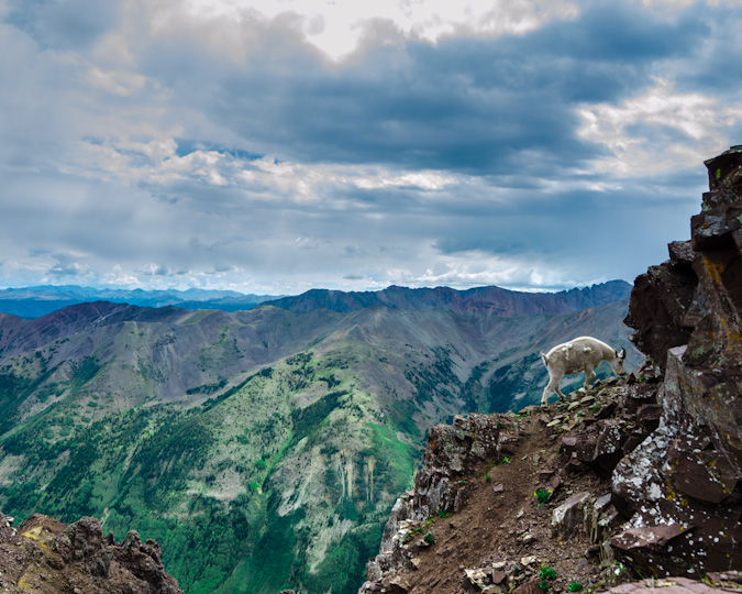
Glenn and I talked shop for quite awhile and he decided to head down. Shortly after though, two mountain goats came strolling up the side of the mountain from the descending route area with none other than Glenn behind them.
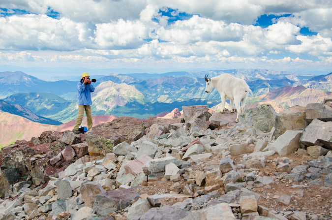
It was such a fun day on the summit, sharing the photographic experience with a true pro. I had fun composing images of the goats and of Glenn. I might be geeking-out a little, but it really was an incredible experience.
Sarah was able to get some incredible shots of all of the action too. Some of my favorites.
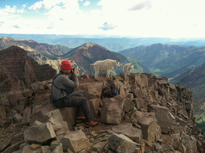
These were quite friendly goats, often coming within feet of me.
Pyramid Peak made for a killer backdrop for the goat.

I bet Glenn got some really great shots of the goats... he was sporting a quite nice Canon Fx camera and a 70-200 lens.
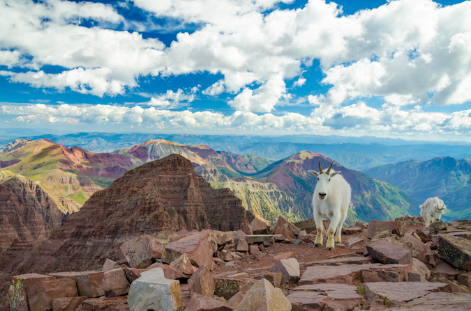
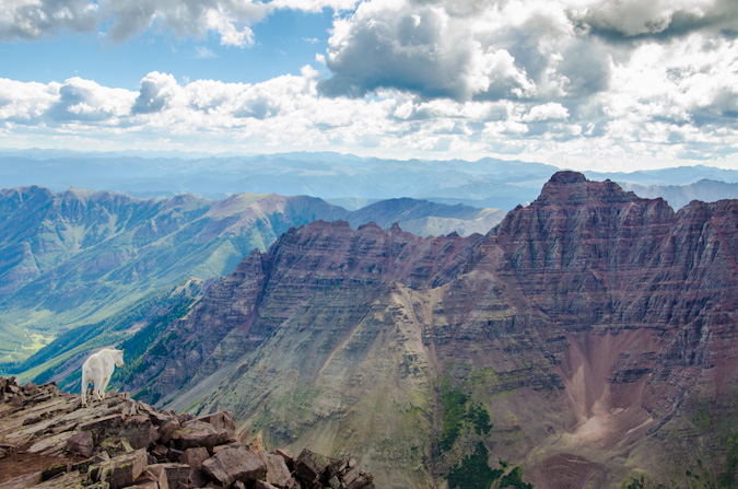
I took so many fun shots of the goats, and I hesitated to post so many here, but they turned out so great, I had to share.
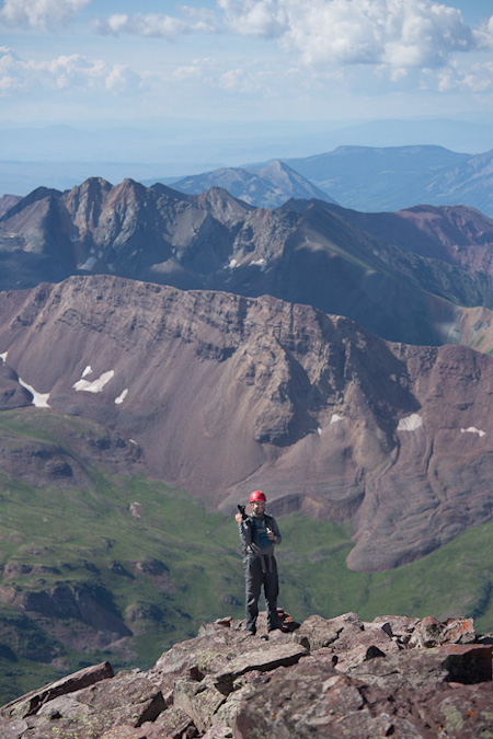
My favorite shot of the mix was this shot of this goat peering out towards Pyramid Peak, foreshadowing the day to come, where I would complete the 14ers.
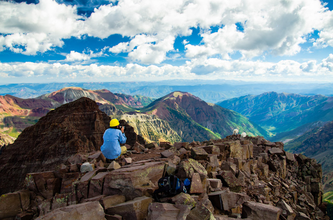
Through all the excitement, I had to stop and take some shots of Sarah and a couple panoramics.
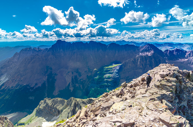
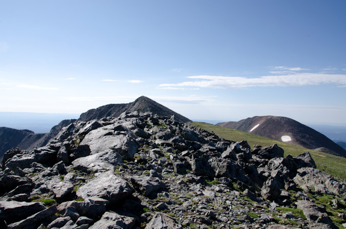
The traverse over to N. Maroon looked like a lot of fun, but it was not on the agenda.
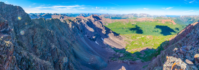
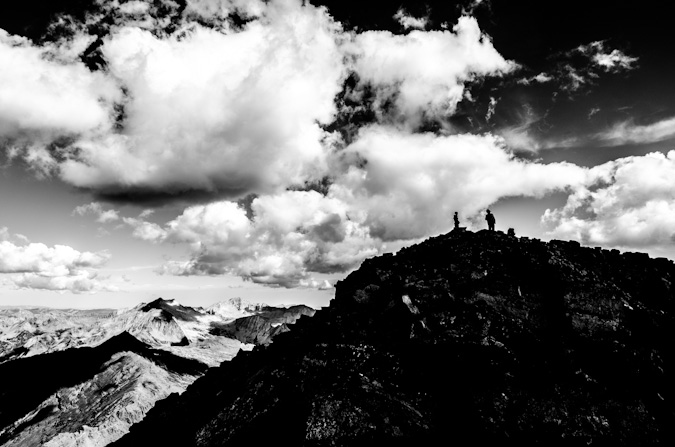
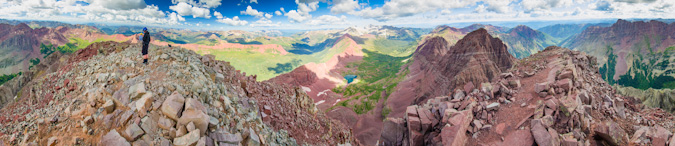
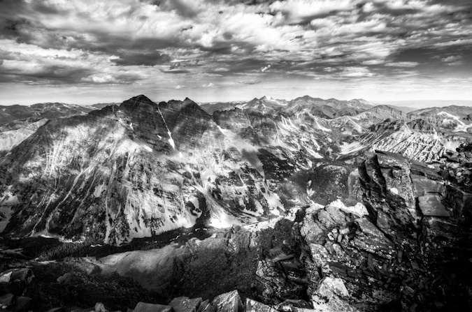
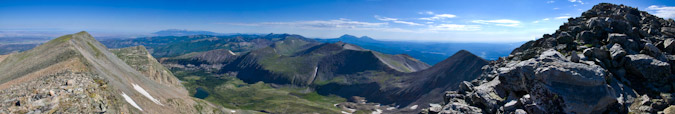
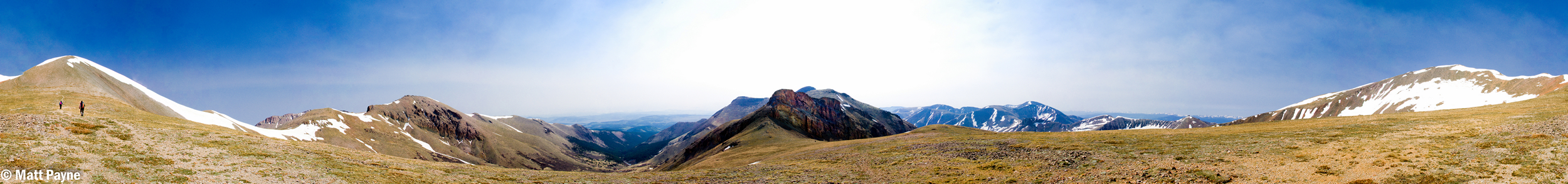
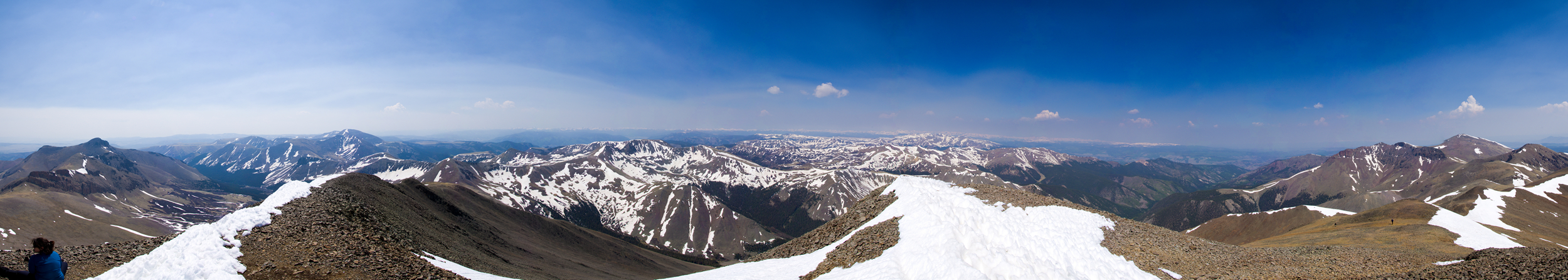
The obligatory 360 panoramic... which demonstrated how large of a summit Maroon Peak really had... and how amazing the views around us were.
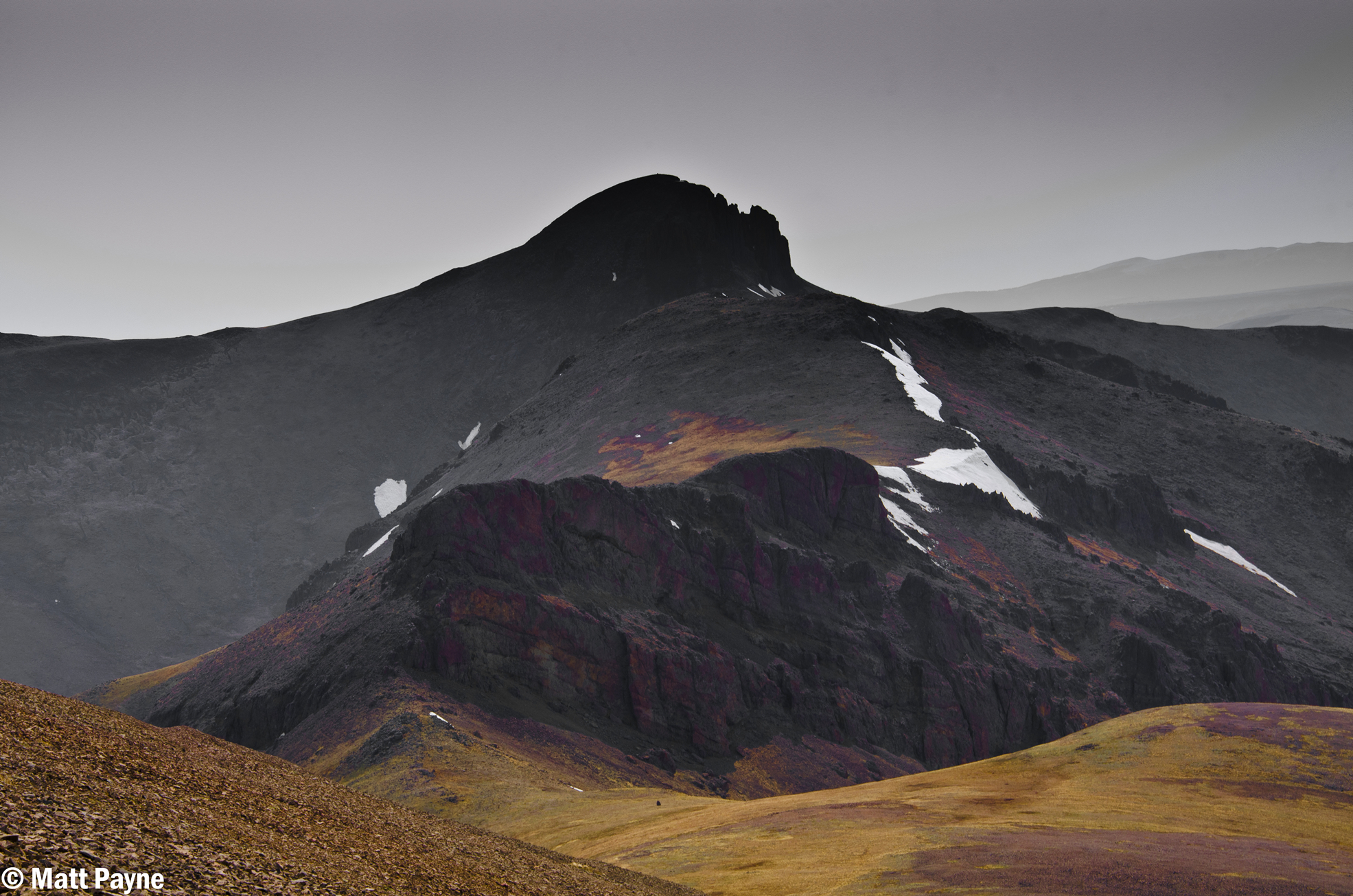
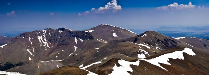
The white coilour for Thunder Pyramid stuck out like a sore thumb above Len Shoemaker ridge.
The weather began to look a little shaky after a long time spent at the summit, so we all decided to head down together. On the way down, Glenn was a really great mountaineer, concerned with safety and route selection in many of the same ways Sarah and I were. It was such an honor to spend the afternoon chatting about photography methods, gear and stories while down-climbing. I felt kind of bad for Sarah but she rolled with it and contributed a great deal to the conversation, having many stories of our mountaineering adventures to convey.
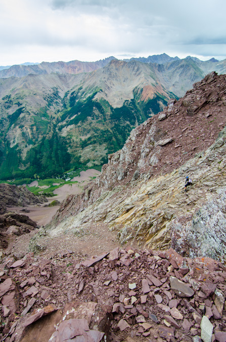
On the way down, at the earlier described gullies, we opted to go with Glenn down a different gully. I think the original gully we took on the up-climb was sturdier (the second of the two when coming up, the first of the two when coming down). Other than this small section, we sailed down the mountain’s route, eventually running into the lone guy we had encountered earlier that was waiting for his friends. Indeed, he was again waiting for his friends and explained that they were very slow and he was concerned because he said they were very set on doing the traverse between Maroon Peak and North Maroon Peak, which is very dangerous and requires a great deal of time. He asked that we try to convince his partners not to attempt the traverse based on the weather and their slow speed.
Shortly after this, we ran into the ambiguously odd duo again as Glenn tried to convey the seriousness of the traverse given their speed and the weather. They did not seem convinced this was problem for them and so I hoped that I would not be reading about them on 14ers.com in the Memoriam section (if you guys are reading, I hope you got down safely). We continued on and eventually reached the ridge safely without any issues.
The hike down was relaxing. No threat of weather to worry about.
From here, we casually followed the steep trail back down from the summit, stopping occasionally to take photos of flowers and a small group of mountain goats, which consisted of two adults and two tiny baby goats (so adorable). This prompted me to wonder about the breeding habits of mountain goats and the herd consistency, so I made a mental note to read about that when I got home. I did learn that it was likely that we saw two females (nannies) with their two kids (babies) – as I learned from this almighty Wikipedia article.
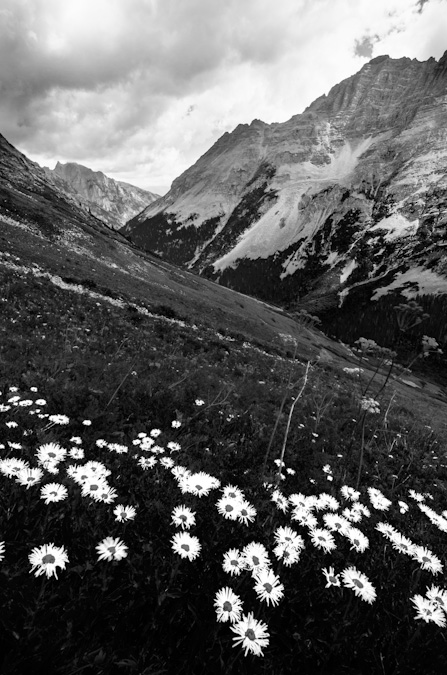
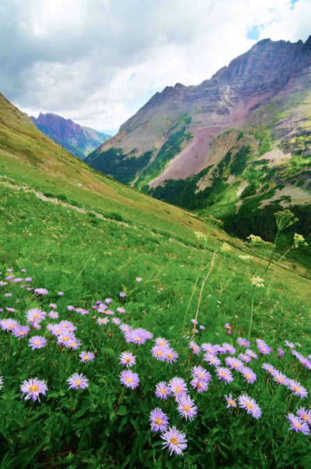
The wildflowers were so fantastic on this hike, it reminded me a little bit of the wildflowers we saw the prior year on our hike up into Lead King Basin.
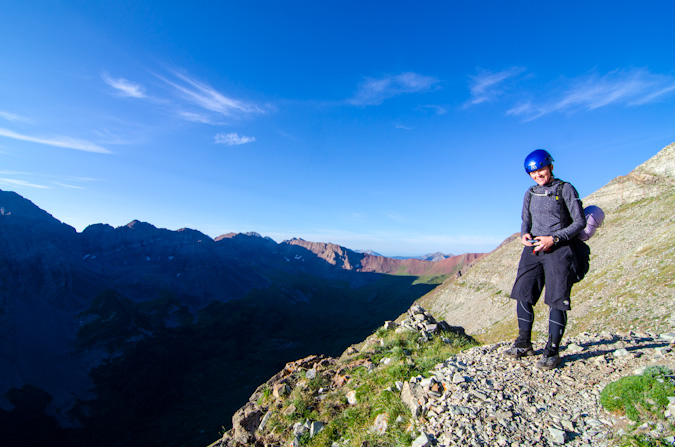
Glenn left us about halfway down to move a little faster so that he could get some rest before his epic sunrise hike. Sarah and I continued down at a decent pace and found ourselves back at camp at approximately 1:45 PM. The weather was holding quite well for the Elk Mountains, and we were starving. We cooked some food and took naps that lasted well into the late evening and eventually the night. We were certainly well rested for the next climb.
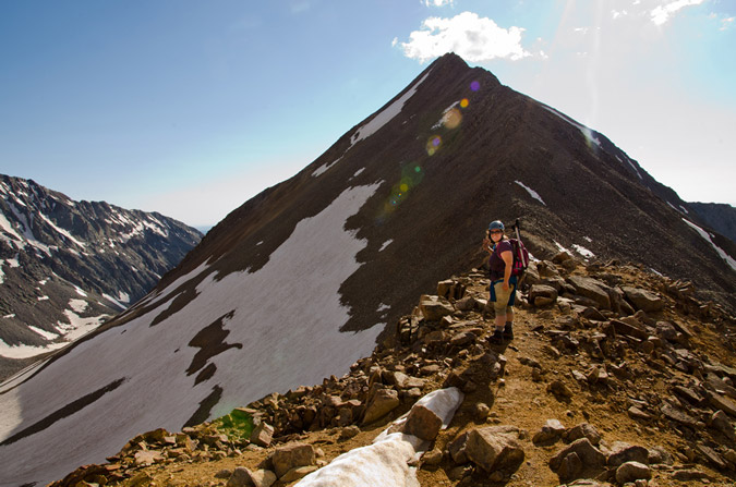
Day 4: Early start and successful summit of Pyramid Peak - 14,018 ft.
The alarm went off and we climbed out of the tent and started hiking at 4:15 for Pyramid Peak. The hike down to the lake and to the trail split off in the darkness was a fun experience as always. Once we found the turn off for Pyramid Peak, we were greeted by a couple that was heading up to do Pyramid as well. They were moving quite quickly and left us in their dust in no time at all. We were both thankful to have a really well-constructed trail to start the day on - the Colorado Fourteeners Initiative built an absolutely bomber trail up the first section of Pyramid in 2006 and it does not disappoint. The trail climbs steeply out of the valley over large boulders and is very well-maintained. Before we knew it, we were starting to get the first sunlight of the day at pre-dawn.
After switching back and forth up the steep slopes, the trail deposited us at the base of a giant boulder field, nick-named the "Ampitheater" due to the fact that it has three of its four sides surrounded by steep sections of Pyramid Peak.
As we rose up the Ampitheater, the views to the north became better and better, with the soft light of sunrise illuminating the surrounding peaks.
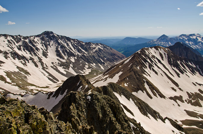
Eventually, we reached the top of the Ampitheater and were greeted with our next task, climbing up a very steep scree and dirt gully to the ridge. We were both overcome with glee over the prospect of such fun hiking (just kidding). Fortunately, the views behind us were starting to get good, with Snowmass Mountain and Capitol Peak poking above the ridgeline in the Ampitheater.
In addition to this, the clouds above were looking phenomenal, and the Maroon Bells were beginning to poke up above the ridge too.
The hike up this section was gruelling to say the least. It was steep, loose and unrelenting. The occasional break to look back was worth the climb though.
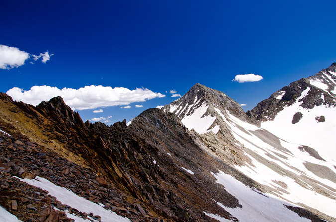
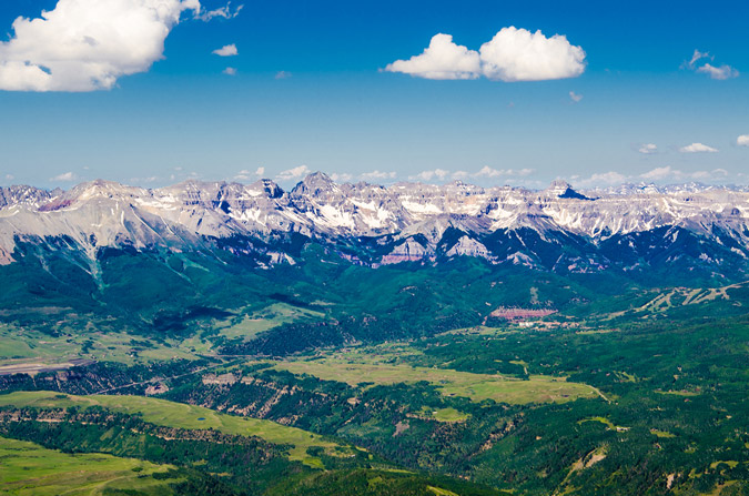
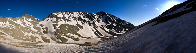
At last, we reached the top of this devilish section of climbing and our day's objective finally came into view for the first time. Pyramid Peak erupted above us like some freakish volcano. Here's a groovy photo with all of the mighty Elk 14ers in view - Pyramid, Maroon, North Maroon, Snowmass and Capitol. 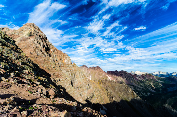
Sarah and I stopped for a bit at the top of this section to rest, eat and study up on the route. Sarah enjoyed what had become her signature staple food of the trip - PB&J on a hot dog bun. Yep. 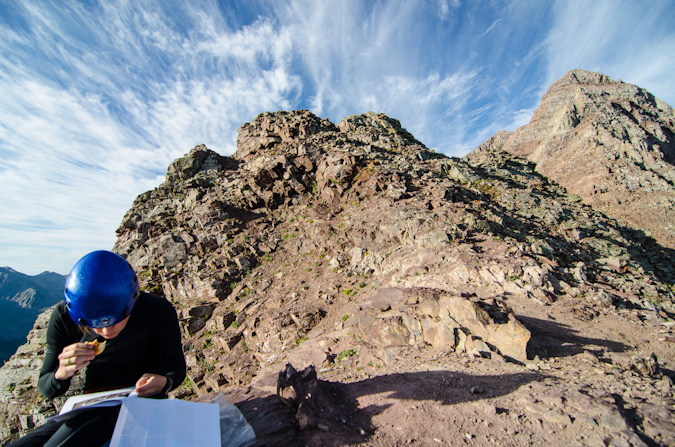
The clouds continued to provide a very dramatic feel for the whole morning.
After a short rest, two climbers joined us on the saddle - they were named Doug and Martin and asked to join us for the rest of the climb so that we would not kick rocks down on each other. This seemed like a great plan to us; although at first glance, Sarah and I were both a little taken back by Doug's bicycle helmet. Fortunately, it turned out he would be one of the safest climbers I've been with.
Doug snapped off a group photo for Sarah and I and we departed for the difficult section of the climb.
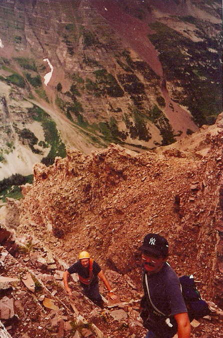
The route was quite obvious for most of the remaining part of the climb, with several cairns and a clear trail in many sections. At one point, we found ourselves at a section that was a huge crevasse in the trail, which totally reminded me a photo I remembered seeing of my dad when he climbed Pyramid Peak. Indeed, the crevasse was jumped by me both up and down. Here's a photo from the 1980s of my dad jumping a similar crevasse.
We reached the infamous "ledge" which proved to be a challenge with my camera bag affixed to my chest. Sarah captured this photo of me being quite relaxed while crossing, with camera in hand.
I had the camera out for a reason though, as I wanted to get a closer shot of Doug and Martin crossing this awesome section.
At last, we reached the infamous green gully, which turned to be the most enjoyable section to upclimb. It was quite solid and easy going, with little to no loose rocks to contend with. It was very steep though, and a miscalculation would prove fatal. Climbing to the top of this section was quite a lot of fun.
We then reached what many consider to be the crux of this route up Pyramid Peak, a section where you can choose between a very exposed class 3 section or an unexposed but more dangerous class 5 section. Coming down from this area were the two climbers we met earlier in the morning near the lake - they had already summited and were coming down, so we waited for them before continuing. As a group, we had a nice discussion about the route and the other two climbers departed.
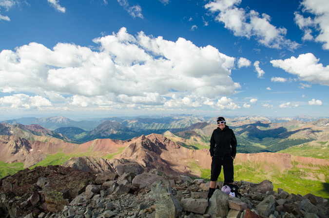
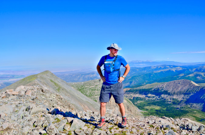
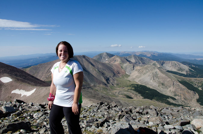
The crux move was spicy but nothing too hard. I thought the summit block on Mt. Wilson was harder and more exposed for sure. The rest of the climb was as simple as weaving our way up cairned sections of ledges. Before we knew it, we were on the summit. Sarah was up first and captured a photo of me summiting my last 14er.
As I reached the top, I took one last look back behind me at the east Elks - they looked so good.
The feeling was surreal, exciting, sad, happy and relieving, all at the same time. It was a flood of feelings for sure, but they were all welcome feelings. I felt like I had accomplished something quite remarkable (even though thousands have done it before me). Perhaps it had something to do with the length of the time it took to finish, or the length of the time I had had the goal. Either way - it was pretty darn awesome! Sarah gave me a big hug and then dropped a huge surprise on me. She prefaced the surprise with the something like the following words, "Angela wanted me to give this to you when you got to the top... I ensured it was not a divorce letter or anything like that, but don't shoot the messenger!"
She then handed me a white folded envelope with my name on it. Inside was the most thoughtful, humorous and loving message I could ever ask for from my wife. Sarah said, "she said you might cry." Which of course, I did a little.
Sarah and I celebrated the amazing day and basked in all of the glory that I knew would come from the views from Pyramid Peak. It was the perfect mountain to finish on. The views of the Maroon Bells, Len Shoemaker ridge, Snowmass Mountain, Capitol, Castle, Conundrum, Cathedral and the rest of the killer Elk Mountains were absolutely surreal and wonderful.
The famous Pyramid Peak diving board was a very inviting spot for photos, and Sarah decided to go surfing. I did an HDR and a non-HDR of this, for fun. You can mouse-over or click to see the non-HDR version.
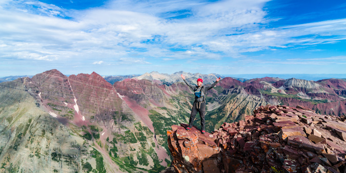
...and my celebratory pose!
It felt like a small little party up there, spirits were high, weather was looking good, and the views were to die for.
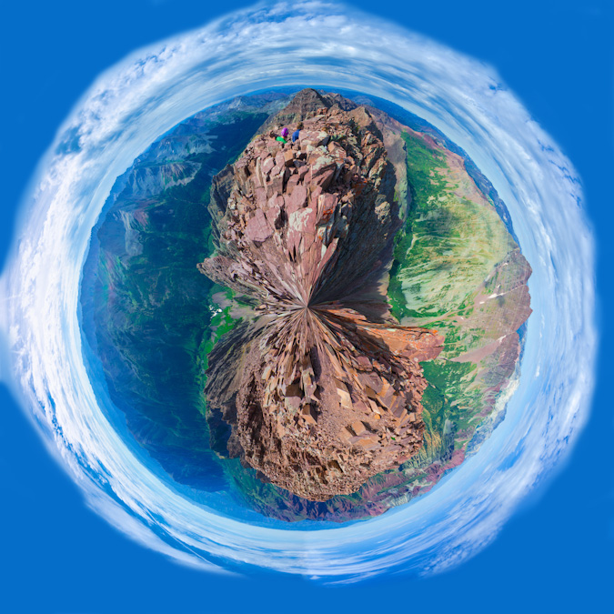
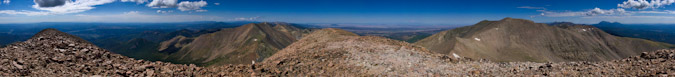
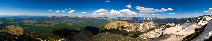
After some food, I fired off a 360 degree panoramic from the summit. One of my favorites to date.
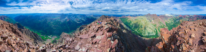
The same 360 degree pano made for a wonderful planet too... for more on those see this article...
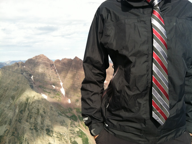
One of Sarah's more awesome traditions is that every Friday she wears a tie and takes a photo of it. This Friday would be no exception!
Weather was starting to build to the west, so we decided to start to pack up our stuff. I still was in awe of the sheer nature of the valley below - how steep the walls were, how amazing the features of the rock were. I'm not religious at all, but this is as close as you can get to a religious experience.
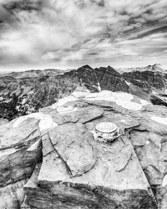
Before we left, I wanted one more parting shot from Pyramid with the USGS marker.
Downclimbing Pyramid Peak was slow going. It always feels much more awkward to downclimb the steeper terrain and Pyramid was no exception. Our group took special care not to dislodge any rocks onto each other and we staggered our decents and ensured we were each clear of a run-out section before the next person started. It was pretty fun climbing though.
Pyramid was one steep mountain, with lots of loose rock to beware of.
I was still amazed at how rugged the terrain was on Pyramid - it looks so unclimbable from all directions, and even when you're up there it feels quite surreal.
The slowest and most challenging part of the downclimb was the green gully. We took turns decending into sections and just as we reached the bottom of it, small rain drops started to slowly fall. We had made it through the hard sections just in time.
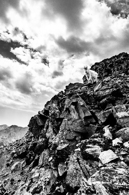
Luckily for us, the rain lasted only a short time and we were able to reach the saddle quickly and safely. Upon arrival, we were greeted by a lone mountain goat, who was probably licking up the urine others had deposited there earlier in the day...
This mountain goat was quite photogenic and decided to pose just for me on the rocks above.
After enjoying the company of the goat, we decided to head on down the most wonderfully exciting and enjoyable dirt and scree fest that was the descent off of the ridge back into the Ampitheater. We both ran out of water at this point and decided to hoof it down as fast as we could, with plans of heading on out of the valley that evening. The thought of a celebratory meal in Aspen was too much to pass up. Once out of the ampitheater, the CFI trail down was quite solid. I could not really imagine how awful this trail would be before this work was done. I took one final parting shot of the Maroon Bells on the way down Pyramid.
Sarah snapped off one last shot of me hiking back to camp. This is one happy dude.
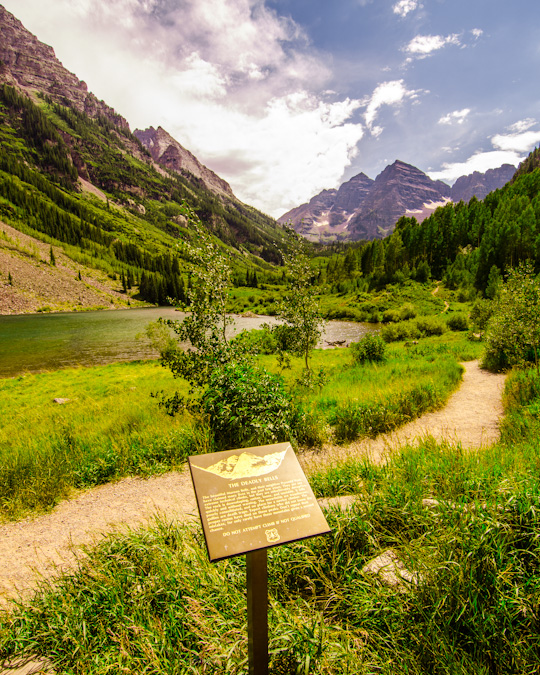
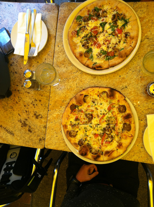
We got back to our campsite and packed up after refilling our water. Our legs were tired. Our souls were refreshed. It was time for beer and pizza. We headed out and I took one final "classic" shot of the Maroon Bells from Maroon Lake with the "Deadly Bells" sign. "DO NOT ATTEMPT IF NOT QUALIFIED."
I'm not sure if I was qualified or not, but I felt greatly accomplished and quite humbled to have experienced them either way.
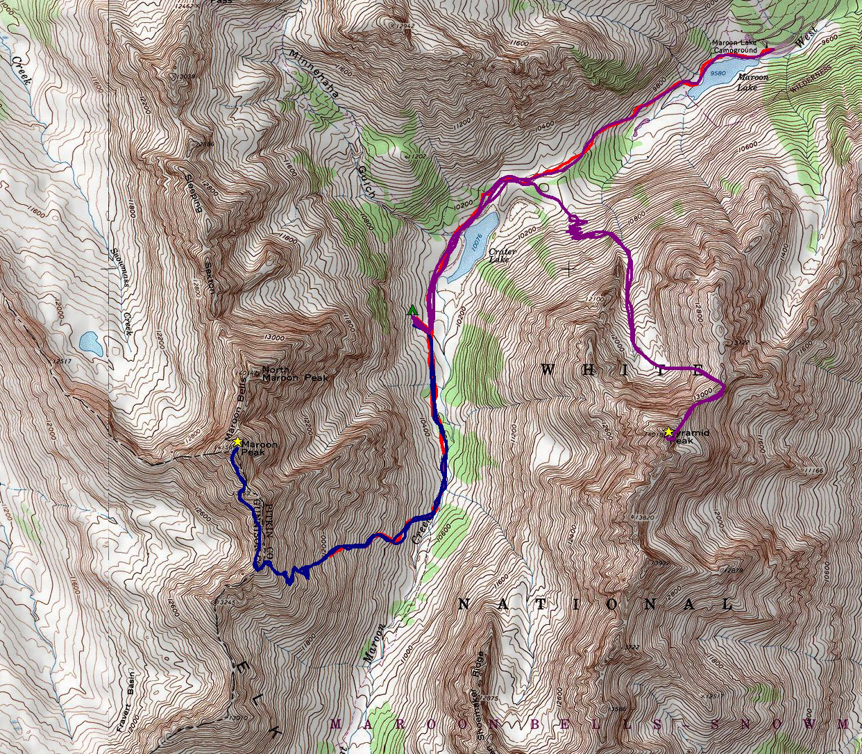
A final look at the route map. Click on it for a larger version.
We decided on a restaraunt called Mezzaluna in Aspen for our celebration dinner. I had a vegetarian pizza (did I mention I'm a vegetarian) with truffle oil and Sarah had a sausage pizza. Two margaritas were served and congratulations were in order.
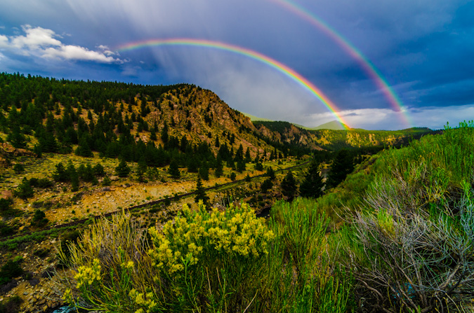
After leaving Aspen and dropping off of Independence Pass towards Buena Vista, we were greeted with a rare double rainbow, which capped off our most excellent trip in fine order. I could not have asked for a better trip, partner, or experience to finish the 14ers.
Conclusion and acknowledgements
A goal that takes 27 years to complete is one worthy of relishing, reflection and sincere acknowledgements to those that helped make it possible.
After fracturing my L5 vertabrae in 1995, I was not sure if I would ever be able to realize some of my goals. Fortunately, through hard work and incredible support from my family, I fully recovered from that and learned a great deal about work ethic. This quest for the mountains has tought me so many valuable lessons about life, about people, about myself...
Most importantly, it has taught me that despite people having severe differences of opinion on matters such as religion, politics or otherwise, something like the great mountains of Colorado can bring those people together to share in life-changing experiences that bind people unlike any other force. I hope to build on those lessons and continue to better myself as a person - my friends and family know there is plenty of room for growth.
To Sarah Musick: Thank you so much Sarah! It was such an honor to share those last two summits with you - you have been a true inspiration to me and my quest to finish. Your support over this past year has been fantastic. You are truly an amazing human being.
Of course, an achievment like this is never possible without the support of others, who are for sure some of the finest people I've had the pleasure to meet.
1. 1st - to my wife, Angela Payne (one fine Vegan chef with a killer sense of humor) - who has given me more support than I ever could have asked for - allowing me to chase my dreams is the best gift a person can give!
2. To my parents, they have been an inspiration for this life-long goal and I would have never have started without them introducing me to the mountains of Colorado at such a young age. My dad's goal to complete the highest 100 began in the 1970's and it quickly became my own goal as well.
3. To my family’s close friend – Dave LeShane – who also was on the quest for the highest 100 when I was a child – and inspired me to dream for the stars while climbing various 13ers with me as a child. Your wisdom, guidance and support over the years was like having a super-awesome uncle with bad-ass climbing stories.
4. To my regular climbing partners - Sarah Musick, Ethan Beute, Jeremy Park, and Regina Primavera (Yalegirl09) - you guys have been absolutely awesome to climb with! Your support, humor, talks, patience, insight and overall awesomeness has grounded me and reaffirmed my faith in mankind's future.
Sarah - you are one of the most amazing people I've ever met - our short but fantastic friendship has been such a blessing for me.
Ethan - our talks and hikes are always some of my most enjoyable days and most memorable experiences - I hope we can continue what I believe to be an incredible friendship!
Jeremy – while we have not done any 14ers together, we’ve known each other since high school and have been amazing friends ever since. Our epic adventure on Vestal’s Wham ridge will always be one of my fondest moments in my life!
Regina - you are one crazy, amazing and true friend! Our hikes are always a great time and I have enjoyed our talks!
5. To my other climbing partners, mostly from 14ers.com –
Terry Mathews (tmathews) - it was so great getting back into climbing with you back in 2009. Our adventures and introductions to class 3 on Crestone Needle, Crestone Peak, Blanca, Ellingwood, Kit Carson and Challenger were fantastic.
Micah (mountainmicah83)- dude – our epic day on Harvard and Columbia will never be forgotten - while I had hoped we could get out more – it was still awesome to learn rope/climbing skills from you and Matt!
Mike Vetter and Travis Arment - what can I say Mike - anyone who would drive all the way from South Dakota to climb Huron Peak with me is one awesome dude. Our adventure up Capitol Peak with the accomplished Travis Arment was unforgettable. You guys are fantastic people.
Barry Johnson (Johnson) – our climb of Shavano in 2009 was my re-introduction to the 14ers after a long hiatus – thank you for joining me on that fantastic day!
Mike (fiemus) and Bob Hay – our hike up Yale was great – learning about all of Mike's SAR stories was one of my favorite days in the hills.
Kara Bauman, Will (WillV), Alli Kolega and Tom Shaar – our climb of Mt. Wilson was absolutely wonderful! Thank you for allowing me to join you guys on such a fabulous adventure!
6. To Bill Middlebrook for creating and maintaining 14ers.com – it has been very helpful for me in this crazy pursuit.
7. All the other awesome mountaineers, climbers and hikers in this community - we need to continue to focus on our common goals and dreams.
Thank you for all for the inspiration to write these, and thank you for reading...
{fcomment}
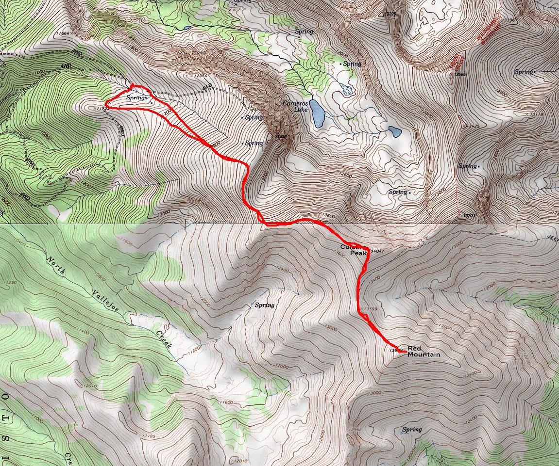
Culebra Peak and Red Mountain - Finishing the Sangre de Cristos
Quite a few people save Culebra Peak (ranked 41st – 14,047 ft.) as their last 14er; however, I wanted to just get it out of the way sooner rather than later. If you’re wondering why I am talking about this mountain as if it is like a trip to the dentist – there’s a reason – it costs $100 to climb it and another $50 if you want to do Red Mountain (ranked 70th – 13,908 ft.). The Culebra sub-range of the Sangre de Cristo Mountains has been embroiled in controversy for years. In fact, the New York Times once called it “the hottest environmental dispute in the Rockies.” Imagine – 77,500 acres of pristine alpine terrain with elk and timber in huge supply, including one of Colorado’s coveted 14ers – all owned by one person. The land used to be called the Taylor Ranch and was renamed the Cielo Vista (heavenly view) Ranch by the newest (and present) owners, Bobby Hill and Richard Welch. The story goes back to 1843, when a long series of events carved the land up into parcels, which were shrouded in controversy due to non-traditional land use rights built into the deeds of the land. Essentially, descendents of the original Mexicans that occupied the land before the Mexican-American War of 1846 – a conflict caused by the annexation of Texas – claimed that they had communal rights to the land to include logging and livestock grazing. The land was purchased by Jack Taylor in 1960 for $500,000 with the provision in the deed that the land was subject to the claims of the local people; however, Jack Taylor had no intention of honoring that issue, and many lawsuits ensued. Additionally, Jack Taylor was known to beat trespassers and arsonists that frequented his property due to the controversy.
Eventually, Jack Taylor was jailed himself for taking matters into his own hands and had an assassination attempt on his life in 1975. After that, he rarely returned, all the while the land was being poached for hunting, climbing and other uses. Eventually, Jack Taylor died in 1988 and the land was passed on to his son, Zachary Taylor, who continued to log the forest of the land, which caused even greater controversy. Long story short, climbing access to Culebra has been mixed over the years, and it has always been a sore topic for many that are on the quest to complete the 14ers. Personally, I have mixed feelings about the practice of charging money to allow someone to walk on your property. On one hand – it is a piece of entrepreneurial genius. On the other hand – it barely feels right for someone to “own” a mountain. I am sure that I am not the only person to think about this and I am sure I won’t be the last!
Now that I am done with the brief history lesson – here’s the details if you’re ever interested in climbing Culebra and Red Mountain yourself. Reservations are required if you want to pay to climb - to reserve a space, call the office in Glen Rose, TX at 254-897-7872. They usually start taking reservations in mid-May and spaces go quickly. They are quite friendly – and send you a packet of materials about the mountain and their rules. The only real downside to the arrangement (other than the rather exorbitant cost) is the fact that you are not permitted to start at your own time – you are required to wait at the property gate until 6 AM, at which time they open the gate and escort you to the ranch proper, where you are required to pay and listen to a speech on how to drive up the road to the trailhead. All-in-all the whole experience left me with a foul taste in my mouth. I felt like herded cattle – like a child being told what to do. I suppose this is out of necessity for the ranch owners; however, I cannot help but voice my distaste for the whole affair. To their credit – they are super nice people and seem to run a very clean operation. OK - rant over.
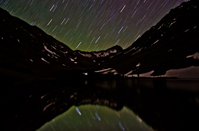
So, Regina and I made reservations back in May for both Culebra and Red Mountain. Since Red Mountain is in the top 100, I felt obliged to add it on. So – Regina and I left for the town of San Luis on Saturday - 7/23/11 to stay the night at the gate of the Cielo Vista Ranch and await for the 6 AM cattle herding to the ranch proper. We arrived rather late on Saturday and set-up our campsite in what seemed to be a desolate desert in the middle of nowhere. I was not going to let that bother me though – I wanted to experiment with some star trails photography and light painting. The results were very appealing.
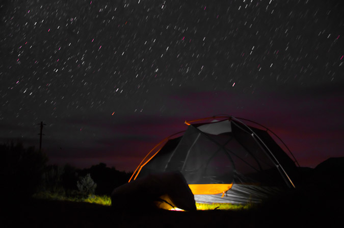
I decided to use the tent as a foreground subject and was able to locate the North Star and centered it above the tent so that the stars rotated around the North Star in a concentric circle pattern.
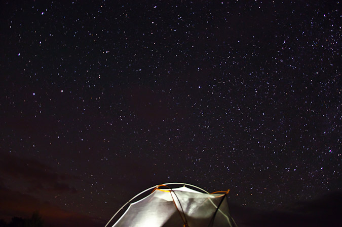
Additionally, I was able to get some pretty nice photos of the Milky Way and other night sky features.

We set our alarm for 5:30 AM and hit the sleeping bags. We got up and followed the herd of cattle at the gate up to the ranch, where we got in line to pay our fees (cash or check only) and to wait for further instructions. Once instructions on how to drive your car in 4-high vs. 4-low were given in great detail, we drove to the upper trailhead, where we found ourselves at the base of the start of Culebra Peak. On the side of the mountain were probably 40-50 elk running up the ridge – quite a sight – but unfortunately too quick for me to get a photo.
Since the ranch bills this mountain as being the most pristine 14er experience, there are no trails. We set-off up an old road to the west and joined up with the northwest ridge and began our climb, which mostly consisted of hiking on moderately steep grass and rock up the ridge to join another ridge.
I was feeling really strong, and made it to the ridge in little time, waiting for Regina periodically to catch-up.
Once the ridge is reached, you find yourself standing before a giant cairn and a lofty view of Culebra Peak.
The route from here was quite obvious – follow the ridge to the top, which is just what we did. I found the route somewhat pleasant, with minor scrambling challenges here and there, but mostly the route was class 1 and quite boring, in all honesty.
Contributing to the relative boring nature of this hike, Culebra lacks much in terms of scenic opportunity. The only notable mountains in view from Culebra are Blanca, Little Bear, and Lindsey far to the north, with some minor 13ers nearby (Trinchera to the Northeast, Vermejo and Purgatoire Peaks to the South).
Needless to say, I was not terribly impressed by much of the views from Culebra – which is not to say it was ugly – it just was not spectacular or notable in comparison to many other mountains I’ve climbed. About ¾ of the way up, I decided to take a 360 degree panoramic set, which turned out great.

The rest of the hike up to Culebra’s summit was easy, with one minor false summit to go over and some fairly easy boulders to navigate over.
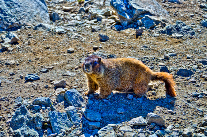
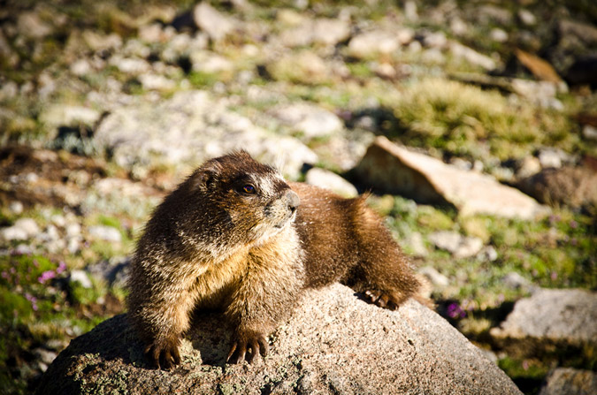
Once on top, I waited for Regina for about 30 minutes and took some photos. The summit was full of quite friendly marmots, which were not afraid to come right up and try to eat my backpack.
Once Regina arrived, we took a few more photos and then Regina explained that she did not feel well, so she hung out on the summit and told me to go ahead and hit Red Mountain real fast.
I hustled down the ridge and up to Red Mountain in no time at all – making it over in just under 25 minutes from Culebra. Views from Red Mountain were a little better, so I took a nice 360 panoramic from there, signed the register, and headed back over to Culebra.
With Culebra and Red Mountain complete, I was left with 34 of the highest 100 and the 15 from the Sangre de Cristo Range completed. It felt great. I hustled back over to Culebra in just over 30 minutes and was pleased to see that Regina had already headed back down.
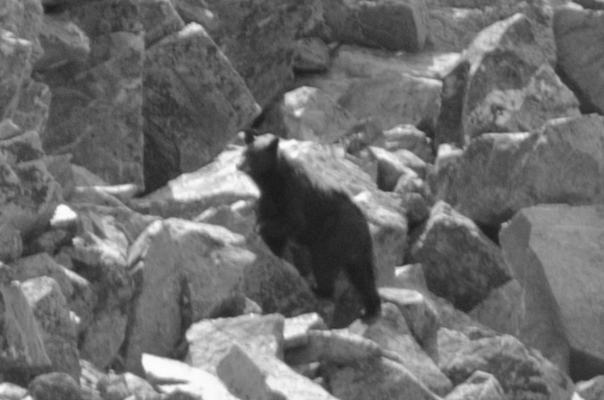
I embarked back down the ridge and was greeted abruptly by yelling from below. Two women were screaming: “There is a bear 40 yards to your left – stay on the ridge!” WHAT!? I’ve never heard of a bear above treeline before, nor have I seen one in the wild, period. That says a lot considering how often I hike. I looked at my altimeter watch and I was at 13,600 ft. Unbelievable! What the hell was the bear doing at 13,600 ft? I did not want to stick around and find out, so I quickly headed for the two women and saw the bear rummaging in the boulders – I presume he was looking for bugs to eat. He was a young bear – maybe 2 years old.
I kept on hiking and eventually rejoined Regina on last section of the down climb from Culebra. We were able to make it back to the car just before hearing the first thunder from a storm that had quickly built above Culebra. We were both thankful to be off the mountain and headed out. We stopped a few times to get photos of Culebra and also of the Blanca massif from the town of San Luis.
Next up – Snowmass Mountain and Hagerman Peak!
Just a reminder - this site costs me time and money to maintain - if you find it useful, please consider supporting the site by remembering to use the affiliate links, especially if you purchase photography related gear from Adorama. Thanks!
{fcomment}
Wilson Peak - An 'Airy' Scramble Above Navajo Lake

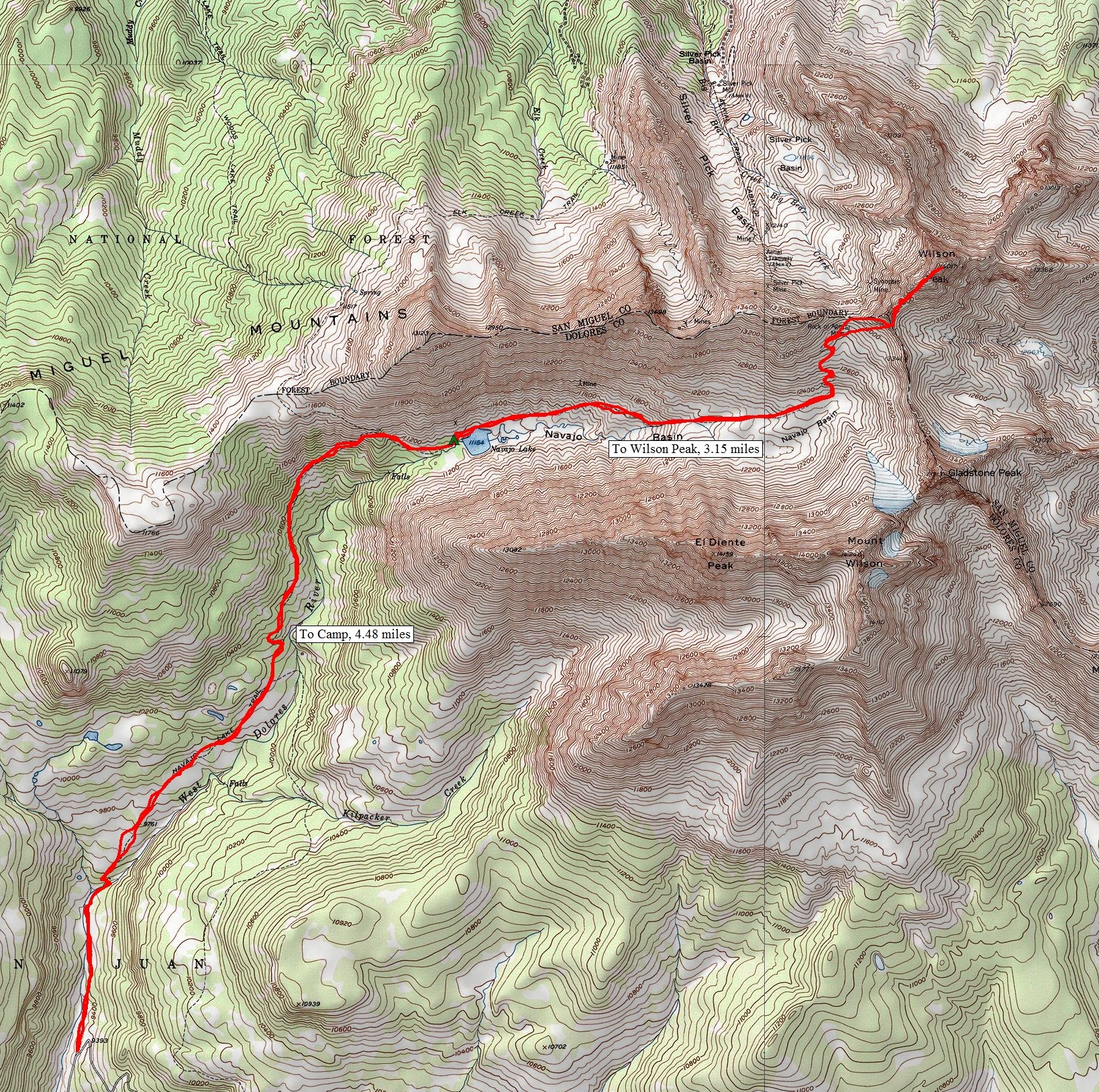
Fourth of July weekend always provides a tremendous opportunity for mountaineering, and this year was no different for me. Early in the year (January), I was eagerly planning my summer's climbs and saw this weekend and knew it would be both tremendous and controversial. You see, my wife's birthday is July 3rd. I begged her to allow me to climb on this weekend, knowing that it would probably be the only way I would be able to successfully complete the 14ers this year, which was my goal. My wife was really cool about it and said I could go. With that being said, I knew that the perfect match for this date range would be the Wilsons (Wilson Peak, El Diente and Mount Wilson). I set aside a total of 5 days for the trip and hoped I would not need all 5 days, but knew that weather could necessitate the use of all 5 days. My climbing partner, Regina and I roughly sketched what we thought would work best earlier in the year and when June 30th finally arrived, we were both excited to get out of town and up into the mountains! The plan was to drive to the Navajo Lake trailhead on June 30th and camp there, backpack up to Navajo Lake on July 1, establish camp, climb Wilson Peak and go to bed. After this, on July 2, we would do El Diente via the North Slopes route in the snow and then traverse over to Mount Wilson. This would leave July 3 for completing Gladstone Peak (a centennial 13er) and for the hike out. It even factored in one extra day for weather or for kicking it in Telluride for a bit.
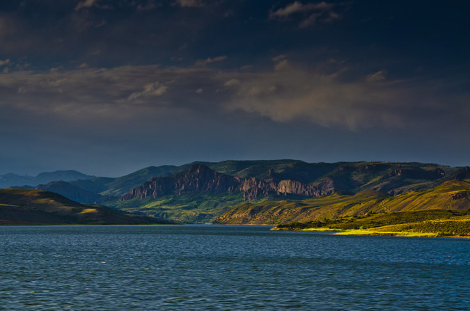
So, with all that being said, Regina and I embarked for the Telluride area, a good 300 miles away. We drove through the Blue Mesa Reservoir area during dusk, and I was able to get one decent photo from the car while Regina was driving. I have always really enjoyed that part of the drive and someday I'll time it just right to get a gorgeous sunset photo there. Until then...
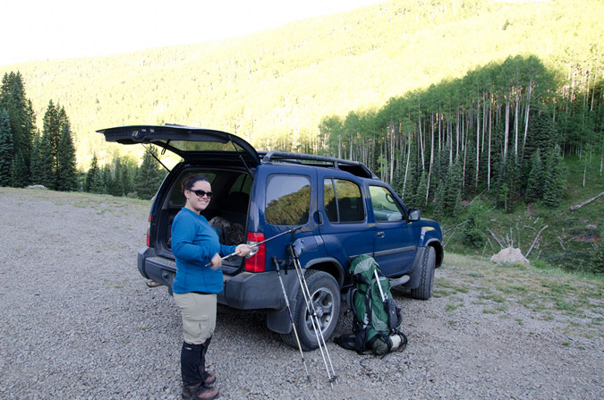
The plan unfolded perfectly and before we knew it we had arrived at the trailhead for Navajo Lake at around midnight. We set-up camp away from the trailhead and set the alarm for 7 AM since we were looking at a good 4.5 miles or so to the lake and an additional 8 miles to Wilson Peak and back to the lake for our itinerary. The alarm went off and we sprang out of the tent and packed up quickly, eager to hit the trail. The weather was absolutely fantastic. This week, I decided to try something I've never done before and pack my tripod with me. While this added some additional weight, it would allow me to get some great photos at Navajo Lake and even try my hand at some more star trails photography.
The Navajo Lake trail was really quite fantastic - it weaves in and out of huge groves of corn lilies (Veratrum Californicum), but I like to refer to them as Indian Toilet Paper since back when I taught Leave No Trace we would always use them for, ahem, wiping.
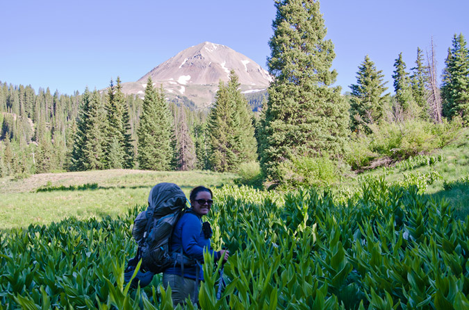
Pretty quickly, the trail leads you up the long meadows and into view of El Diente, which by the way was one of the most deadly mountains last year.
The whole area was covered in those corn lilies and wildflowers, which slowed me down a bit due to me wanting to take a ton of photos. I think I have a serious photography problem or something... what do you think?
 |
 |
 |
 |
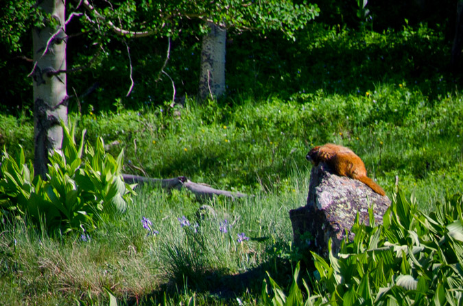
Naturally, a hike in the San Juans and the Lizard Head Wilderness Area are not complete without a sunbathing marmot!
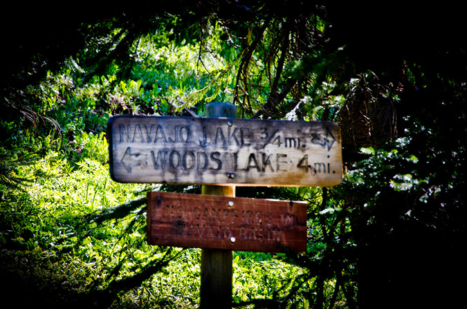
The trail kept winding up towards Navajo Lake and eventually we reached the trail junction for Woods Lake.
The closer we got to the lake, the more vibrant and ubiquitous the wildflowers became and I could not help but take more photos. What can I say, I'm a sucker.
A mere 3 hours later we finally arrived at Navajo Lake. The view of the lake and Gladstone Peak was absolutely stunning.
We were able to establish camp about 300 feet away from the lake up on a small plateau - it was an absolute gem of a campsite. After setting up our tent and getting everything else situated, we packed up our daypacks and headed on up the trail with the objective of Wilson Peak in mind. Our departure time was 12 PM. Normally, I would not attempt to climb a mountain so late in the day, but the weather was superb and I knew the forecast was totally clear, so we opted to give it a shot. Worst case scenario, we could always head back down to the lake if the weather turned on us.
Now, Wilson Peak has never held much status in my mind, purportedly being the easiest of the group's 14ers, so I never did much research on the route. Sure, I read the route description and printed off a few photos and paragraphs, but I felt pretty confident that it would be a fairly easy climb. Boy - I was really pleasantly surprised and wrong about that assumption, as you'll read later on.
The hike up into Navajo Basin was really enjoyable from the lake.
 |
 |
After awhile, the trail finally brought us even with El Diente to our right, the view of the North Slopes route came into view nicely. Mount Wilson sits at the top of the basin, right of Gladstone Peak, and is connected to El Diente by a massive, spiny ridge, as seen in the below pano.
Additionally, the blue hues of Navajo Lake kept me looking back, enjoying the vistas of the valley.
The trail was not terribly steep but it did weave in and out of large snowfields, making it a bit more interesting but nothing too dicey, so far.
Finally, we reached the headwall that leads to the Wilson Peak - Gladstone Peak saddle beneath the Rock of Ages Mine, which required us to head up a giant snowfield. The snow was quite firm and easy to hike through.
I was feeling really good and had gained a bit of distance between Regina and I, so I periodically stopped to let her catch up.
The snow in the North Slopes Couliour for El Diente looked superb and I was a bit excited to see how that would work out on the following day.
At 2:30 PM, we both reached the Rock of Ages mine, which felt quite like something out of the 1800's. An old wooden mine shack still sits on the mountainside along with a small wooden bench, a mining cart and some other odds and ends.
We rested at the mine, ate some food and discussed the next steps. The trail continued on up towards the Rock of Ages saddle to our left, but I knew from reading the route description that the trail winds back across the mountain just above the mine itself, so I figured it would be a good opportunity for some off-route exploring up through some easy class 2 boulders above us to the Wilson Peak - Gladstone Peak saddle.
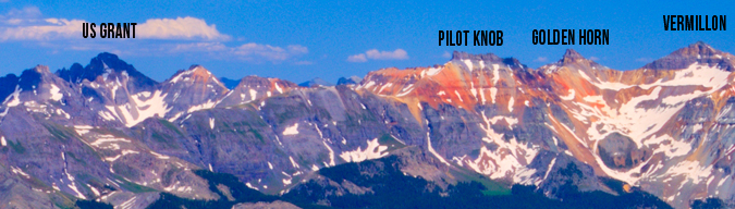
Personally, this terrain is a playground for me - the rock was somewhat loose but not too crazy, and it was fairly obvious which rocks were stable and where you needed to go. Regina on the other hand, not having grown up climbing off-route like me, felt a little less comfortable on the boulder field and was starting to have some doubts about the rest of the climb. I assured her that she would be fine and that she needed to treat the rocks with respect, expect that they will move, and be nimble about her movements. Eventually we made it up to the saddle without incident and were greeted by the first insane views of the day to our east. A cornicopia of San Juan mountains laid before our eyes and I was excited to finally get views of Lizard Head Peak, Fuller Peak, Vermillion Peak, Golden Horn, Pilot Knob, U.S. Grant Peak and South Lookout Peak, which all rest at the head of Ice Lake Basin - one of the most gorgeous locations in Colorado. Can you identify them all?
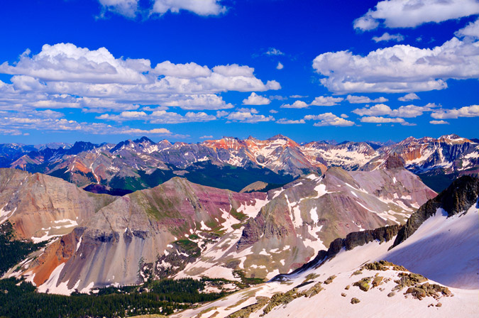
Here, let me help you!
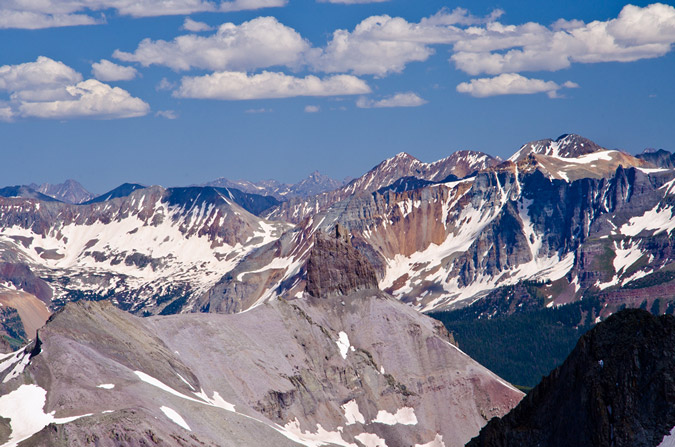
Of particular awesomeness was the view of Lizard Head Peak, which will likely forever rest on my unclimbed list!
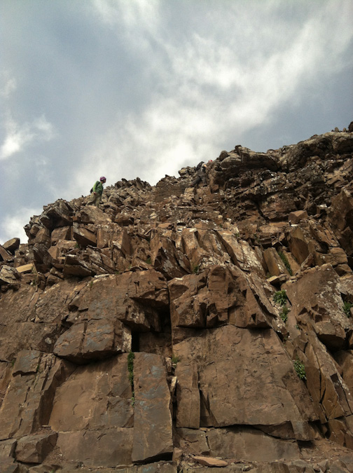
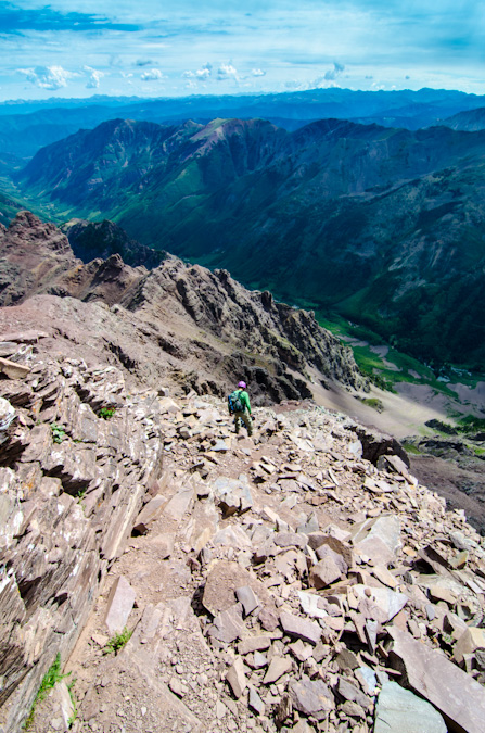
At this point, Regina and I had to make a decision. The weather was great. Barely any clouds in any direction. But - Wilson Peak was still a long ways off and it was already 3:30 PM. I still felt strong but Regina was fairly demoralized by how far away Wilson Peak looked still. From the saddle Wilson Peak was still a half mile away and a good 600 feet up across insane snowfields and rotten rock. I encouraged Regina to give it a shot with me, so we did. Right off the bat, we were greeted by a pretty intense snow field at the base of a cliff that was quite run-out, meaning, if you fell down, you were going to travel a long way down and probably die. We deployed our ice axes and secured our helmets and crossed, using extreme caution. Soon, a second and then a third snow field of equal danger were presented to us as well as crumbling rock and difficult trail-finding. Regina became really sketched out by the whole thing and decided that it was as far as she would travel and told me to keep going and that she would wait there. I was fine with that idea, so I continued on. I'm not going to lie - I was not mentally prepared for this climb. I thought Wilson Peak would be a walk in the park. Having much of the route obscured by steep and dangerous snow that had softened considerably throughout the day, my mountaineering skills were certainly challenged. The route before the false summit was chossy at best, with huge loose boulders cascading above and below me on a regular basis. Oddly enough, I was calm in this environment. I have an odd knack for loose rock and when my footholds and handholds gave way, I went with it, almost like walking onto an escalator. I chose my route carefully enough so that I could avoid the larger messes, but a few rocks did manage to take huge chunks of flesh out of my finger and hand. No worries though, the bleeding stopped quickly and I didn't even stop to apply a bandage. All in a days work. I was finally able to reach the ridgeline that connects to the false summit, and was able to catch views of a small wildfire that had broken out to the north-west of me.
Of even more interest at the time, Wilson Peak's daunting summit block stood before me like some ancient pyramid. Again I found myself thinking - wow - really? I never expected this much awesomeness from this mountain. I was excited. Was this going to turn into a class 4 scramble? I sure hoped it did! The exposure looked inviting, but the rock was crumby and resembling of tiny pinnacles. I knew that I needed to choose my route carefully. The route description from 14ers.com stated that there was two ways to skin this cat - go left and downclimb to some safer class 3 sections, or continue on the ridge and challenge yourself with some nuts class 4 stuff. I chose the class 4 stuff and it did not disappoint me in the least.
In the interest of weight and balance, I decided to take a huge drink of gatorade and leave my pack on the false summit, bringing along my camera, which was attached to my chest by my new Lowepro Toploader bag. Yes, I realize that I broke one of the key tenets of mountaineering by leaving my pack behind, but I still feel it was the best decision.
After carefully finding my way down and through the class 4 section, I reached the summit at 4:50 PM. I was still feeling great. Naturally, the views were absurd and rediculous - in a good way of course! Sneffles towered to the north-east alongside all of her insanely shaped neighbors. All-in-all I would rate the Wilson Peak views as a 8 or 8.5. Pretty amazing.
Sneffles and her friends:
I was able to set my camera up to take a quick self-timer too - how fun.
I figured with Regina waiting below, I should get off the summit pretty quickly, and so I did, leaving at 5:03 PM. In the distance, I spotted my pack and I thought it was neat to see the nastiness of the downclimb I did earlier as well as my pack for a dose of perspective. I basically went straight down from where my pack was at.
Zoomed out, you can see that the saddle where Regina was waiting for me was a long ways off. I believe she was waiting for me just where the snow was starting to end.
Another view of the climb back up to the false summit from Wilson Peak with my backpack at the top:
The downclimb back to Regina went much faster and I was able to reach her in just 30 minutes from the summit. She had safely crossed back to the saddle and had waited for me there. She also took a shot of me on the Gladstone Peak - Wilson Peak saddle:
We opted to head back down the standard way to the Rock of Ages Saddle and had a long conversation on the way down. I knew that Regina was probably feeling pretty bummed about not getting to the top of Wilson Peak, especially after the absolute disaster that was our Snowmass Mountain attempt the week prior. I was pretty proud of the way Regina handled this situation. We talked about how this type of climbing just was not fun for her and that if she was feeling uncomfortable on the rock that it was not worth getting killed just to check off a box on a list. I knew that Regina had a strong goal to finish the 14ers this year, but I think she has a much richer appreciation for mountaineering and all of its challenges. I think that in time she will grow more and more comfortable on class 3 and class 4 climbs, and will complete the 14ers; however, there's no sense in getting killed because you don't feel comfortable! Kudos to Regina for having a clear mind about this issue. All too many climbers lose sight of this important perspective in their quest for glory.
The Rock of Ages Saddle proved to be a nice location to capture a nice panoramic of the Navajo Basin, with Gladstone Peak (center) at the head and continuing on down the ridge to El Diente.
We took pause back at the Rock of Ages Mine for some good 'ol fashioned mining fun. Regina took a more conservative approach to her mining pose:
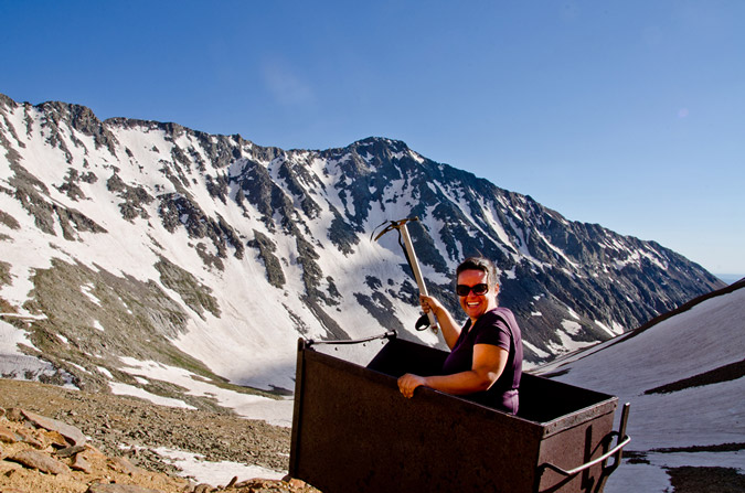
But... I was still pumped from doing Wilson Peak, plus I wanted to give my best Miner-49-er impression! I think the result was more of a hybrid between pirate and crazy guy...
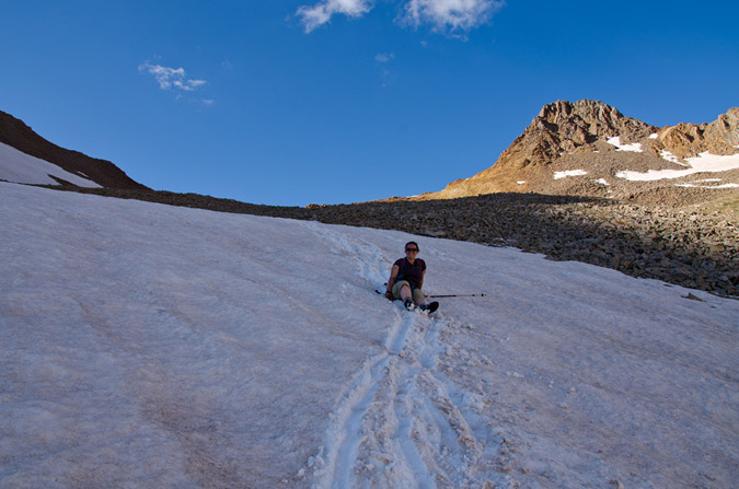
Cruising back down the Navajo Basin was quite fun since the snow had softened up just enough for some glissading and boot skiing.
However, the sun was beginning to set, and my photographic funny bone started to shake. I knew that the Golden Hour was approaching and that there would be some amazing opportunities for some killer shots soon.
 As we worked our way down the snow fields, I was getting more and more anxious for the photography opportunities. I kept looking down at my altimeter watch to see what time the sun was setting. According to my watch, the sun would set at 8:45 PM. I was really pushing myself to get down to Navajo Lake before then so that I could take advantage of my tripod and the sunset.
Unfortunately, there were just too many awesome things to take pictures of on the way down!
I even found a model marmot to pose for me - how kind of him!
I thought he was pretty funny! He even gave me his best "oh crap" look! Haha.
As the sun set further and further, I kept pushing myself to hike faster and faster. Would I make it?
The photographic opportunities were endless...
I was even able to get a quick HDR from the trail, although the results were not terribly great.
I finally passed Regina and she pretty much knew what I was up to - I needed to get back to that lake! Alas - I did reach the lake right on time at 8:00 exactly, 8 hours after we had left camp. Navajo Lake submitted her glory to me quite beautifully...
And I even did a pretty decent HDR too:
Regina and I convened at camp and decided to cook some Mountain House meals ASAP to refuel. While I gathered some water at the creek, I could not help but notice that the red rocks of El Diente were reflected off of the creek...
Regina and I talked about our plans for the remainder of the weekend. We tossed around a few ideas. Maybe I could climb Mount Wilson and El Diente with another group at the lake? Maybe we would just head out and call it good? We decided on the latter. I did not want Regina sitting around all day while I climbed some more, and since the mountains are not going anywhere, I figured it would be totally cool.
Regina and I threw down on our meals like two starving children. Regina was pretty tired and went to bed, but I knew that my adventure had just begun. With tripod at hand and camera at the ready, I set-up for a night of star trails photography, which is quickly becoming one of my favorite things to do.
Navajo Lake would provide the perfect setting for star trails, and I knew that I would get a few keepers out of my efforts.
As I waited for the perfect amount of star light, I embarked on a slight experiment. I knew that in a lot of star trails photos, the goal is to center the photo on the North Star, since that star does not move across the sky. The result is a center star that does not move with the rest of the stars rotating around it like a carousel. Unfortunately, I totally forgot how to identify where the North Star is in the sky, but knew that it had something to do with the Big Dipper. I realized that the Big Dipper's cup pointed at the North Star, so I centered my camera on that star and tested it out. Sure enough, I had successfully located the North Star.
Finally, the moment was right and I opted to do the one exposure method of shooting star trails, where combining photos is not required, but precision is. I think it went pretty well, although I really wanted to do it for longer, but literally fell asleep on the shores of the lake while the camera took the shot...
I also decided to compile a set of exposures @30 seconds each to see which method produced the best results. I certainly feel torn!
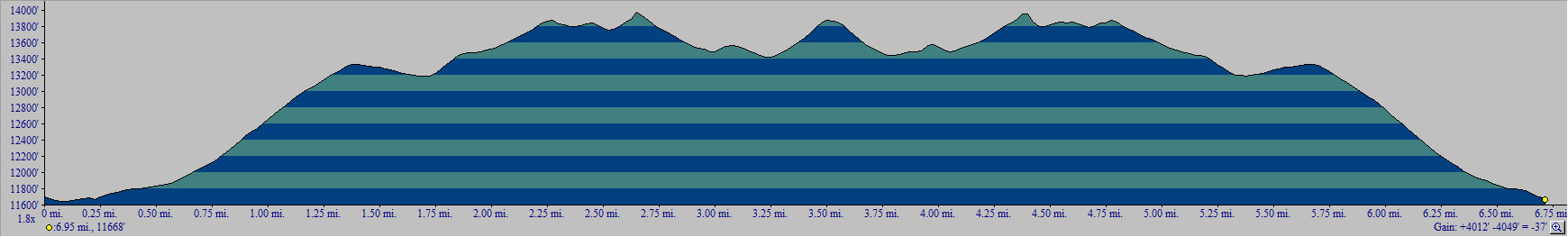
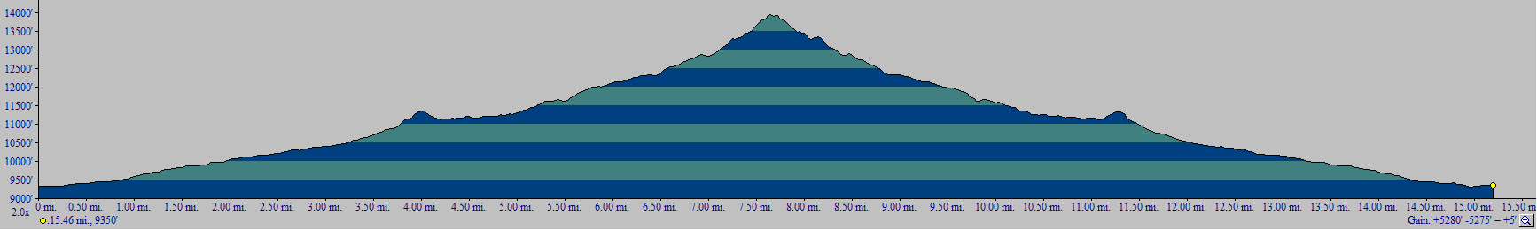
I finally went to bed, knowing that I had captured something magical in the reflection of the lake. In all, I ascended 5,280 ft. and hiked over 15 miles. Click the elevation profile for a larger version if you'd like.
The next day, we packed our packs and headed out, but not without some obligatory shots of more wildflowers and one whacky mushroom!
 We departed the valley thinking that our adventure had ended. We left knowing that we had gleaned some positives from the trip and that even though our plans did not pan out the way we intended, that it was still a great time. Little did we know then that our adventure had just begun...
San Luis Peak - an adventure in photography and friendship
San Luis Peak is a gentle giant, rising to 14,014 feet in the middle of the La Garita Wilderness Area, which means "The Lookout" in Spanish, according to Wilderness.net. The 50th highest ranked peak in Colorado, San Luis Peak is named after the valley it towers over, the San Luis Valley. According to Hayden's 1877 Atlas of Colorado, the valley itself was named by an early unknown Spanish explorer, the patron saint of whose village was San Luis.
I've been wanting to climb San Luis for awhile now. Not a technical climb nor arduous hike, San Luis is generally considered one of the easier 14ers; however, due to its remote location, it is not climbed nearly as frequently as other 14ers. Indeed, the trail-head is located nearly 50 miles from any recognizable form of civilization. For this reason, I am quite thankful that I was able to get a ride with Regina Primavera (Yalegirl09 on 14ers.com), my friend and hiking partner. Regina and I planned out many of our hikes quite early this year and San Luis was to be the first mountain for us to tackle together. Additionally, another awesome person, Sarah Musick, found me through my website and a mutual friend, and asked if she could join us.
Regina and I picked up Sarah and departed for the San Luis trailhead on Friday evening, June 10th, 2011. Excellent conversation ensued and we were all quite acquainted with each other before we reached Salida, Colorado for dinner. We made a stop at Amica's Pizza and Microbrewery, which reminded us all of Il Vicino in Colorado Springs (and for good reason too, apparently Amica's used to be a Il Vicino and was later converted by the new owner). The food and beer were all quite fantastic. With spirits high, we continued on to the town of Saguache, Colorado (pronounced Saw-watch), refueled, and drove the beautiful yet never-ending road to the San Luis trail-head. A note about the road - it was somewhat confusing for us coming from the San Luis Valley. If you are coming from the San Luis Valley area, drive north on Colorado 114 to Dome Lakes, then turn left onto the "15-GG" road. Our mistake was that we did not drive all the way to the 15-GG road, but instead headed up the NN-14 road before reaching Dome Lakes. It still gets you there by going the way we did, but it is MUCH longer! For our trip, we opted to take the Stewart Creek trail.

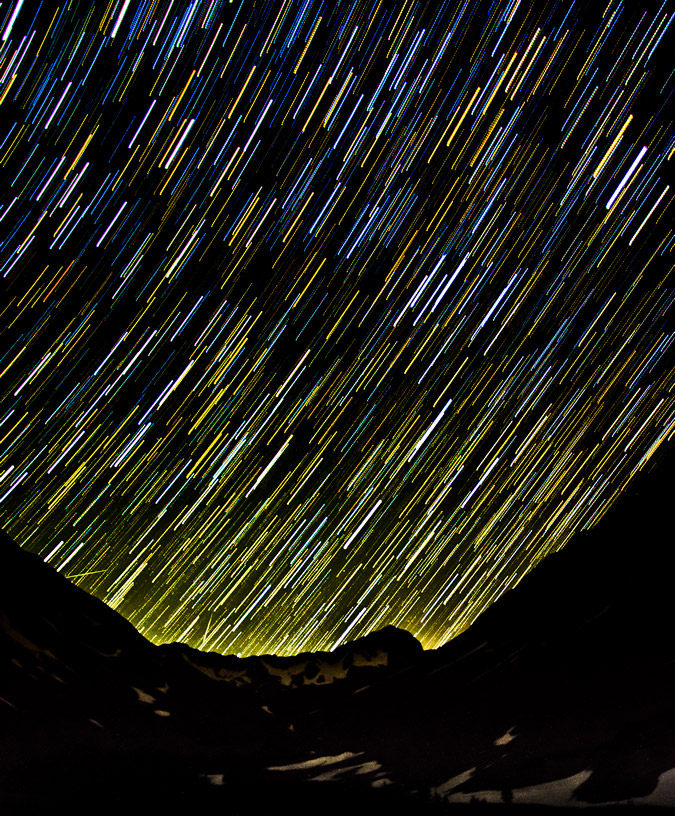
Upon reaching the trail-head parking lot, we set-up our camp site quickly with the aid of headlamps. The stars were pretty incredible since we were in the middle of nowhere, and I decided it would be a great time to try out some star trails photography.
The stars were looking good... hopefully the star trails version would be just as good!
There are a couple techniques one can use to accomplish star trails in a photo. The basic method is to take one long exposure (over an hour), which captures the movement of all of the stars as trails across the photo. The drawback from this technique is that you have no room for error because of the long single exposure and, due to noise caused by heat and other factors in the camera, you need to turn on noise reduction in camera, which basically takes an equally long exposure with the shutter closed at the end of the shot and then reduces noise based on the comparison of the open and closed shutter shots. The second method, which I employed, is to take multiple shorter exposure shots (30 seconds to 4 minutes each) over a period of time, with little time between shots to ensure that no gaps exist in your trails (unless that is what you want), and then combine them later in a program like photoshop or startrails.exe. In order to get the below photo, I set-up my camera, a Nikon D7000, to take a photo every 45 seconds. The camera was set on manual focus, with the stars in focus, at aperture of 5.6; the shutter speed was set for 30 seconds because I forgot to bring my shutter release cable, otherwise I would have probably set my shutter speed at 2 minutes or so. I then imported the photos into Adobe Lightroom and adjusted the exposure and cleaned up any unwanted artifacts that streaked through the exposures (airplanes, satellites, etc). I copied the development settings of the photo I did the work on and applied it to the other 47 images for consistency purposes. Finally, I loaded all of the images into startrails.exe, which is a free program. Startrails combines all of the photos together into the one you see below. All-in-all, I was very pleased with the results.
Additionally, I decided to add the photos together into a time-lapse video, showing the change in star position across the 35 minute time-span, as seen in this YouTube video:
After waiting in the cold for an hour with Regina while the camera captured the photos, we set our alarm for 4 AM and crashed in the tent. 4 AM came sooner than I liked, but I felt much more rested than I did on my last adventure up Princeton.
We packed up our tent and sleeping amenities, ate some quick trail food, and departed. Since none of us were really sure about the conditions of the mountain due to a real dearth of trip reports online for San Luis recently, Regina and I opted to pack our crampons, and we all had ice axes. Regina and Sarah were looking quite excited to begin the hike at 5 AM, despite Regina stating she felt sick.
Naturally, I had to look as excited as possible, despite the fact that I am not a morning person!
The trail heading up the Stewart Creek valley was gentle and steady. One thing that was remarkable was the beaver ponds, which were quite ubiquitous. We were even lucky enough to be greeted in the early morning by a couple of beavers, whom used their tails to loudly splash water, as if to say, "this is our house!" As we continued up the trail, we shortly glimpsed a very young moose that was grazing near one of the beaver ponds. Before we could capture any photos of it, it ran into the woods. Oh well!
Before long, the sun began to rise and the inner nerd photographer in me began to get excited. The Golden Hour is easily one of the best times to take photos, and I quickly searched for some beaver ponds or other water features to balance out my compositions.
 |
 |
We stopped near a small pond and a crook in the stream and I set-up my camera.
If you are not familiar with The Golden Hour, it is well defined by Wikipedia: "In photography, the golden hour is the first and last hour of sunlight during the day, when a specific photographic effect is achieved due to the quality of the light." Today was no exception. Due to the fires on the Colorado-New Mexico border and in Arizona, the sky and the clouds had a brownish-red hue to them, making for some interesting light effects.
I think I may have frustrated Regina and Sarah with the amount of time I spent shooting photos at this point, but I think the time was well worth it, personally. I have been trying to focus a little more on composition in my photographs lately, including thinking about the rule of thirds and incorporating lines into the photo in order to draw the viewer into the photo. I've also been using Lightroom to do most of my editing. Let me know what you think about my efforts!
While I was playing in the woods with my camera, Regina decided it would be fun to take a picture of me, taking pictures.
Something about me being rich and famous someday (yeah right)! Additionally, Regina and Sarah teamed-up and came up with the brilliant plan of putting Regina's crampons in my pack as punishment for the long wait I had caused (and more importantly, because Regina did not feel well).
On we continued up the trail, with Sarah playing videographer to our adventures.
Sarah and Regina made for great companions, it was amazing how well we all got along and how closely aligned our political, religious and philosophical views were.
We rested for a little bit to eat and drink, and Sarah shared some amazing little snacks her friend made. Apparently, her friend is beta-testing these snacks to be sold to cyclists, hikers, climbers, triathalets, etc. I must say, they were delicious! They were little balls of goodness!
We spent a little time at a huge set of beaver ponds, admiring the clear water and great morning air.
Before we knew it, we were at treeline after a few simple creek crossings.
Once we hit treeline, the trail ran right into a huge snowfield that presumably went over where Stewart Creek is supposed to be.
From here, the goal was to gain the saddle between Organ Mountain and San Luis. The trail was hit or miss through the snow, but never felt difficult. The snow was not a problem at all, and I think Regina was a little bummed that she didn't get to use her crampons.
There was a group of 5 guys that were behind us pretty much the whole way up. In total we counted 15 people including ourselves the whole day. I was able to get a large pano from most of the way up to the saddle, which included the guys behind us.
We quickly gained the saddle and enjoyed views of both Organ Mountain and San Luis, which was pretty close!
Organ Mountain behind Matt.
After the saddle, the trail leads you up towards a bump that Regina kept saying was Baldy Alto, but is in fact just a bump on the way up San Luis. The trail bypasses this bump to the left and then heads right up below San Luis' ridge.
A 360 view from the ridge between Organ and San Luis. Click for a higher resolution version.
Organ Mountain was impressive. I had originally thought we might have time and energy to hit it as well, but with Regina not feeling well, I decided to just do San Luis Peak. Anyways, I really liked the imposing feel that Organ Mountain imparted upon me here, so I had fun editing this photo to really convey that feeling.
We opted to follow the trail and stay low instead of going up to the top of the ridge.
Subsequently, the trail led us into some nasty snowfields, which we had to downclimb to go around. We later lost the trail due to the snow and ended up going straight up some relatively unpleasant scree to the ridge.
We reached the summit at 10:45 AM, a modest 6 hours since we left the car. Surely if Regina wasn't sick and if I didn't own a camera we could have shaved a good 2 hours off the time!
The smoke was very evident from the top, by sight and smell. It really degraded the view and photography. Regardless, I was able to get some good shots from the top, including this near-360 view (click for higher resolution).
I was also contemplating knocking out Stewart Peak (center) and Baldy Alto (right of center), as seen below, but opted not to due to Regina not feeling well. I did not want to split the group up if someone was not feeling good.
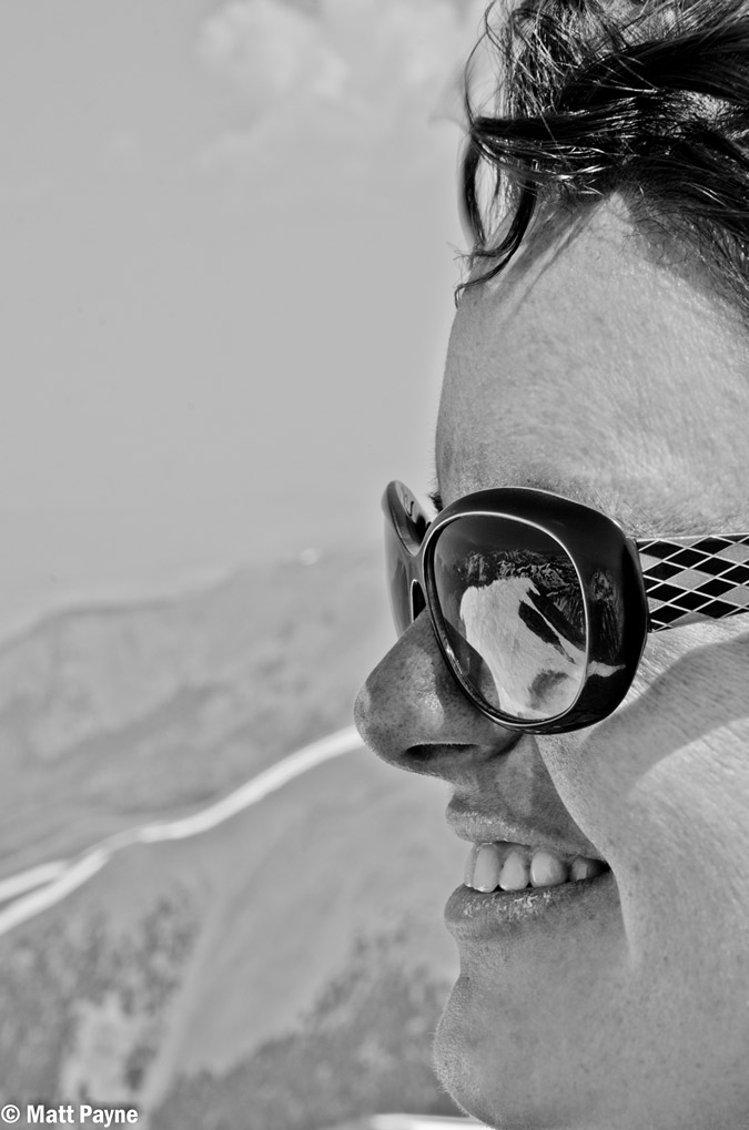 I had fun shooting this photo of Regina - the mountains to the west were reflected nicely in her sunglasses, plus she was quite a cooperative model! All in all, it felt great to climb my first mountain with both Regina and Sarah, and I think everyone was quite proud of their accomplishment!
After enjoying some cliff bars on top, we all decided to head back down. The hike down was quite easy, and before we knew it, we were all back at the first snowfield we had encountered before. Regina cracked some jokes about falling into the snow, which was hard enough to prevent post-holing, thankfully.
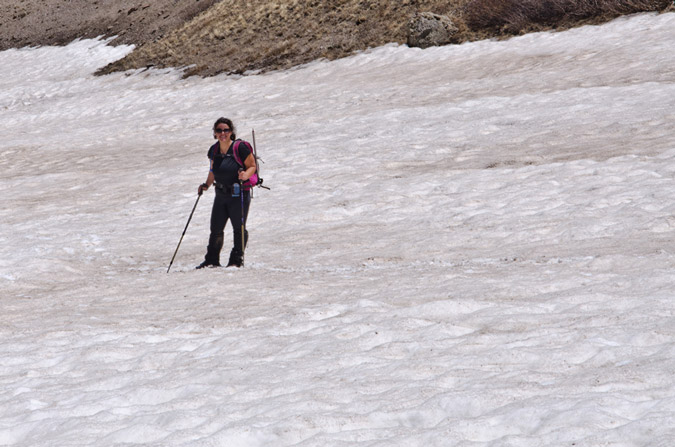
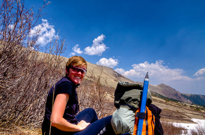
On the way back down, I caught something moving out of the corner of my eye. Much to my surprise, a huge moose was moving slowly through the beaver ponds below. That was probably the highlight of the trip!
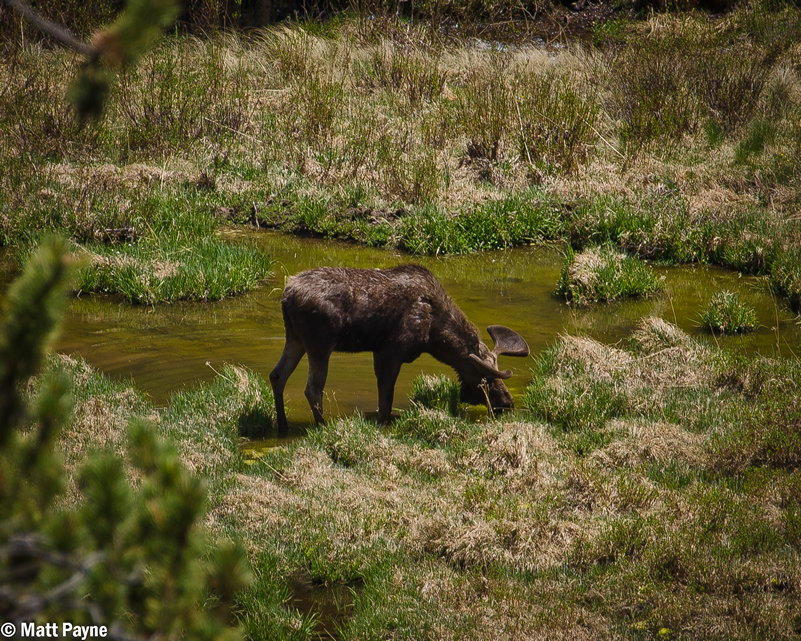
The Stewart Creek valley is a very beautiful place. I am glad I need to return to do other climbs nearby!
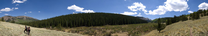
We finally reached the trailhead again, and I took some fun bracketed photos to run through Photomatix. If only I had a tripod...
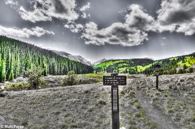
The total hike was 11 miles round-trip, including 3,500 feet in elevation gain. I would rate this hike as moderate to easy in comparison to other 14ers I've climbed.
The drive home was fairly uneventful until I was able to discover the moon rising above the Sangre de Cristo Mountains, including Crestone Peak (right) and Kit Carson Mountain (center).
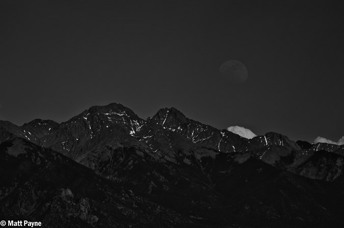
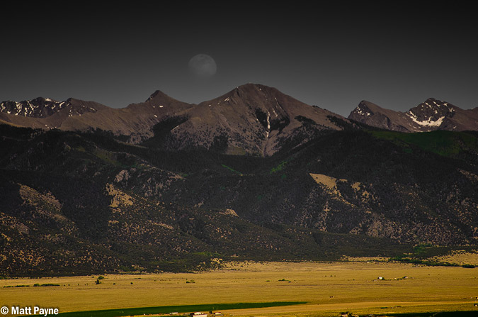
As soon as I returned home, I made sure to check-off another box on my 100summits t-shirt. Thirty-eight of the highest 100 to go and ten 14ers to go!
I look forward to more exciting hikes with Regina and hopefully Sarah too!
If you would like to stay up-to-date on all of my articles, photography musings, trip reports and other mountaineering related news, please feel free to follow 100summits on Twitter or Facebook! Also, if you're planning on doing any online shopping and if you enjoyed the content, please help keep the site going by using the links on this page to help fund the site.