Displaying items by tag: Night
Adventures in Silverton, Colorado: Backpack to Island Lake and summit U.S. Grant Peak
After visiting Ice Lake Basin in August of 2013, I knew that I had to return to the area to photograph the wildflowers there at peak season (mid-July). After moving back to Colorado in November of 2015, I knew that one of my first destinations would be the Ice Lake Basin area. I also wanted to get my wife into backpacking so I got her equipped with some light gear and we both began exercising together to get ready for the primetime hiking season. Since my wife was new to backpacking, I decided to get our pack weight as low as possible. My friend Todd Myers loaned us a great book on Ultralight Backpacking by Mike Clelland which offered some great tips to get our weight down. The items I picked up for my wife included a new sleeping bag, a new sleeping pad, and a new backpack. We were able to get her pack weight under 15 lbs, which I think is a huge success. Here's the short list of gear we picked up for her:
1. REI Joule Women's Sleeping Bag - my wife sleeps super cold and this bag kept her nice and cozy at 12,500 ft, and it only weighs 2 lbs 2 oz. Success.
2. Therm-a-rest NeoAir XLite Sleeping Pad - while this is probably the lightest sleeping pad I've ever seen and it packs down to almost nothing, my wife complained it was a bit too small. Get the longer version.
3. Osprey Tempest 30 backpack - this pack was the perfect size for what she was carrying and weighed under 2 lbs. Awesome.
For myself, I picked up a new backpack as well, the Osprey Exos 48 - a perfect size pack for a tent, bag, pad, food, cookware, and my camera system.
We weighed all of our gear using a kitchen scale and used the awesome gear planner from Erik the Black to calculate our total weight. The whole planning thing helped my wife get into the ordeal and get excited, I think.
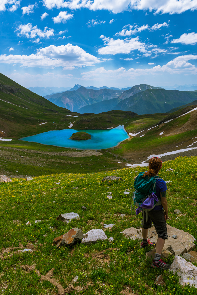
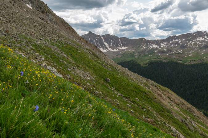
Lastly, we invited some of new friends from Durango, including Todd, Autumn, and Ellen. Good times were for sure going to be had! From my last adventure up to Ice Lake Basin, I knew about a shortcut by taking the road up to Clear Lake and then parking at the 1st switchback. This saves about 1,000 feet of total climbing. We arrived at the small parking area, which was empty (a good sign for sure). Our adventure began immediately by crossing the strong creek coming down from Clear Lake. This was my wife's very first stream crossing and she did it like a champion. The trail was steeper than I remembered and my wife struggled a great deal on the way up, but our group was supportive and I was SO proud of her determination. She rocked it! As we entered lower Ice Lake Basin, we had a decision to make - to continue on to Ice Lake Basin, to stay at the lower Ice Lake Basin, or to go to Island Lake, which was somewhere I had never been. The group unanimously voted to go to Island Lake since we anticipated the weekend to be quite busy with wildflower peepers and we thought Island Lake would be a little less busy. I personally had no problems with this since I could head over to Ice Lake no problem to take photos if I wanted. We made quick work up towards Island Lake as sunset approached and I captured a shot of the last light as we gained elevation quickly. The wildflowers were insane. By the way, you can check out the map of where we went and the GPS / GPX file over on Gaia GPS, who generously gave me a free Pro account. I love Gaia GPS - such an awesome app! You can purchase it here and help support the site.
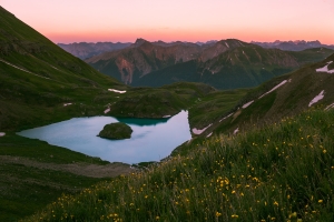
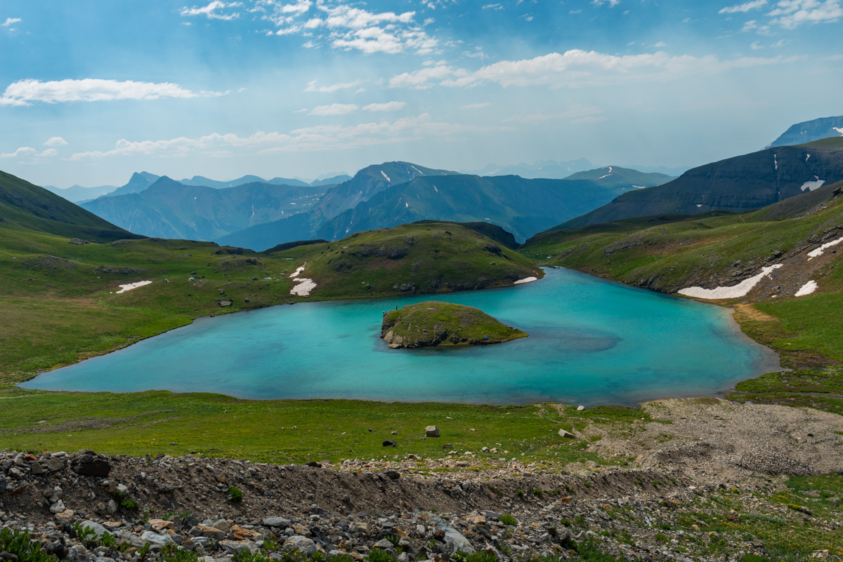
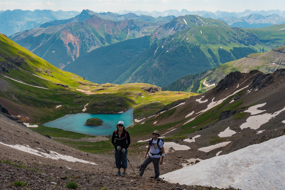
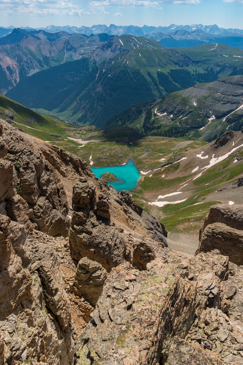
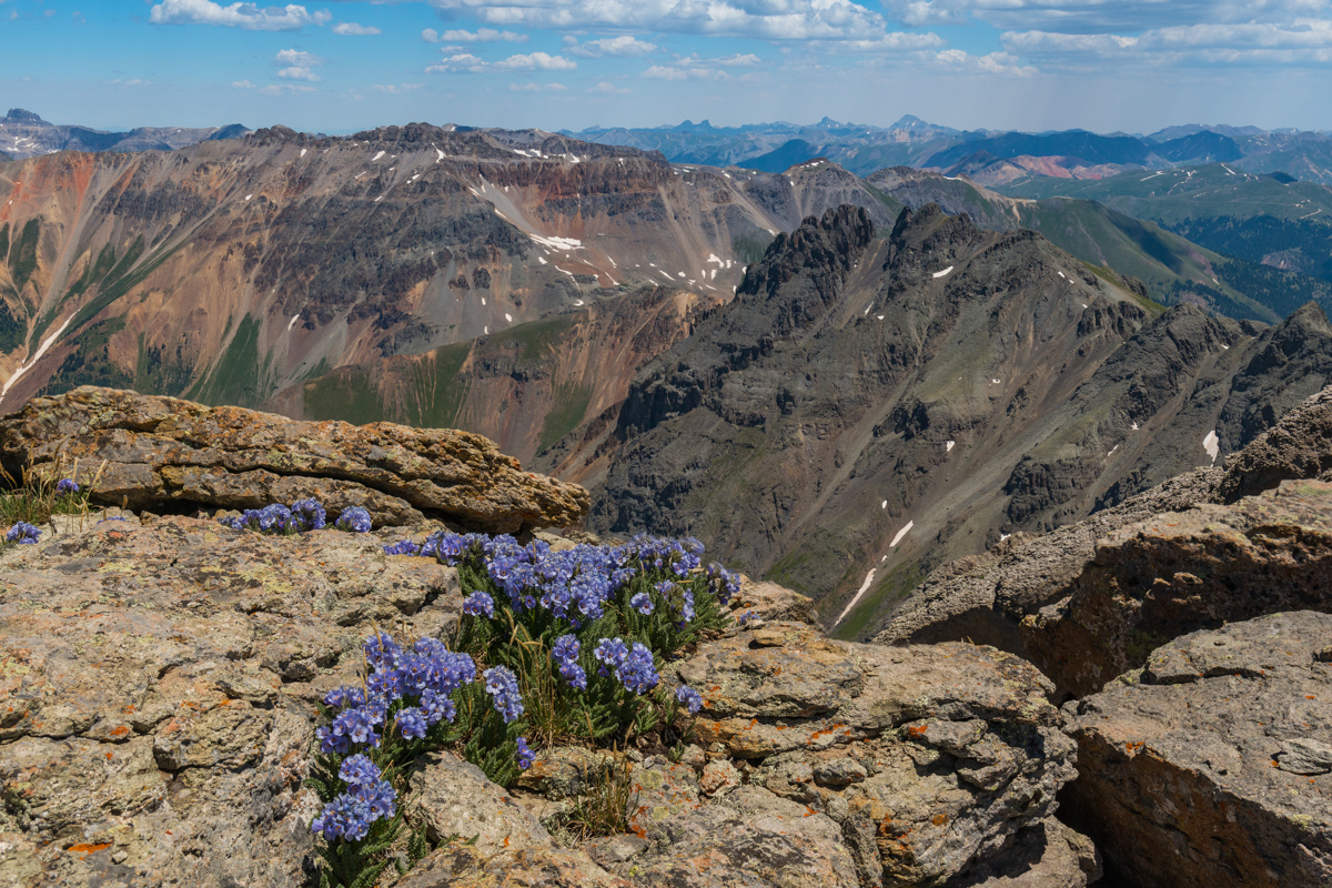
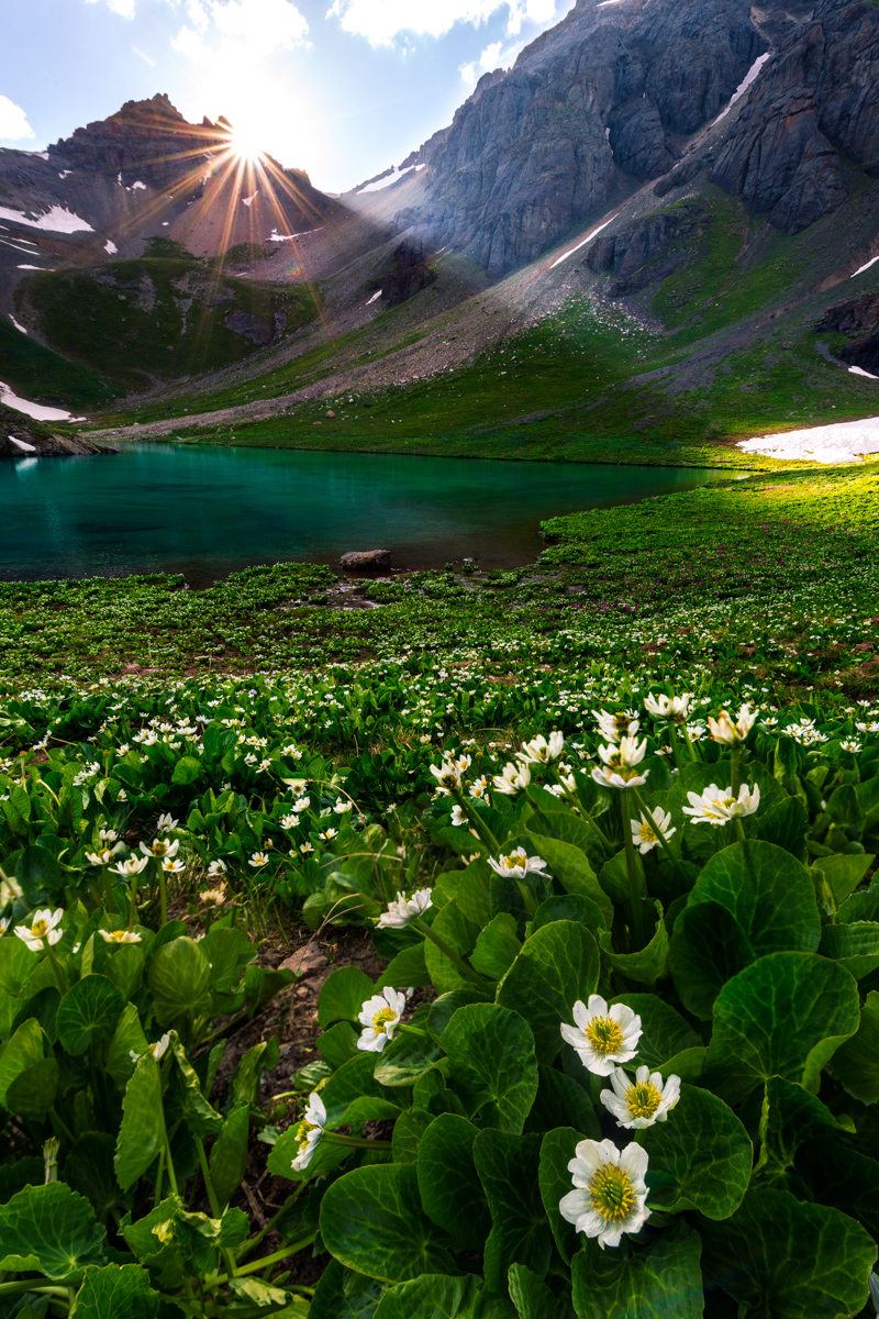
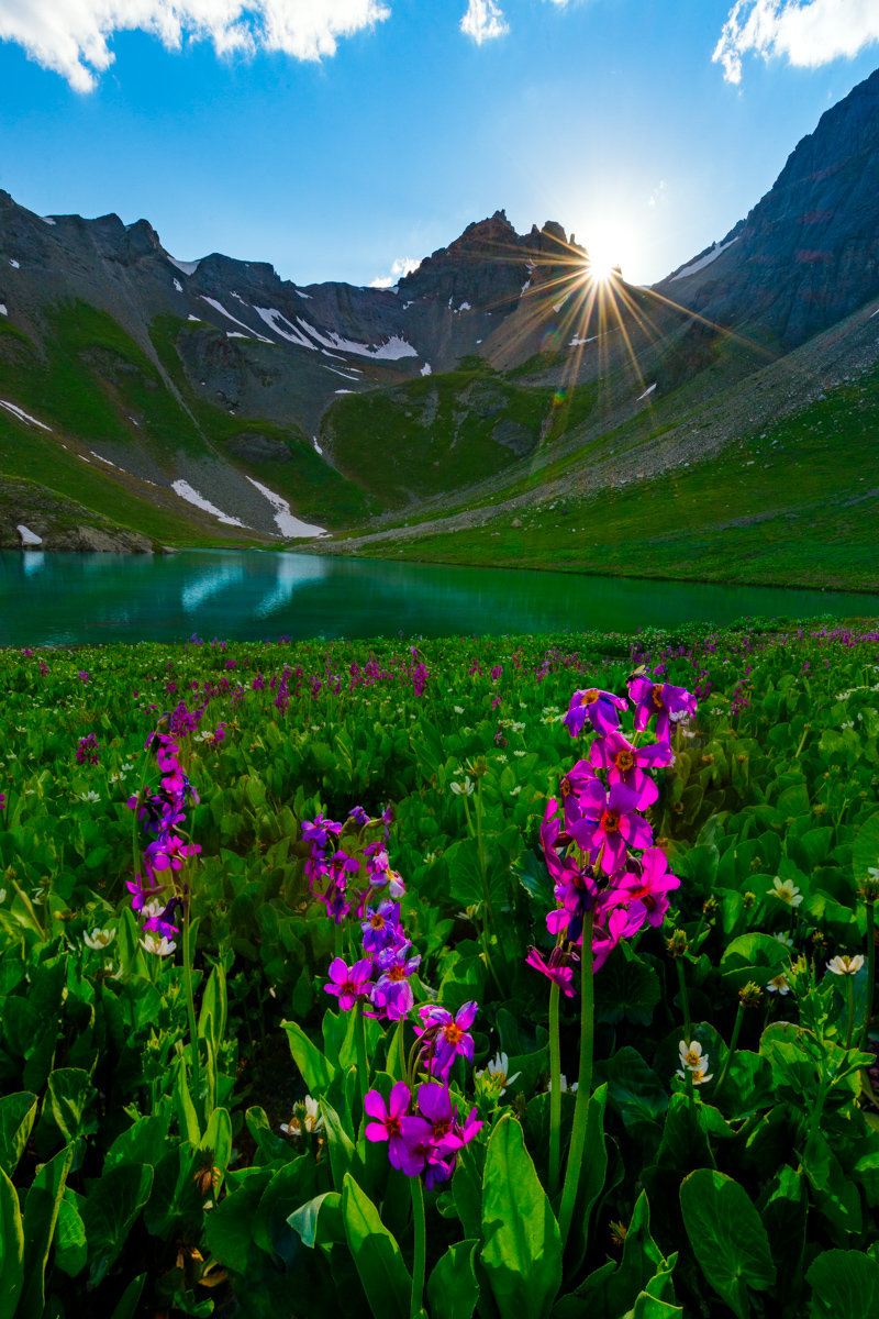
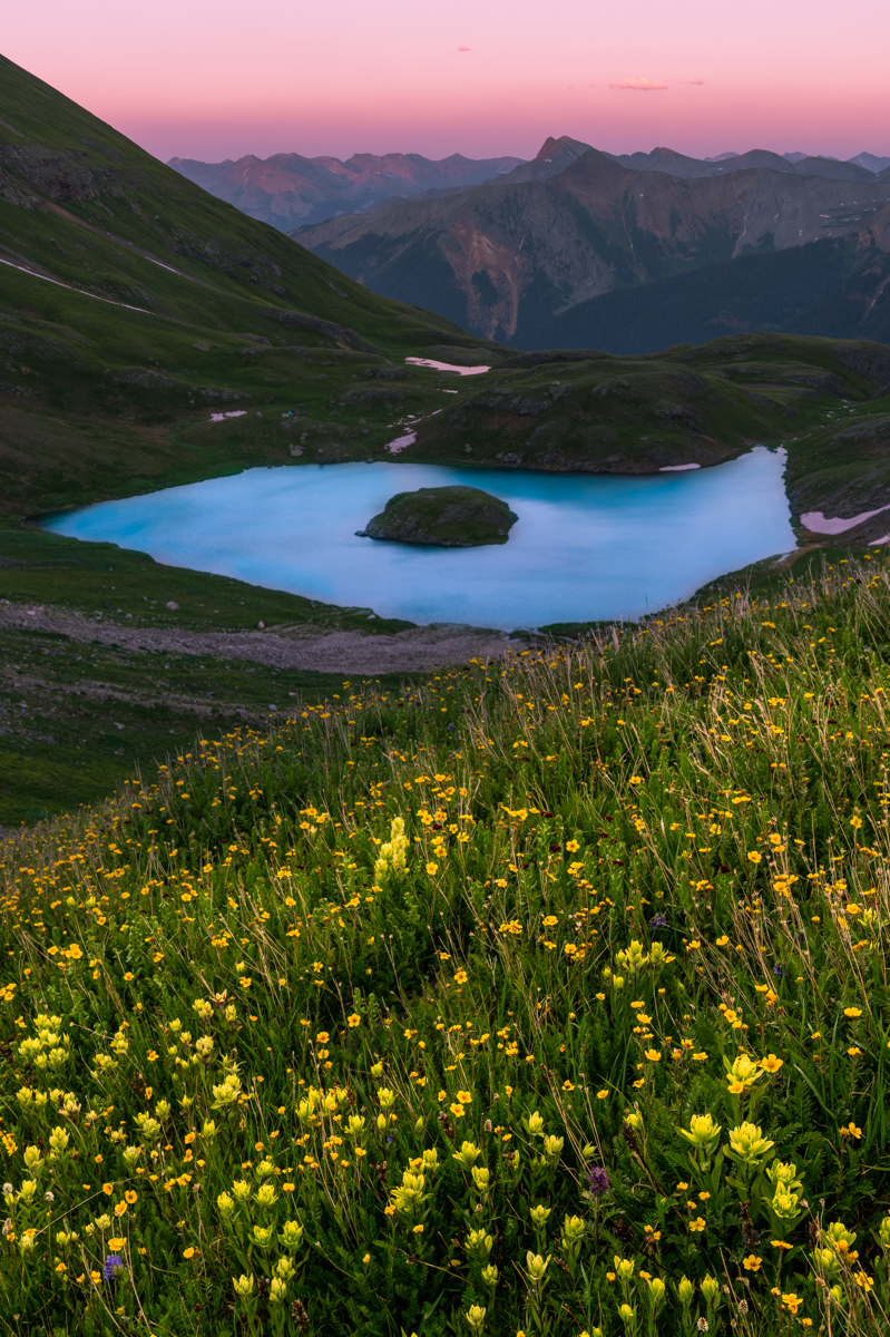
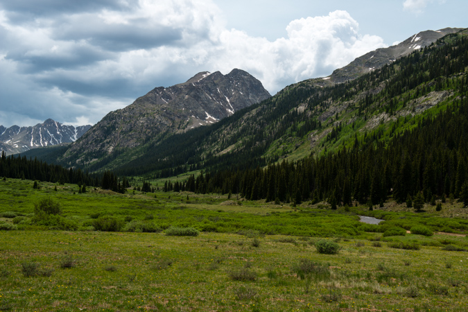
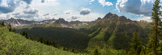
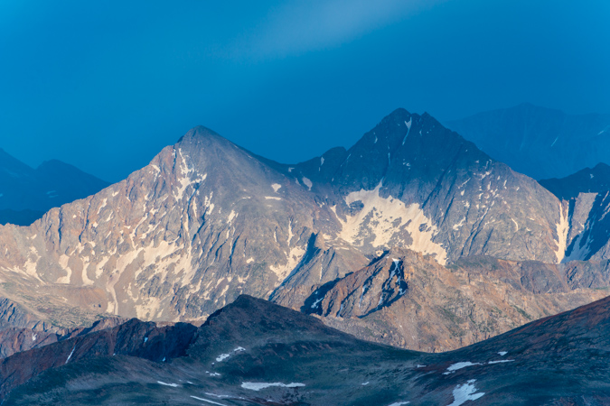
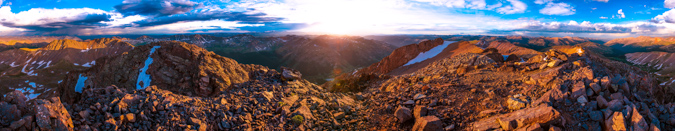
Upon arriving in the upper basin near Island Lake, the whole area opened up to the South and East, revealing views of the Grenadiers, the Chicago Basin 14ers, and Rolling Mountain (right). As you can see, the yellow paintbrush were stunning.
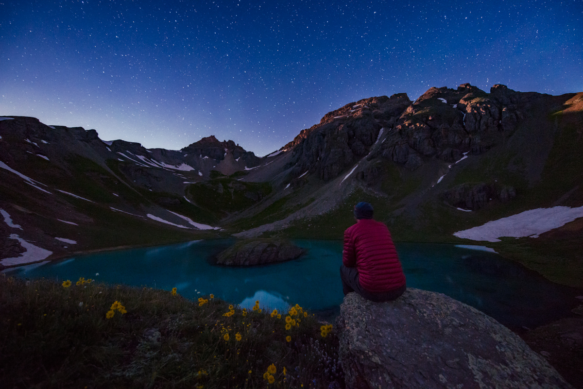
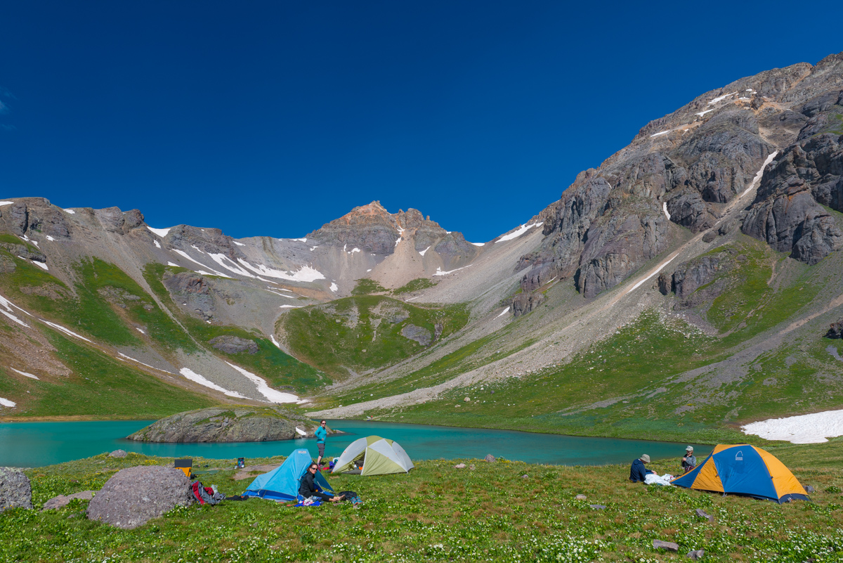
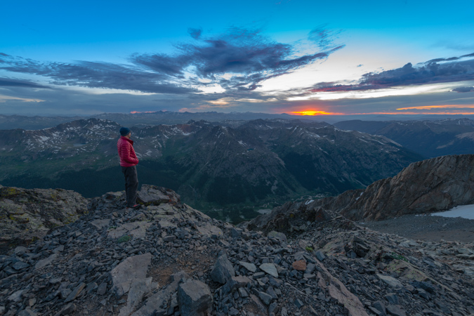
Our group found a great spot right by Island Lake to camp and we proceeded to get set-up. We were alone at the lake (or so we thought) and just loved the solitude. I knew that I would have some great opportunities for some photography at night - I had studied the projections for the moon's brightness, location, and time of rise/set as well as the location of the Milky Way and the time it would rise and set - all using a handy app called PhotoPills. Since the moon was looking to be quite bright and nearly full, I knew that I would shoot in two sessions - early at night for the bright moon illumination, and later in the very early morning after the moon had set. So - I set off to take some photos using the bright moon light to provide some ambient light in the basin. The Milky Way was barely visible, but the moon provided some light to bring out the flowers in the basin and the summit of U.S. Grant Peak.
The lake was mesmerizing. I could sit there and take it in for hours.
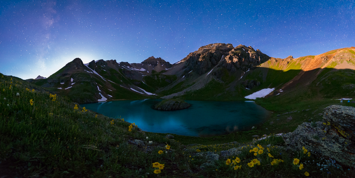
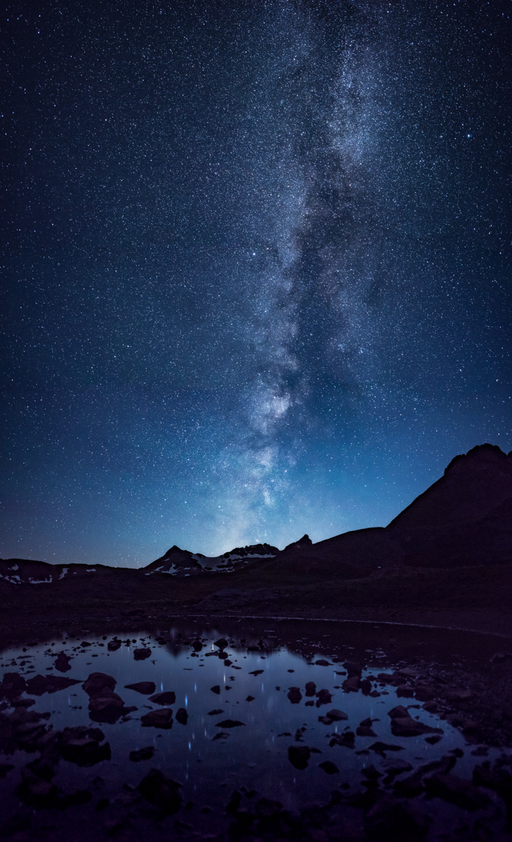
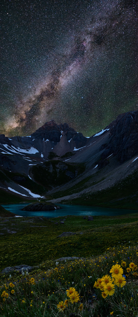
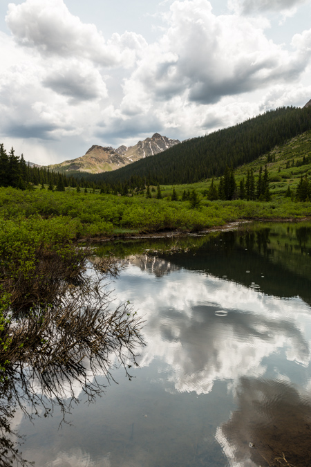
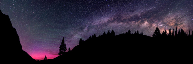
After wandering around for awhile taking photos, I decided to re-join the group at our campsite and go to bed. I set my alarm for 2 AM so that I could find a cool spot to photograph the Milky Way. Sleep is over-rated. None of us slept all that well - it was eerily quiet and everyone could hear everyone else move in their bags, open and close zippers, etc. It was pretty tough to get any sleep. I got out of the tent at about 1:45 AM and looked for a good spot to shoot the Milky Way, as planned. I found a little shallow lake nearby that had a nice view over towards the Ice Lake Basin 13ers. I was able to find a way to place my tripod in the center of the lake (it was really only about 3 inches deep), and loved how I could get the reflection of the Milky Way in the water. An amazing sight, for sure!
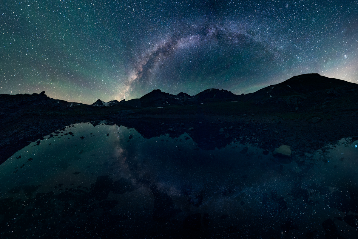
I really wanted to get a 180 degree panorama of the full Milky Way reflected in the water, and was able to pull it off after some work on my settings. The airglow (those high, green looking clouds) was looking awesome as well.
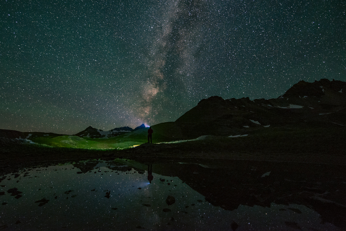
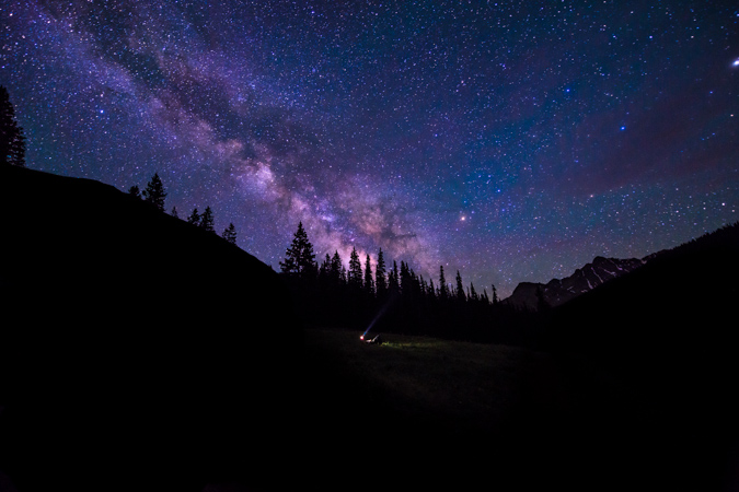
I played around a little with my headlamp as well, wanting to add a human element to the scene. I think it worked out pretty nicely.
I went back over to Island Lake to set-up for one last shot before going to back to bed. This was a photo that I shot as a tattoo concept that I have been thinking about for awhile - imagine the flowers or a campfire at the bottom on the wrist and then the tattoo works its way up the arm to the mountain and then the Milky Way. I think it would look great, personally.
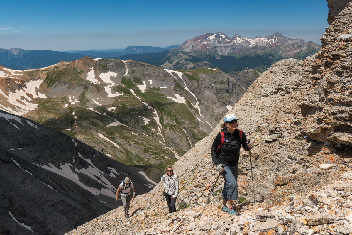
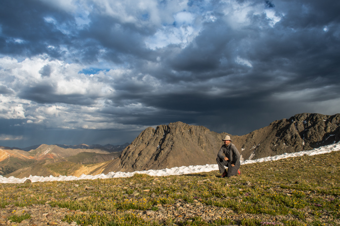
I went to bed again around 4 AM, getting about 4 hours of sleep total. We all woke up and enjoyed the amazing view from the lake and noticed some hikers heading up U.S. Grant Peak. I threw out the idea of doing the same and everyone agreed to give it a shot. So, we made breakfast and got ready for an adventure up U.S. Grant Peak. Normally I do a lot of research before climbing any peak; however, for this one, I decided to just see how things would go and turn-around if needed. I knew there was some challenging class 3 or 4 sections but had no idea what would be in store for us. Exciting!
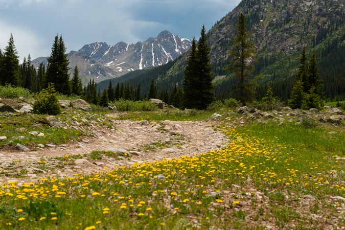
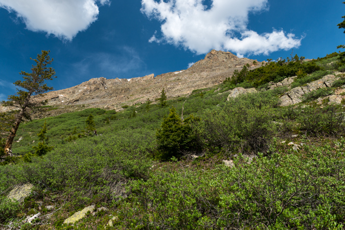
Off we went towards U.S. Grant peak - our goal was to gain the saddle between the two small areas of snow to the right of the peak above the lake seen above.
While we were hiking up there was a large group of day hikers having a bit of fun on the island - one even took a backflip off the lake. I'm thinking that was pretty damn cold. More on that later.
We reached the last section with grass and that is where my wife decided to rest while we continued on. She had an amazing view to take in.
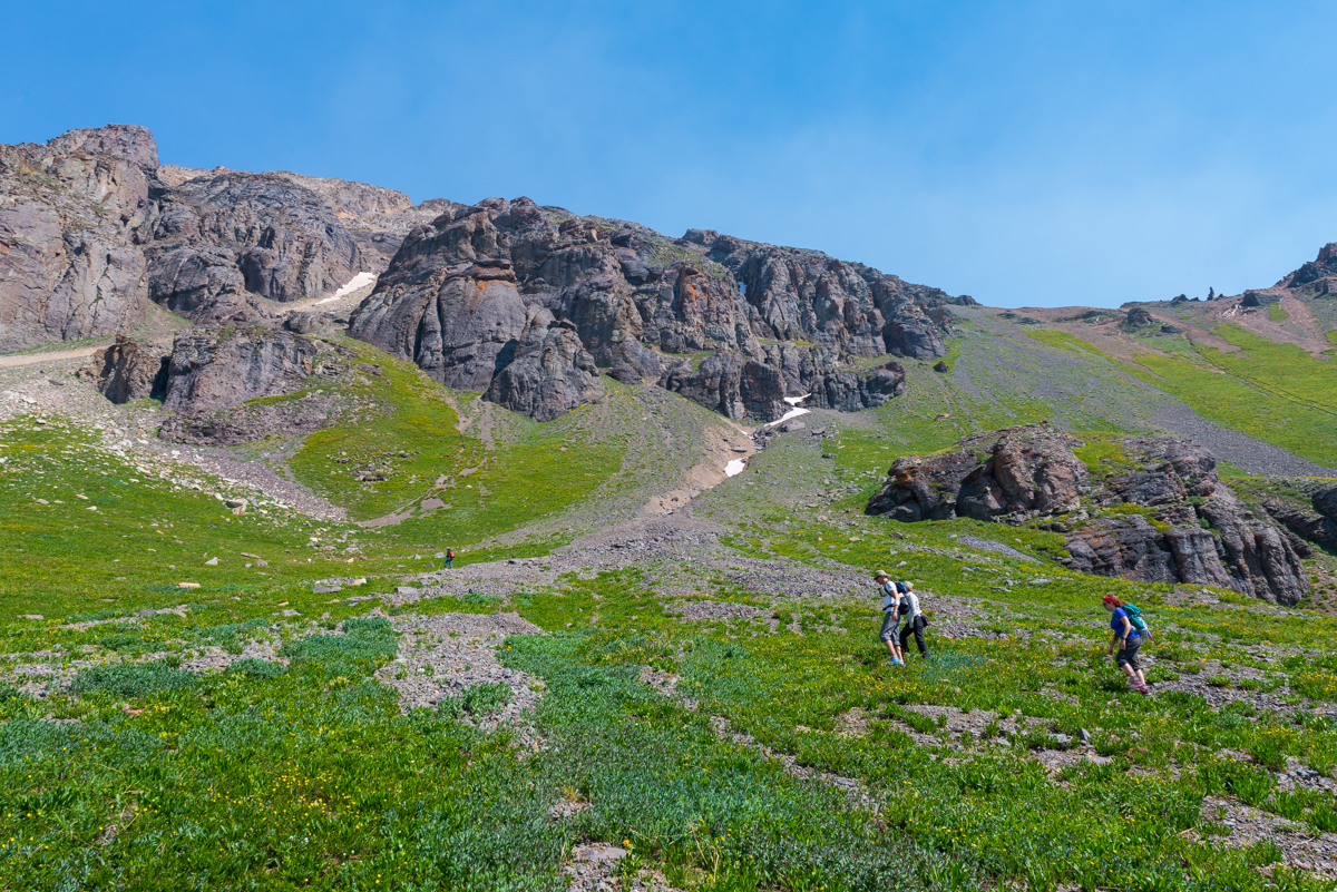
There was a very lightly travelled trail up to the ridge up the muddy dirt and scree. My legs were feeling great so I took the lead, which was awesome because then I could stop and take photos of my friends climbing up. This was a particularly memorable climb because it was Autumn's first mountain climb in Colorado, one I'm sure she will remember.
The higher we got, the better the view was, which eventually opened up fully to reveal the San Juans in their glory, from Pigeon all the way over past Vestal and again past Jones and Handies (right to left).
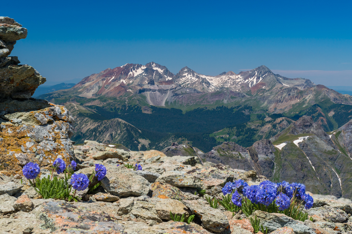
Upon reaching the ridge, I was greeted with a glorious view of Mount Wilson (left), Gladstone (left of center), and Wilson Peak (center). It was great seeing them from this vantage point since I had just climbed Gladstone and Wilson Peak the weekend before from Bilk Basin.
Ellen and Todd joined me on the ridge to take in all of the awesomeness.
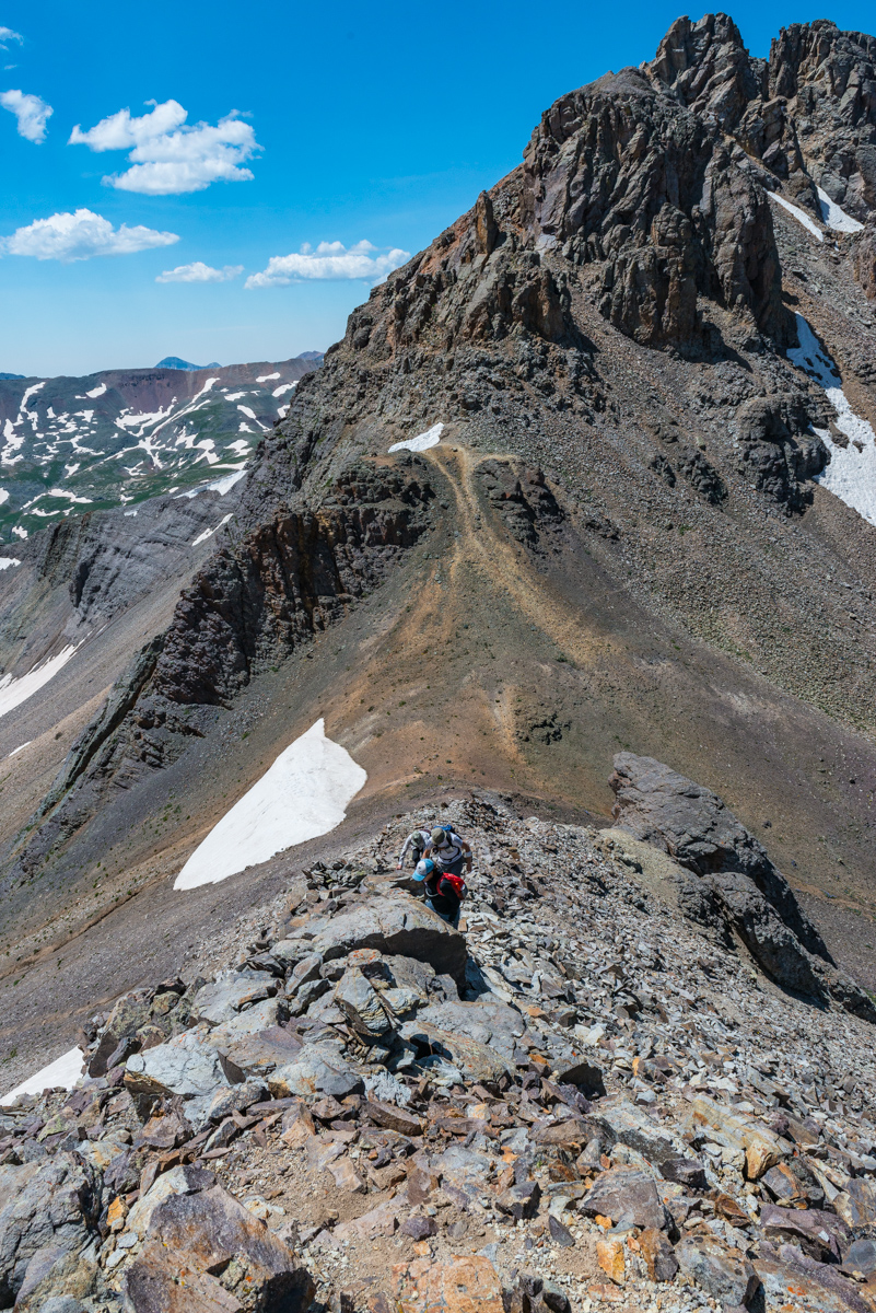
From the ridge we took a right turn and followed a very solid but slightly loose trail straight up the ridge. Here is a view looking down that ridge.
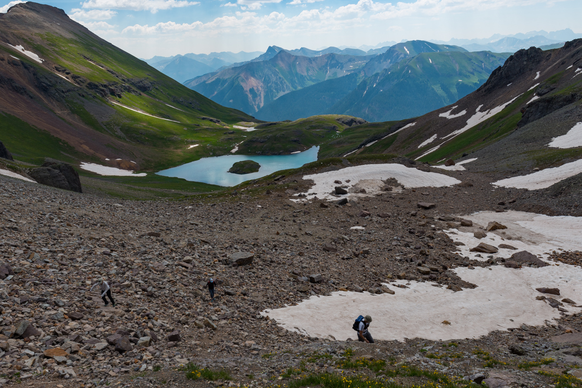
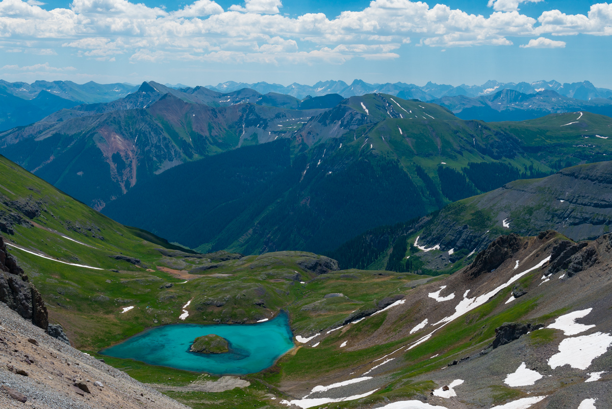
The view back down to Island Lake dominated my mind as we scrambled up the relatively easy class 2+ scree.
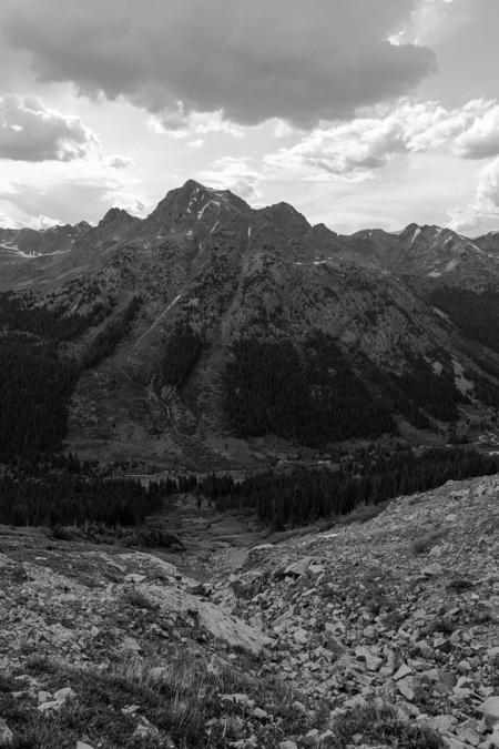
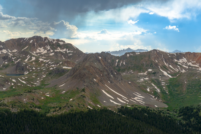
Eventually, looking back we could see Pilot Knob's gnarly summit block behind us over in Ice Lake Basin. The group continued the slog up the loose scree, which was pretty manageable.
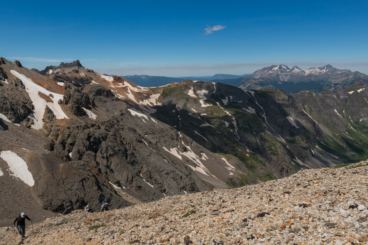
I live for this kind of terrain but I think my friends thought I was a little crazy for enjoying it. The rock was pretty much what you'd expect in the San Juans.
We eventually found ourselves in a steep orange gully with great hand-holds on the sides which was fairly loose. Sticking close to the wall made for pretty easy navigation.
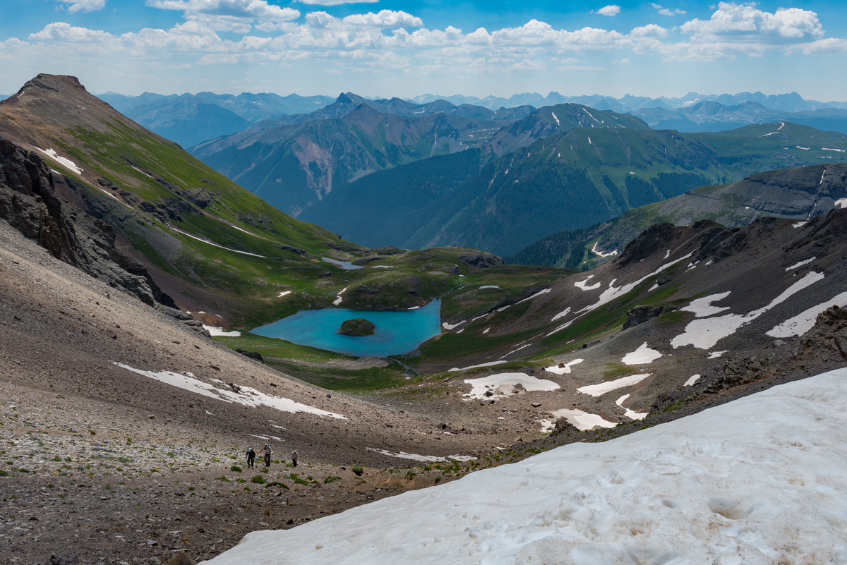
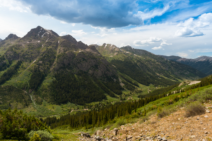
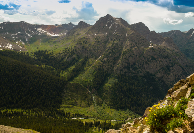
The full beauty of Ice Lake Basin presented itself as we gained elevation, showcasing both Ice Lake and Fuller Lake. The weather looked like it would hold for the whole day.
Honestly, I think I could have stayed up there for hours on end, taking in the views in every direction. It was just the reason I moved back to Colorado.
Island Lake pretty much stayed in view the entire way up, a nice beacon and reminder of just how high we had climbed in such a short amount of time.
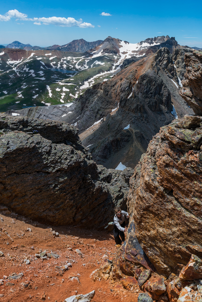
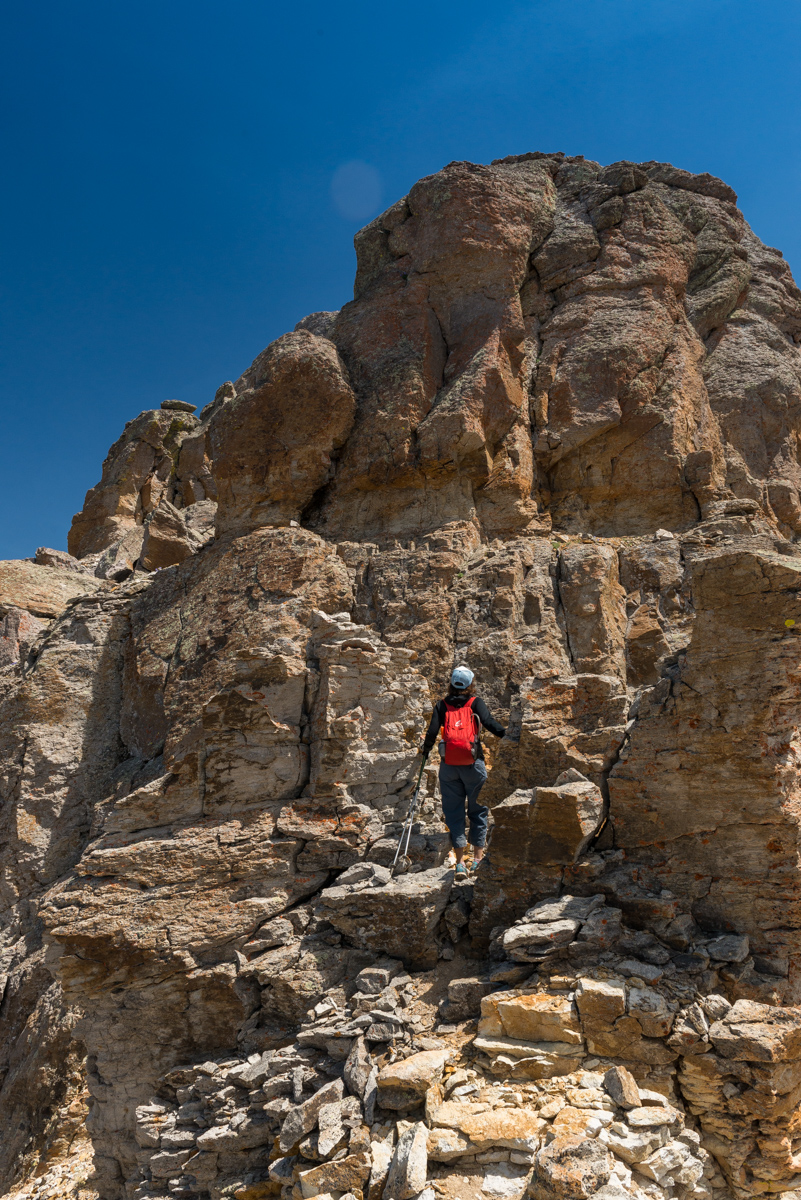
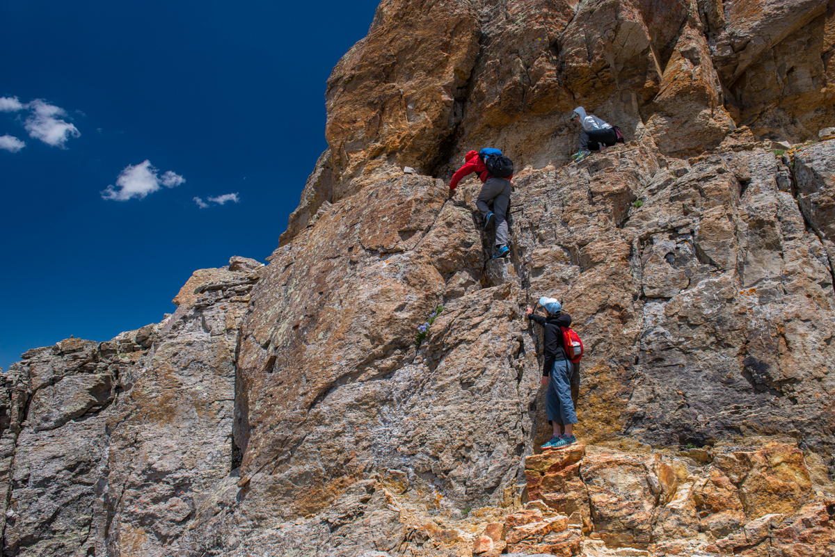
At last we reached the crux of the climb, which I had no idea existed. We got to this wall and wondered if we had taken a wrong turn or if we needed to go around, or, what? Upon close examination I decided it was the only way up. It consisted of three or four relatively exposed moves up to a small ledge, which wrapped around to the right. I went first and Ellen decided to join me. Todd and Autumn decided to stay behind because it looked too difficult.
When Ellen and I got to the top, about 3 minutes later Todd and Autumn joined us - we were so excited that they decided to come up the wall. Even though the shots are out of sequence, I thought it best to show how hard the wall looked, on our way down, with Todd and Autumn still needing to downclimb it (below).
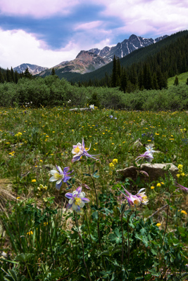
The top was magnificent. Here's Ellen topping out on a summit filled with purple wildflowers (their name always escapes me).
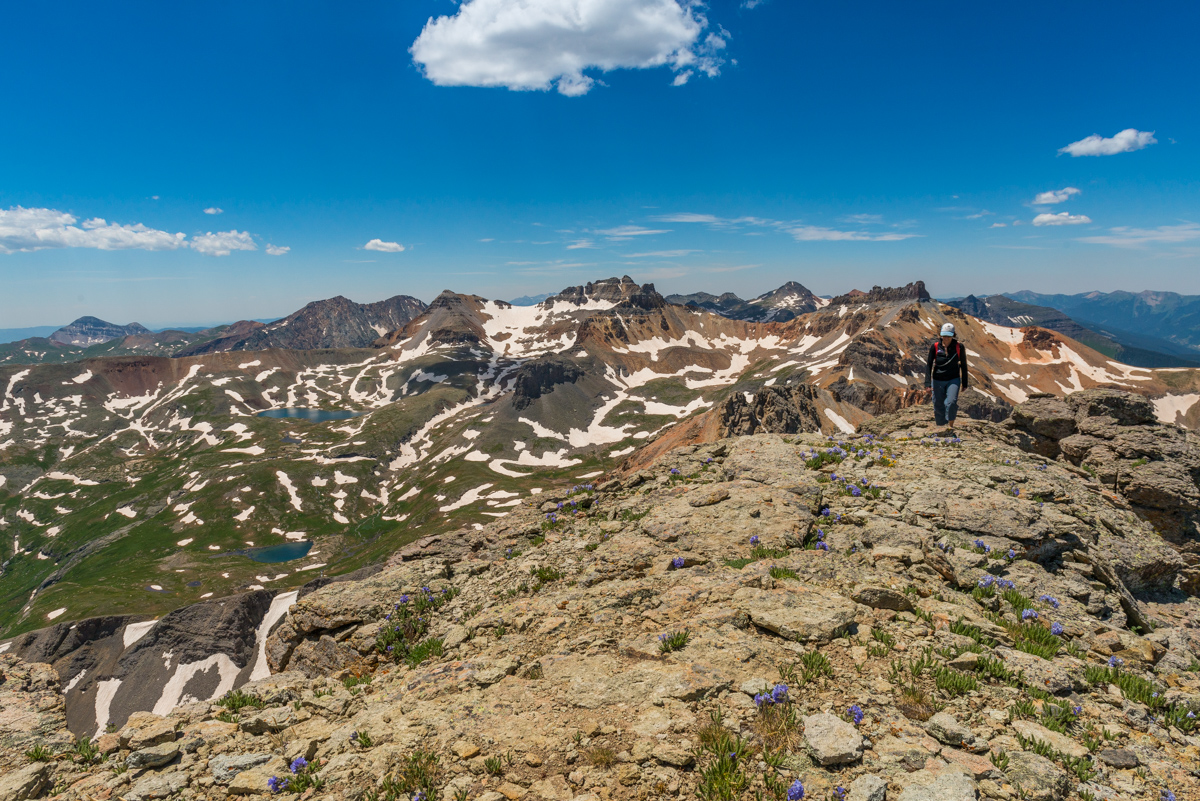
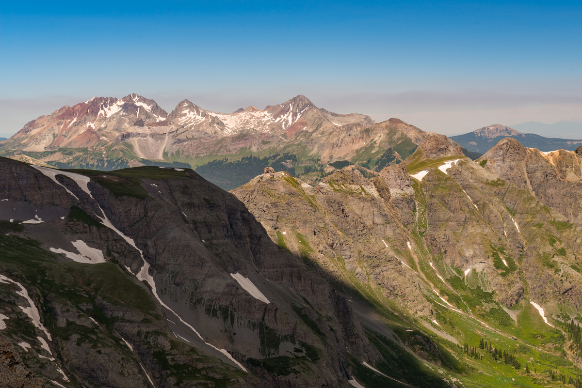
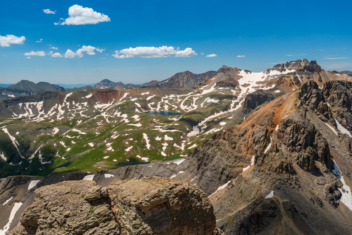
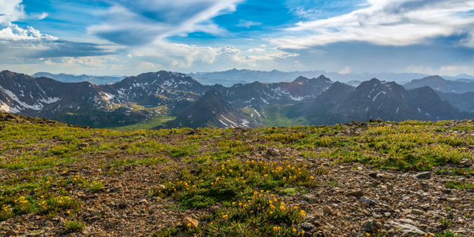
From the summit you could make out every major summit in the San Juans, including Uncompagre and Wetterhorn (top center).
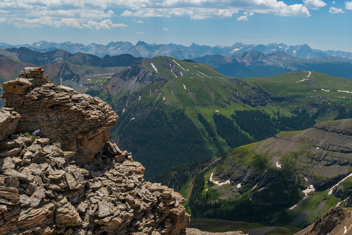
My gaze kept going back over to the San Miguels to the west. They were so damned impressive.
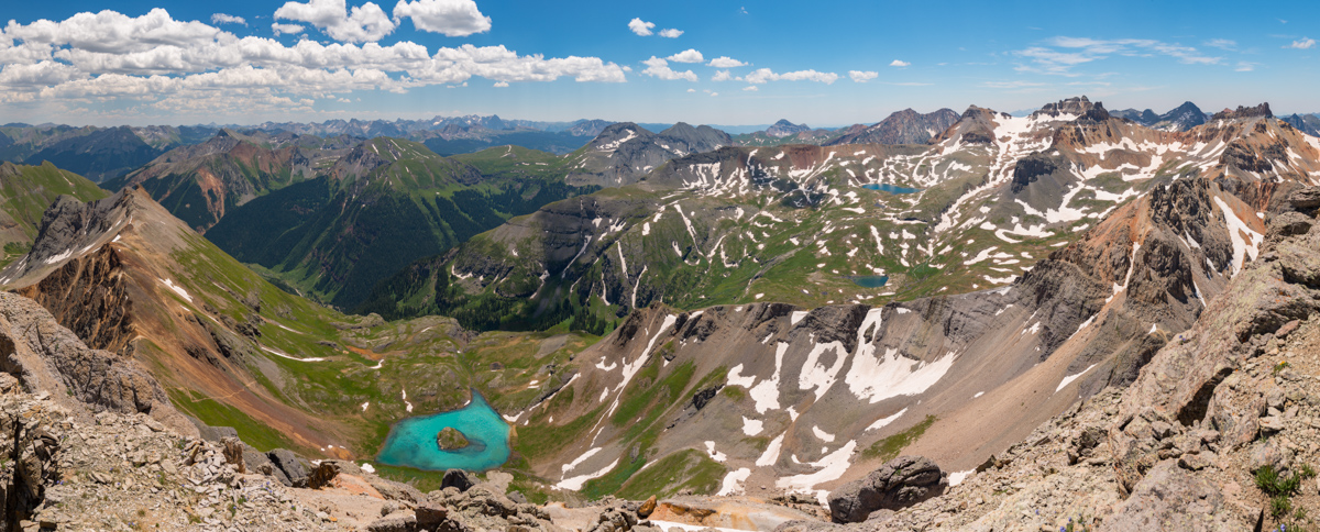
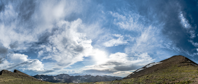
Next, a 180 degree view showing most of the San Juans and Ice Lake Basin, and Island Lake. So amazing.
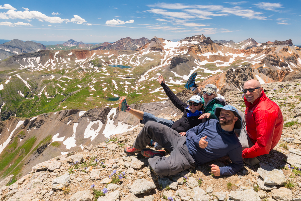
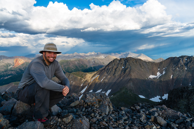
A quick group photo was in order, so I set up the tripod and self-timer. All I remember is that Todd invented a new food item on top - a burrito consisting of Peanut Butter, Fritos, and slices of apple. Apparently it was quite delicious.
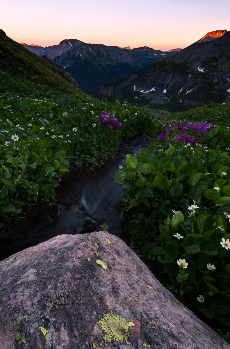
After enjoying lunch, we head back down, without any issues at all. We all faced-in on the crux and it was surprisingly easier than I thought it would be. Now, remember above where I said the lake was cold? When we were about 1/2 way down the ridge, I noticed a group of people huddled around our tents at the lake. I was not too concerned until I saw them open Todd's tent. My first reaction was, "what the heck are they doing, trying to steal beer or something?" I raced down the mountain at a quick pace and caught up with the group. As I approached they asked if they were invading our campsite. I replied, "well, yes, kind of...". They apologized and said that their son (probably about 14) had swam in the lake and was getting hypothermia and needed somehwere to lay down and warm up, and was that OK? I felt horrible for thinking they were doing something bad and replied, "of course not - not a problem at all, and that makes total sense!" The rest of our group arrived and we helped them ensure he had food and was warm before they departed the basin. We rested up and as the sun dropped lower and lower I decided to get the camera out and take some photos of sunset at the lake. It was a pretty nice one. The marsh marigolds and fireweed looked awesome.
The last light left an impression on the fireweed that I knew would look fantastic in camera. I think I was right.
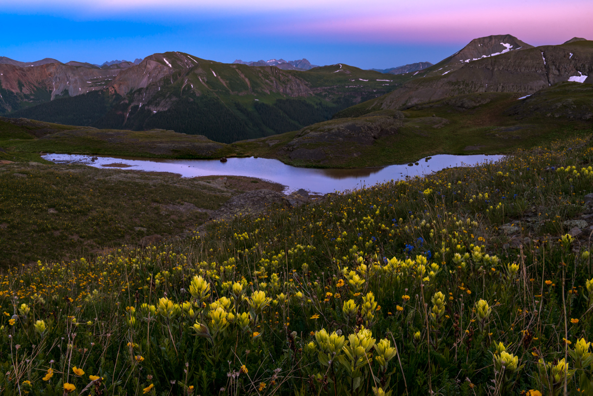
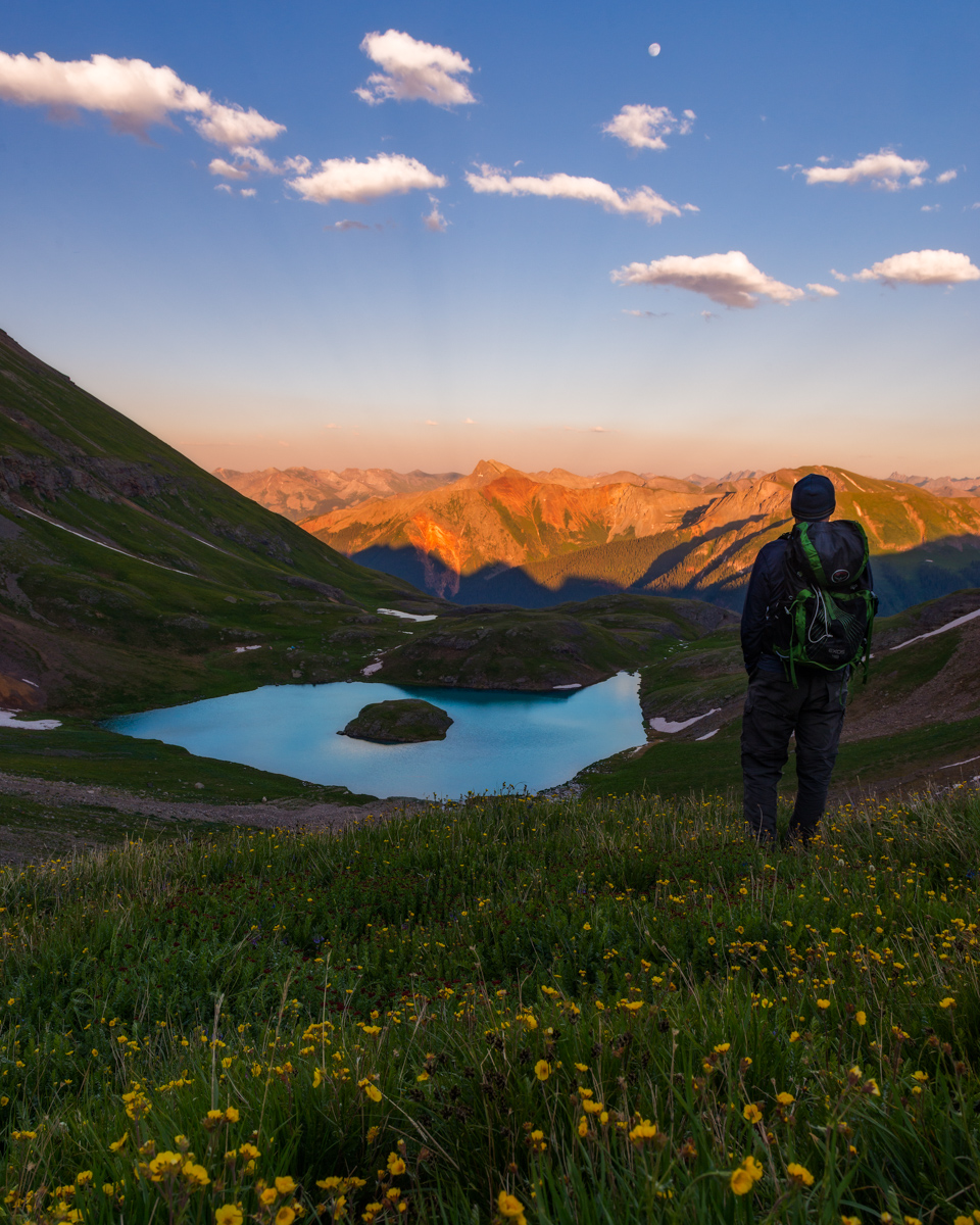
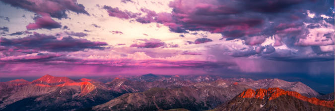
After dinner, I decided that I wanted to hike back up to the top of the grassy area below the ridge for U.S. Grant. I know that sounds crazy but I had a vision for some shots looking back over the lake at sunset. I hoped the clouds would stick around, and they were looking like they might, so I took a chance and hiked back up the mountain again. Todd thankfully joined me and kept me company. Unfortunately, the clouds did not cooperate much, but I think I still got some decent shots, including one with the nearly full moon in it.
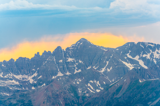
As the last light kissed the tops of the Chicago Basin 14ers, I took advantage and snapped off a two-row panorama to include the pink sky (which was a bit hazy from fire I presume), the lake, and some wildflowers.
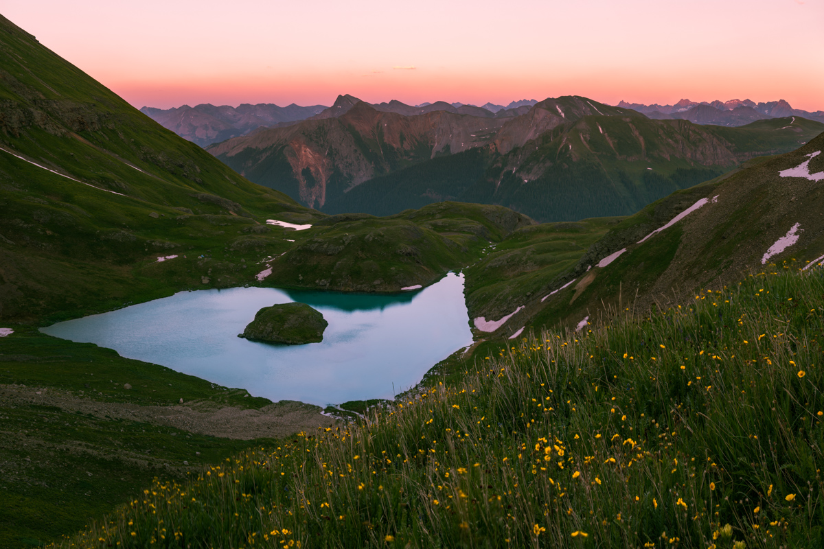
It was quite a memorable sunset, for sure. Flowers + sunset + Island Lake + San Juan Mountains in alpenglow = awesome.
We head back down to our tents and got some much needed sleep. I never did make it over to Ice Lake for sunrise wildflower photos. Maybe next year! As a reminder, you can take a look at my GPS and/or KML file for this hike over on Gaia GPS. Prints of my photos are always available on my photography website (if you see one you like and can't find it, let me know). Thanks for reading!
Scaling Colorado's Highest 13er - Grizzly Peak at Sunset
Climbing mountains in solo-mode is therapy for me. While I have often espoused a deep belief that climbing mountains solo is a safety concern, there are times when the benefits outweigh the risks. I'm not sure that this particlar climb qualifies; however, I must admit, this was a truly wonderful experience that I will never regret. I decided somewhat at the last minute to take Friday off of work and climb a 13er. Having only 20 or so Centennials left to complete my quest of the highest 100 in Colorado, I have been getting more motivated to tackle the mountains left.
Grizzly Peak had always intrigued me. It is one of the few Centennials not visible from a paved road (I am fairly confident of this) and has a very remote status. Grizzly Peak is nestled deep in a valley just west of the summit of Independence Pass between Leadville and Aspen and is the most western Centennial in the Sawatch Range. There are tremendous views of the Elk Mountains from Grizzly Peak, including Pyramid Peak, the Maroon Bells, Snowmass Mountain and Capitol Peak. Grizzly Peak also carries with it the distinction of being the highest of 7 mountains in Colorado named Grizzly and the highest ranked 13er at 13,988 ft. (Sunlight Spire is higher, but is not ranked - for more on this issue see this article).
Since I would be climbing by myself, I knew I would have as much time as I needed to take photos and do some crazy photography projects from or near the summit. I chose the west route of Grizzly due to the very short length of the climb, which was very appealing for weather purposes. The plan was to drive the road to the base of the mountain Friday morning, climb the mountain, take photos of sunset from the top, and stay on the top as long as possible for a shot of the Milky Way and to do some star trails photography. According to Roach's 13er guidebook, the road is open all the way to the very base of the mountain, leaving only about 2 miles of hiking to the summit. When I reached Grizzly Reservoir, the road was closed at this point, which meant I had to add another 2 miles both ways to my hike. This was not a huge deal, but it certainly made me re-think my plan.
Being that I had nutty plans to do some extensive photography work from the summit, I packed quite heavily. I was carrying the following photography gear with me:
| Item | Weight (lbs) |
| Gitzo Carbon Fiber Tripod w/ Arca Swiss Ballhead | 6.4 |
| Nikon D800 DSLR w/ Arca Swiss Plate | 2.8 |
| Nikon 14-24 f/2.8 Lens | 2.0 |
| Nikon 24-70 f/2.8 Lens | 2.0 |
| Nikon 50mm f/1.4 D Lens | 0.5 |
| Nikon 300mm f/4 D Lens | 3.0 |
| 1.4x Teleconverter | 0.5 |
| Total | 17.2 |
I'm not especially proud of carrying all of this weight up a steep mountain, but I certainly don't regret doing it.
After I parked my Jeep near the Grizzly Reservoir campground, I head out with a pack full of camera gear and fresh legs at about 1 PM. This is not a very typical start time for me, and probably not highly recommended due to weather concerns, but I figured I would play it safe and keep an eye above for the hike in. For any photographers reading this, I decided to stick with the 24-70 f/2.8 as my walk-about lens, which worked out fairly well. The round-trip stats for this hike are 8 miles w/ 3,500 ft. of elevation gain.
The view from the road was fantastic. Lower, but very rugged 13ers adorned the valley and made for quite a nice sight on the hike in.
I certainly enjoyed the view but was keeping an eye on developing thunderstorms above.
I'm usually not a fan of hiking on a road, but I could not really complain with the view I had, plus I had the Nerdist podcast to keep me entertained.
On the hike in, I was able to find some Columbine flowers growing in a small open field, making for a fun photography experiment. One thing I have been wanting to try to do is a technique called focus stacking, which allows a photographer to capture a very sharp photograph that is really the combination of multiple photographs taken at various focal points. I tried that out on these columbine flowers, which worked pretty well considering the wind was blowing (which makes focus stacking almost impossible).
I was looking for a gully cut into the side of the mountain to my left (east), which would be my entrance point for the Grizzly Peak ascent. The mountain has no trail and is basically a steep slog up a very pretty, wild, but generally straight forward gully going up, up, up. Before reaching the gully, the rain started to come down a little, so I stopped to get a photo at this beaver pond before putting my camera away and heading up the gully.
While small rain was coming down, I decided to keep my camera bag packed in my main pack to make it easier and to give me some peace of mind. As such, I was unable to take any photographs with my camera until the rain totally left and I was about a quarter of the way up Grizzly via the gully. I stopped to snap a set of photos to be later stitched into a panorama, looking west across the valley towards Truro and several un-named 13ers.
A look up at the terrain revealed just the sloggy mess I was climbing up. It was quite steep and somewhat difficult to navigate through all of the small pine trees, willow trees and rocks. I just had to pick my way up and take frequent rest breaks (I was carrying a lot of weight, haha). The Nerdist podcast of Rick Moranis made the slog a lot less painful, although my laughter probably drove wildlife away.
As I continued up Grizzly, the storms seemed to subside, and I was feeling a lot more comfortable about the hike up and eventual stay on the summit. A look back down the gully showed the way up and I could now see the road I hiked up from the North (right).
Once above treeline, the gully was pretty obvious in terms of where to go. It was mostly rock and dirt with wildflowers and boulders strewn about.
The views were pretty enjoyable in all directions. Despite some wind, I really could not complain.
The 13ers to the west kept me looking back quite often, and the wildflowers were just too cool. They were all over the place, even above treeline, which is always awesome. I probably could have made it up the mountain in a lot less time, but I took the time to take some quality photos. This is another focus-stacked image making it so the very close flower in the foreground could be in focus as well as the distant peaks.
As I continued up, views of the Elk Mountains (specifically, Castle Peak) began to materialize above the horizon to the west beneath some virga coming from some small storm clouds.
I was not worried about the weather yet - the clouds were pretty small and my new expansive views to the west indicated I should be in the clear for the remainder of the day. At this point, the climb became progressively more difficult for my weary legs. The weight of the photography equipment was really kicking my rear end and I had to take more and more breaks. The terrain was also much more difficult - not technically, but physically demanding. There were more boulder fields to contend with and the dreaded scree that takes you downhill one step for every two you take. As such, I decided to pack away my camera again so I could focus on the hike and make sure I did not fall. I finally was able to reach the saddle between Grizzly Peak and Garfield Peak as the light from the impending sunset was starting to generate some magic on the valleys below to the west and east. Seriously, if you've never done a sunset climb before, you need to - it is simply one of the most amazing experiences you can have in the high country.
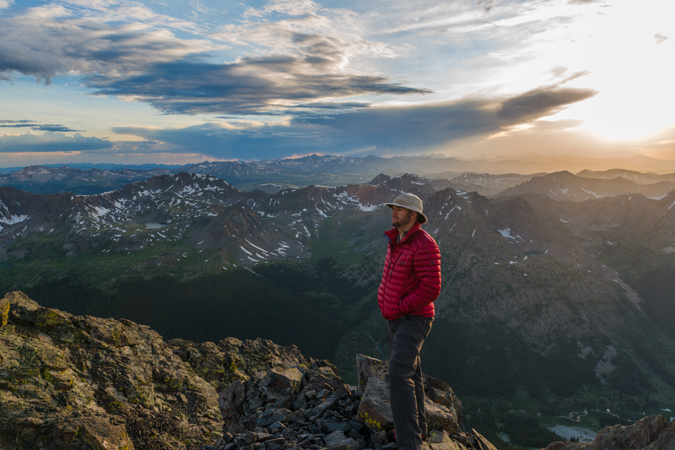
While the weather to the west was looking fabulous, the weather to the south and east was starting to look kind of nasty. I was not too concerned yet, but was keeping watch. One benefit of carrying a 5 lb tripod up a mountain is that you can do self-portraits. Here's one looking south and east towards Garfield Peak and Taylor Park (not visible).
I also decided it might be fun to do a very large vertical panoramic showcasing the sky from the saddle, looking South-West-North. To the north (right) would be the summit of Grizzly Peak itself.
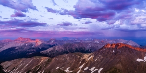
After about 20 more minutes of climbing, I was able to reach the summit of Grizzly Peak. I was greeted by an incredible view to the east and south, which included the Three Apostles and an amazing rainbow just shy of Taylor Park, where a huge thunderstorm was brewing.
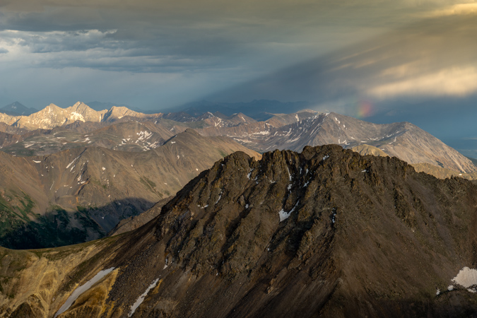
It was pretty awesome to be on top of the Continental Divide before sunset. The views were great, and that sweet rainbow stuck around for quite a long time to the northeast. The light from the sun was hitting the clouds over Taylor Park and causing some interesting streaks to appear. I signed the summit register, which was last signed by a guy I had read a trip report of from the day before. He had made a tribute to Steve Gladbach, a very accomplished and famous Colorado mountaineer who had just perished on Thunder Pyramid. I decided to also sign the book as "For Steve." I think Steve's passing weighed on every mountaineer's mind heavily, including mine. I never did get a chance to meet Steve, but we exchanged several cordial and thought-provoking messages over on 14ers.com regarding my morbid articles I write about the mountaineering deaths each year. Steve wrote a very eloquent and thoughtful post about death over there a few years ago and it always stuck in my mind. I even remember responding to his post saying that "heaven forbid you die in the mountains..." and yet - he eventually did. Steve had conquered the goals I have set for myself and I had always looked up to him, not only as an accomplished mountaineer but as a very amazing person. There are countless stories of his selfless acts and I felt a solo climb a nice tribute to his life.
As I enjoyed the last few minutes of sunlight, I had to take advantage of my somewhat foolish decision to haul up my 300mm lens, which weighs 3 pounds on its own. I wanted to get some zoomed in shots of Ice Mountain, Pyramid Peak, the Maroon Bells and Snowmass Mountain using the 300 and a 1.4 Teleconverter, which gave me an effective focal length of 420mm.
Castle and Conundrum were looking freaking awesome, with some crazy sunset light surrounding it. Thanks to Michael Colson for the correction!
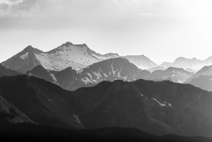
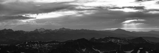
Snowmass Mountain was also looking wicked with the sunset light, giving the photo a very layered feel in black and white.
As the light continued to approach the magical photographic Golden Hour, I had some fun playing with different photos.
I also stitched together a massive 360 summit pano centered on the sun. This photo, being taken with the Nikon D800, is a massive file. If printed at native resolution (no loss of quality), it would span 30 feet wide. I'd love to see that. If I have time later, I'll work on an interactive 360 file so you can see this thing at a bigger resolution and zoom in.
The sun went behind some clouds but then created some nice god beams coming down near Mt. Sopris.
Then the sun reappeared and allowed me to snap off this photo which I think looks kind of like a Colorado flag.
A look back to the east revealed some magic also. The light was very soft and colorful, showcasing the grand scale of La Plata Peak (left), Colorado's 5th highest mountain.

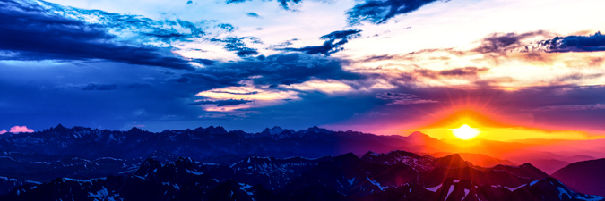
Sunset from the Continental Divide - an awesome experience. I took some artistic liberties on this next photo...
As the sun dipped below the horizon, and stood and watched the magic fade.
At this point, I had to make a decision. Watching the clouds to my east and south, I was getting a little nervous about the prospect of staying on top of the mountain to photograph the night sky. I was really motivated to do so, but I did not feel like it was a risk worth taking. While climbing down the mountain in the dark did not appeal to me, getting struck by lightning was even less appealing. I decided to pack up the gear and head down. The hike down was an adventure to say the least. It became quite dark very quickly, as there was no moon. I found myself in some sketchy spots where I had no recollection of that route from the hike in. I took my time and was very deliberate about each step. I was able to ride down a scree field a ways using some scree-skiing techniques and from there it was pretty much a boulder/snowfield/cliff/willow dodging fest. Downclimbing in the dark without a trail - not recommended - AT ALL. Hahahaha! It was certainly not the safest mountain climbing experience...
After reaching the road at 11 PM, I was rewarded with some insane views of the Milky Way. I set-up for some shots of the Milky Way and to my huge surprise, was able to also capture the Northern Lights! This next shot is a panoramic looking north-east-south. I just can't believe I got the Northern Lights - so awesome.
My final shot is me laying in the grass with my head-lamp, gazing into the night sky.
I slept under the stars at my Jeep back at the Reservoir after a long but enjoyable hike out in the dark and drove home to Colorado Springs early the next morning. What a great trip!
If you enjoyed my photos, please consider purchasing a print for your home or office. You can visit my gallery for a full showcase of my photography - if there are any photos from this trip you are specifically interested in, please do contact me.