Displaying items by tag: 13er
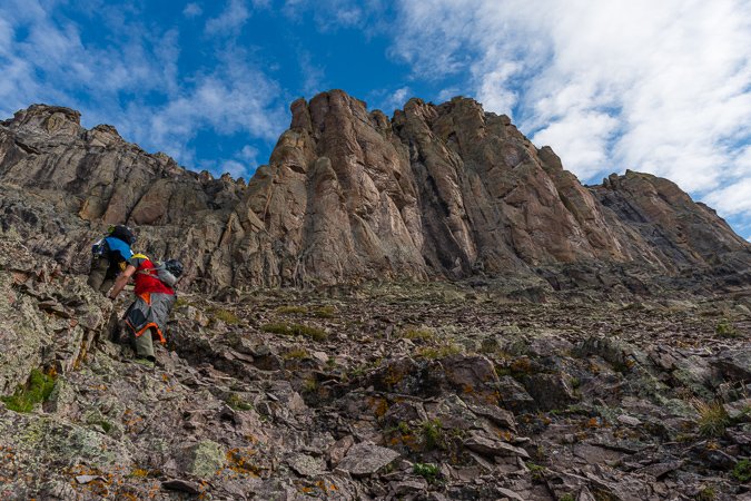
Completing the Centennials - ending a decade-long goal on Thunder Pyramid
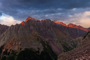
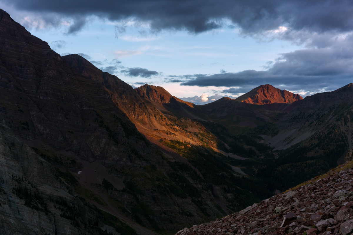
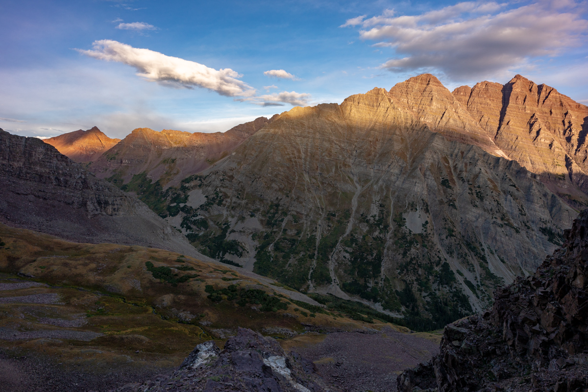
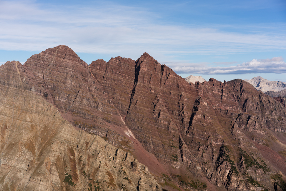
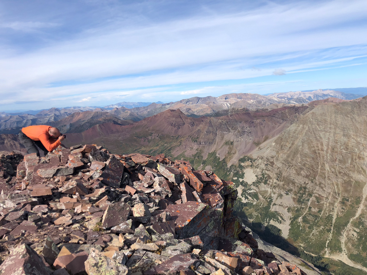
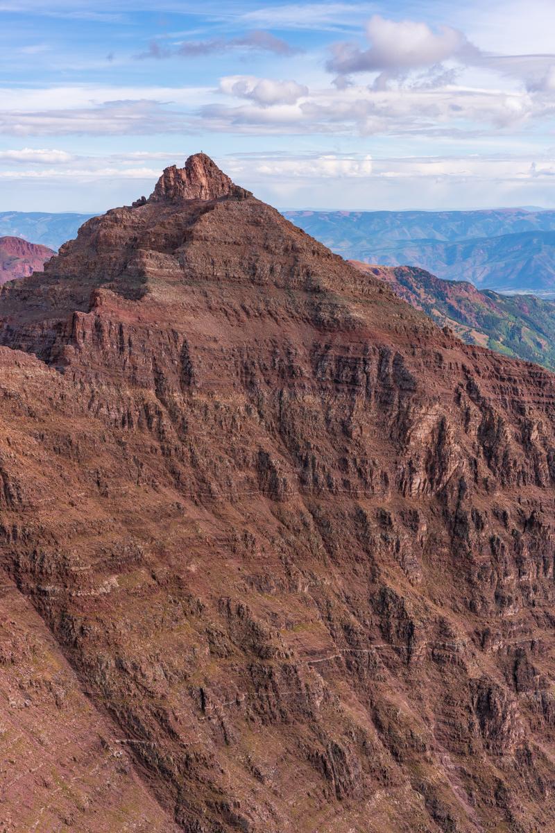
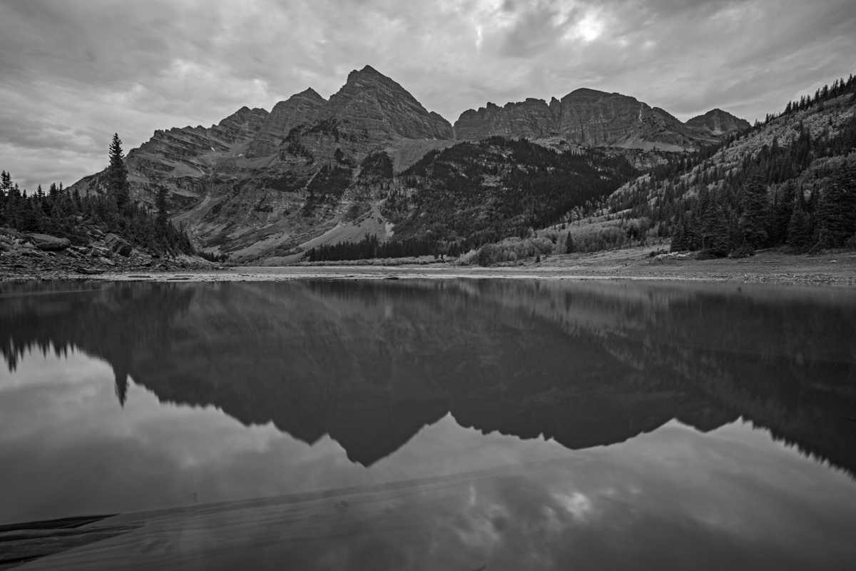
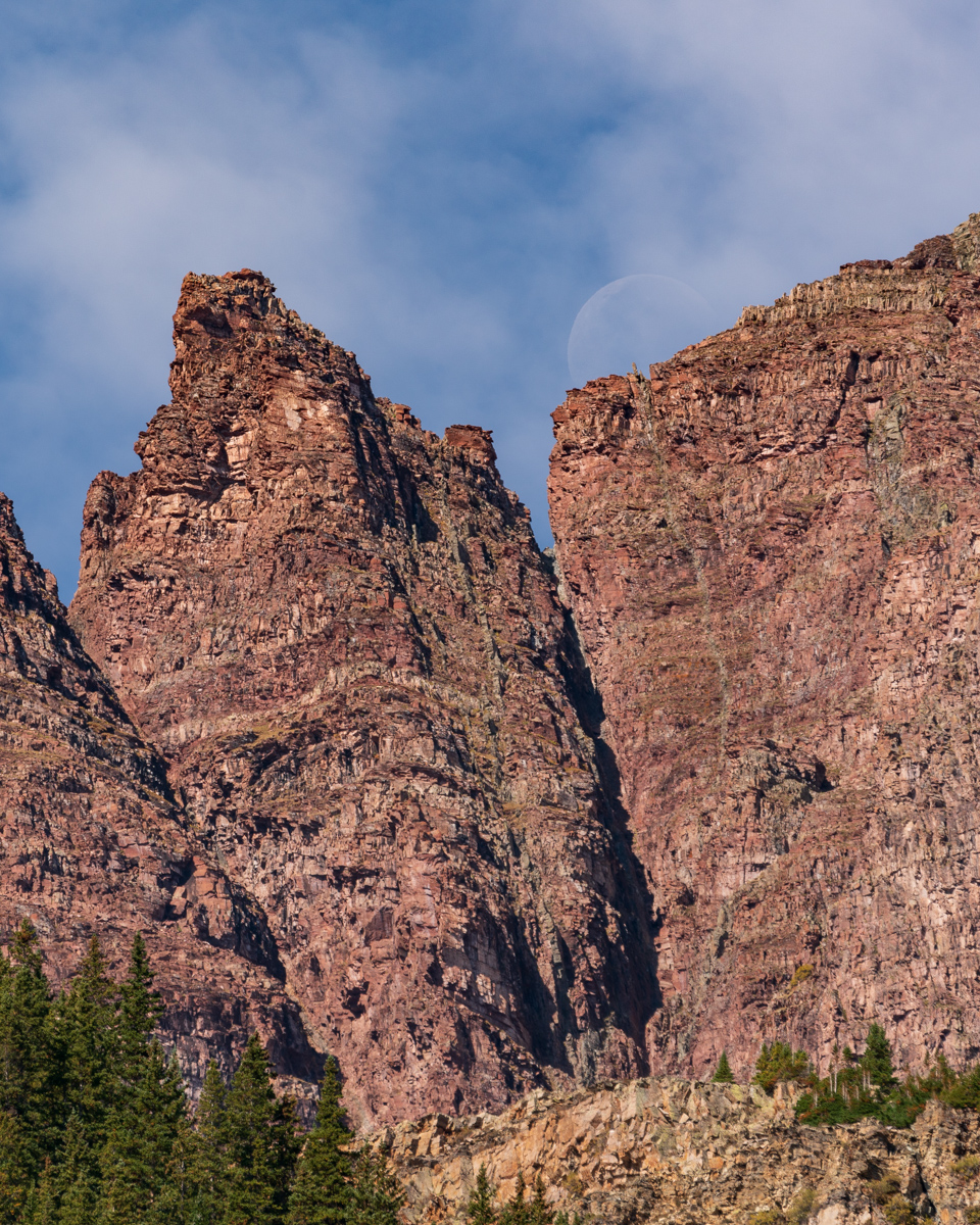
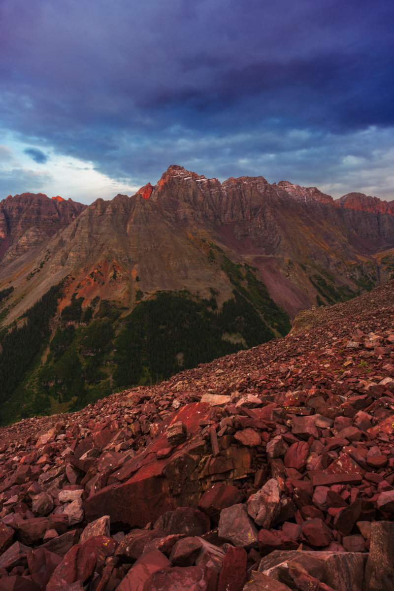
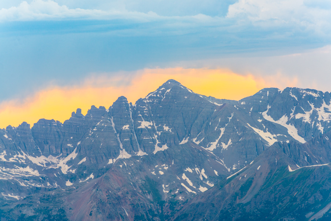
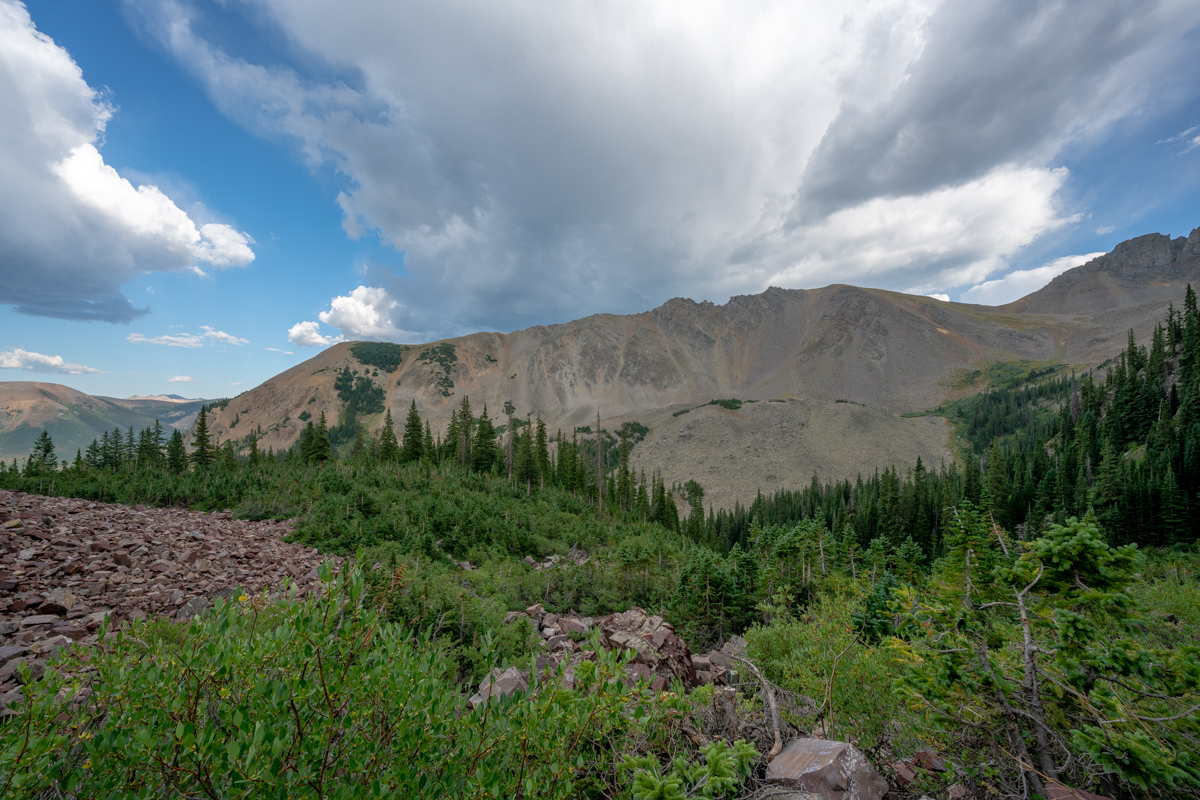
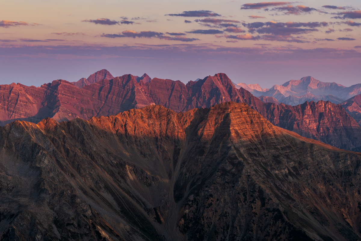
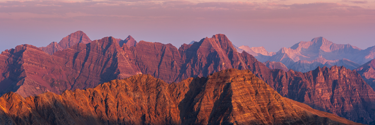
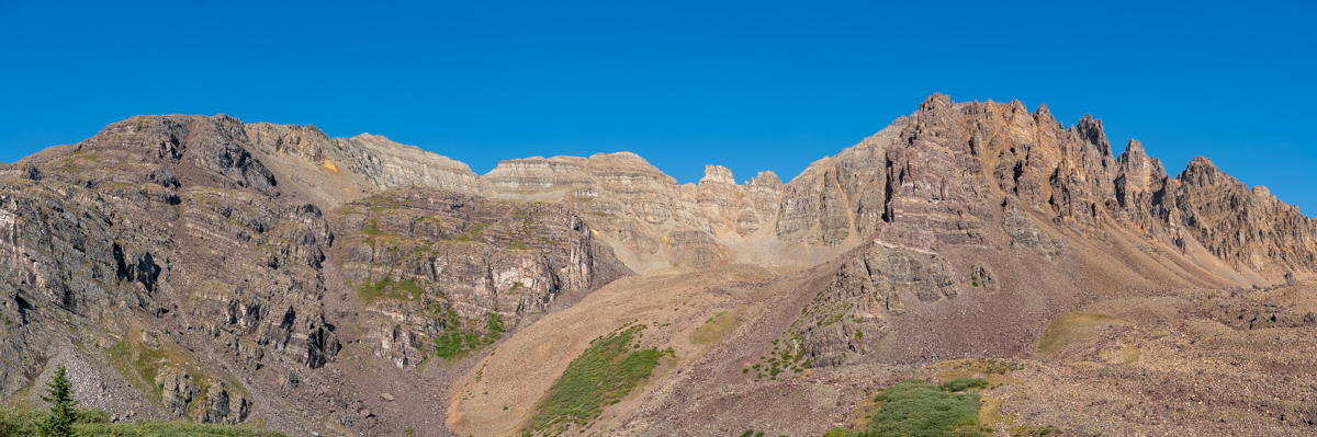
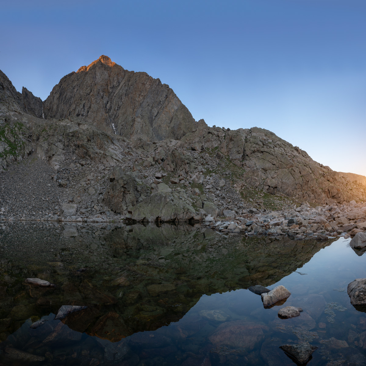
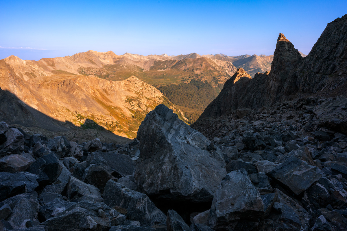
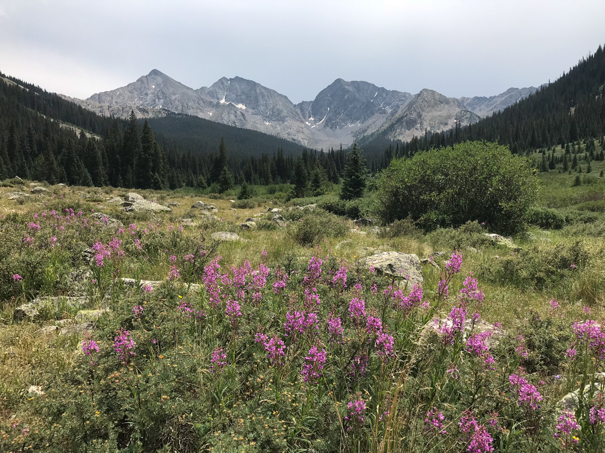
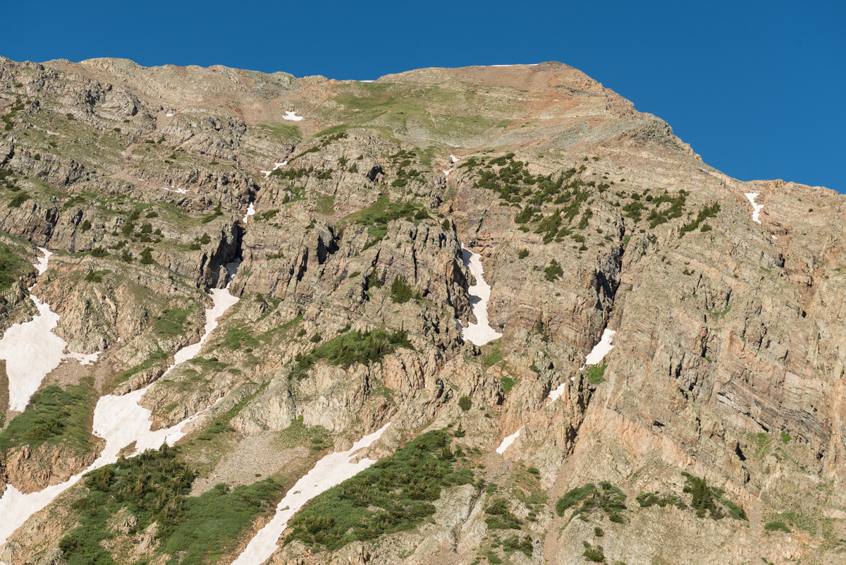
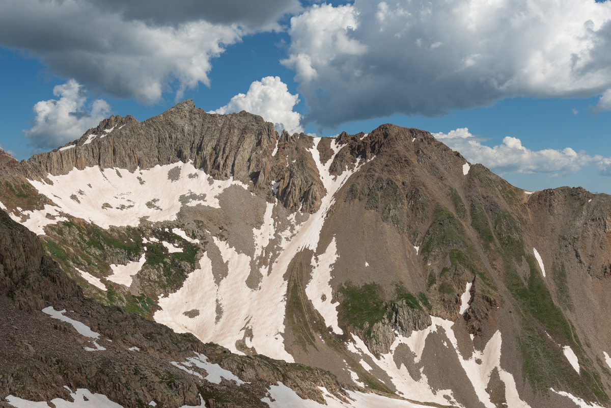
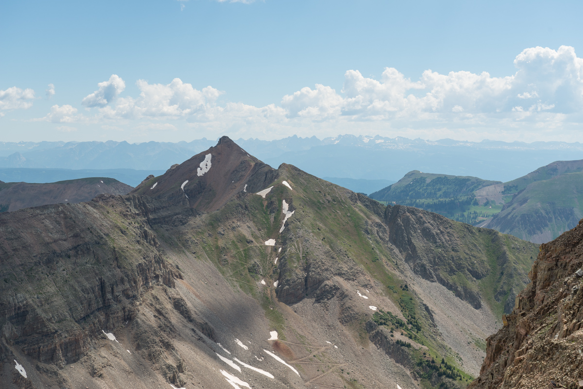
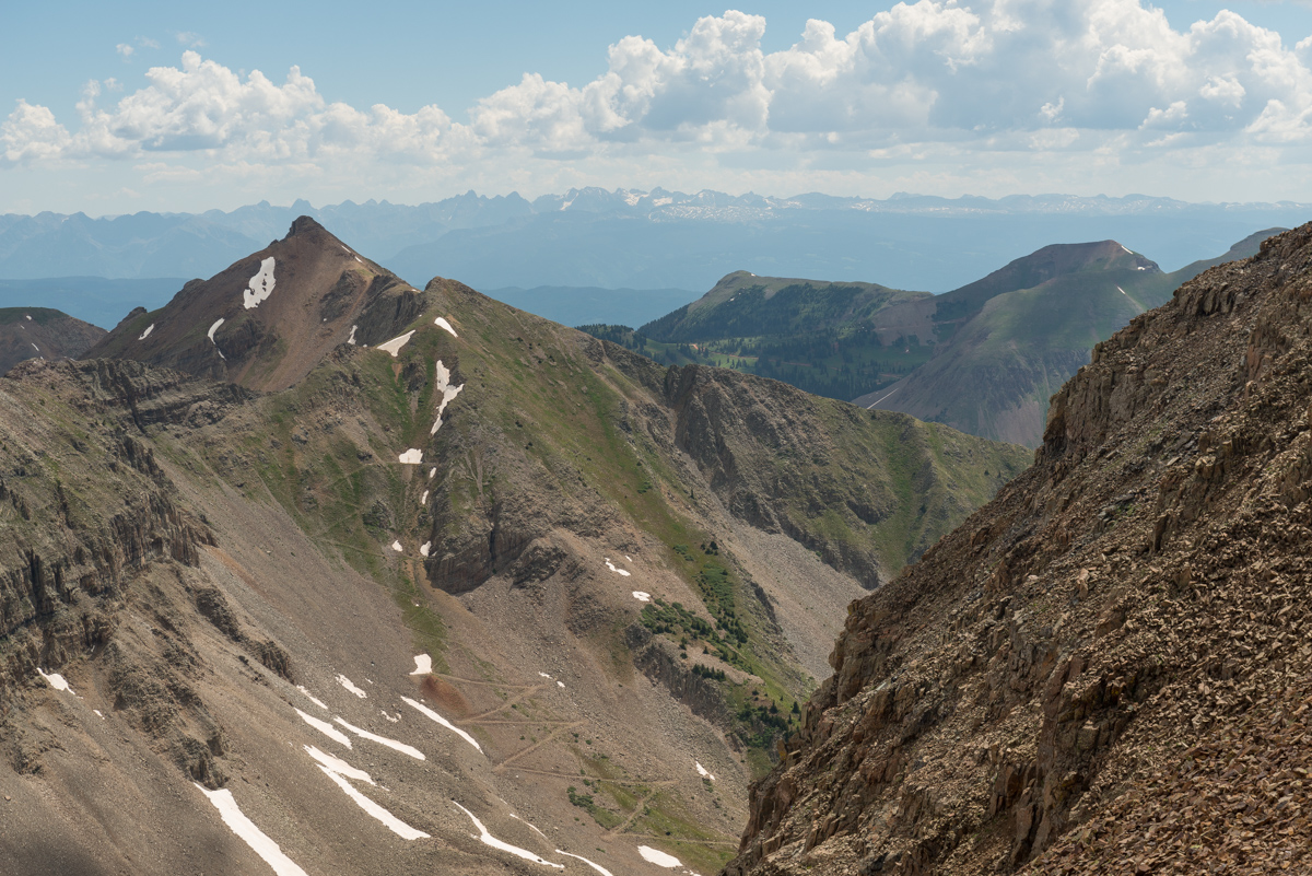
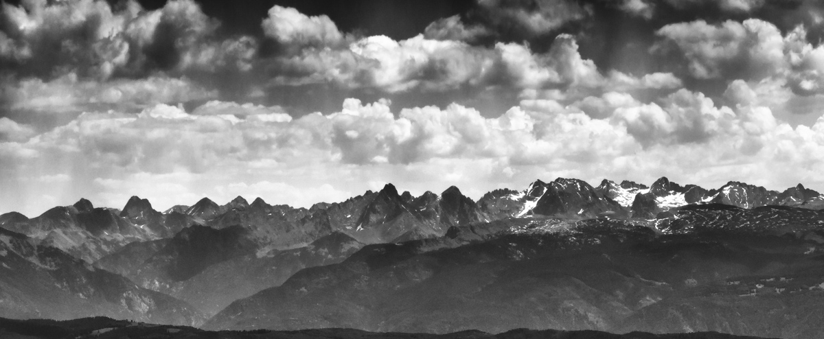
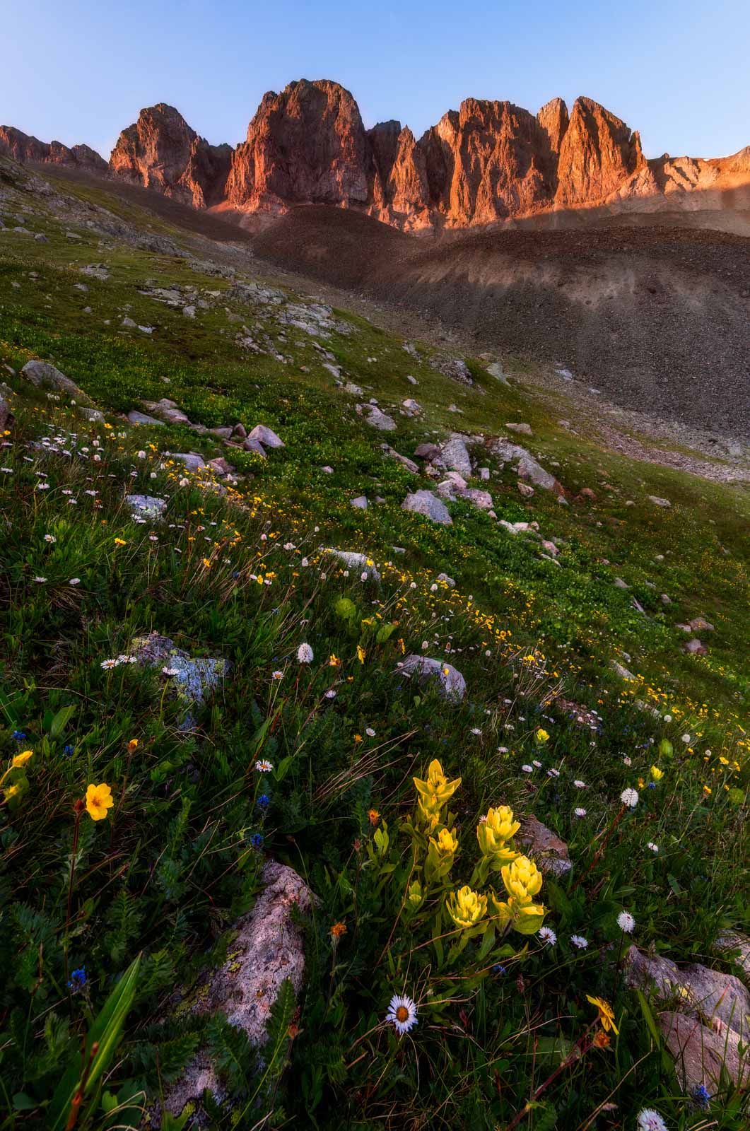
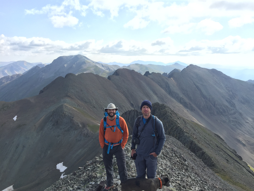
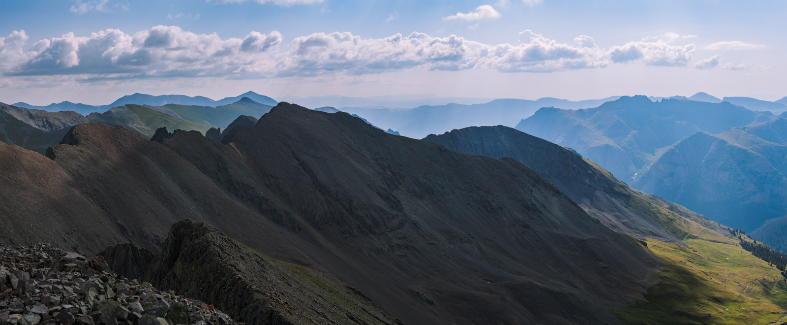
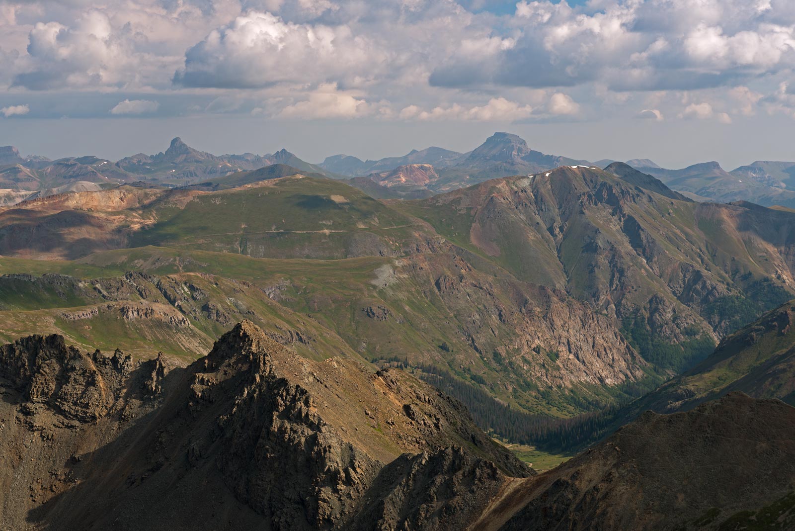
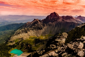
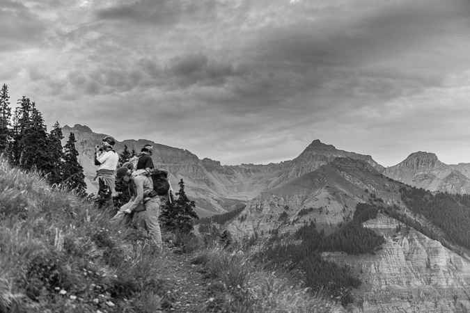
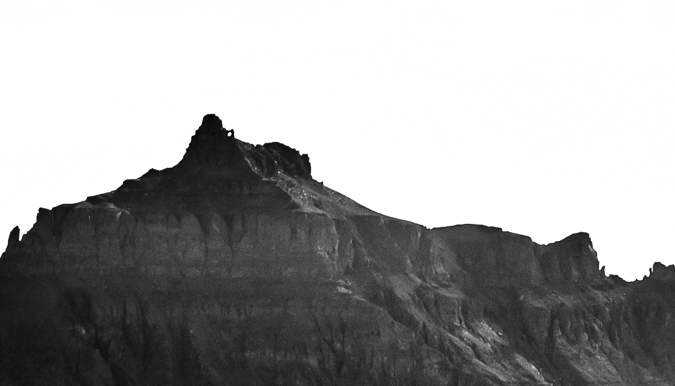
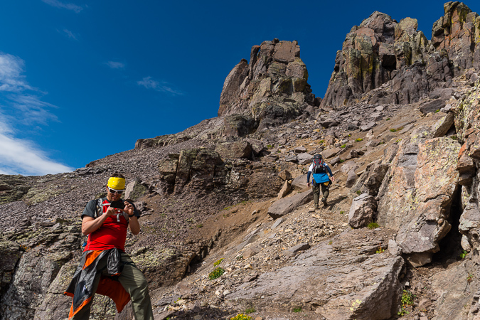
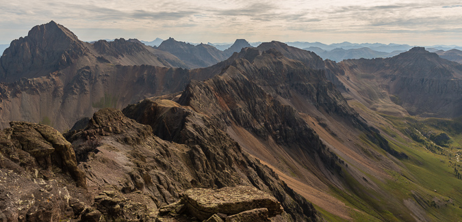
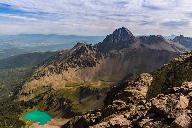
 Pyramid Peak and Thunder Pyramid as seen from Maroon Peak in 2012
At the start of 2018, I told myself that this would be the year that I would complete the Centennials (the highest 100 mountains in Colorado). For no great reason, I wanted to finish my goal before I turned 40 (I'm 39). It was a somewhat lofty goal considering I had lost my job in January, started a new job in February, and was not in the best physical shape of my life. I started this goal officially in 2009 and game out of the gates in a hurry. I had a headstart, having started climbing peaks when I was 4-years-old (1982). I had completed 22 / 100 by the end of 1998 when I was in college, but took a very long hiatus after that. I only completed 5 more peaks from 1998 to 2008. That means that between 2009 and the end of 2018, I completed 73 of the highest 100 mountains. That feels substantial. In January 2009, I built this website and began documenting my journey. This trip report may be boring in some ways so bear with me. It is my way of reflecting back on this journey and reminiscing on a goal completed. The following summaries don't include repeat peaks or other peaks not in the highest 100 that were climbed those years.
- In 2009, I completed 20 summits on the list.
- In 2010, I completed 12 summits on the list.
- In 2011, I completed 14 summits on the list.
- In 2012, I completed 5 summits on the list and finished the 14ers.
- In 2013, I completed 5 more summits and then moved to Oregon.
- In 2014, I completed 1 more summit (how sad).
- In 2015, I completed 2 more summits (still very sad), but moved back to Colorado at the end of the year.
- In 2016, I completed 3 more summits.
- In 2017, I completed 3 more summits.
- Finally, in 2018, I completed 8 more summits and my goal. My average per year that I was actively seeking the goal was 7.3 - not bad!
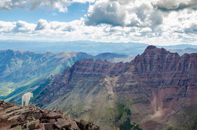
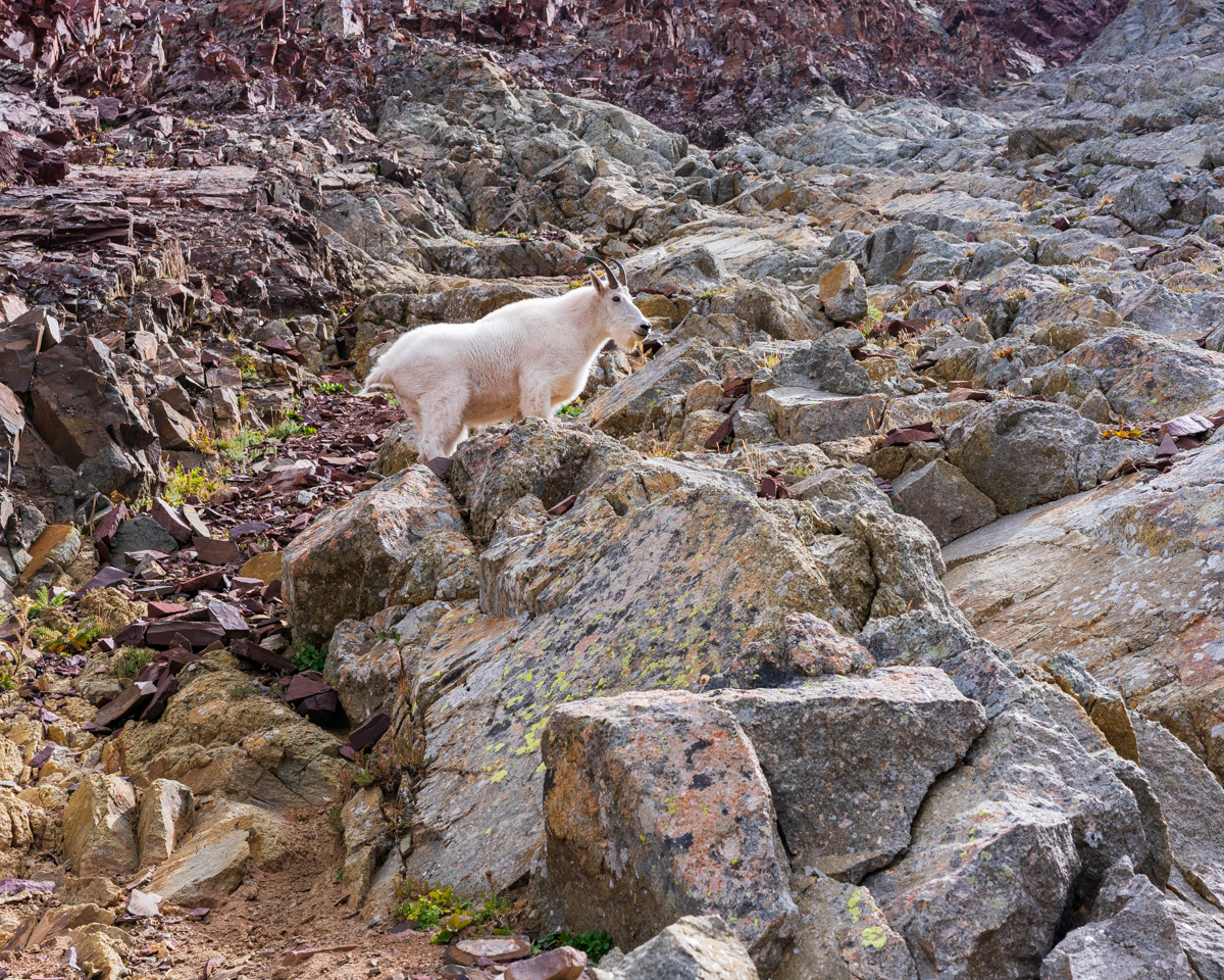
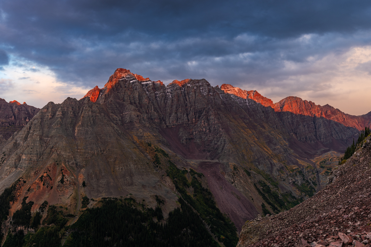
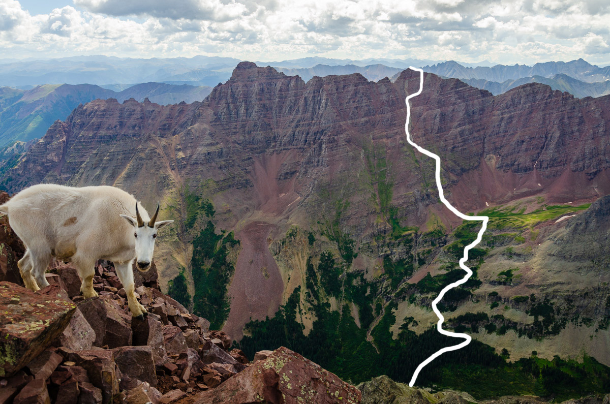
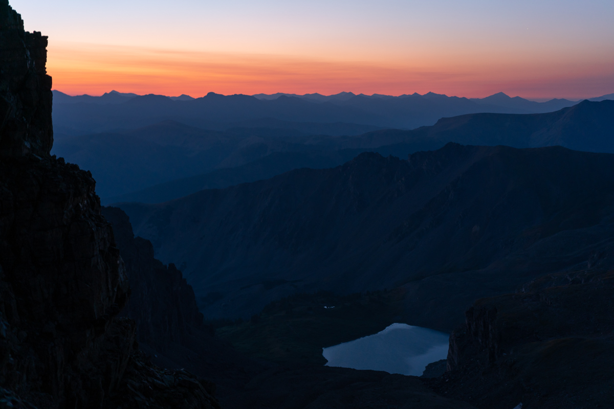
A mountain goat gazes upon Pyramid and Thunder Pyramid from the summit of Maroon Peak
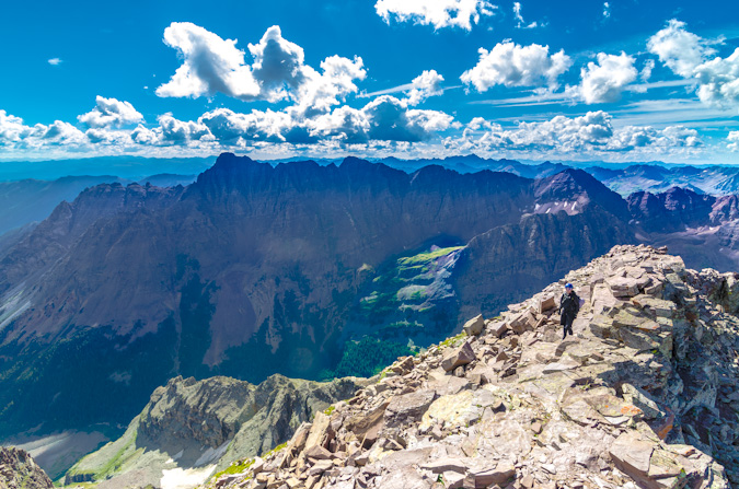
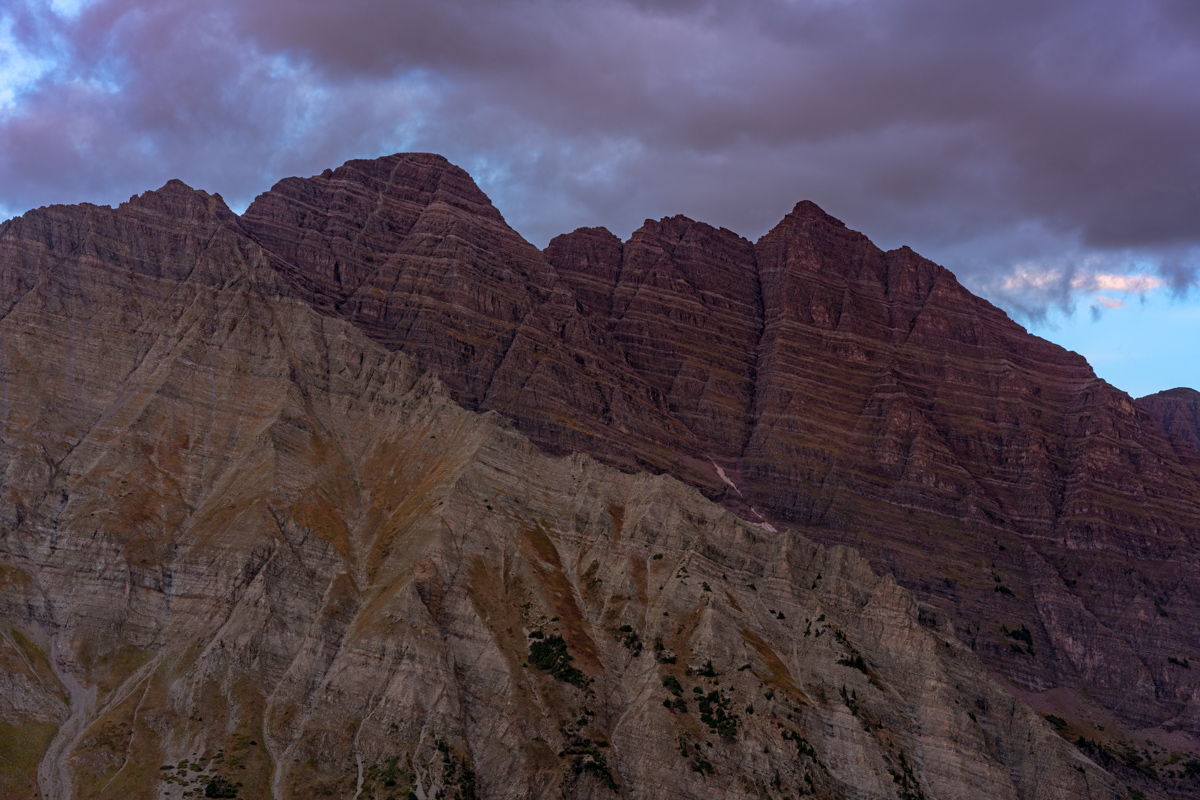
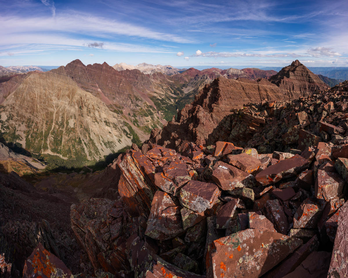
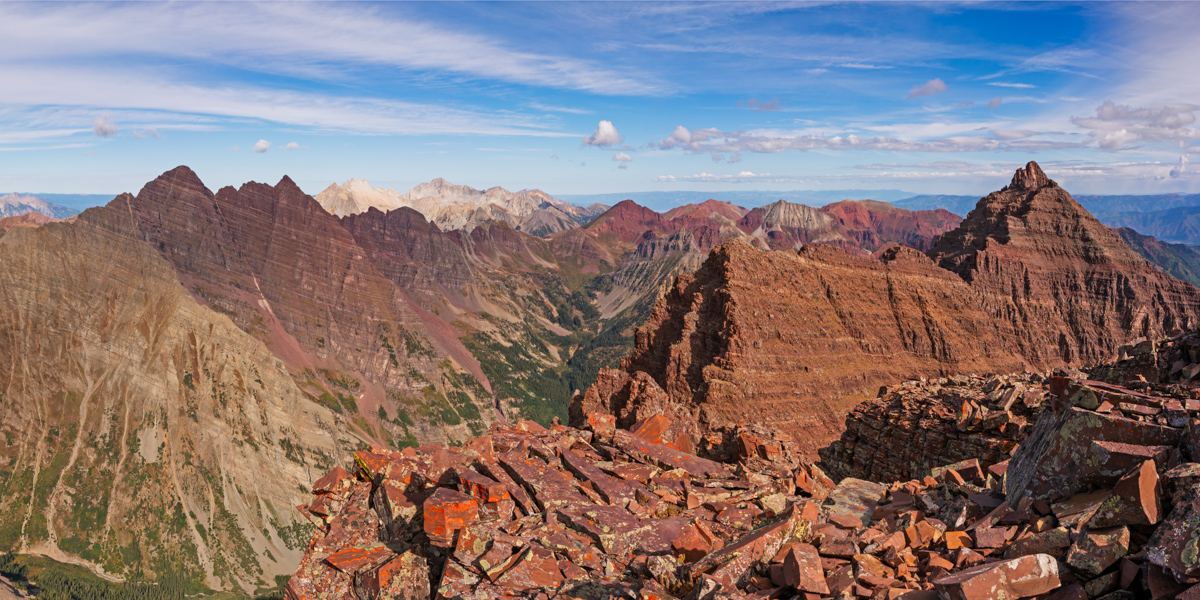
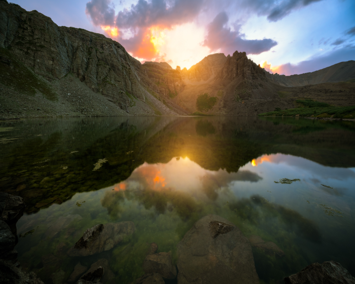
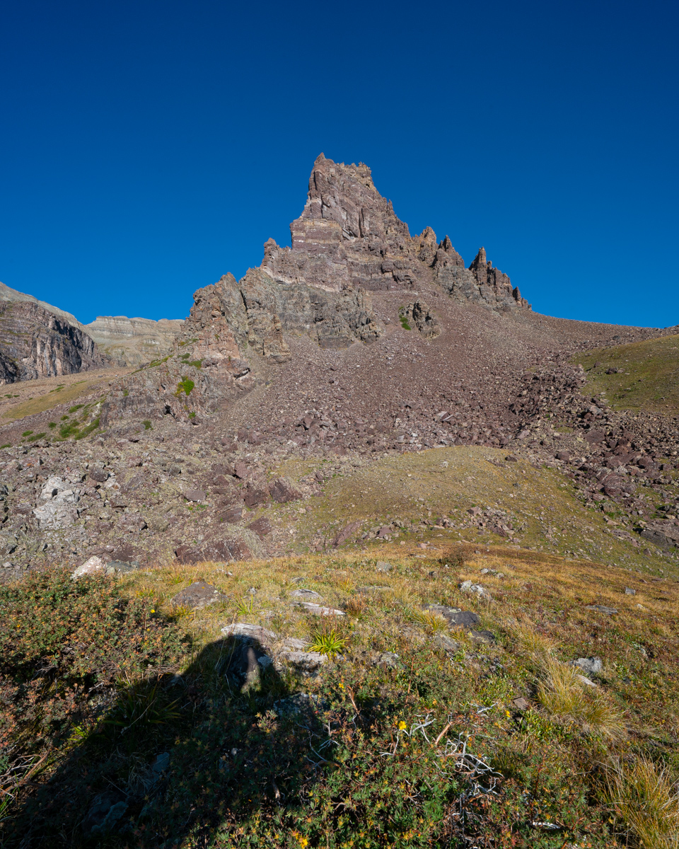
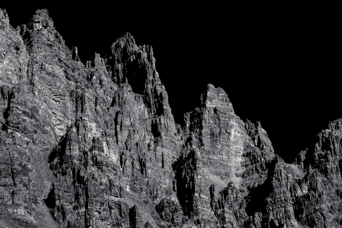
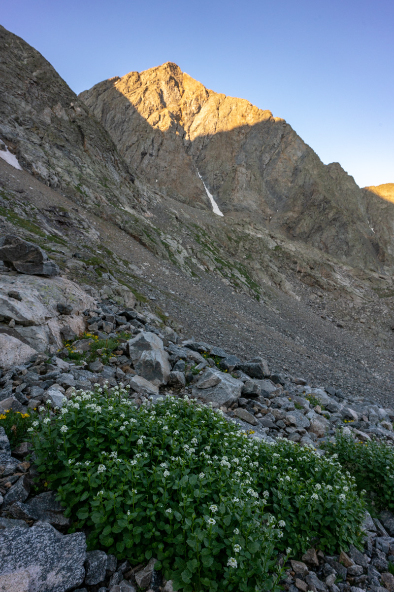
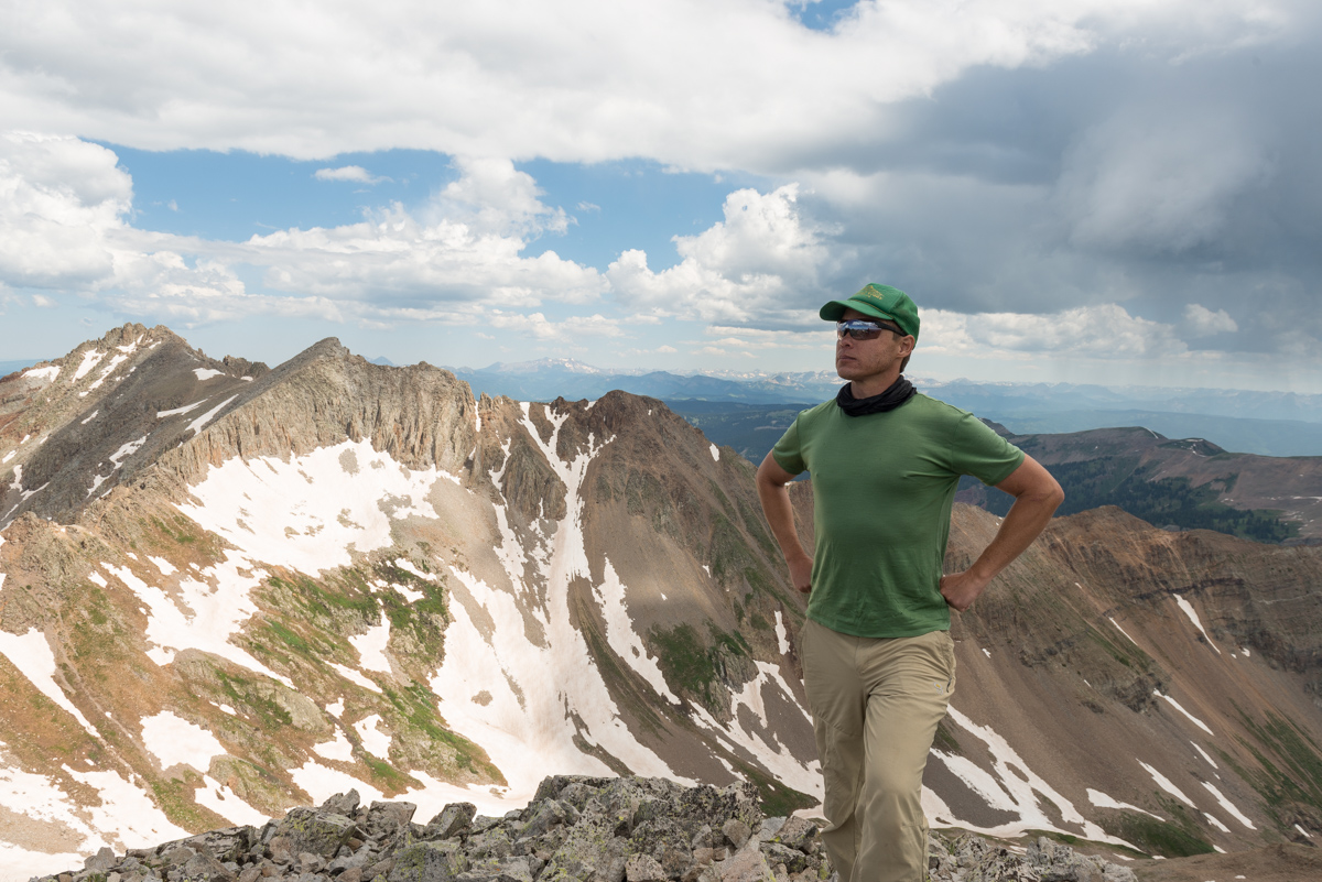
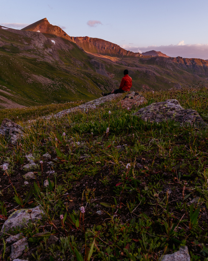
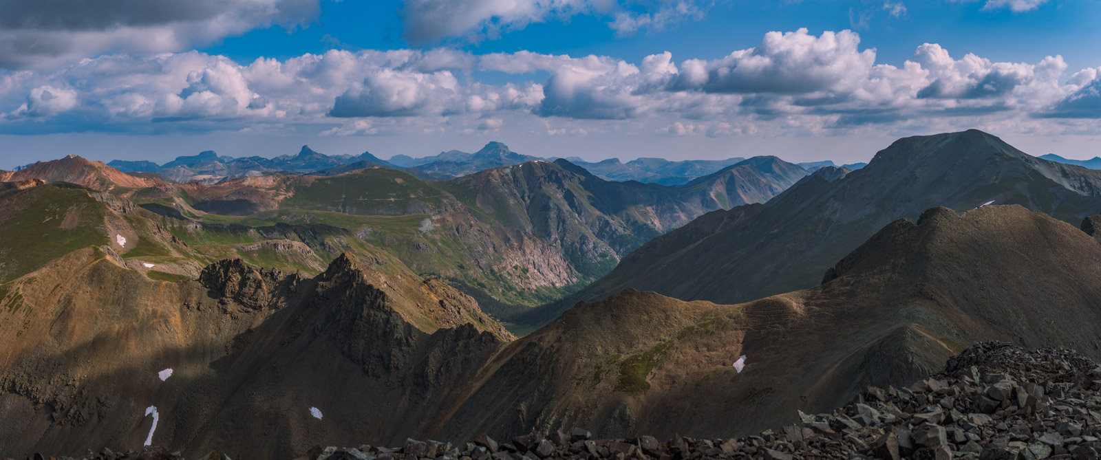
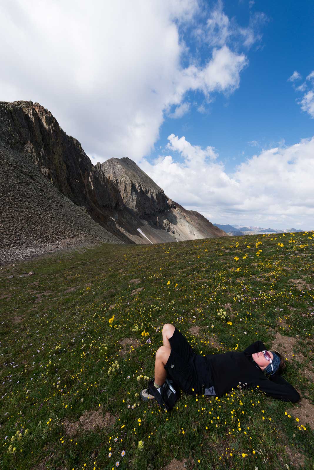
Regarding the subject at hand: I have been dreading Thunder Pyramid ever since gazing upon it in 2012 from the summit of Maroon Peak. The vantage from that position makes Thunder Pyramid unclimbable, the White Gully leading to the summit a straight-up nightmare. I had heard horror stories (all greatly exaggerated) of the looseness of the rock on Thunder Pyramid and many very exceptional climbers, including David Morano and Steve Gladbach, have perished on her slopes. The mountain was ultra-hyped in my mind and I was completely prepared for anything I found due to that hype. Anxiety is a powerful driver for some of us and I'm no exception.
As always, you can see and download my full route and GPS tracks over on the incredible app, Gaia GPS, which I use on my iPhone to plan, track, and follow my routes on these trips. It is absolutely invaluable and worth every cent. I personally love that you have full access to all USGS topo maps and National Geographic Trails Illustrated maps as well. You can use the app while in airplane mode and even save maps for offline use. To get a nice discount on the application, follow this link and you'll also support my efforts to keep this site running.
For this trip, I decided to pack quite a lot of camera gear (by the way, these are affiliate links and using them helps me pay for this site and to bring you better content):
- Sony A7R2 Camera
- Laowa 15mm f/2 lensaowa 15mm f/2 lens
- Zeiss Loxia 21mm f/2.8 lens
- Sony 55mm f/1.8 lens
- Sony 70-300 FE telephoto lens
- Feisol Tournament 3442 tripod
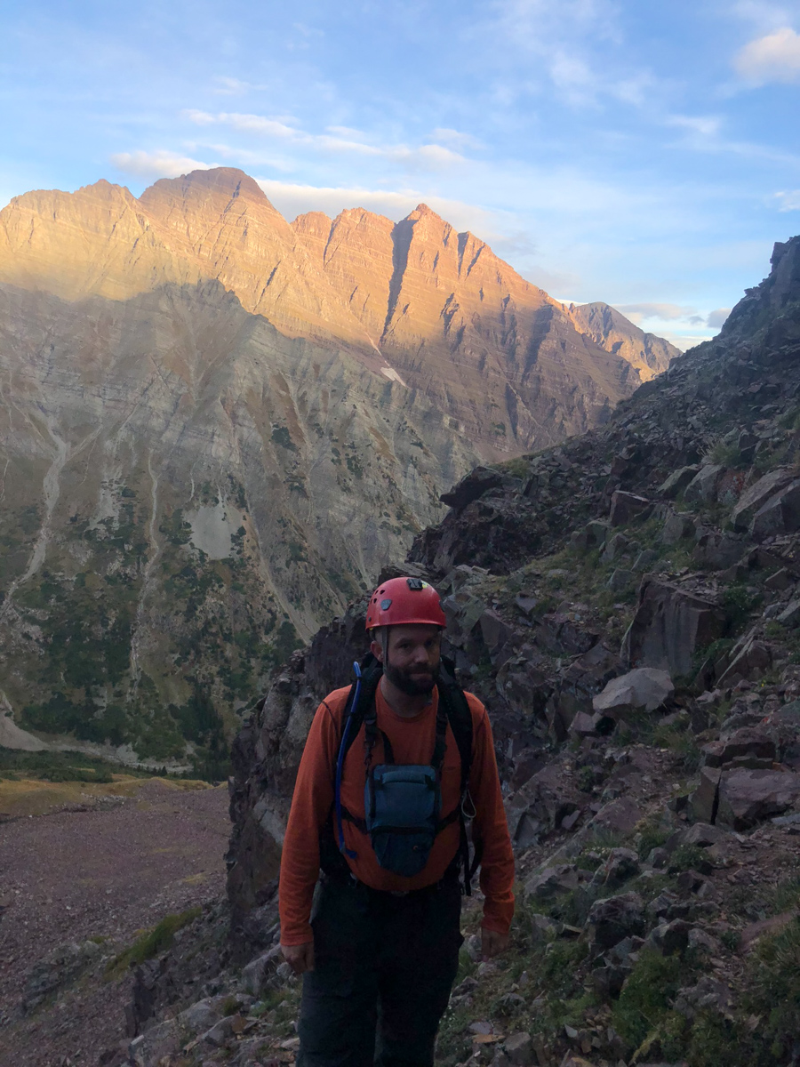
As usual, I used the beta from Gerry Roach's High Thirteener Guidebook. I was still using the 1st edition of the book; however, his new edition is available on Amazon after many years of waiting - rejoice! Also, huge shout-out to my good friend Kane Englebert who called me to give me some excellent tips on climbing this peak safely - thanks man!

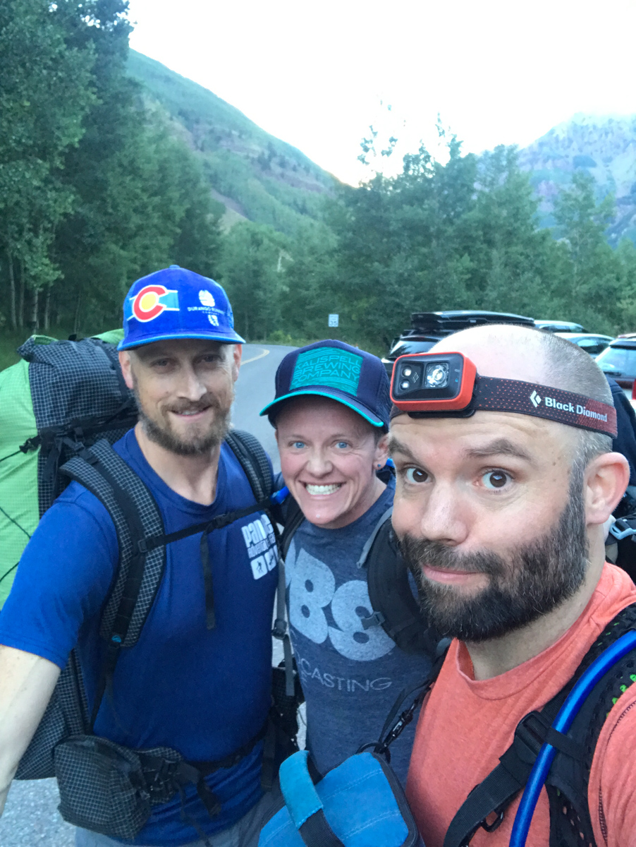
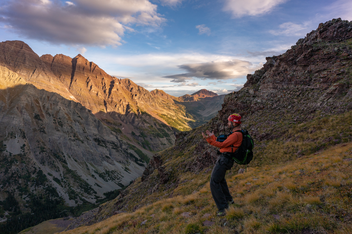
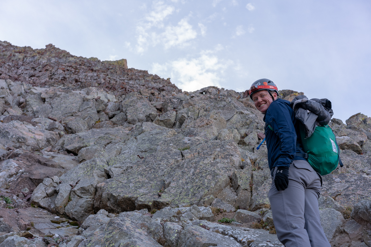
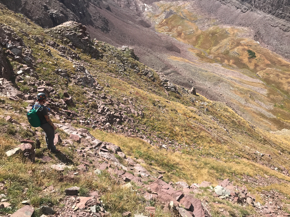
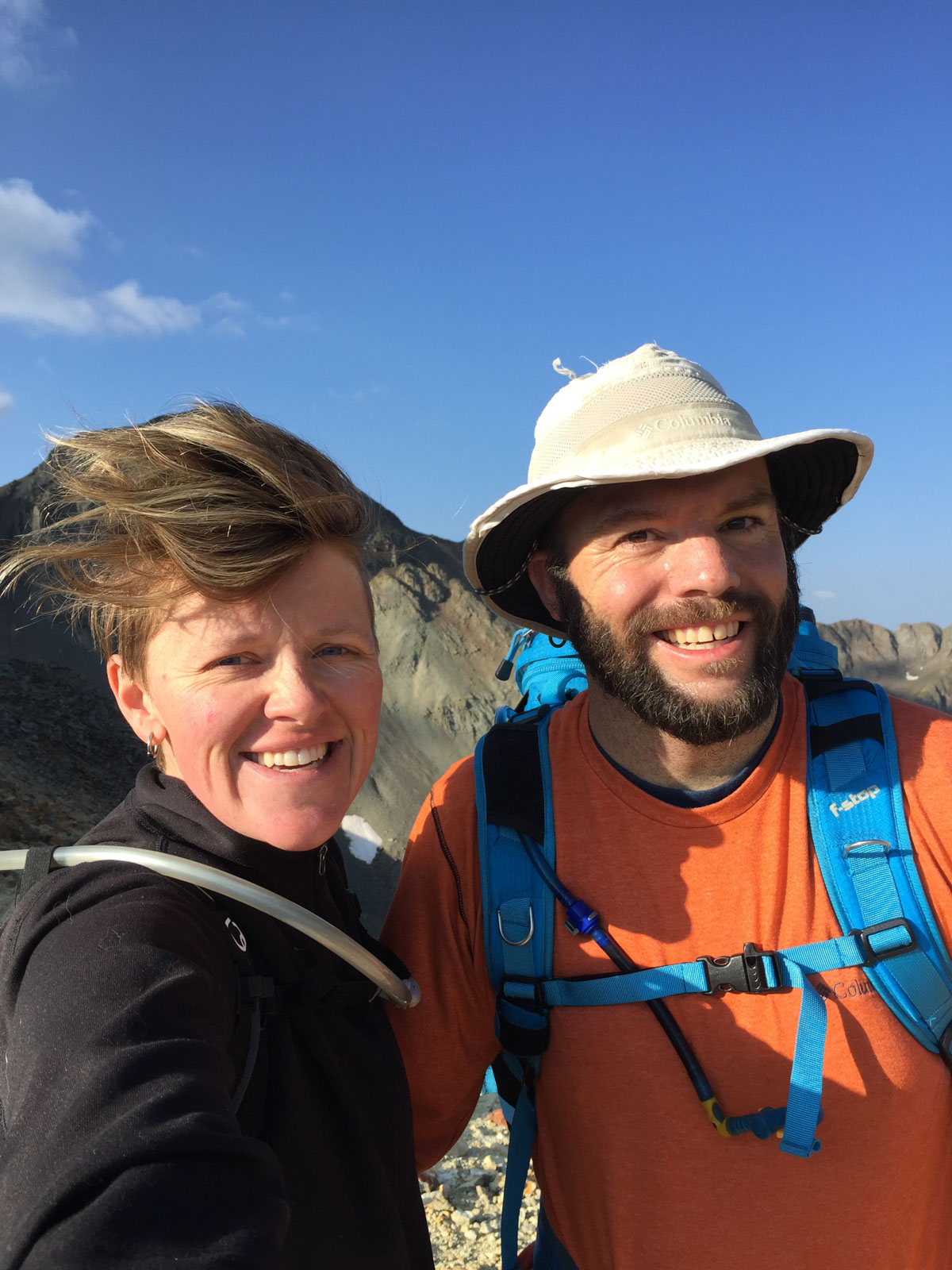
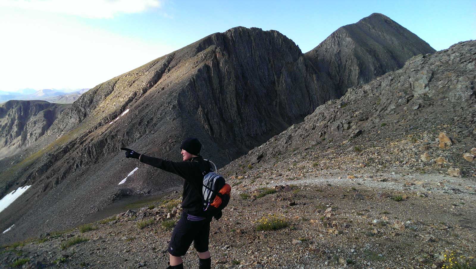
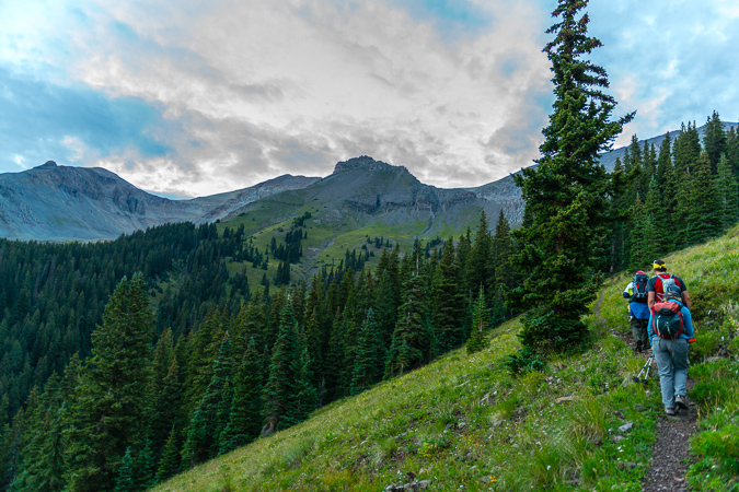
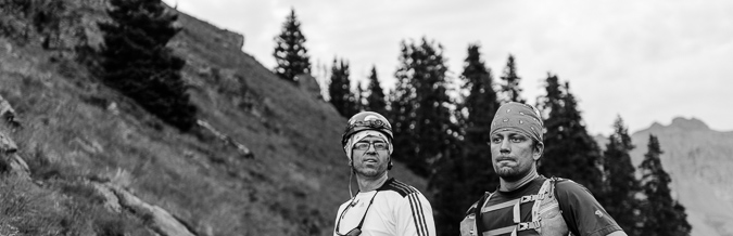
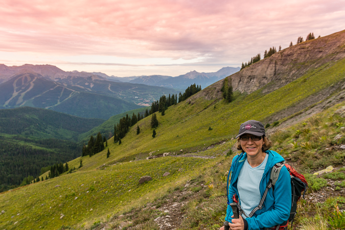
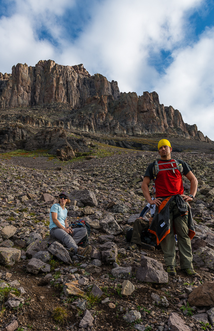
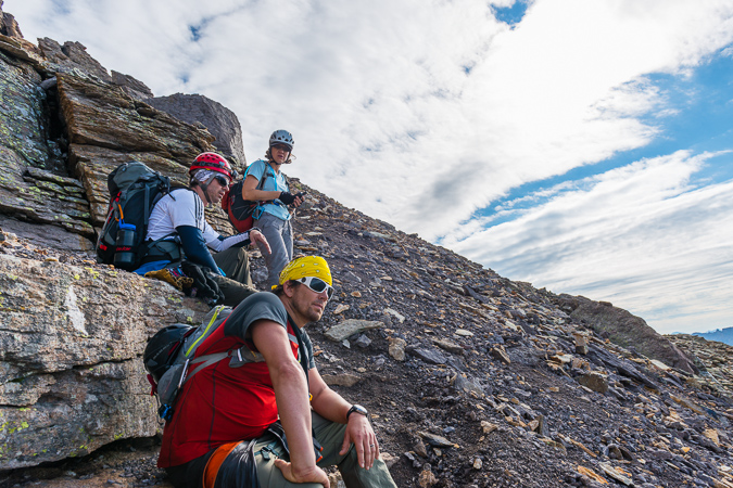
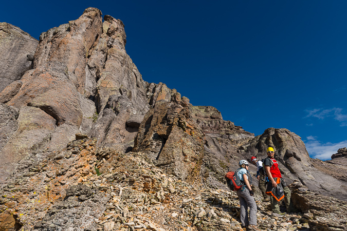
I decided to invite my two best friends for this final climb: Silas Musick, who has joined me on 16 of the highest 100 peaks; and, my friend Todd Myers. Since Todd was training for the Imogene Mountain Run in a week, he opted to just join us for the backpacking and stay in camp during the climb. The plan was for Todd and I to meet Silas in Aspen and then drive to the Maroon Bells parking lot together. Todd and I left Durango at noon on Friday. We met Silas at 6 PM in Aspen and we were all at the trailhead and ready to hike at 7:30 PM. We were planning to backpack to Crater Lake, set-up camp, and then get up really early for our attempt on Thunder Pyramid. Silas also had North Maroon on his radar and so we knew we would be in the area for a few days. The three amigos began our trip up from the lake in high spirits.
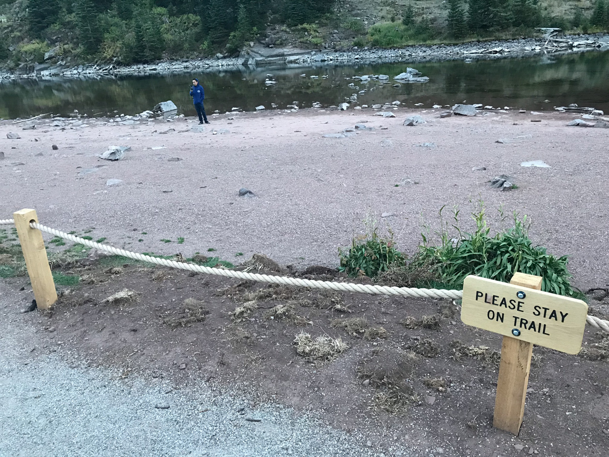
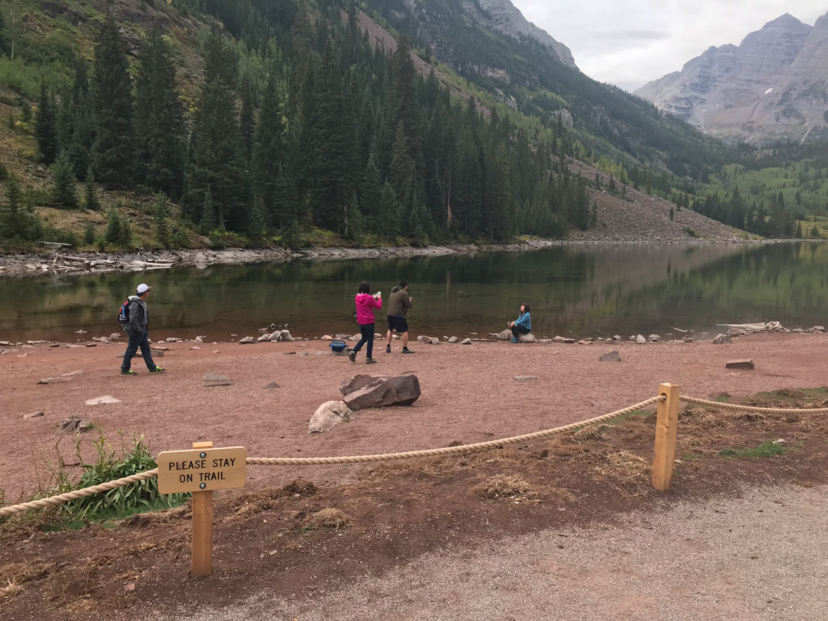
I was surprised to find that Maroon Lake had a rope surrounding it - which will not bode well for those looking to photograph it during autumn colors. Already, we found lots of people that simply disregarded the signage to stay on the trail, despite a sign being visible on the rope every 20 feet or so. Seriously, how hard is it for us as humans to simply obey rules? Do folks feel like they are above them? Anything for Instagram? What's going on here? You may not agree with the rope, but if you're going to enjoy public lands, you need to follow the rules. While they may sometimes be poorly implemented, we should still follow them. For more on the Forest Service's decision to rope it off, see this link.
We arrived pretty late at our campsite and set-up in the dark. There was an abandoned tent at our site - one of those cheap Walmart tents. I sure don't envy the job of the Forest Service to keep these places looking halfway decent. The total disregard of Leave No Trace principles is quite astounding. OK, off my soap box! Silas and I set our alarms for 3:45 AM and hit the sack.
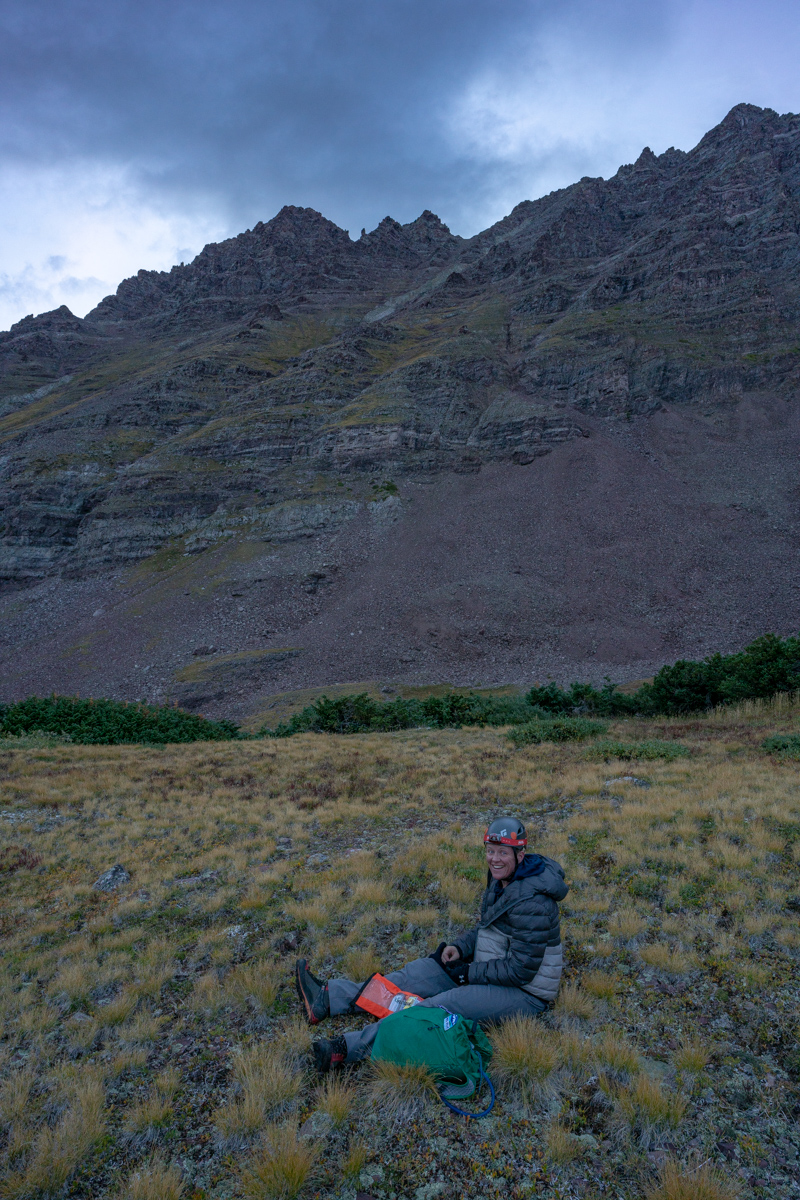
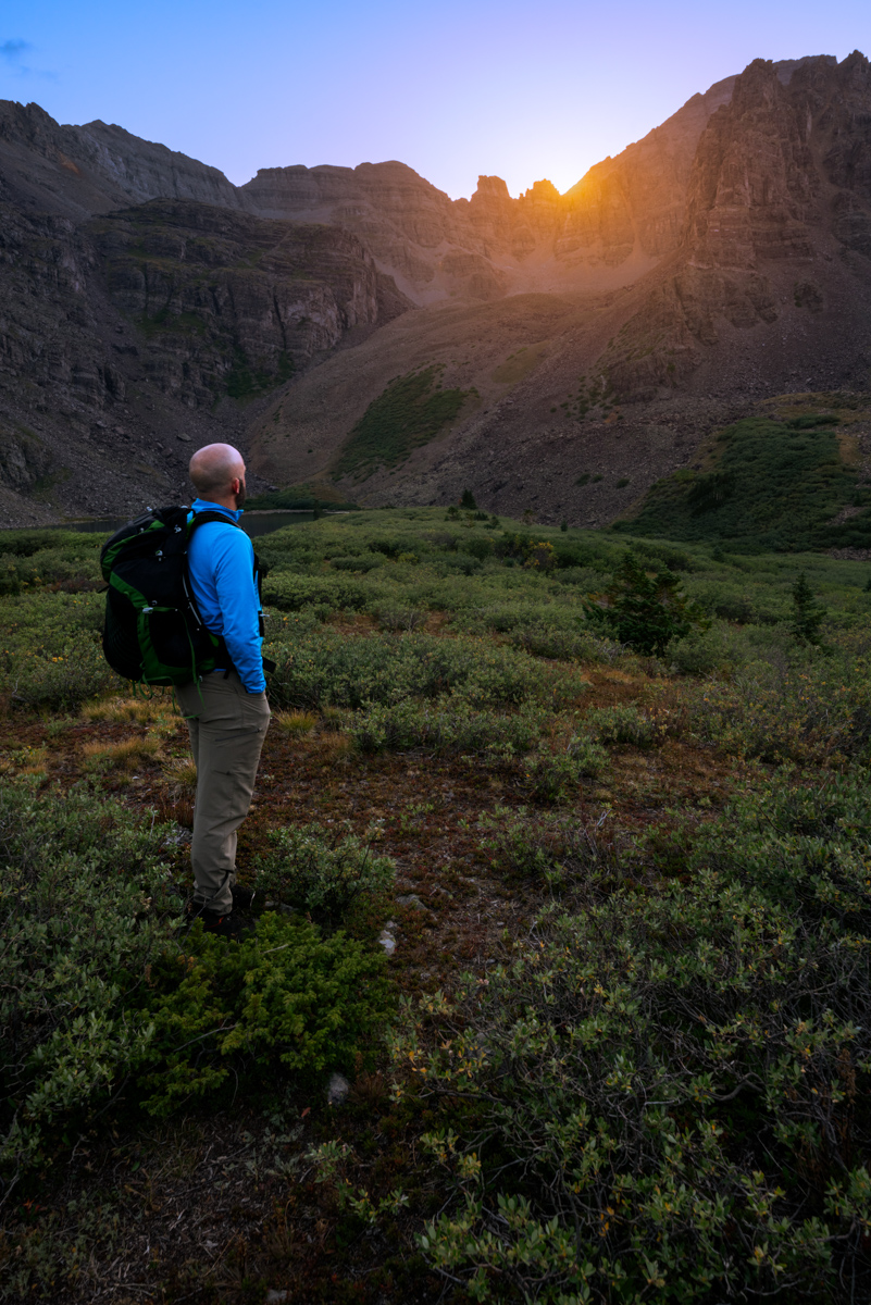
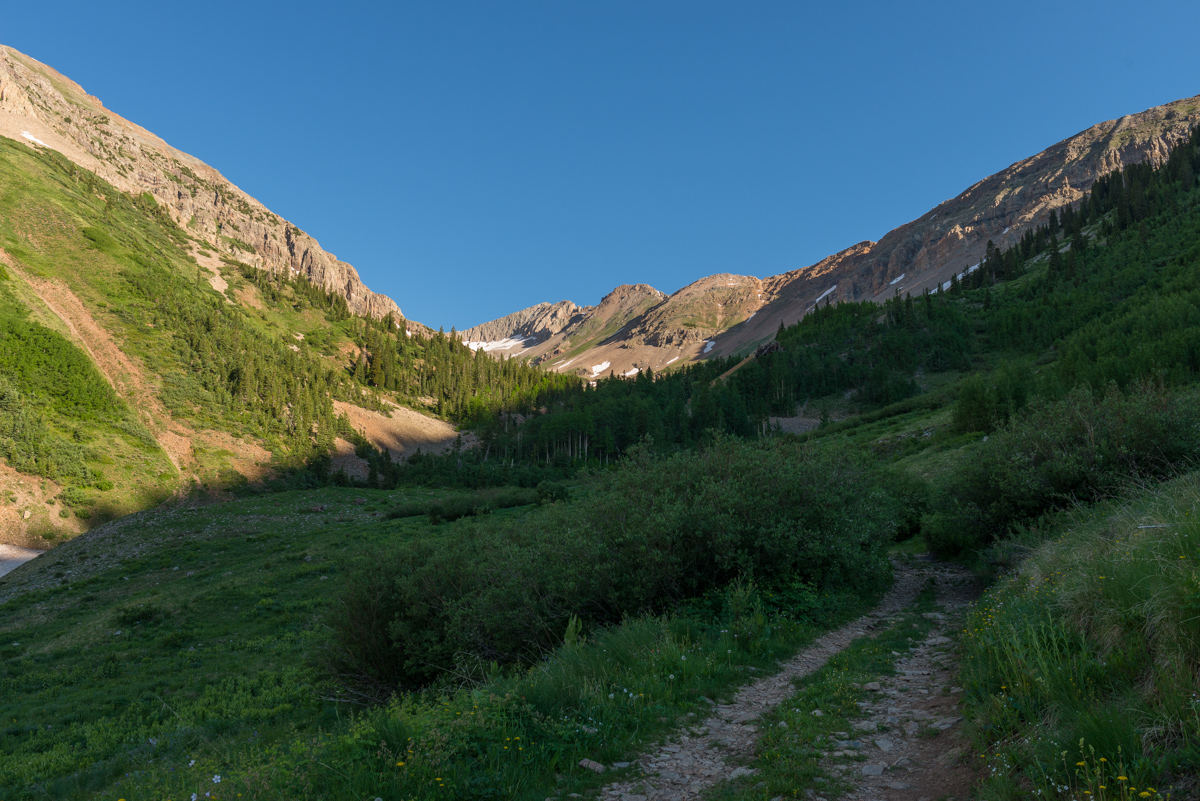
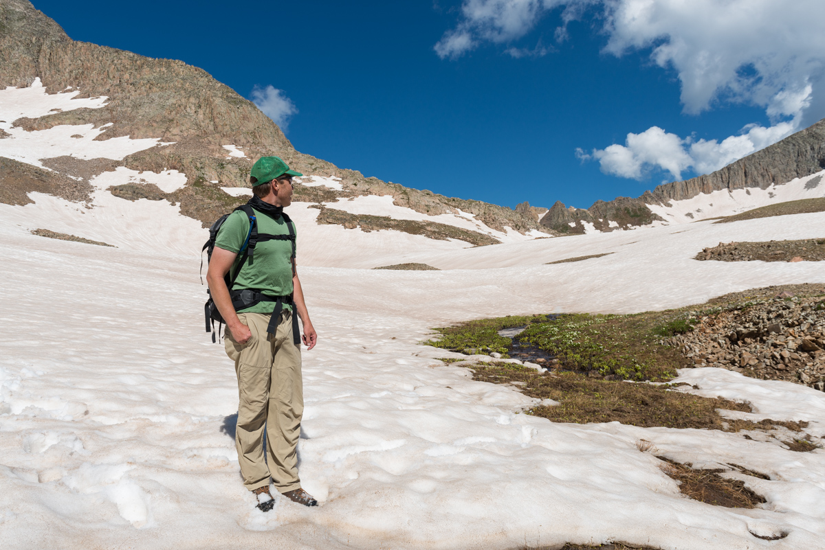
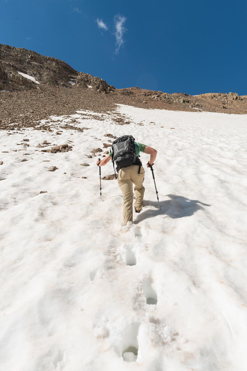
We woke up at 3:45 and left camp at 4:00 AM. The forecast for the day was not great; however, it was also looking like the best weather window for the weekend. We anticipated early storms and lots of clouds in our future and wanted as early of a start as possible. While this meant hiking up the first section of Thunder in the dark, we felt it was a good choice.
After hiking about 10 minutes, a young man by the name of Austin stopped us on his way down from above asking if we had cell phone reception. We of course did not and explained that you would have to go all the way into town to get cell reception. He explained that his father, Brad, had altitude sickness and asked him to go down to get help. We explained that the most important thing was for his dad to get down and for someone to help him do that. We urged him to go back up and get him. He reluctantly agreed and hiked with us to the Thunder Pyramid turn off. We wished him luck, made sure he had food and water, and went our separate ways. More on that story later!
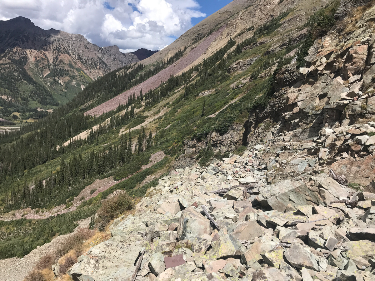
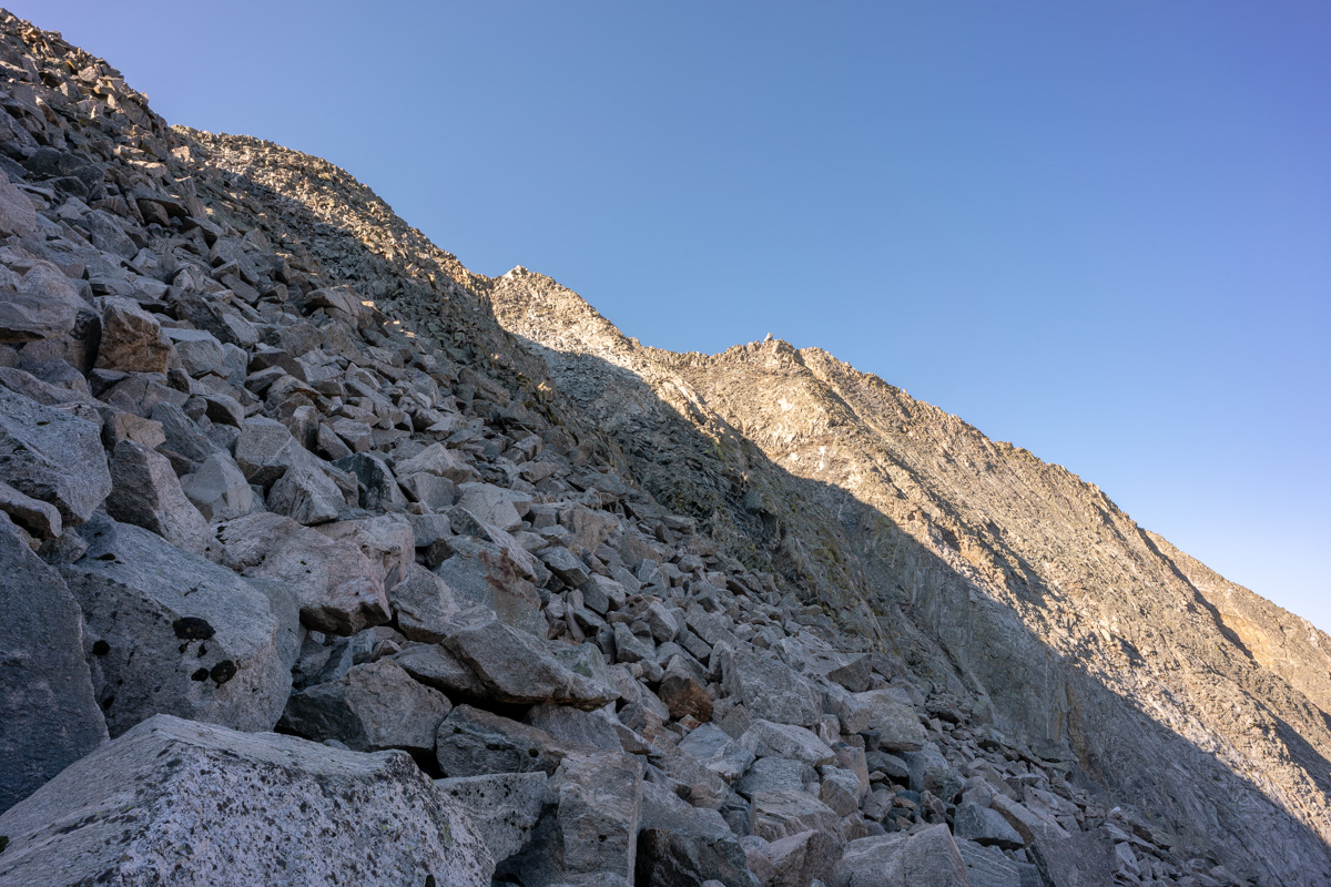
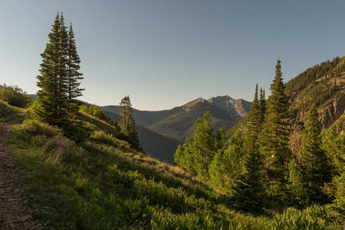
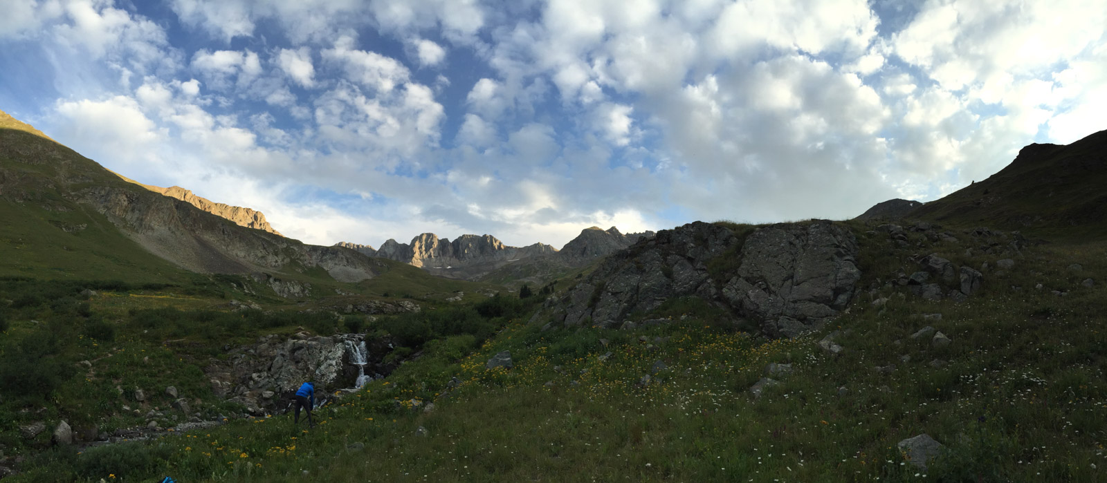
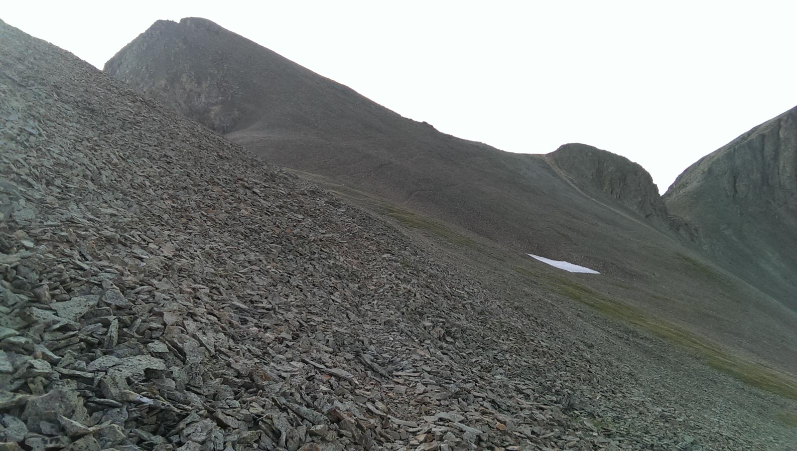
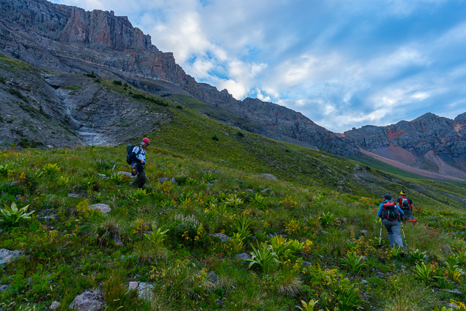
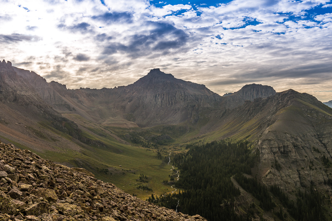
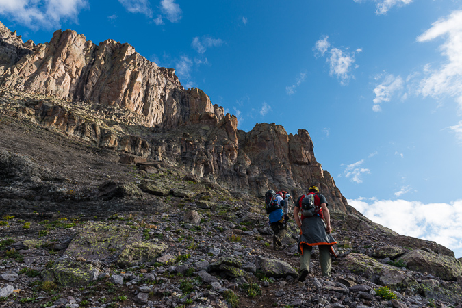
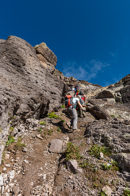
We had a tough time finding / following the trail from the cairned turn-off for Thunder Pyramid. We ended up bushwhacking up steep forested garbage until we reached the first cliff band. We followed that cliff band to our left to a weakness and followed that weakness up to another cliff band. This pattern continued until we found ourselves above treeline looking back on the Maroon Bells before sunrise.
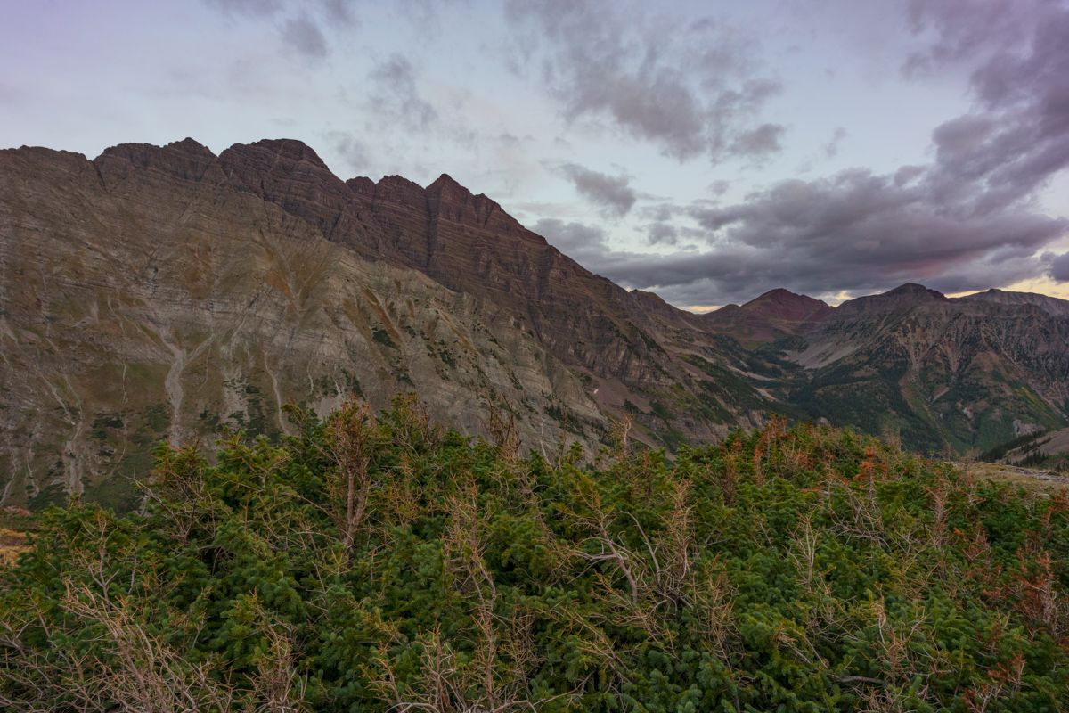
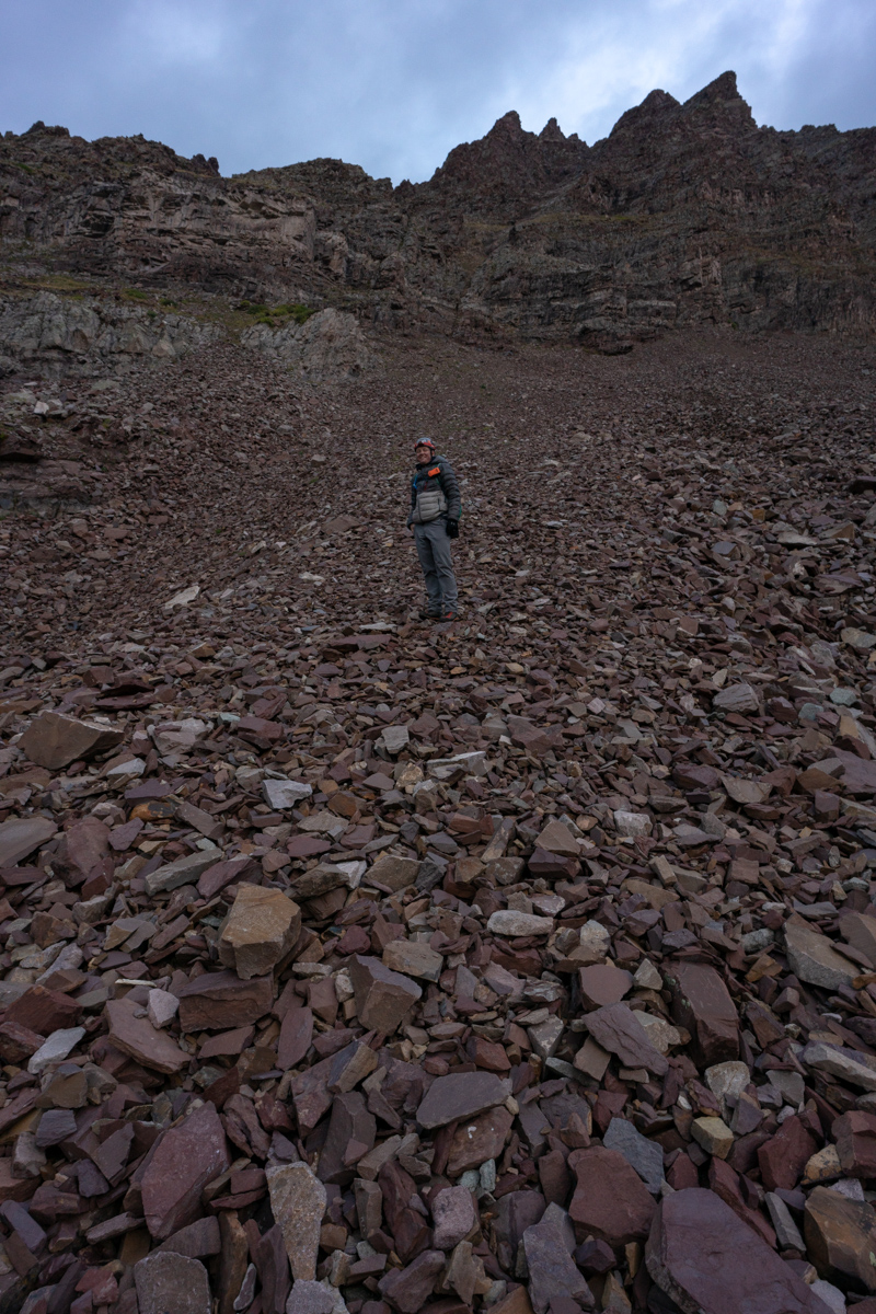
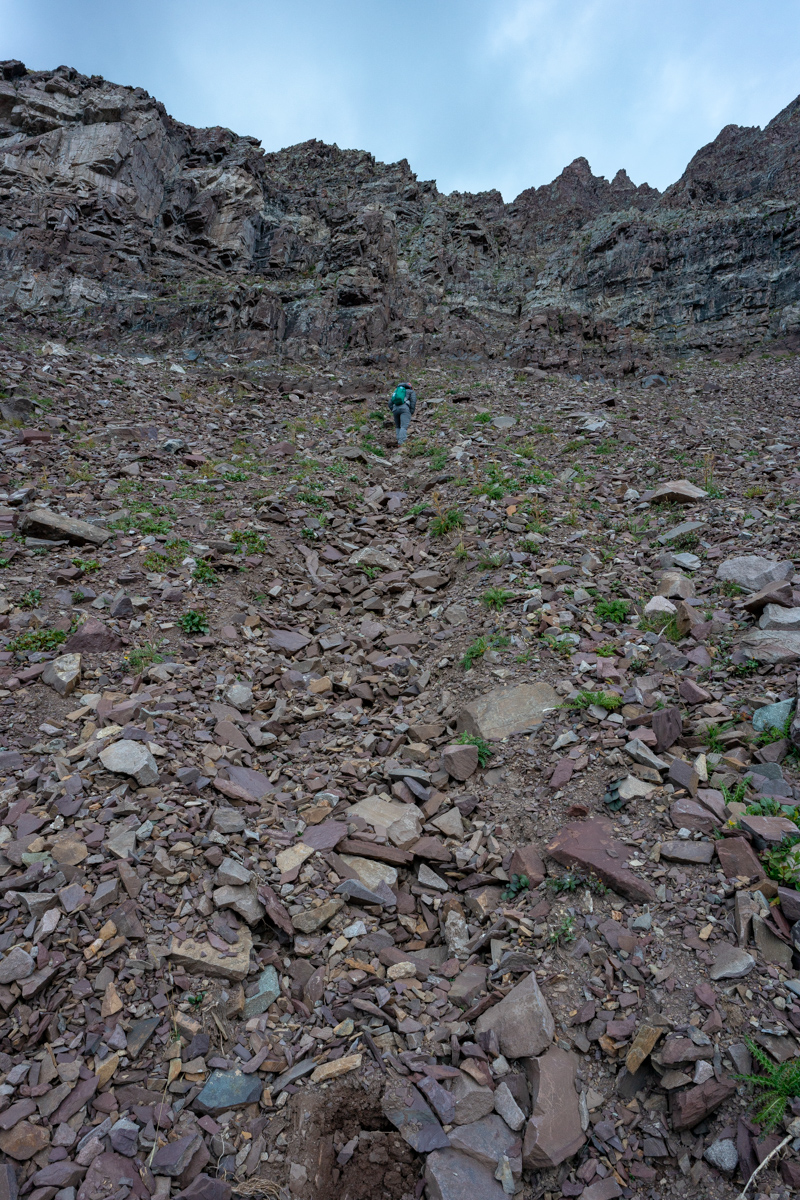
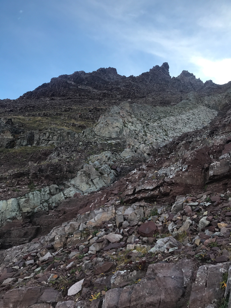
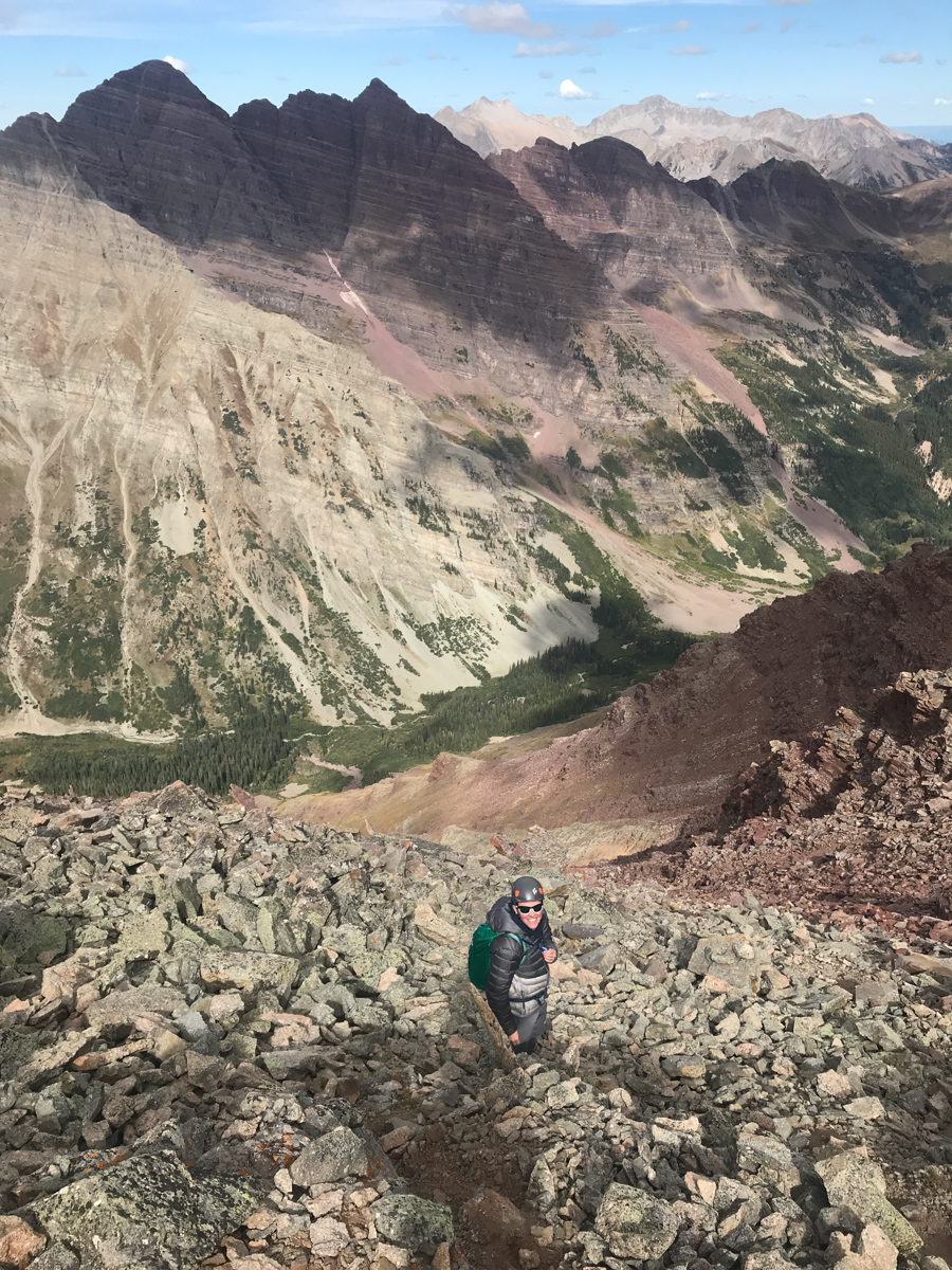
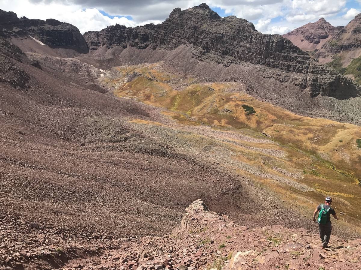
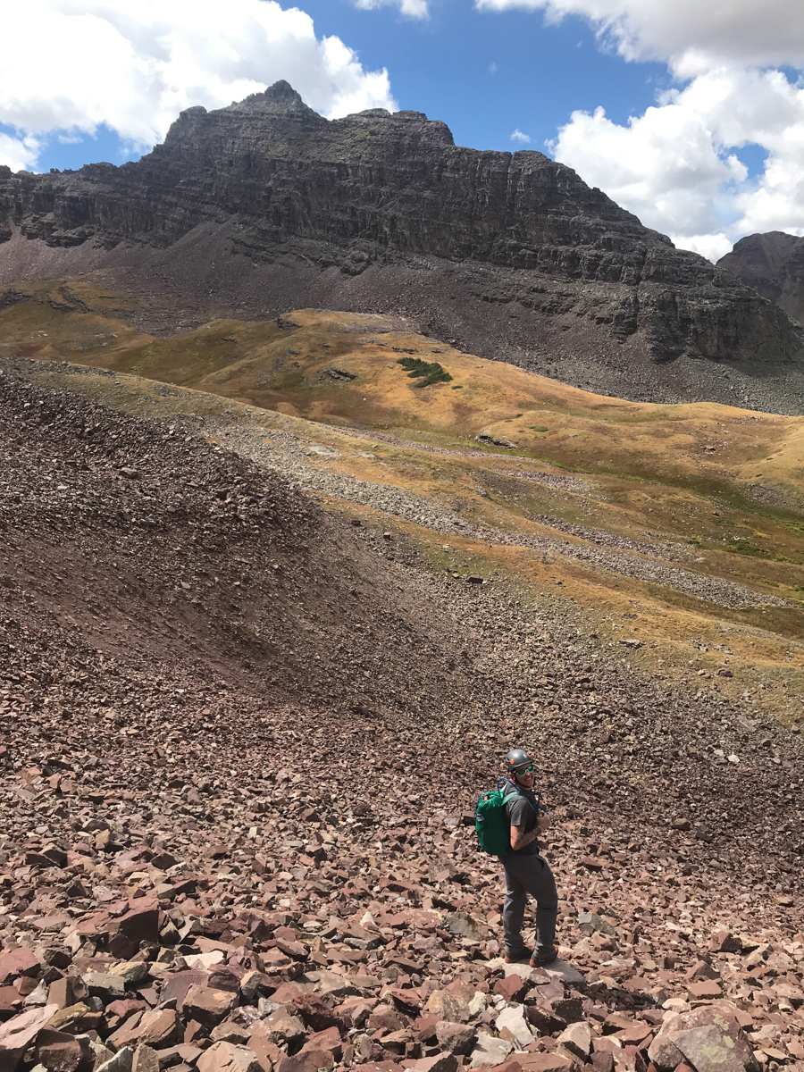
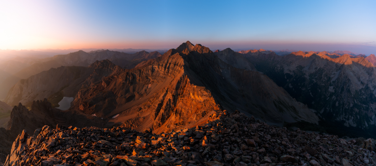
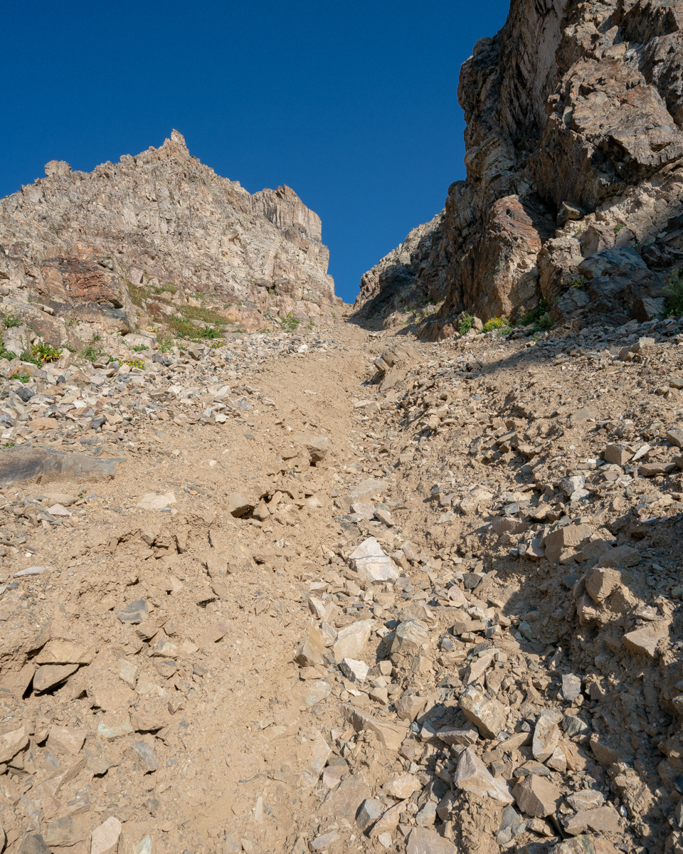
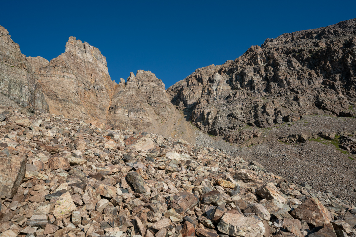
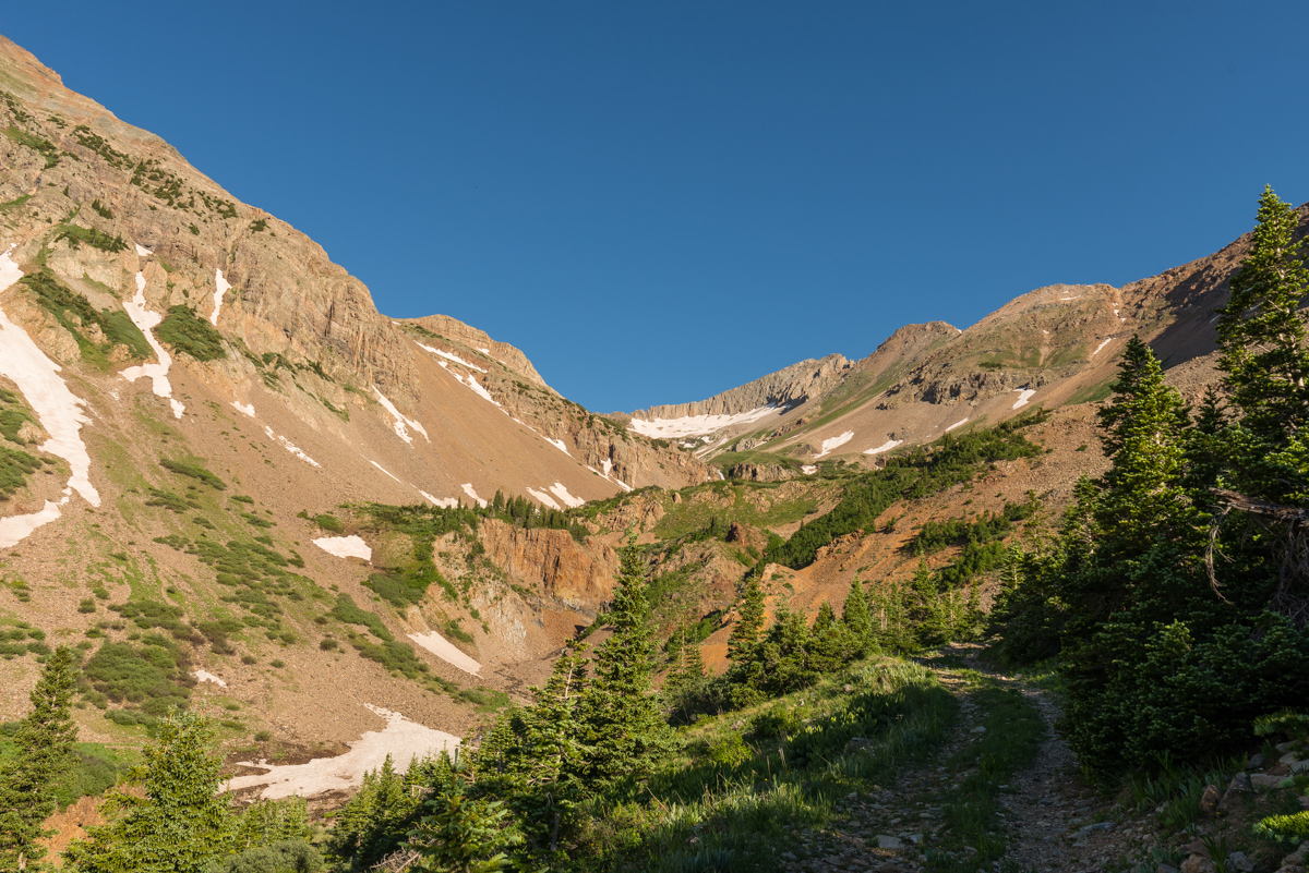
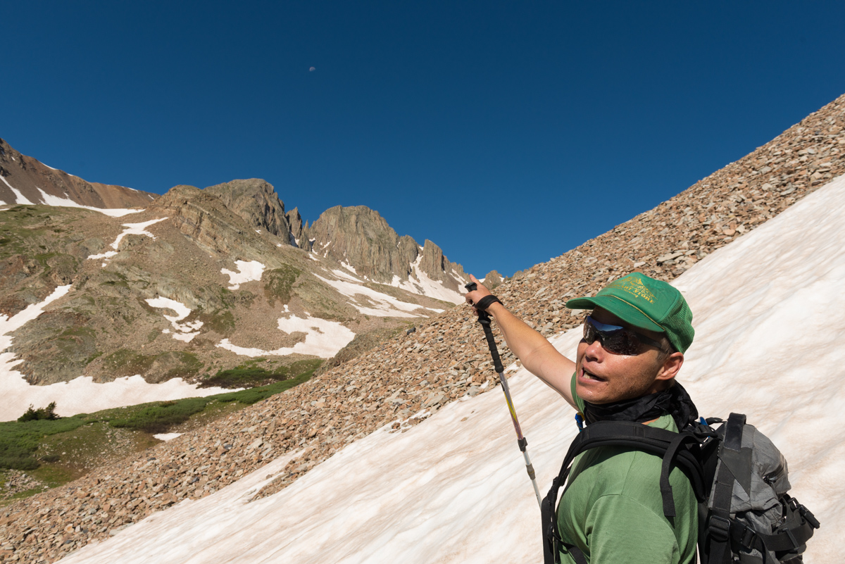
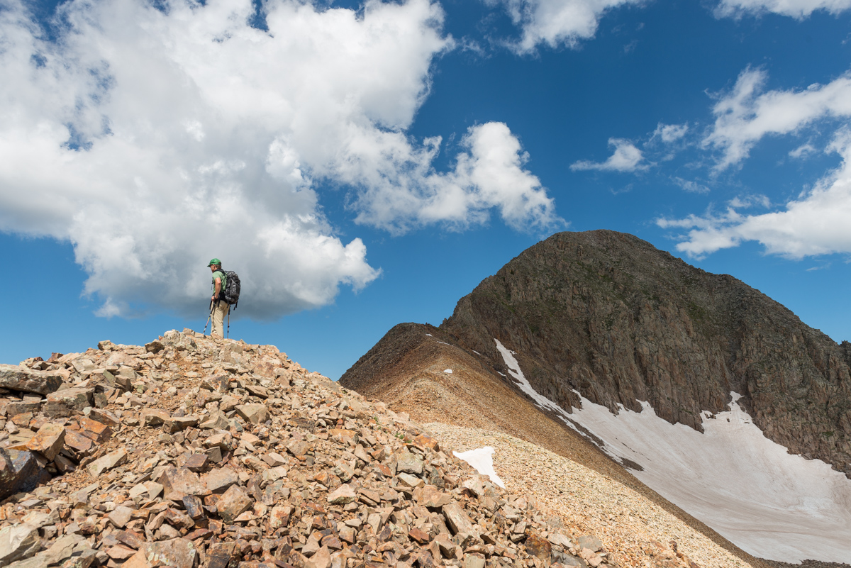
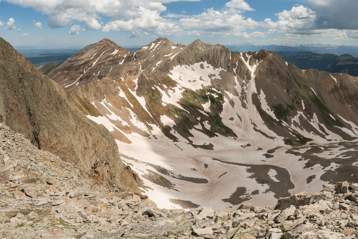
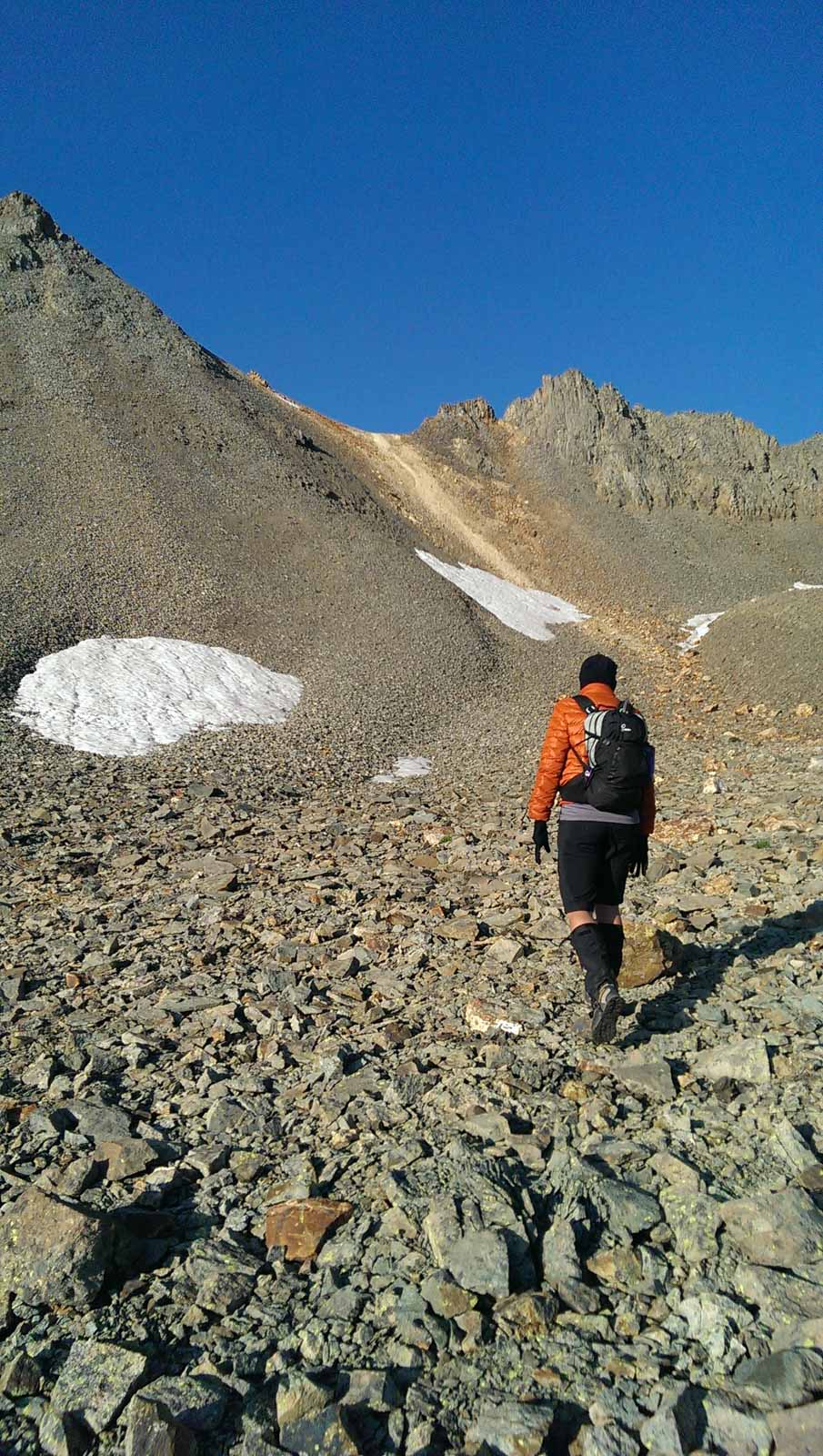
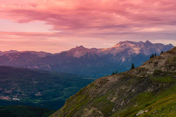
The sight of Thunder Pyramid above us was certainly sobering. Clouds were already forming to the north and we felt like the hardest parts were still yet to come. We knew the next step was to identify a steep gully of talus and follow it more or less to the base of the famous white gully. We decided on the gully to the left of the really large one filled with junky talus.
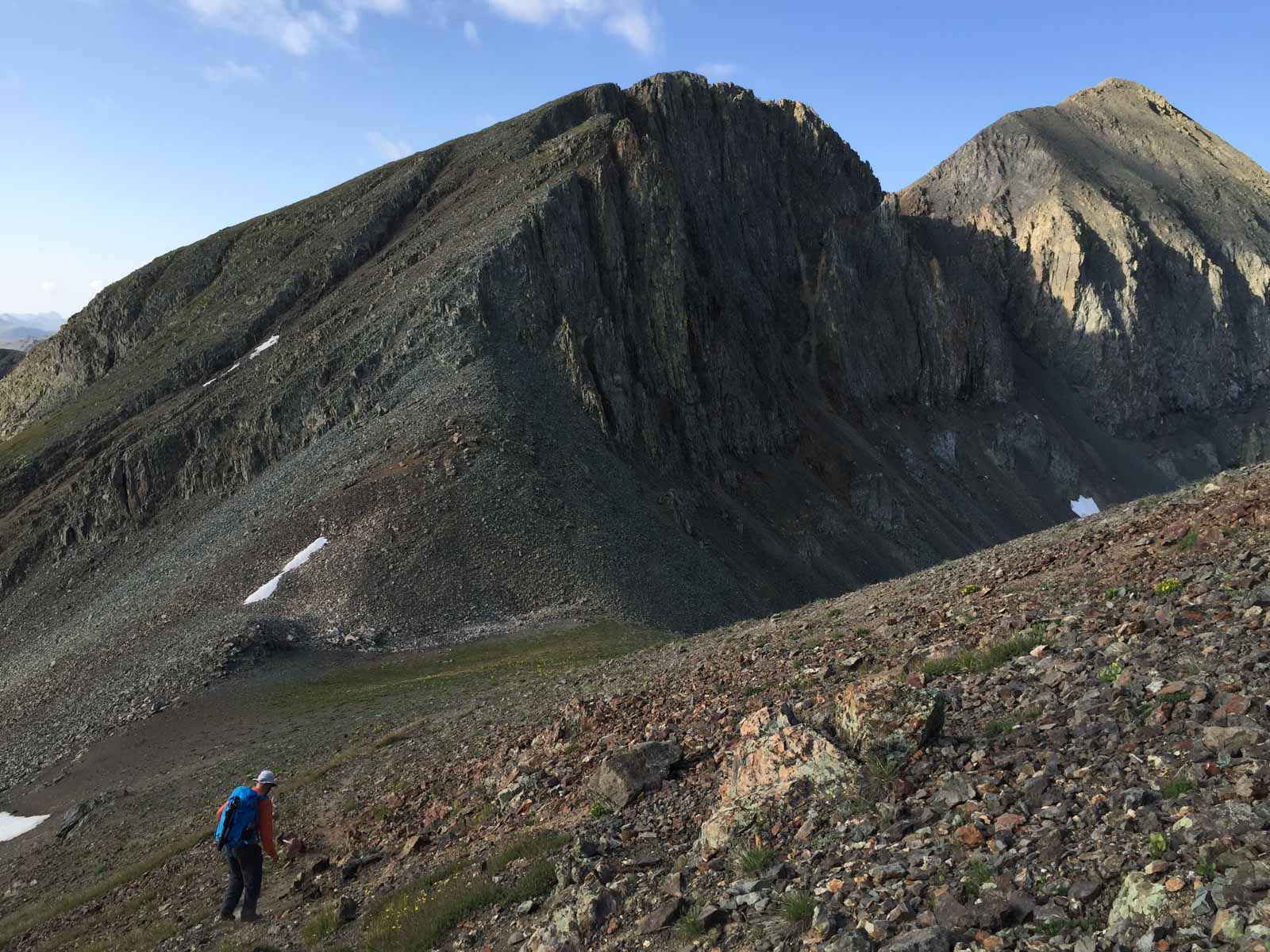
The talus was not too terrible or awful, but it was certainly made of the same garbage Elk Mountains stuff we had grown distateful of on Maroon and Pyramid in previous climbs. I personally found it quite inviting compared to my experience on Cathedral Peak!
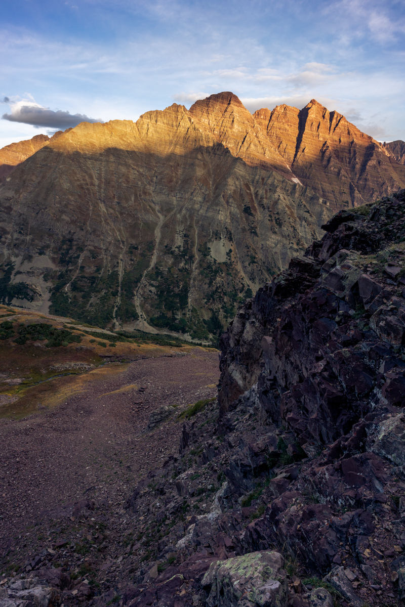
As we ascended the gully, the light over on Buckskin Benchmark to the northwest was looking quite fine!
And naturally my gaze was constantly drawn by the Maroon Bells. What a magnificent pair of peaks to be able to stare at throughout the day.
Silas was armed with cell phone and Spot GPS, and I was armed with my Sony A7R2 and my cell phone equipped with Gaia GPS. Technology has really come a long way in a short amount of time since I started documenting these climbs!
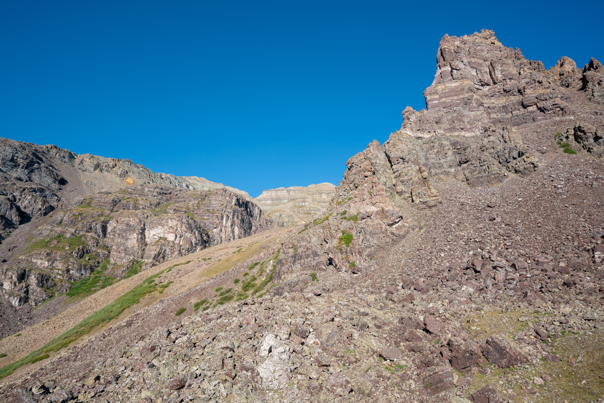
As we climbed up into the gully, the views above Len Shoemaker Ridge were getting really nice. I don't love climbing on the rocks in the Elks, but damn they make for great scenery!
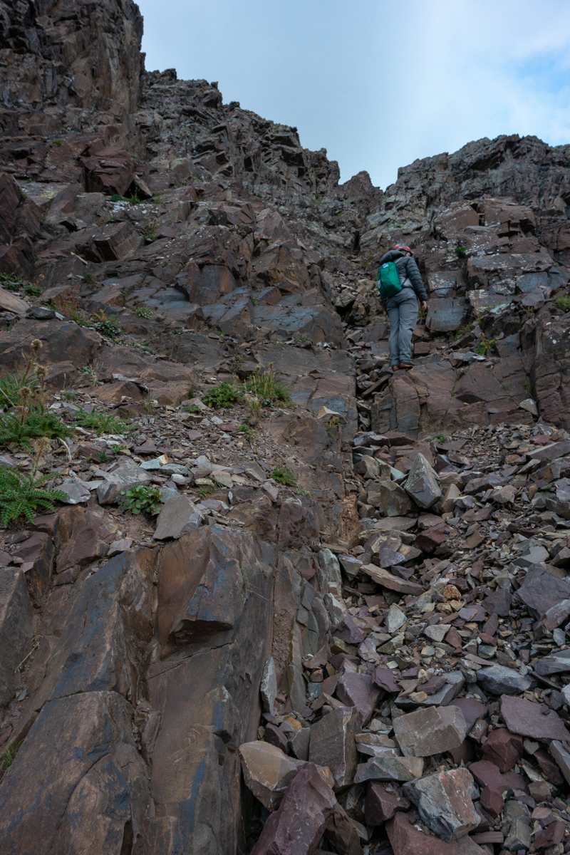
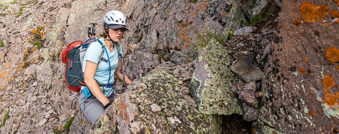
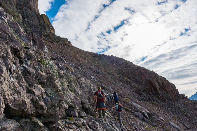
Below you can see another good view of the gully we chose to climb up, which I felt was very solid class 3 climbing all the way up until we turned off to the left.
More views of the class three climbing...
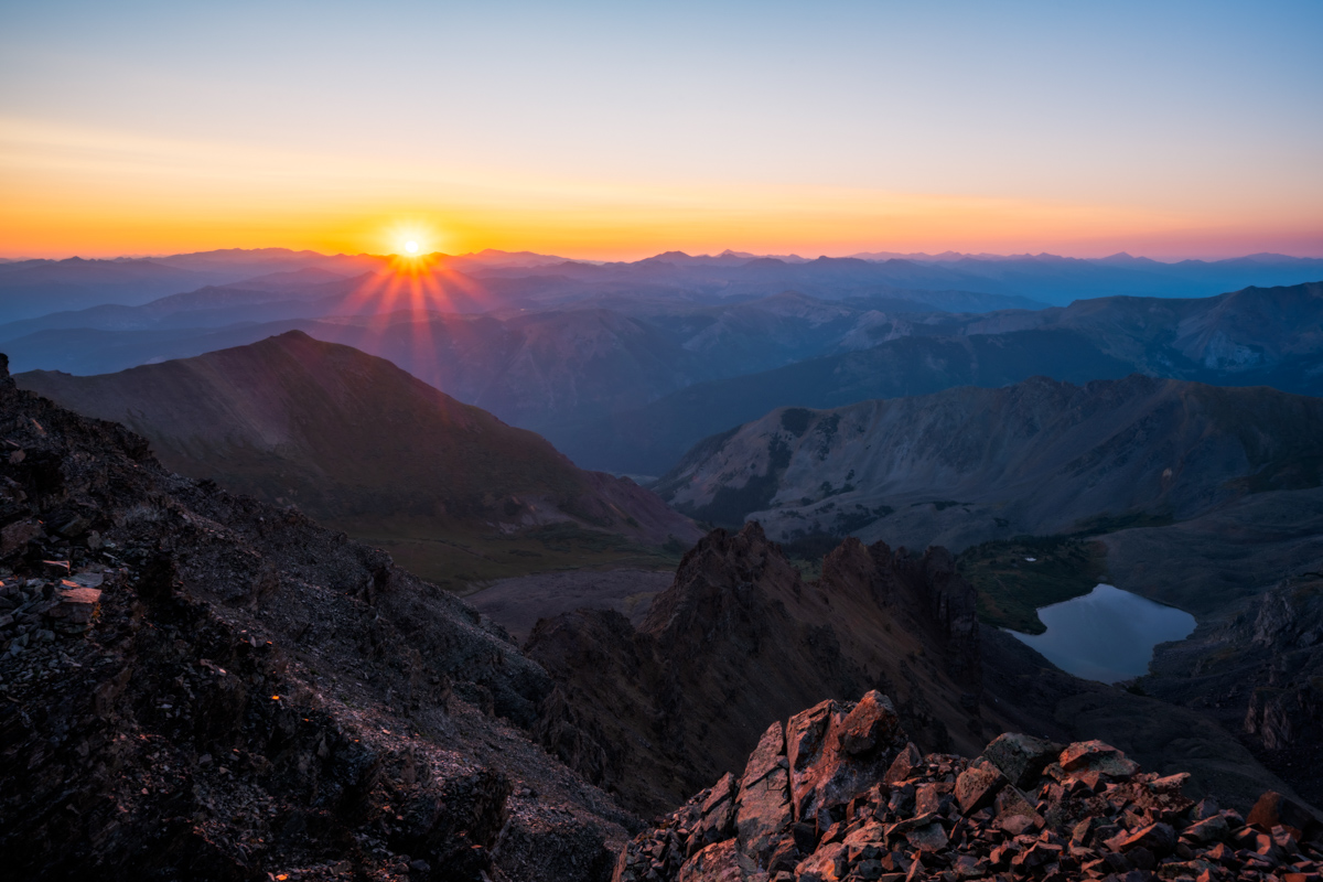
And finally the sun hits the Bells and makes me a happy dude.
I took advantage of the great views of the Bells to showcase the terrain down below us in the gully. I think this photo does a good job of showing you the complexity of the rock in this section.
I also found myself quite enamored by Bellview Mountain, which is seen left (south) of the Bells in the photo below. I really would like to climb that one someday. I bet its an incredible vantage of the Bells; aptly named indeed.
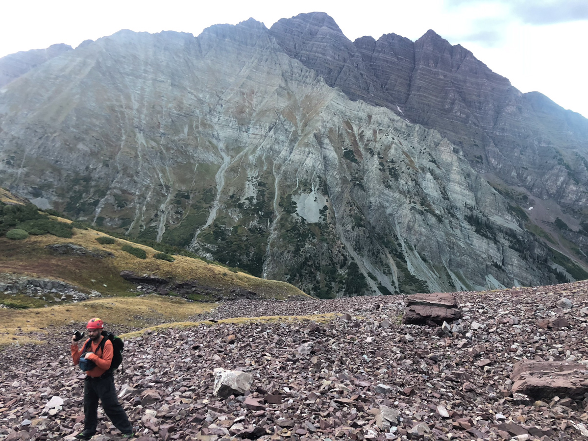
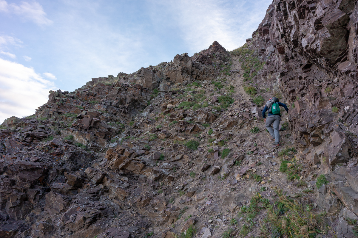
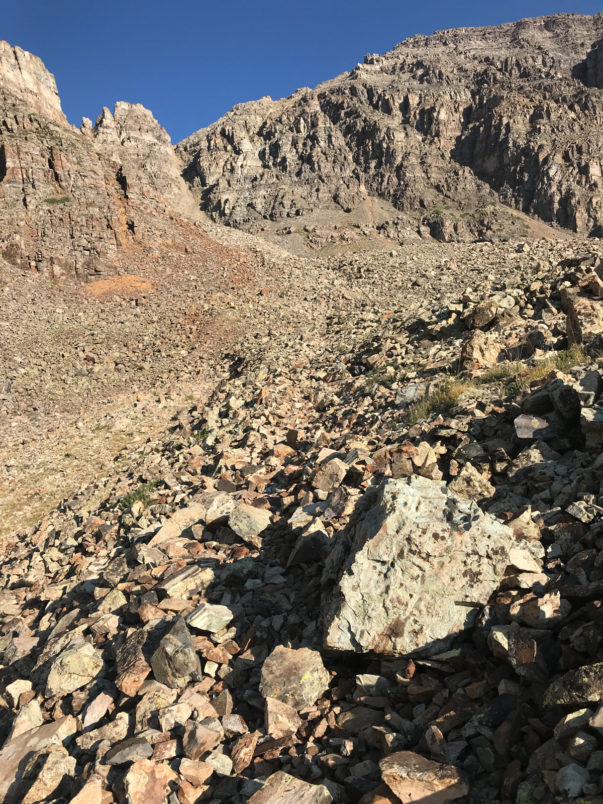
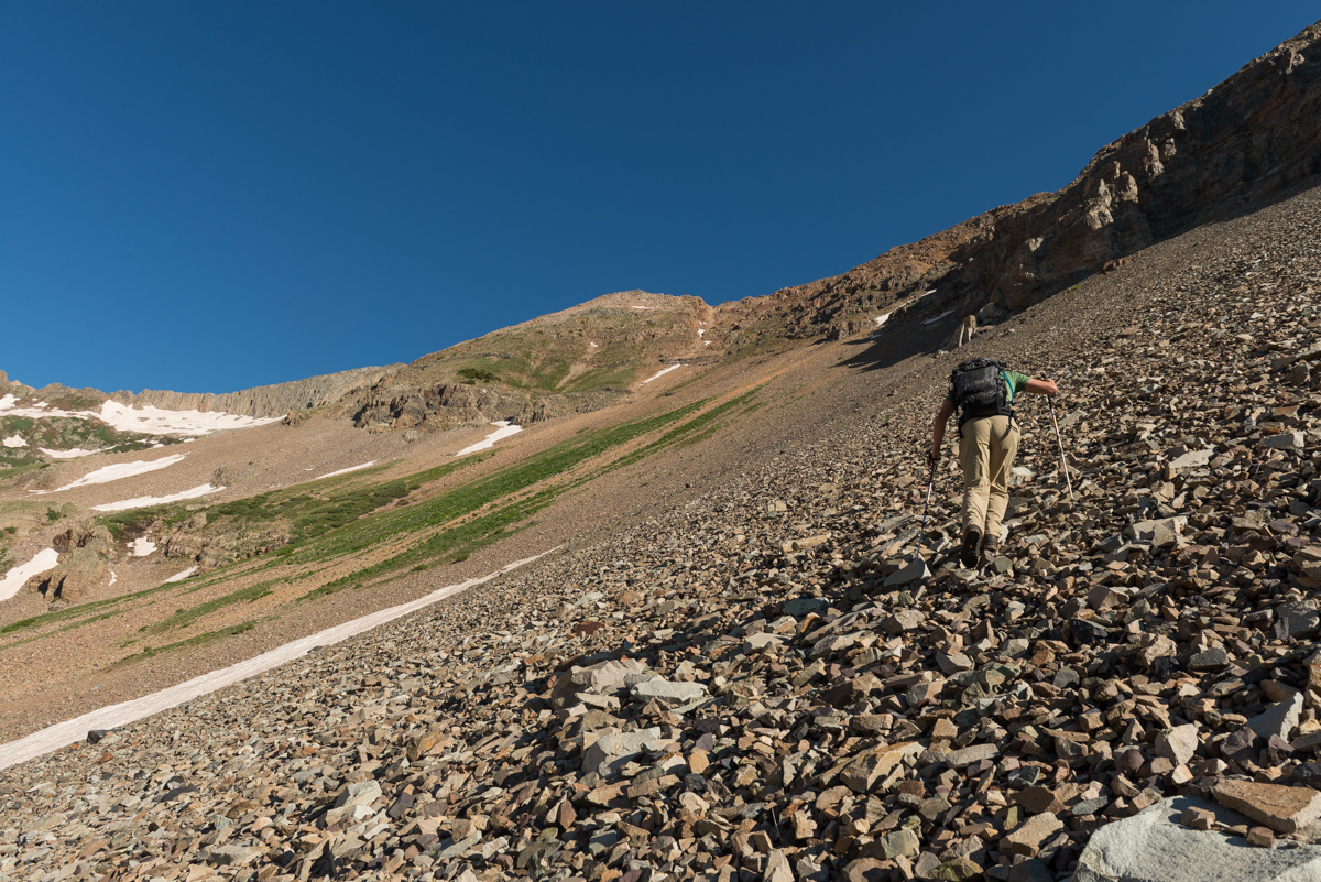
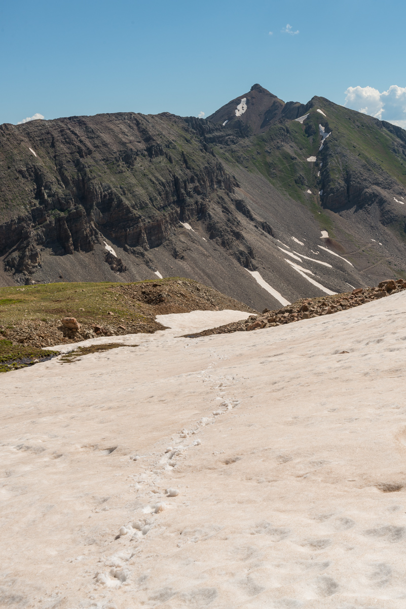
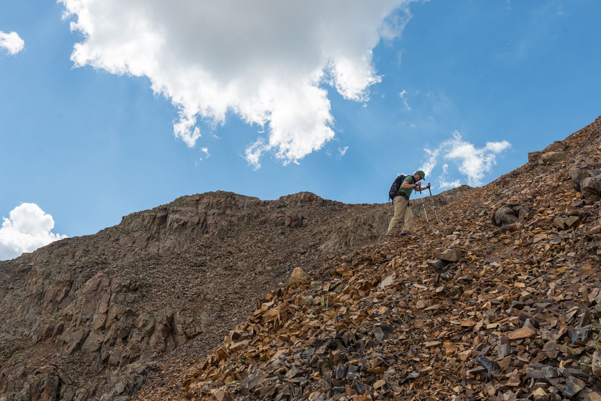
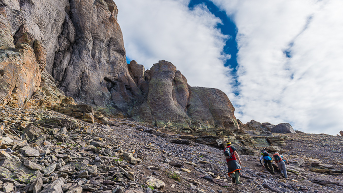
Once we reached the top of this gully, we saw a noticable trail heading left up a very steep dirt and rock slope below the next cliff band. We decided to take it. I knew it would probably lead to the base of the white gully. The trail is what I describe as a "climber's trail," aka - not very solid, very loose, and very steep!
After reaching the top of this section, our view of the Bells really opened up and I could not have been more happy with it.
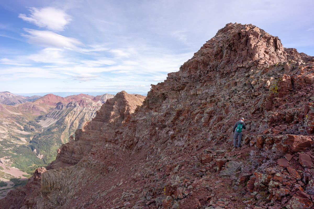
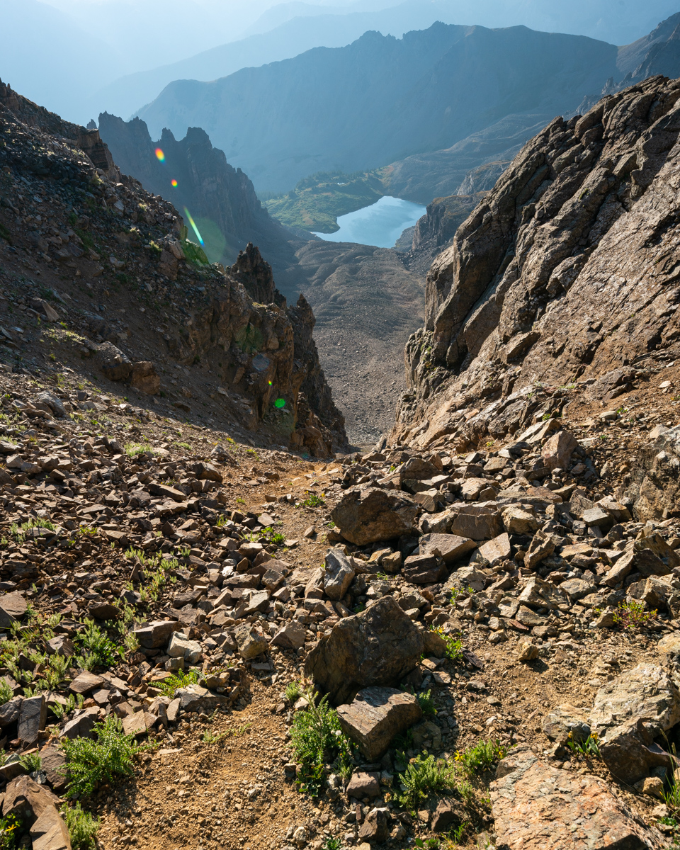
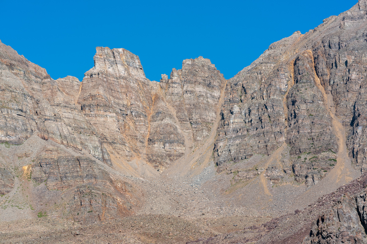
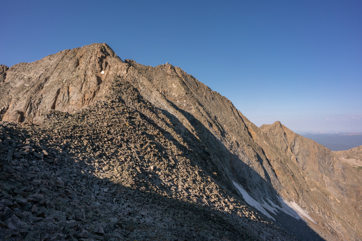
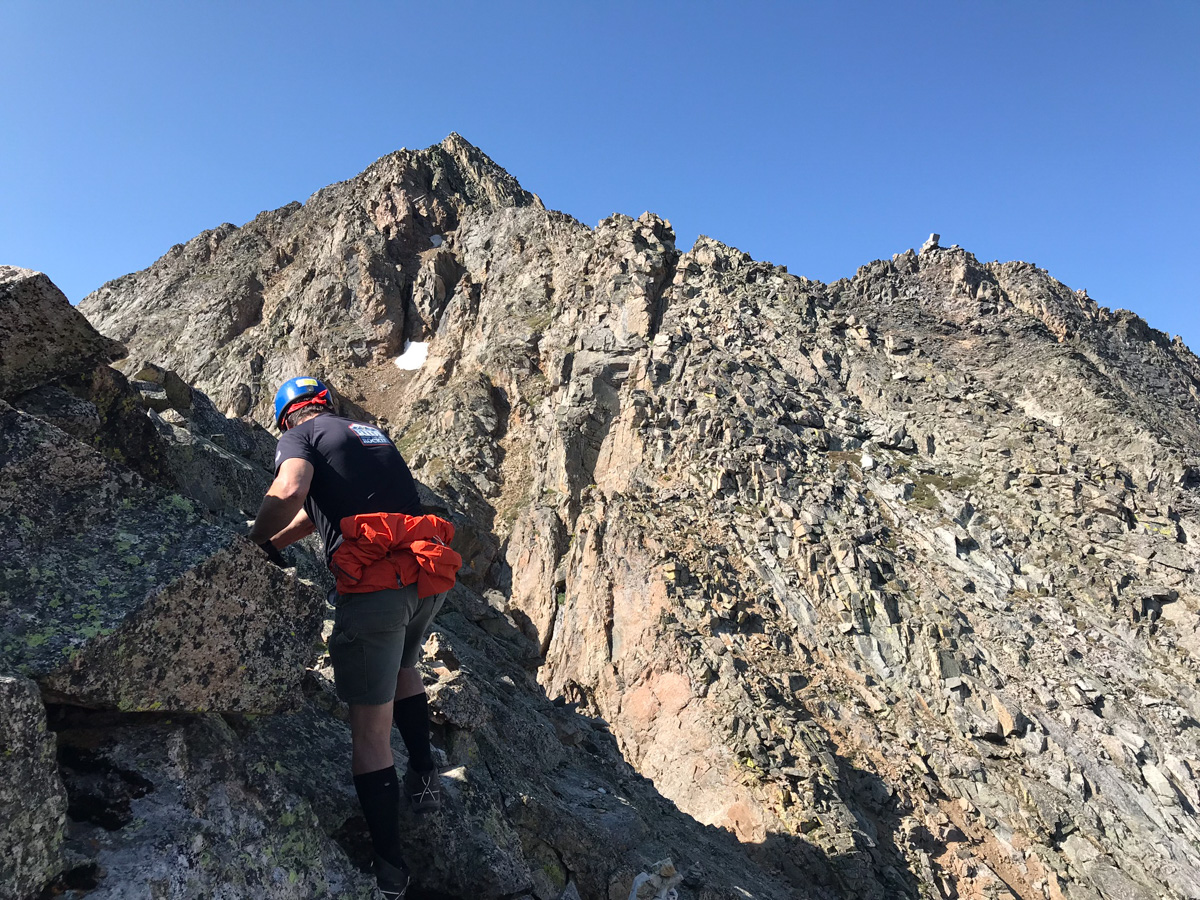
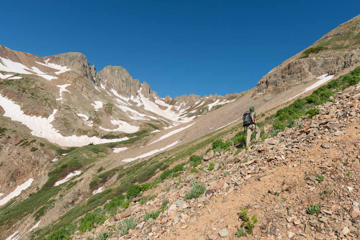
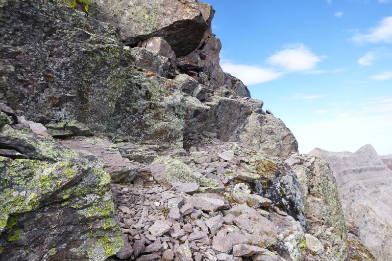
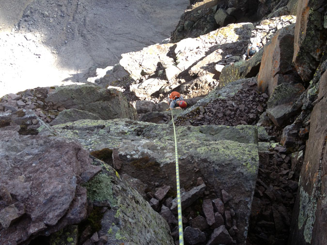
Indeed, the famous white gully came into full view and revealed our future. I was excited to reach this section finally. There was a decent trail all the way up to the base of the gully from here.
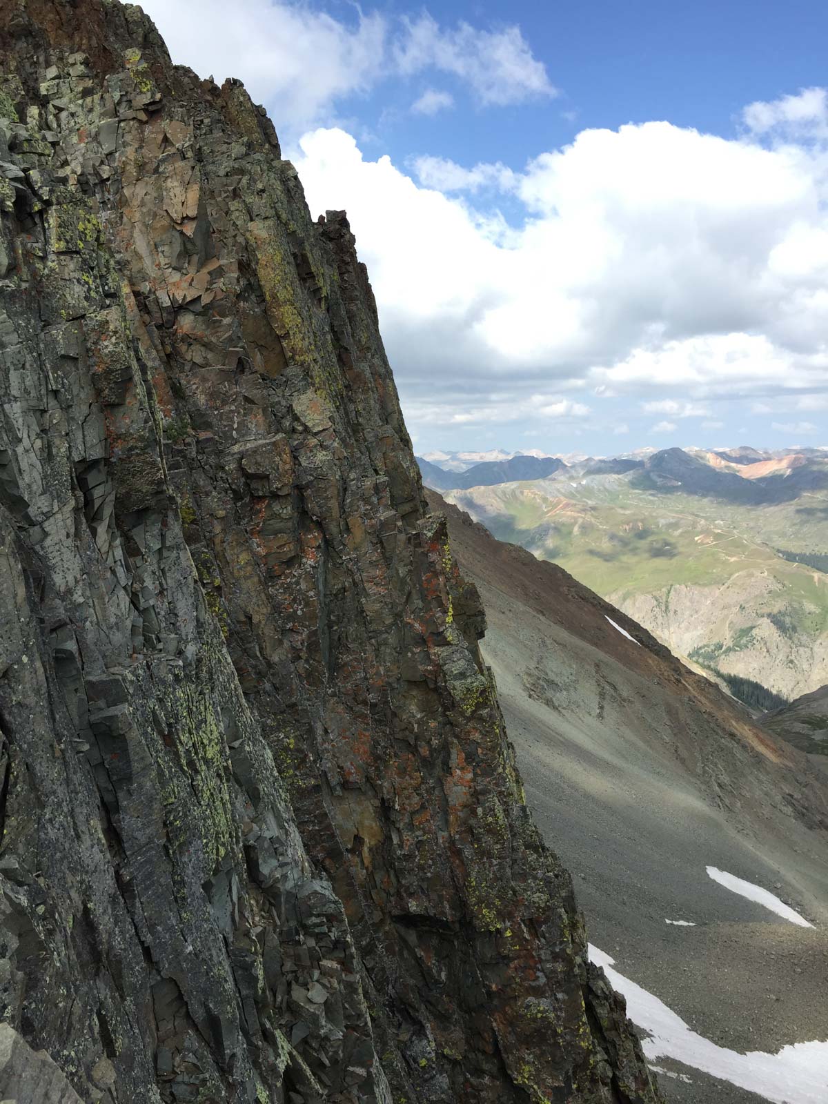
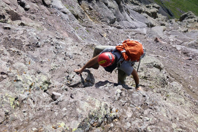
As predicted, the white gully was much less daunting up close than from afar. Many of climbers warned me of the loose nature of the rock in the white gully and I was prepared for anything.
It was at this point that I decided to film the rest of the journey to the top with my GoPro Hero 4. I created a 30 minute video which is in hyperlapse format with pauses at key moments. I'm not a professional video editor nor do I have the time to edit this to give it full justice, but I figure it serves as a nice beta for folks wanting to know more about the white gully, the final segment, etc. Also, its fun for me to look back on later in life.
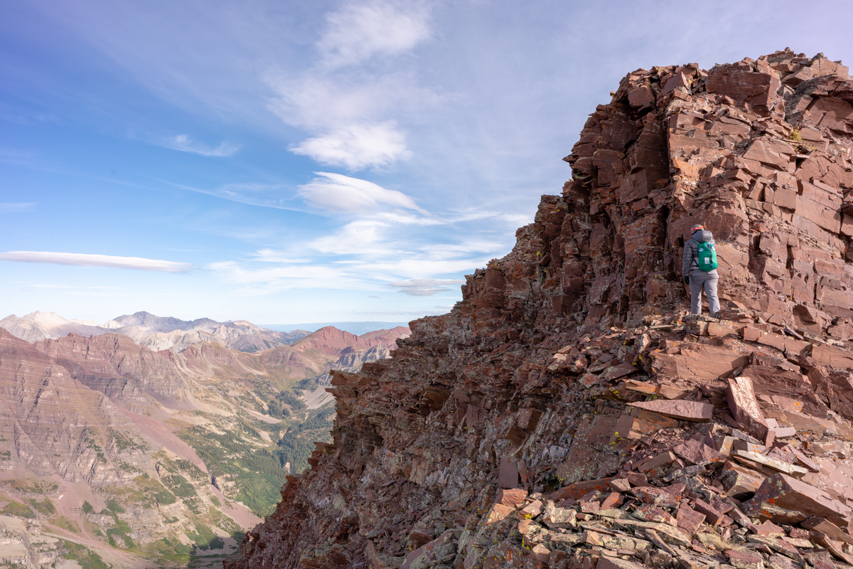
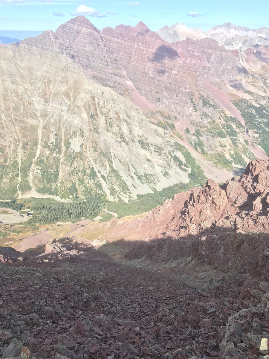
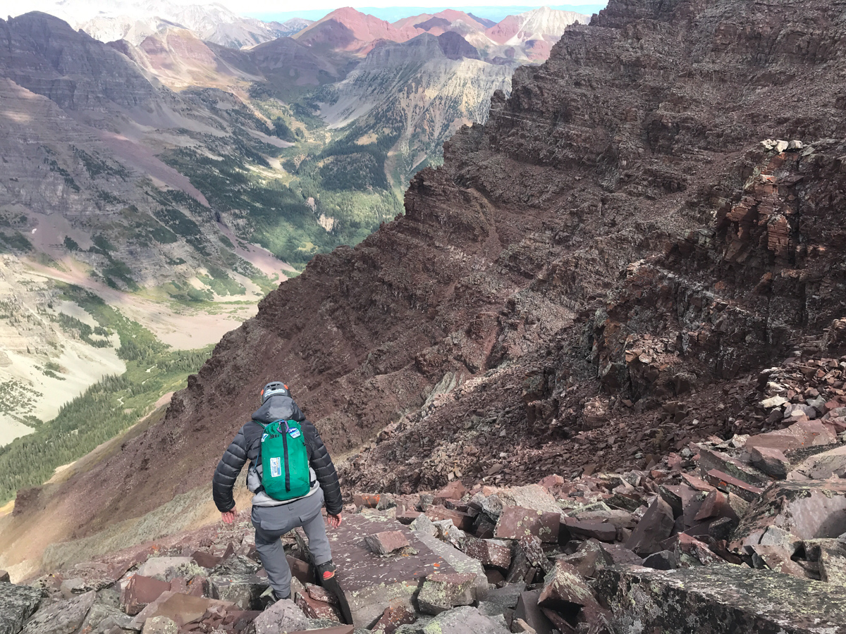
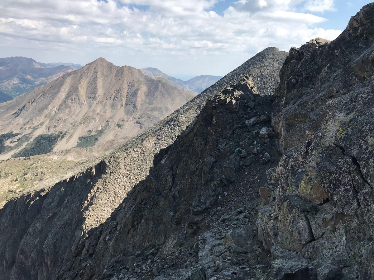
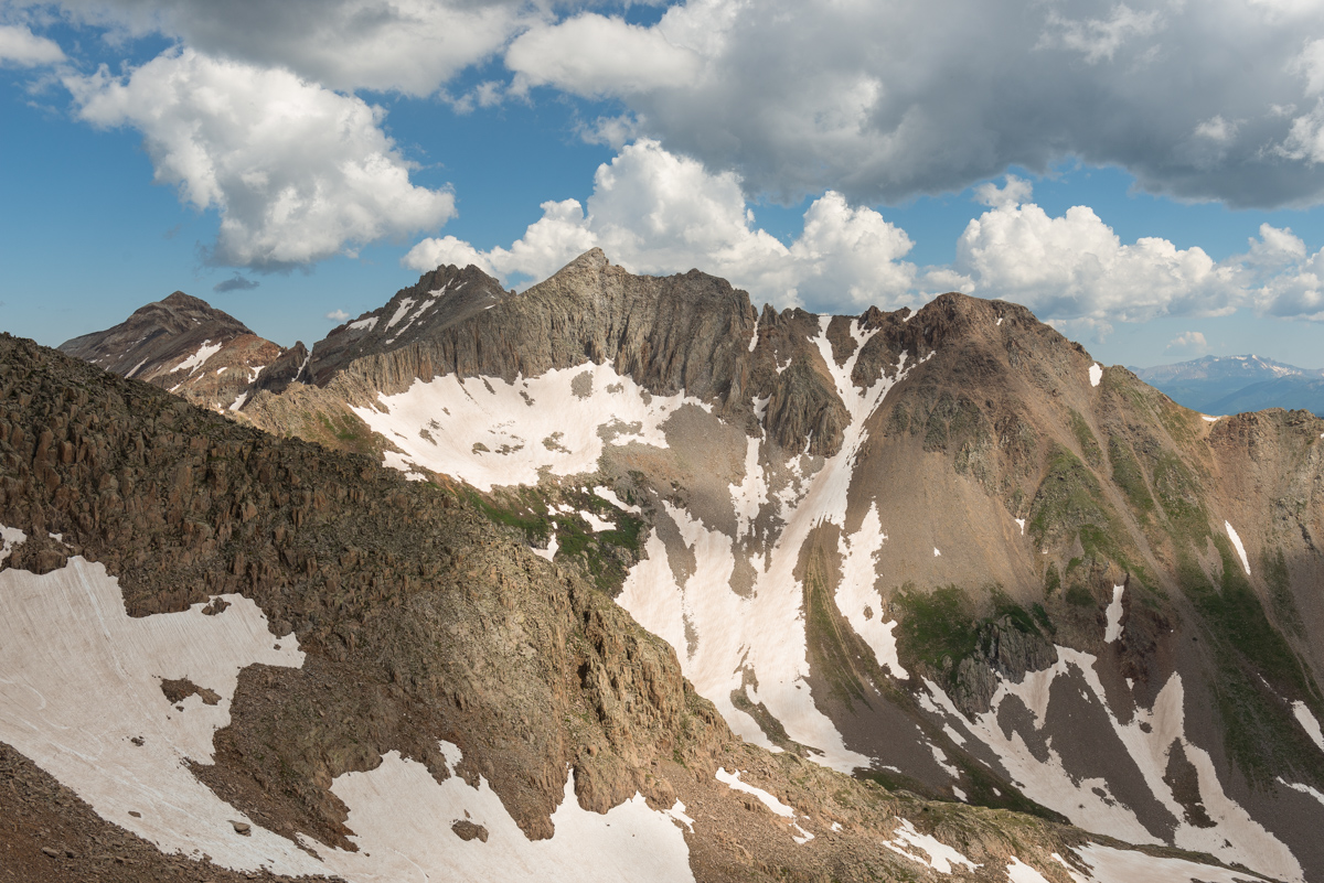
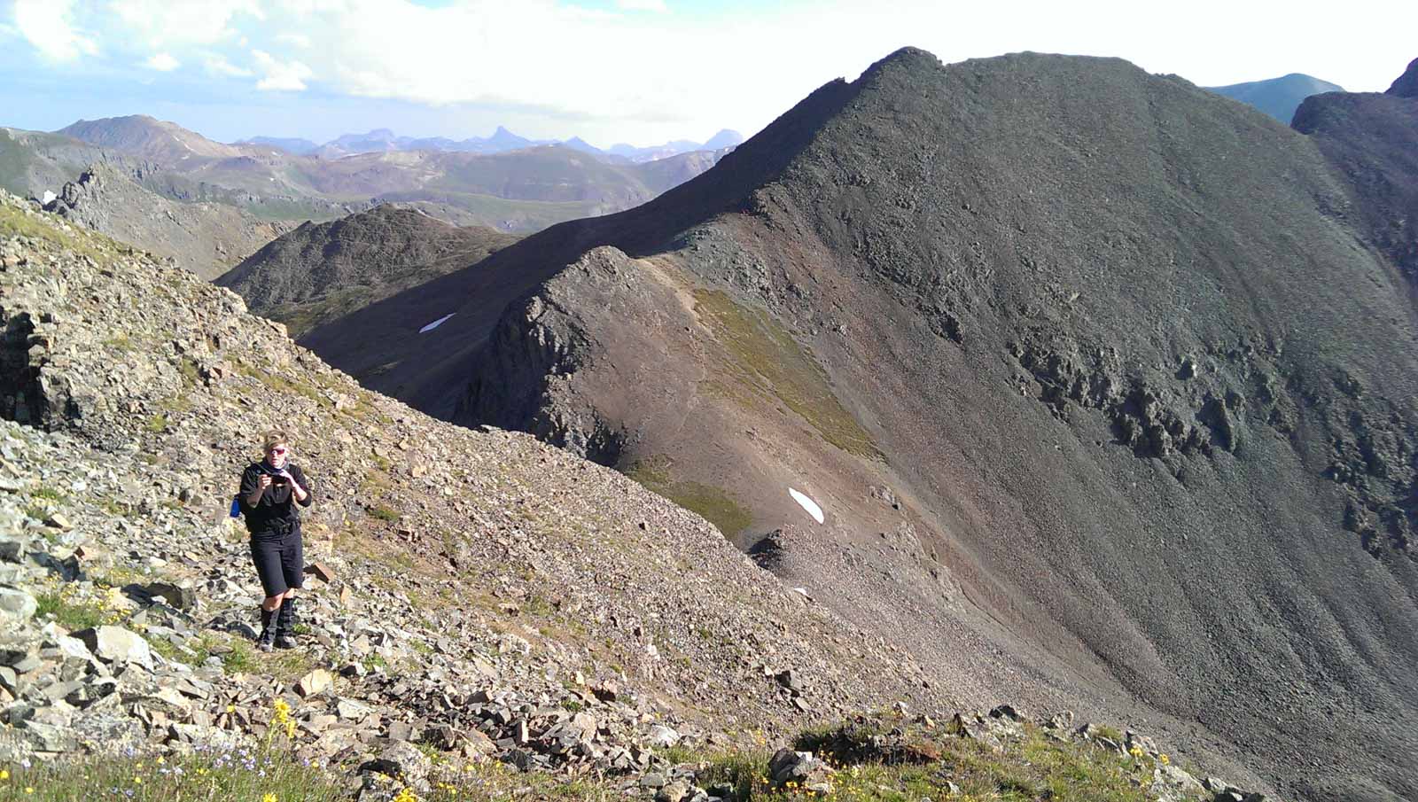
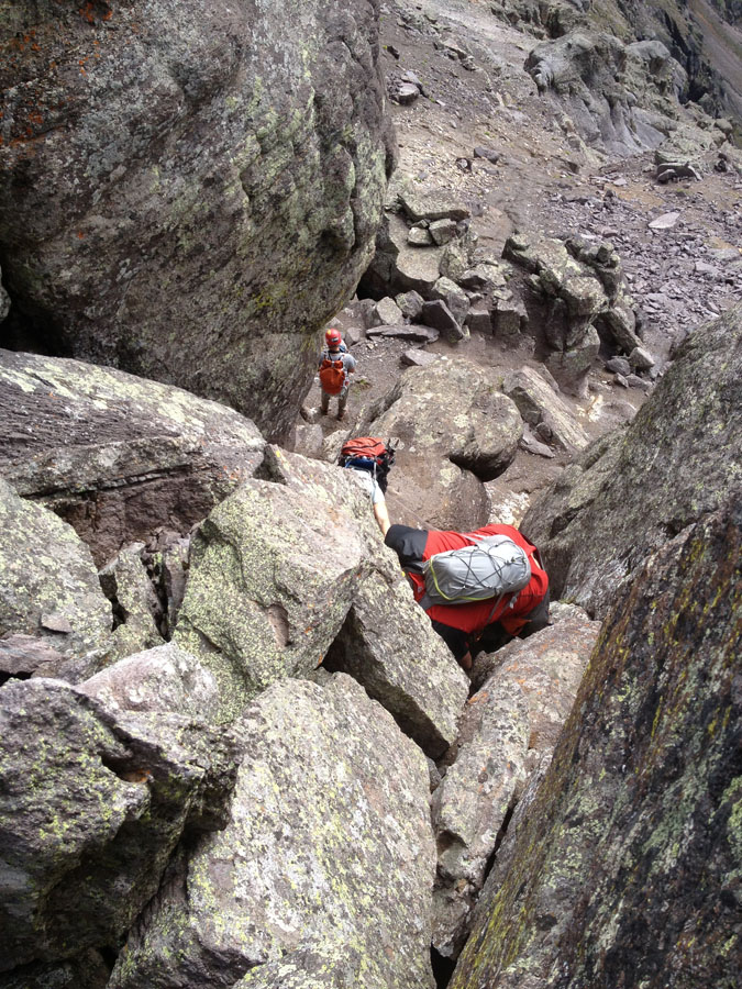
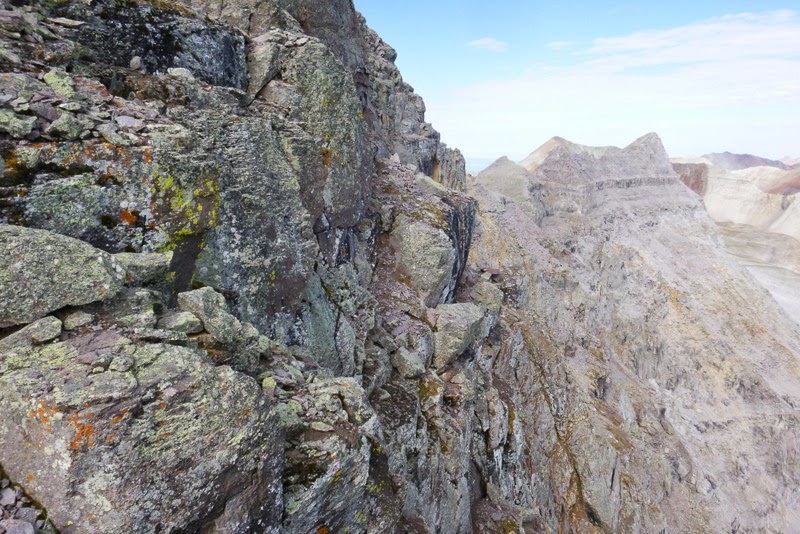
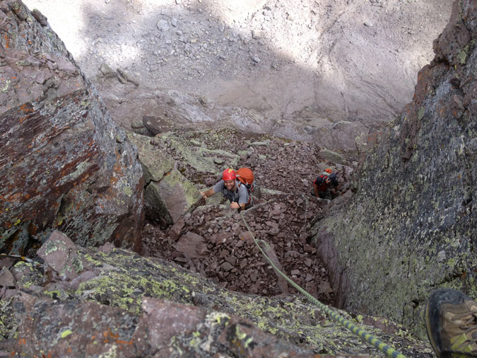
About halfway up the white gully, we began to get great views of all the 14ers in the area. The below shot really intrigued me. It includes Maroon, North Maroon, Snowmass, and Capitol all in one frame. Nice! By the way, I did not find the white gully to be loose at all! We chose to stay high on the left side in the white stuff and it was very solid. Once exiting the gully to the right, things get much dicier.
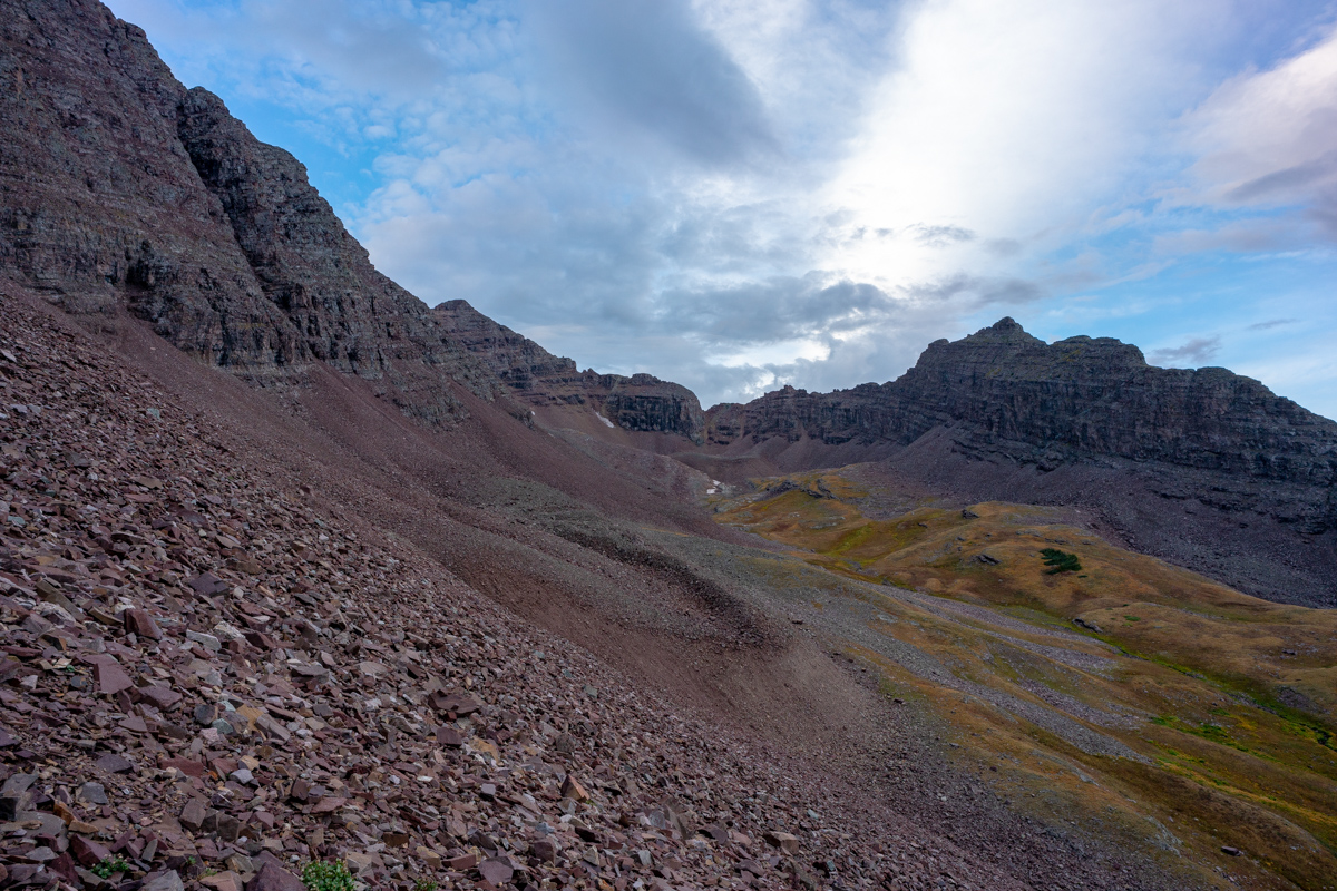
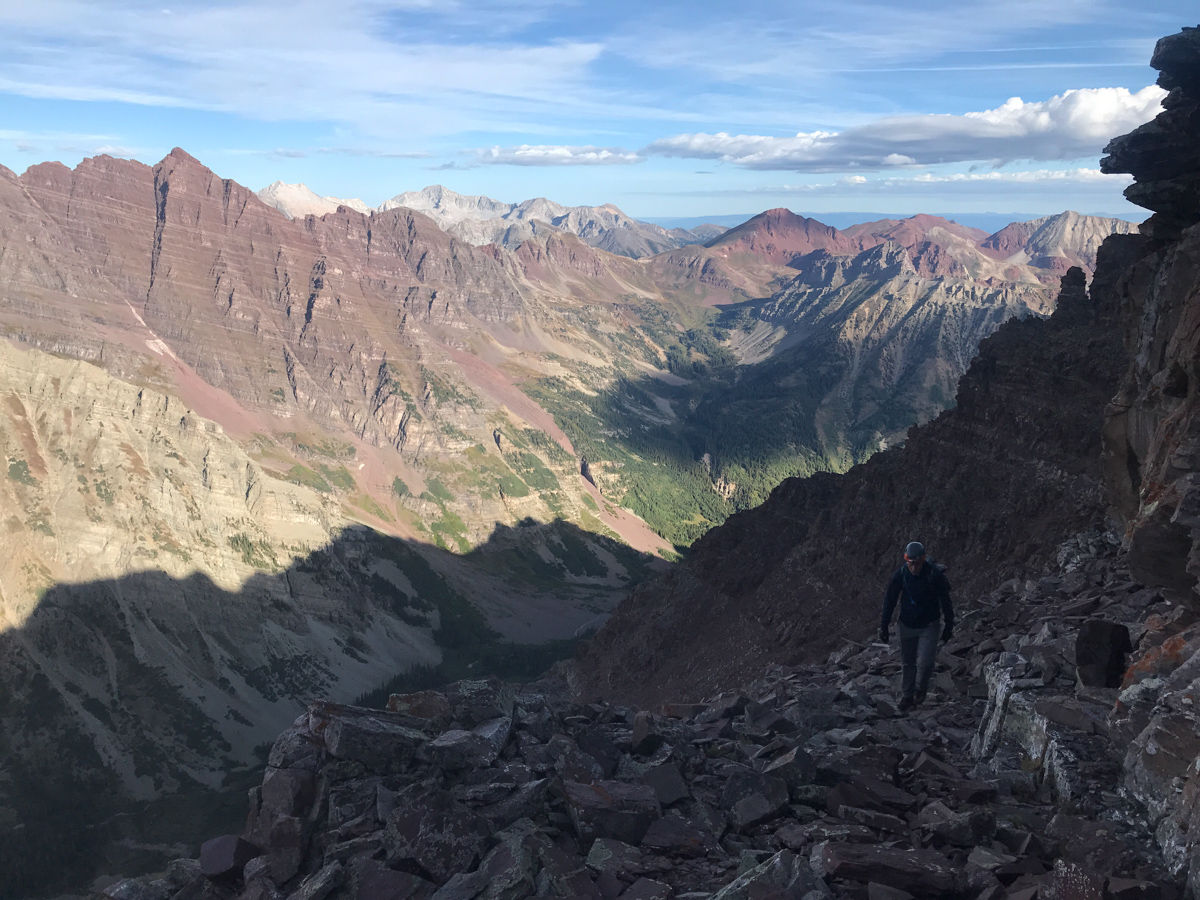
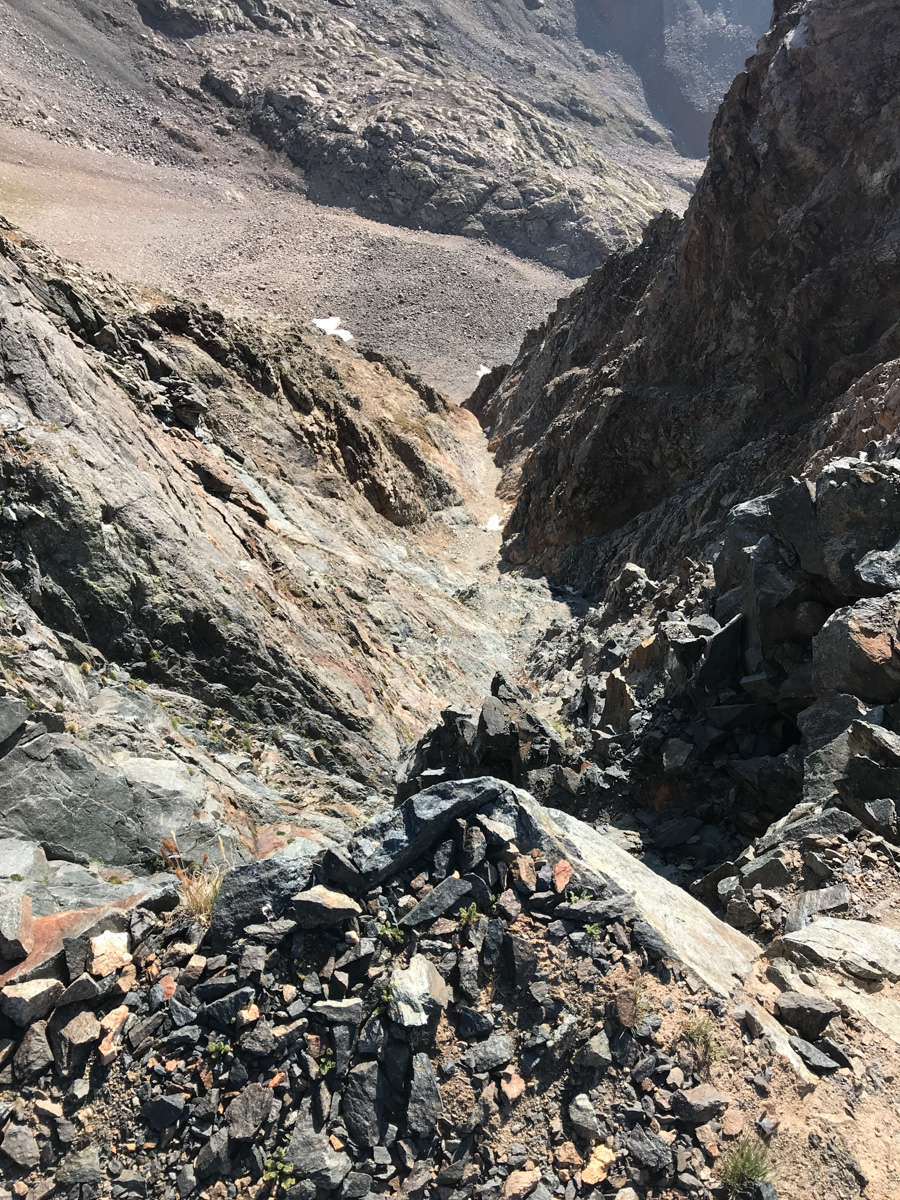
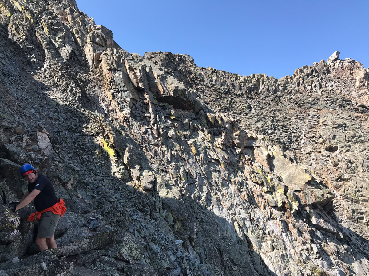
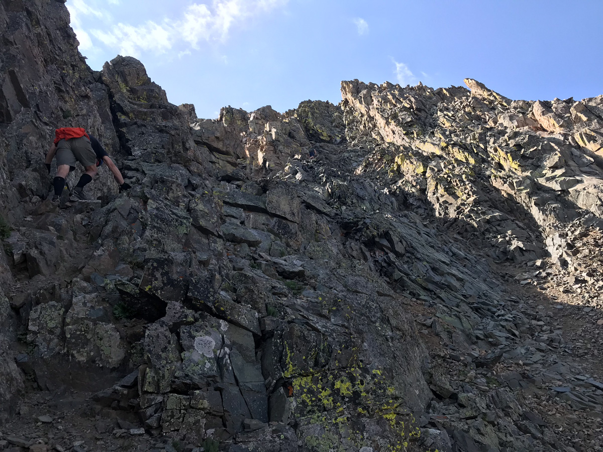
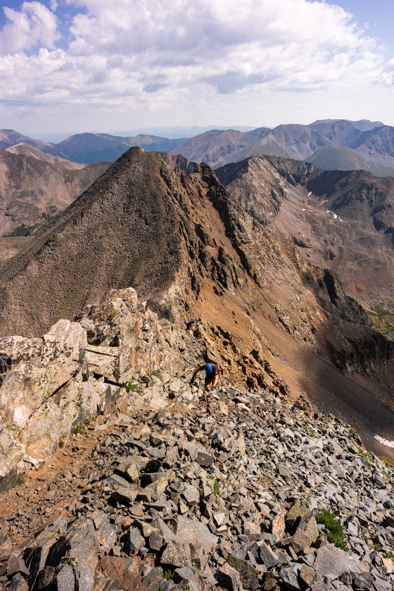
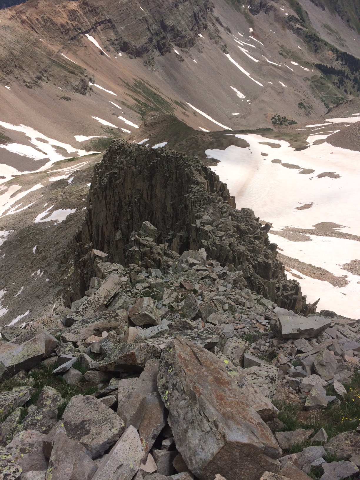
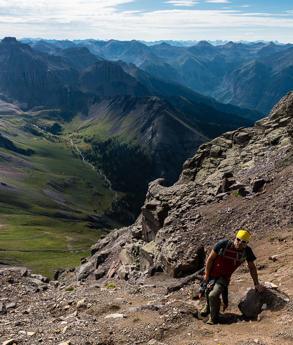
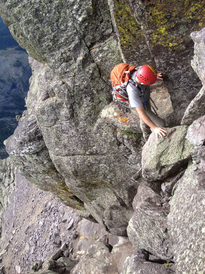
We exited at 13,400 ft. just as Roach suggests. There's a pretty obvious spot to exit below some cliff bands. We had to pick our way through some very nasty rock and maybe strayed a bit too far right into the next gully when we should have stayed high on the "ridge" here, but nothing was obvious at this point. We just went a couple feet at a time, making sure to stay close to each other and stay very mindful about potential rockfall above and below. It is more a mental exercise than a physical one from this point forward.
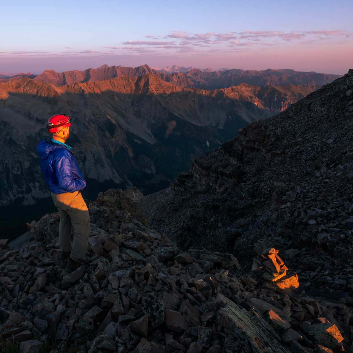
Just below the saddle between Thunder Pyramid and Lightning Pyramid, we found it best to cut under more cliff bands and stay high on lighter colored rock as pictured above.
Once we reached the saddle, it was very clear where to go next and we were feeling very excited to be so close to the top!
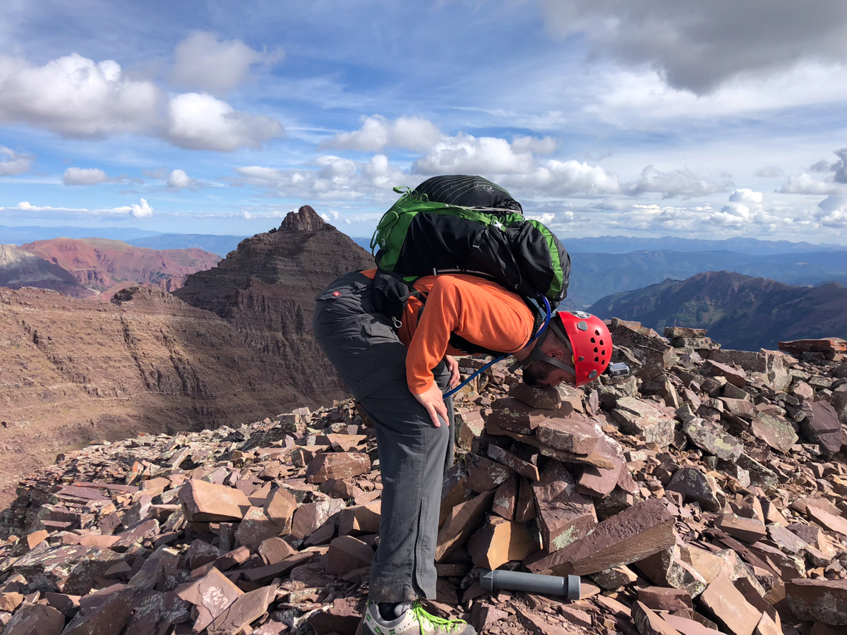
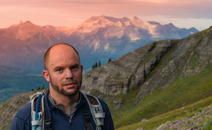
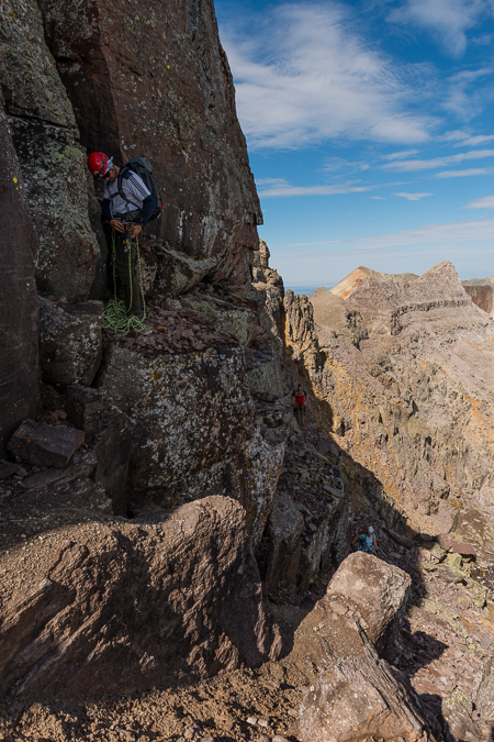
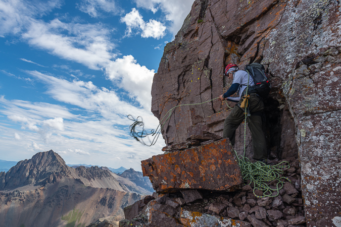
I let Silas go first as I wanted him to film me ascending the final section.
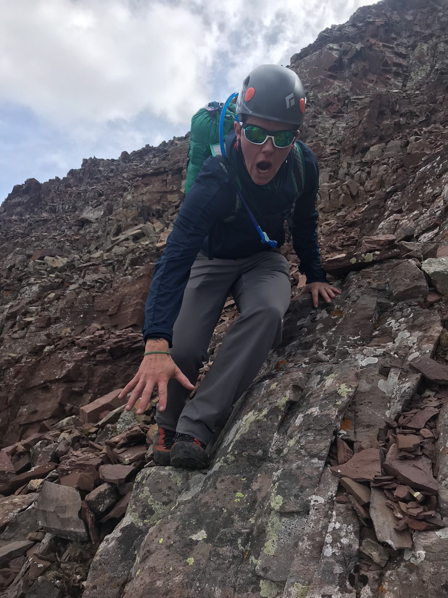
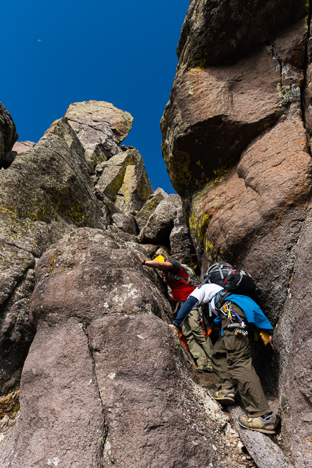
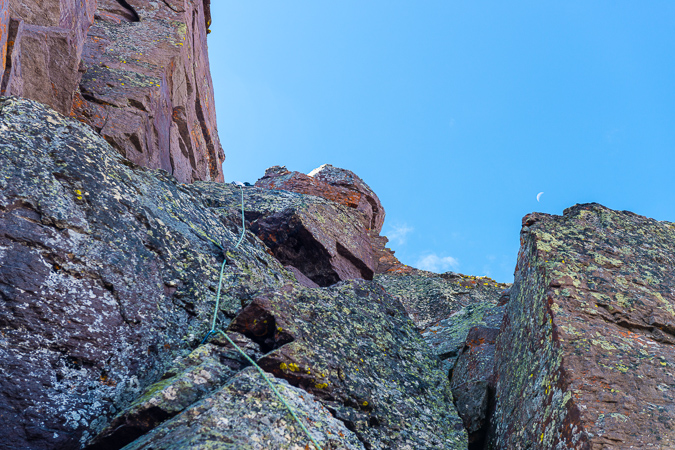
They very last section, which you can see on the earlier YouTube video, was pretty simple to find the solution too, but it did require some easy class 3 chimney climbing. A real joy, to be honest. We just had to be ultra careful about the loose rock above the chimney, as it was ubiquitous and precarious. Below is Silas' film of me arriving at the summit. What a crazy feeling it was.
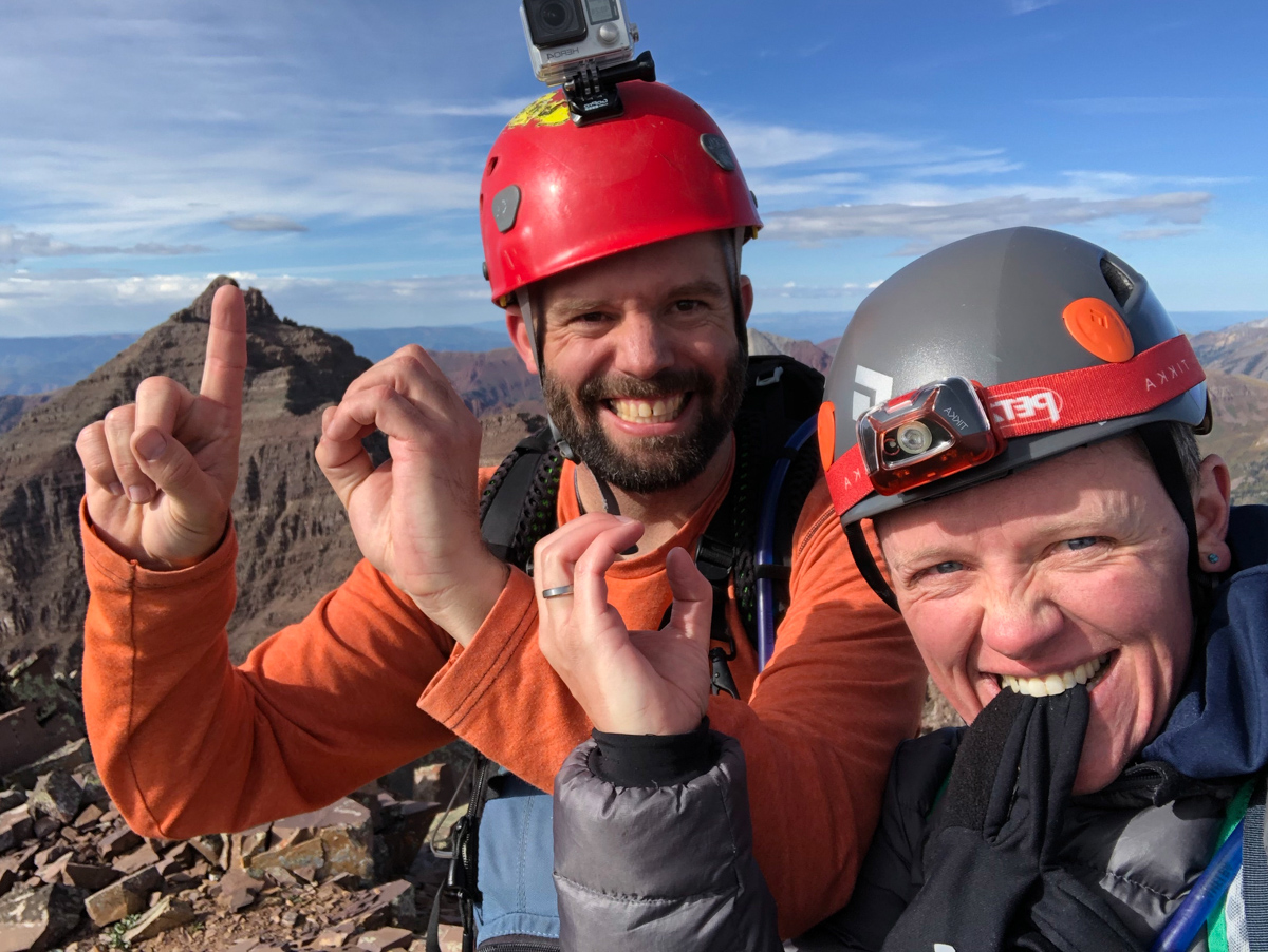
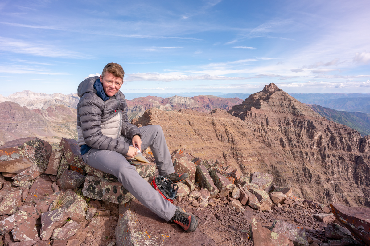
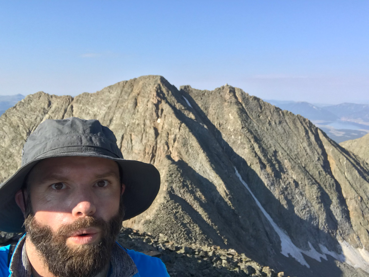
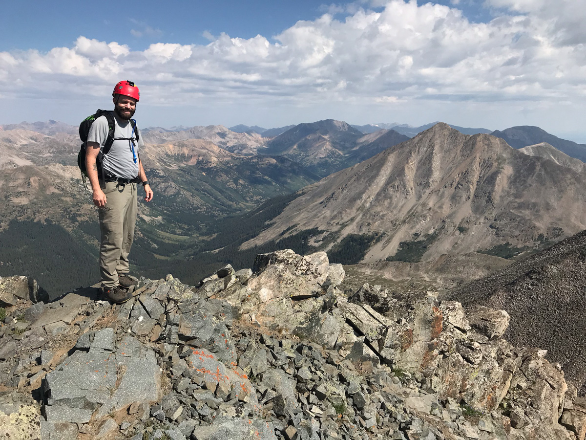
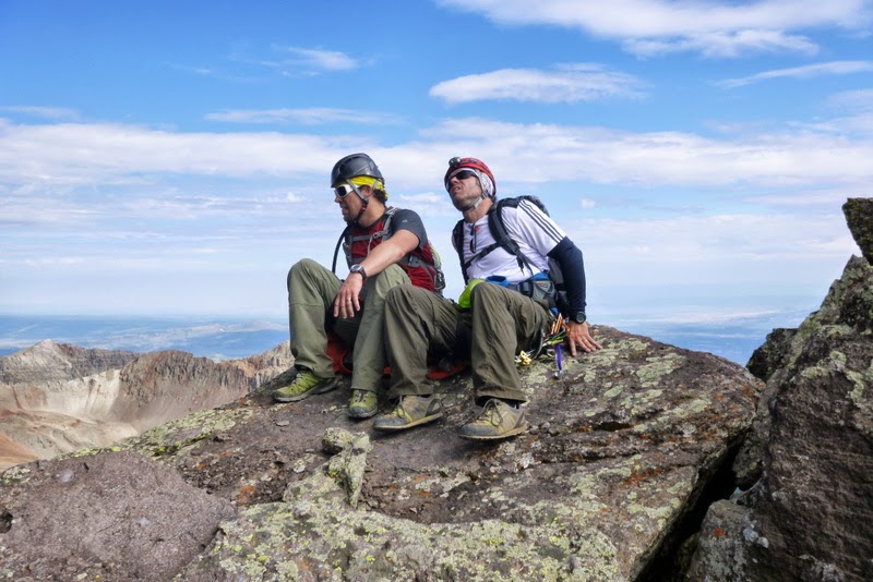
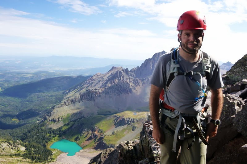
Nerd move! Number 100!
Upon arrival, the first order of business was for Silas to surprise me with a letter written by my mom and dad for Silas to read upon us reaching the summit. It was so incredibly heart-felt and I teared up big time. The video of me reading it is below. Thanks mom and dad!
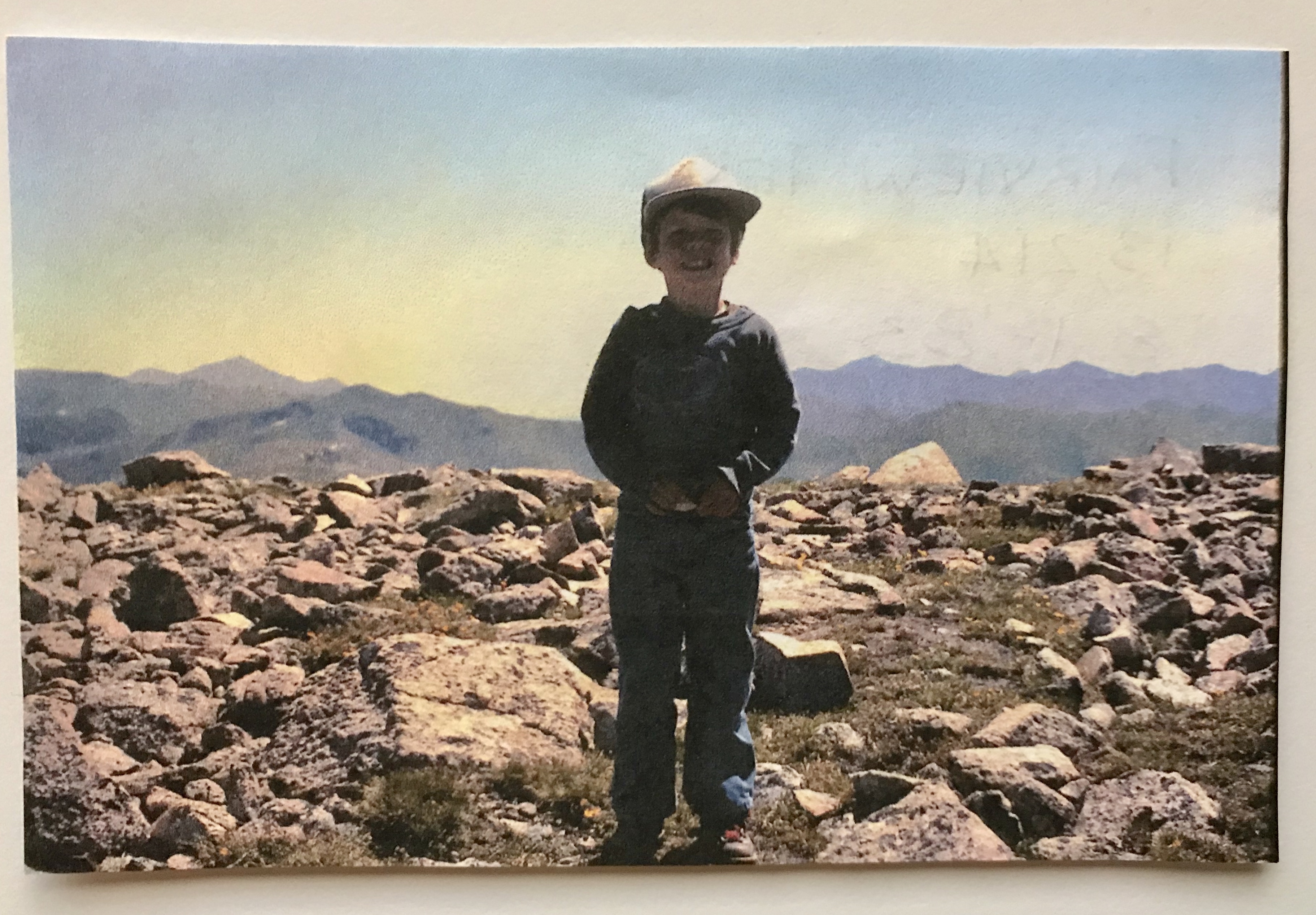
And of course, here's the photo they sent with it - me standing on my first 13er - Fairview Peak at age 4. Good stuff!
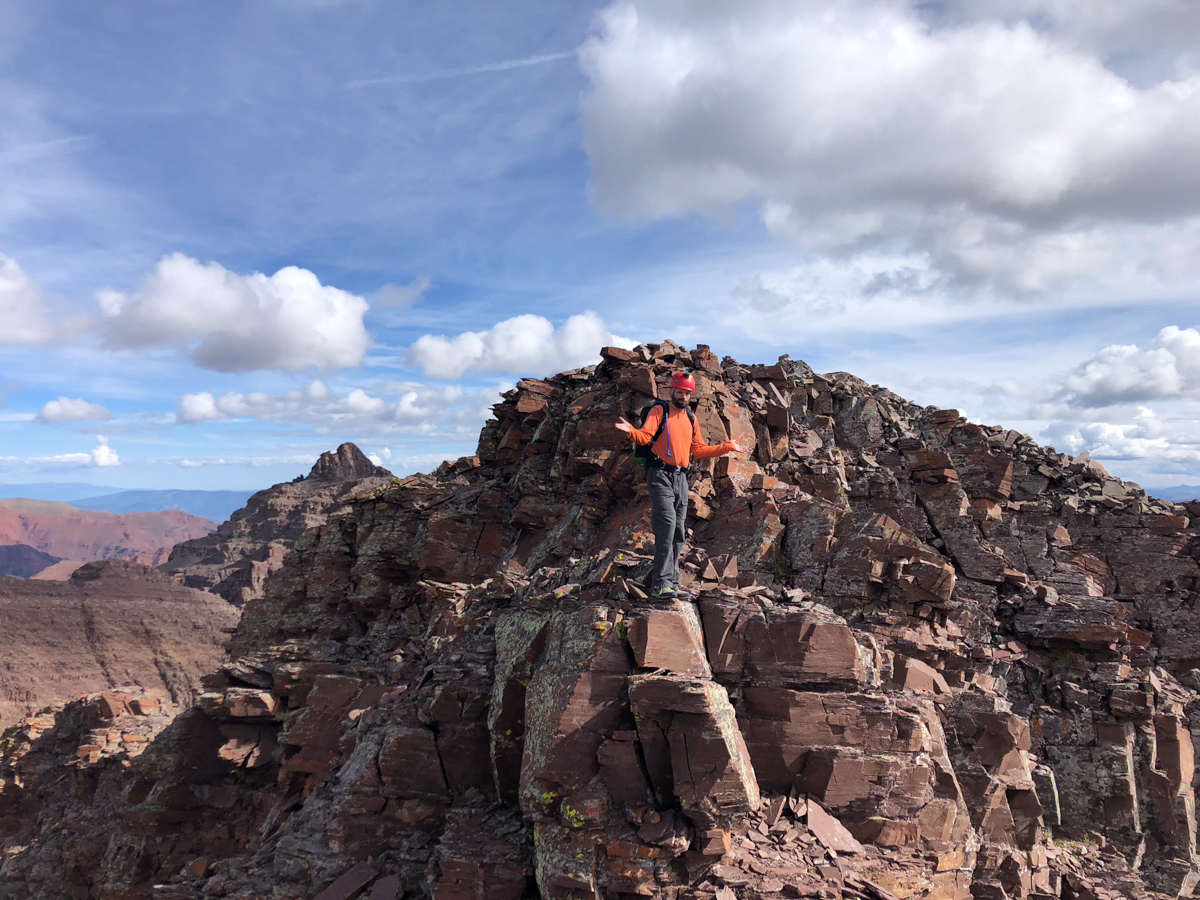
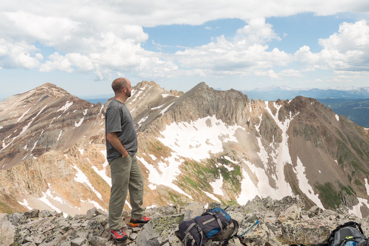
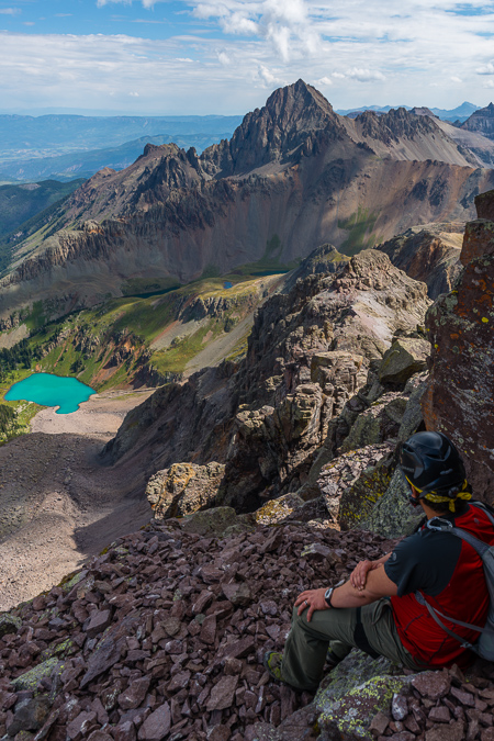
It was so great celebrating this one on top with Silas, who I think was more elated than me!
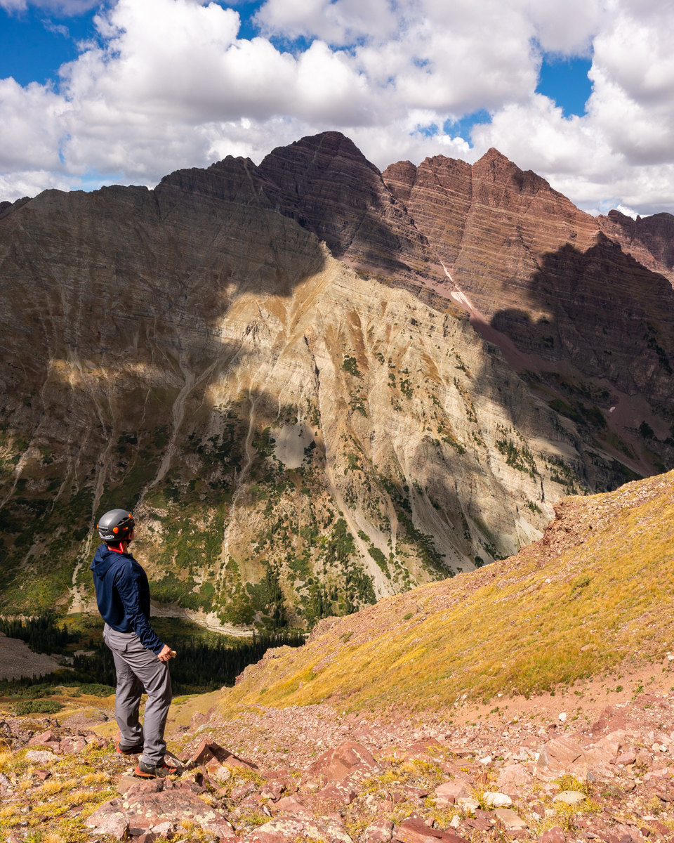
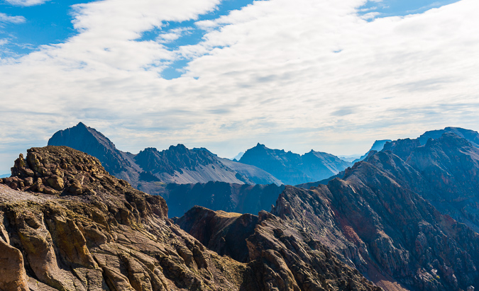
It was also really cool to have a view of Pyramid from here, which I finished the 14ers on in 2012.
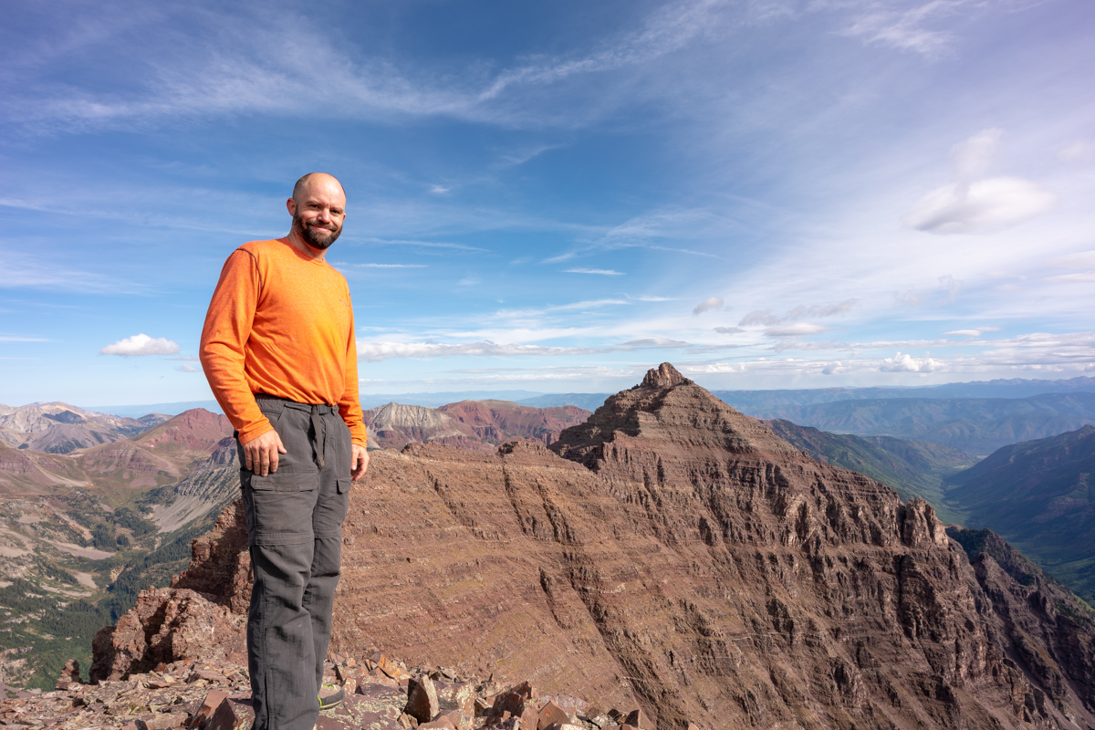
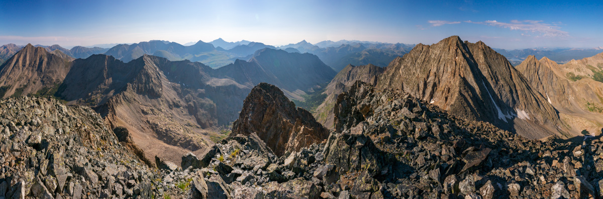
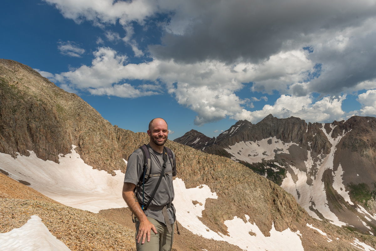
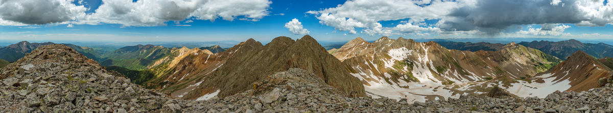
The scale of these mountains is so hard to describe in photos; however, I think adding me to the frame helps.
I had a special surprise for Silas too. I brough my 100summits.com T-shirt with me and a sharpee so he could check off the last box for Thunder Pyramid. What a great feeling!
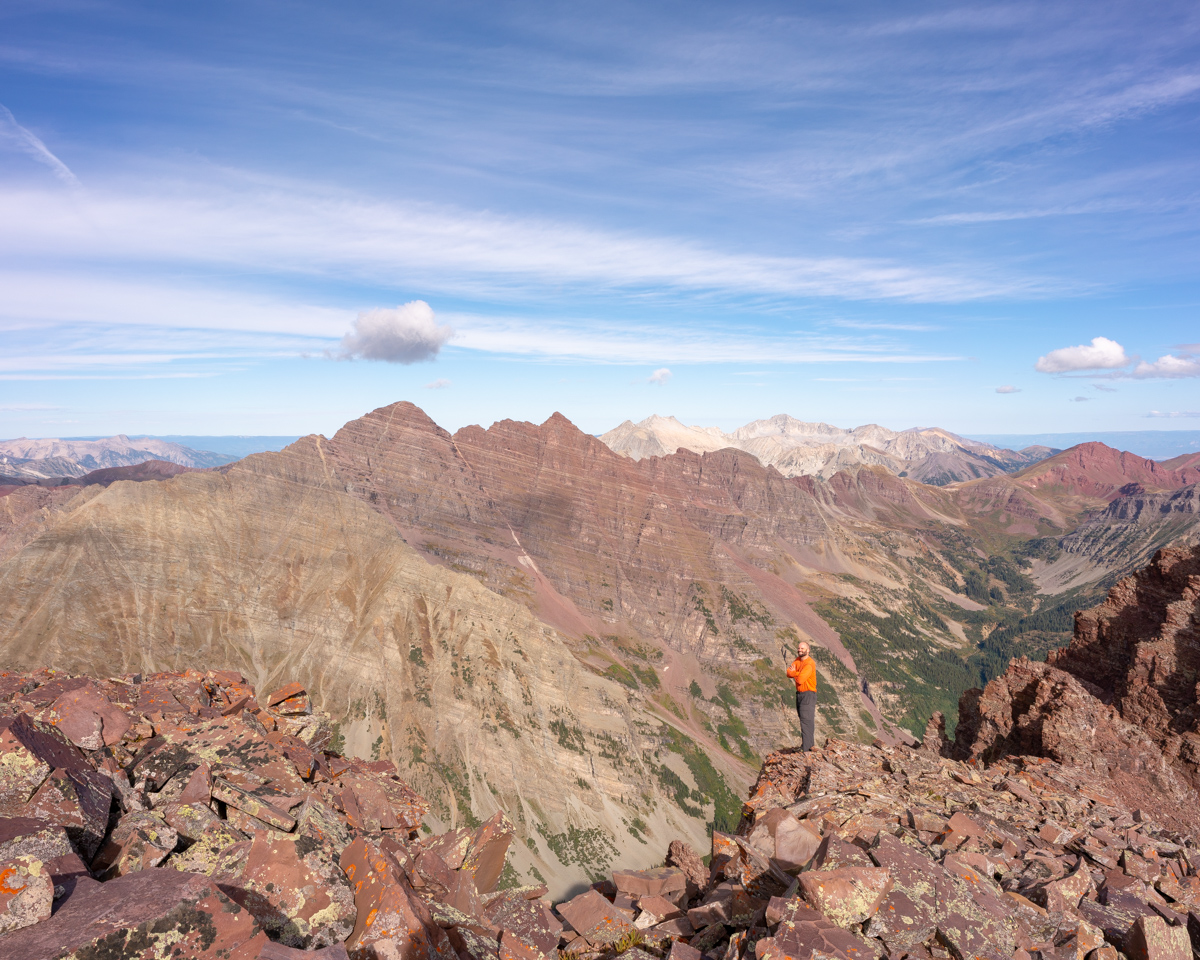
I wonder why they call these the Pyramids?
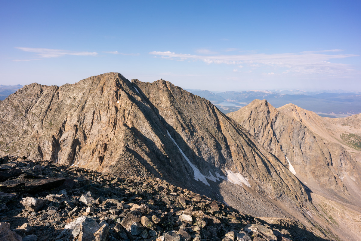
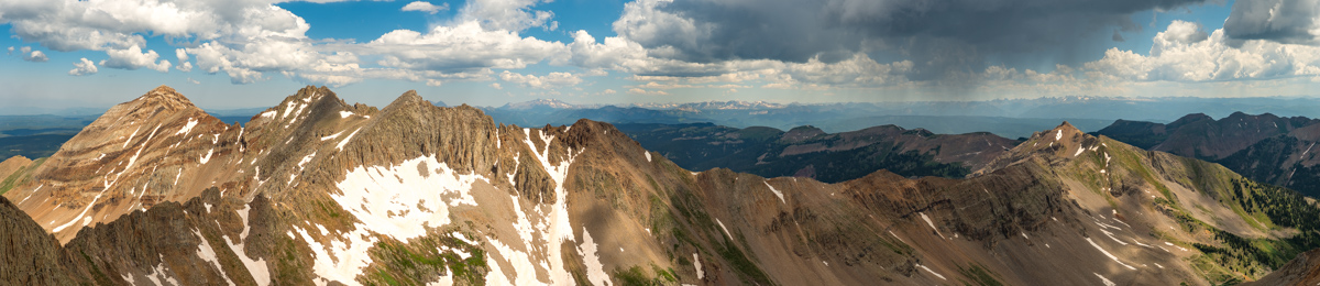
Silas caught me in the act of composing a photo while there. I really wanted something to show off the gnarly rocks in the foreground while including all of the great peaks of the area, so I had to get really low!
And the result:
Another angle:
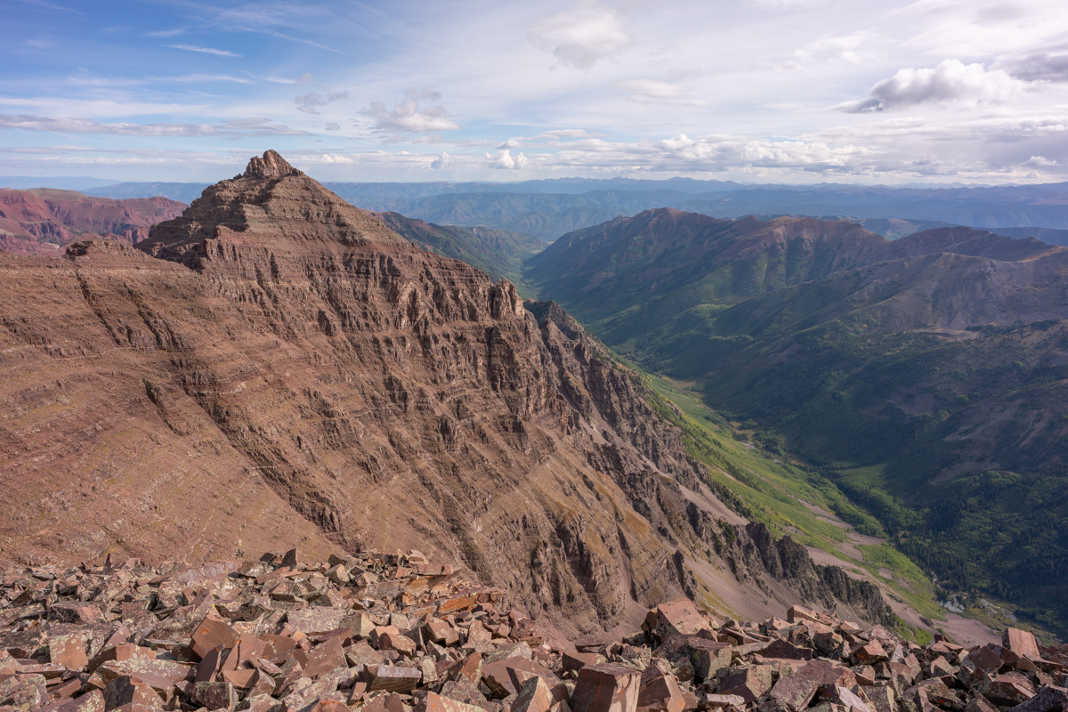
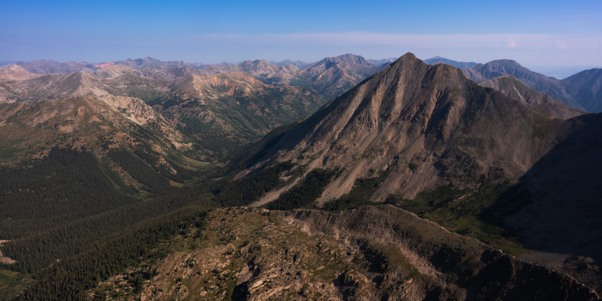
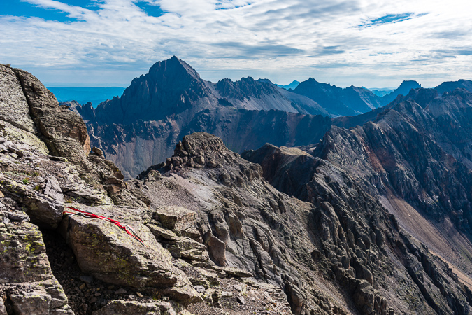
I felt like I needed a shot of Castle and Condundrum too, even though the light to the east was quite harsh. I think they still look quite formidable from here though. It was crazy to think just a couple weeks ago I was on Cathedral at sunrise looking this direction.
We also noticed a pair of hikers on top of Pyramid. This photo really shows off the scale of that peak well.
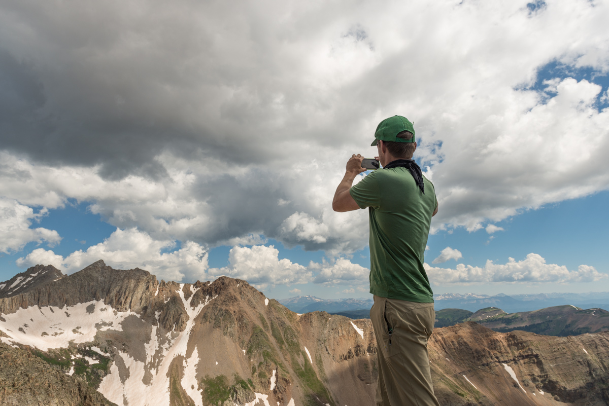
I decided to sign the summit register and have Silas video it for posterity.
I also felt compelled to kiss the top of the mountian for some reason before departing. It was fun Thunder Pyramid - thanks for the ride!
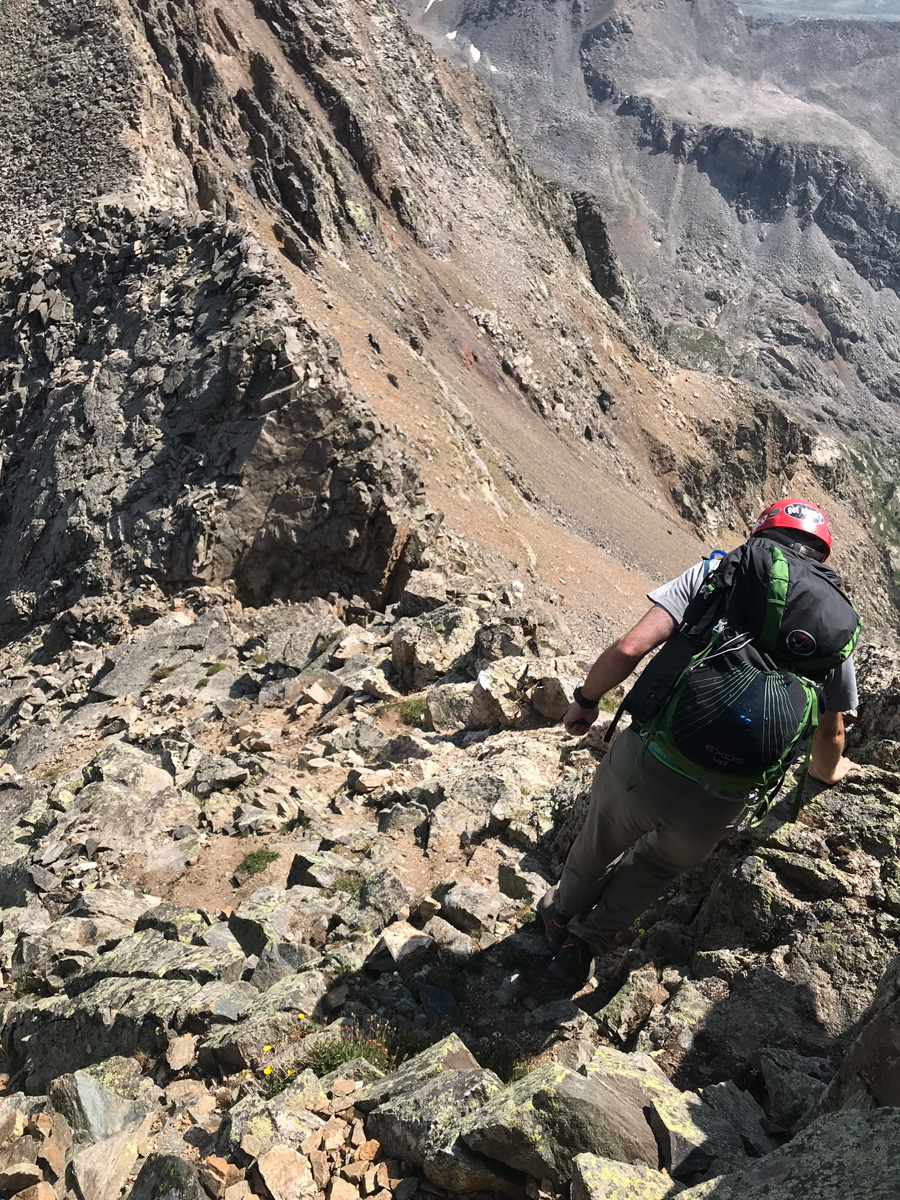
The journey down began and I was still on cloud 9 but knew we needed to be extra safe on the descent. There were sections near the summit that had decent exposure and made Silas quesy to look back at me on the edges. I was like, "what's the big deal?" :-)
Upon reaching the saddle the view down was sobering. It looked incredibly nasty. Fun.
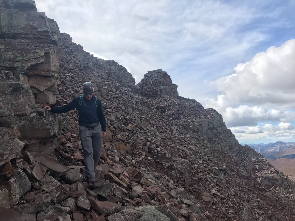
We made our way down carefully, picking mostly the same route as before, except we stayed a bit higher towards the top of the ridge instead of going south into the gully.
The rock here is especially loose and nasty. Great care should be taken to navigate down. I got some fun action shots of Silas in the act.
Don't fall!
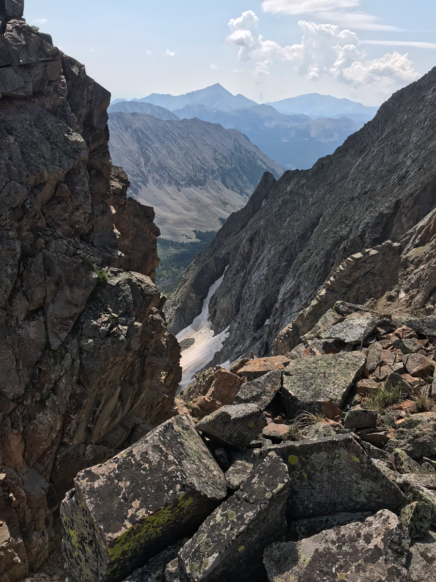
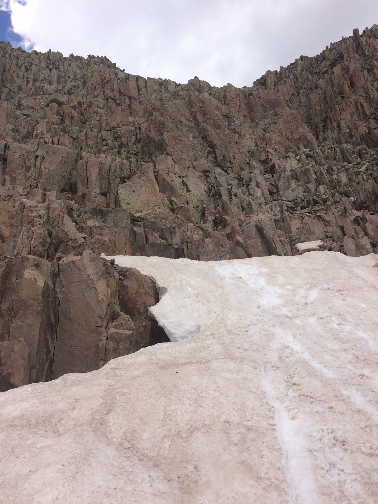
Here is a good view of the spot we chose to turn off from the White Gully, only in reverse.
Upon reaching the white gully, we were equally excited and dismayed by the appearance of a mountain goat below us. Despite our efforts, he kept climbing right up the gully towards us and eventually above us. We now not only had to contend with our own rock fall, but also the rock fall from the goat. Fortunately, he did not knock any rocks down on us!
Reaching the bottom of the white gully was a relief, and, we were pleasantly surprised at how well the weather had held up!
I absolutely love the next shot of Silas gazing at North Maroon (which he climbed the following day).
We made it to the turn off for the very first gully and found that dirt/rock section to really suck - here's a good view of Silas entering that section. It was super steep and very unpleasant.
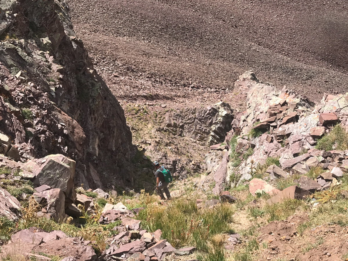
We opted to follow the far left gully to exit, which was much less steep but much more loose and filled with nasty talus. At least the view of Len Shoemaker ridge was good.
Every step in this gully was dangerous. It was a real ankle destroyer.
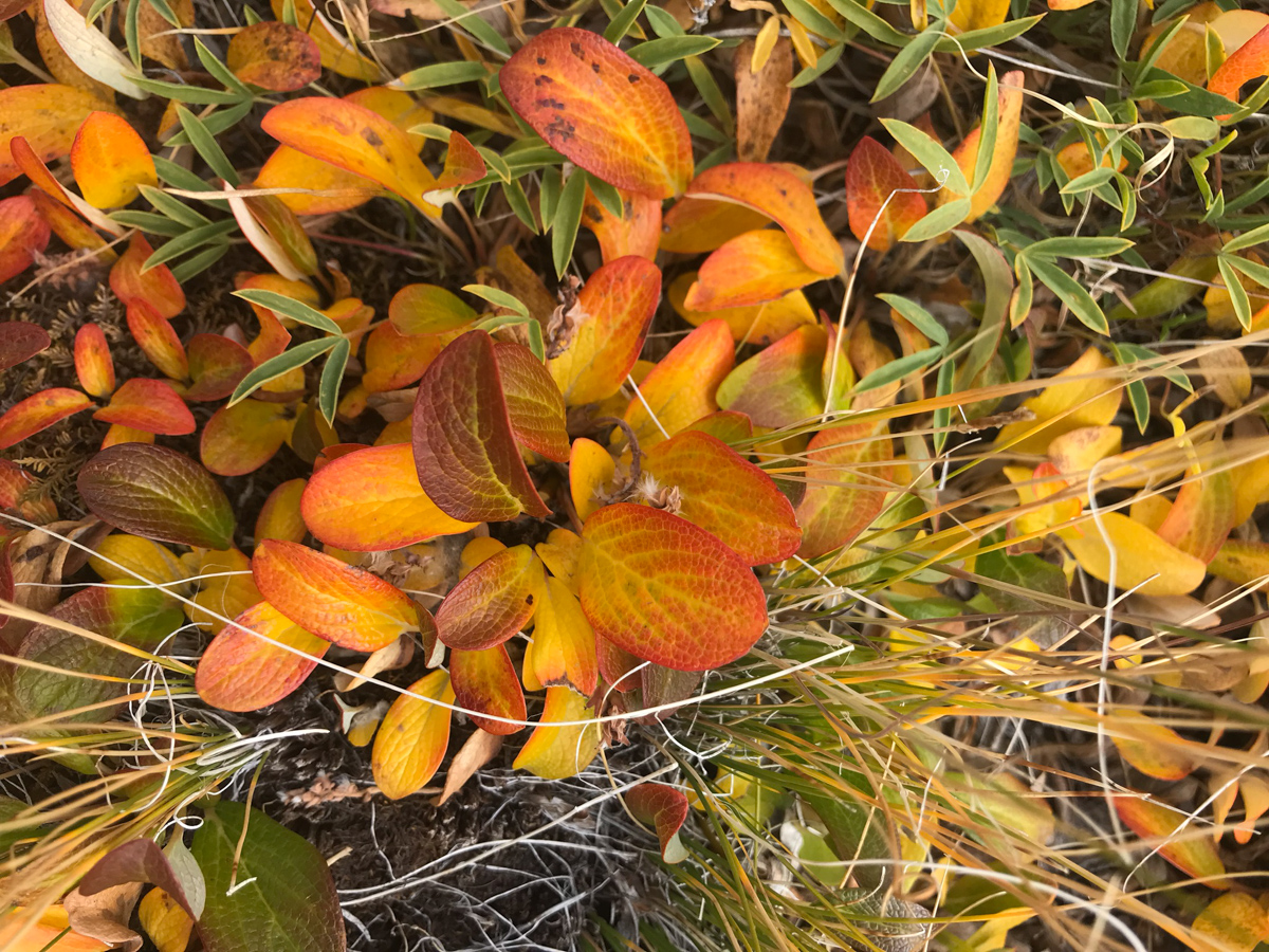
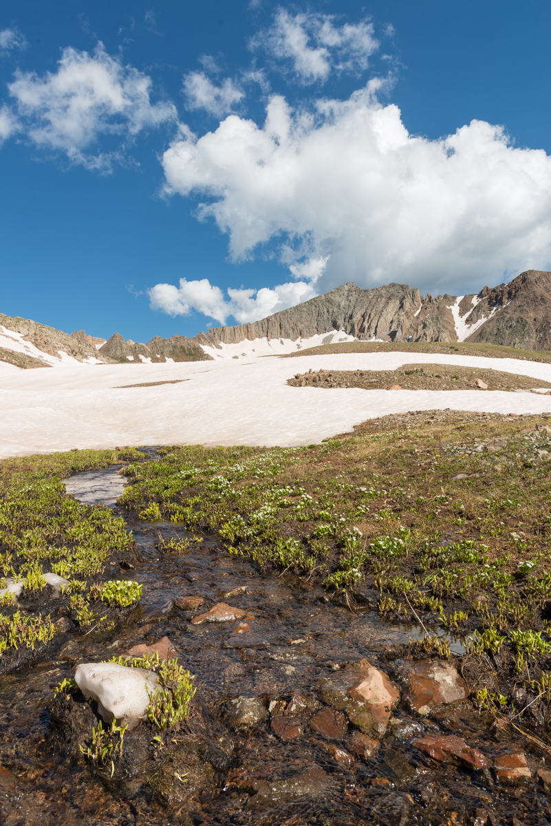
Upon reaching the flat surface below the talus field, we stopped to admire the foliage - the tundra had turned yellow and orange, reminding us that fall had arrived.
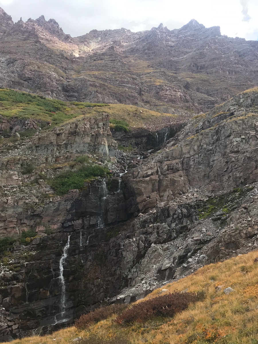
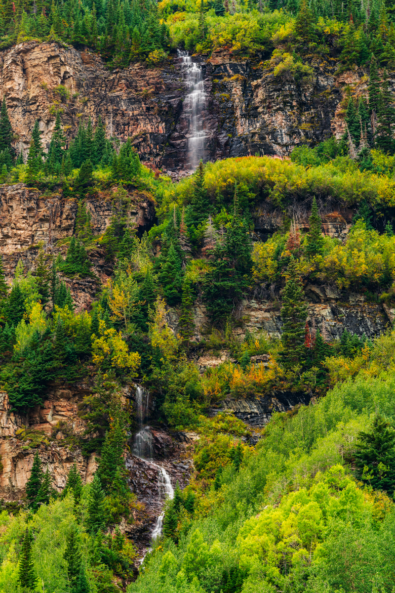
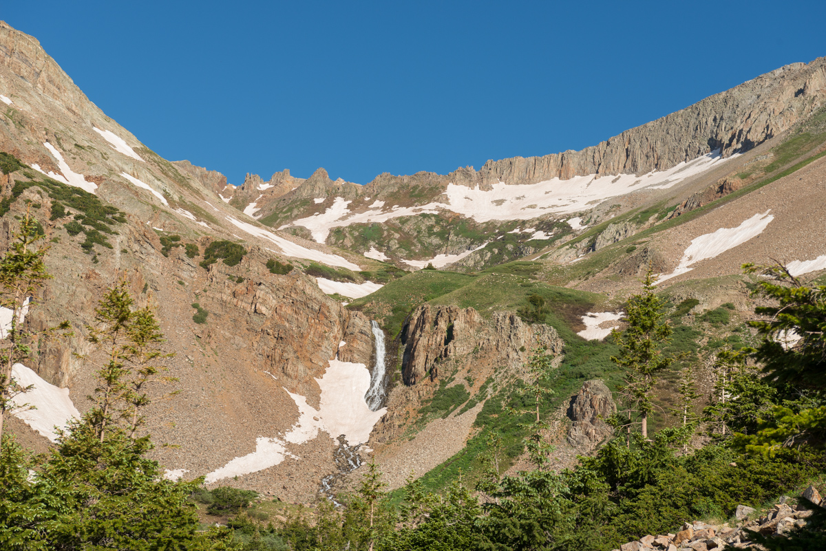
A look back up Thunder Pyramid below some waterfalls we found - a glorious sight indeed.
We picked our way down pretty much following our ascent route - here you can see one of the sections where we navigated below and above two cliff bands by following a nice rocky section.
At treeline we found some very large plastic peices that we think were from a downed helicopter. They appeared to be part of the cockpit and were about 2' by 2' in size. Silas carried them out. We reached the base of the peak without incident! Success! Upon reaching our campsite, we found a Ranger talking to an older gentleman who seemed a bit out of breath. I confirmed it was the father we had told the son to go back to get earlier in the morning. It had apparently taken them this long to get him down to our campite near Crater Lake. He thanked us for helping his son Austin, saying when Austin came back for him, he had fallen asleep. They eventually airlifed them both out from the lake, which quite the specticle to witness. I got some photos and video of the event.
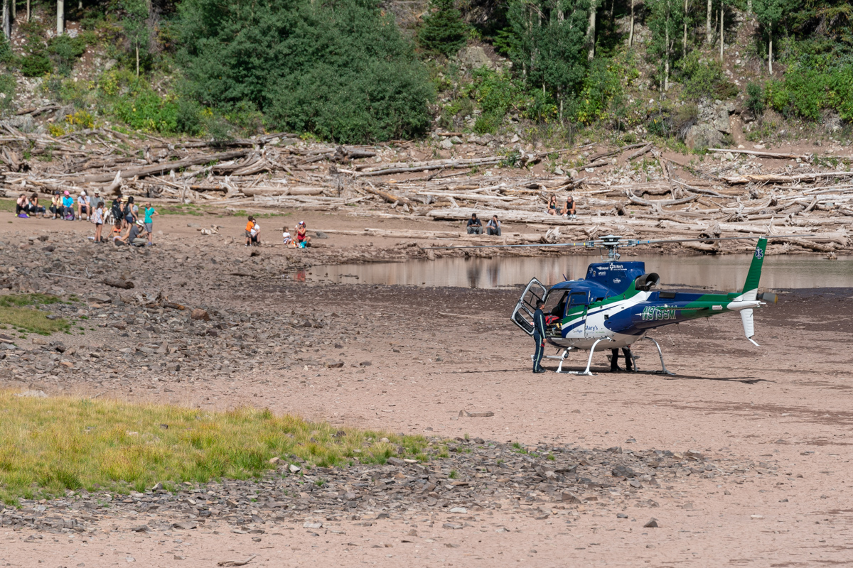
It was impressive seeing the pilots navigate the lake with the helicopter.
Once the drama stopped, I stopped to get some photos of the surrounding area with my telephoto lens. The light in the steep gullies below North Maroon was particularly mesmerizing.
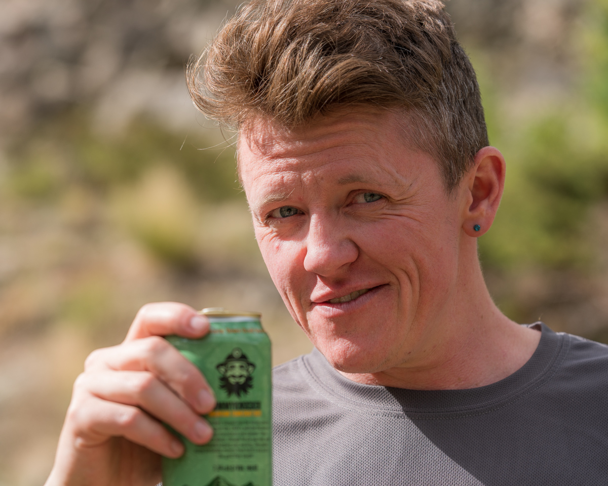
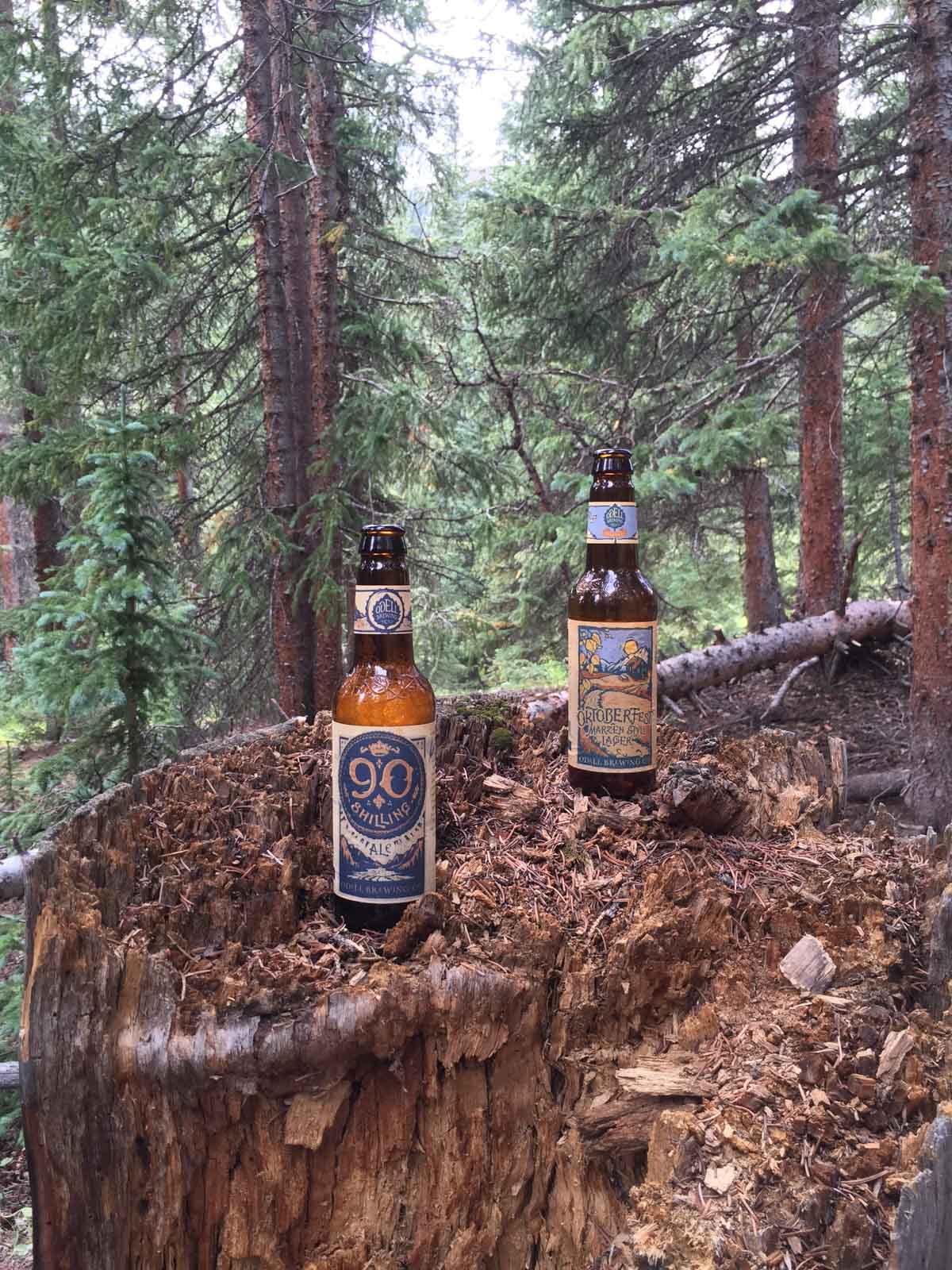
And of course we celebrated with camp beer!
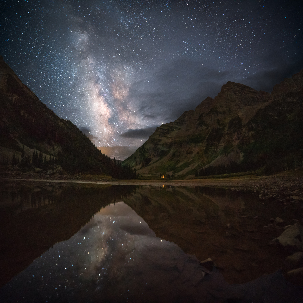
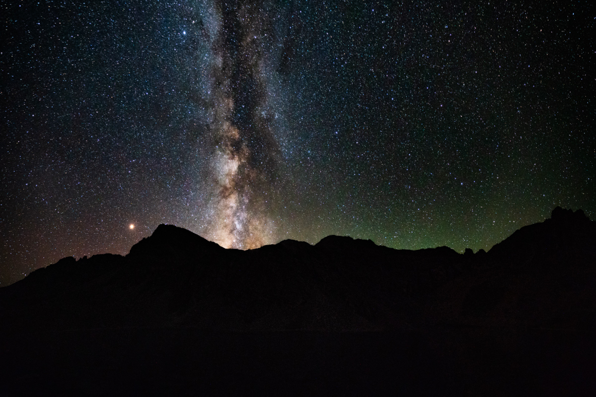
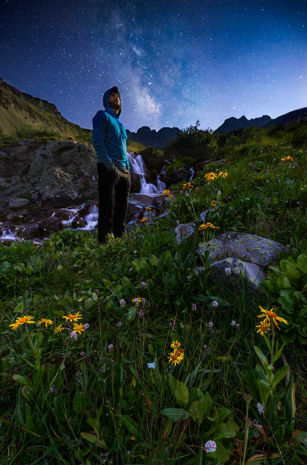
After telling Todd about the climb and settling in for the night at a new campsite, I decided to head down to Crater Lake for some night photos. Using my new 15mm wide angle lens, I was able to get the whole lake, both Bells, and the Sleeping Sexton in one photo. Nice.
I was particularly excited to re-create a photo I shot here several years ago with inferious camera equipment - the Milky Way in the valley gap between the Maroon Bells and Pyramid Peak. I think it was quite the success.
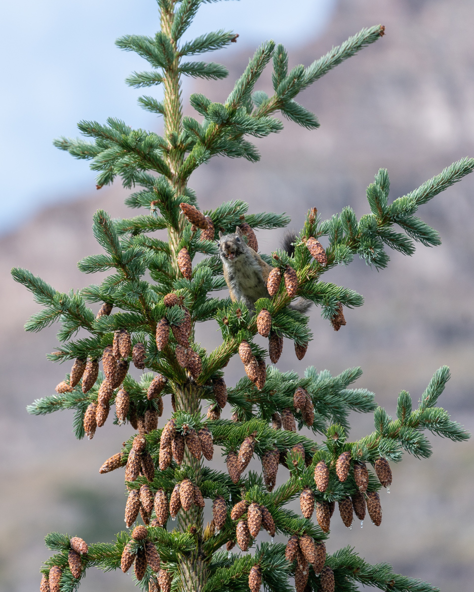
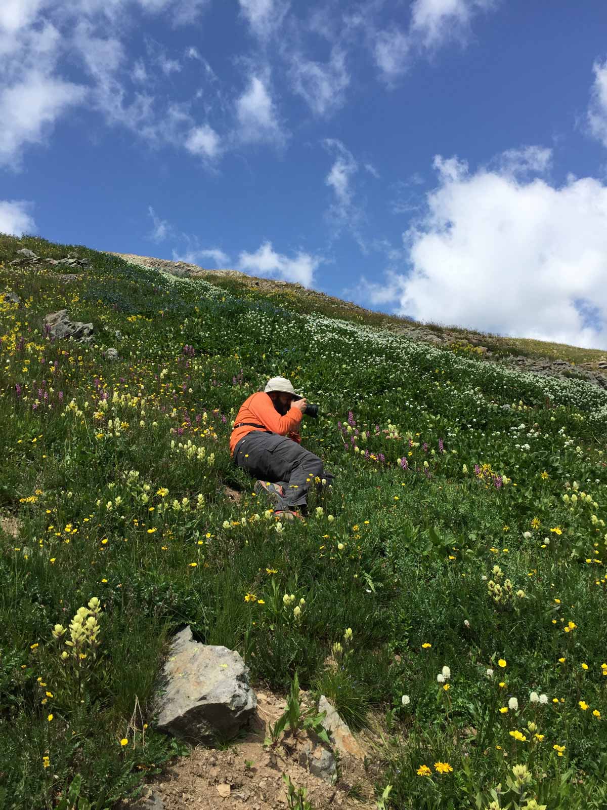
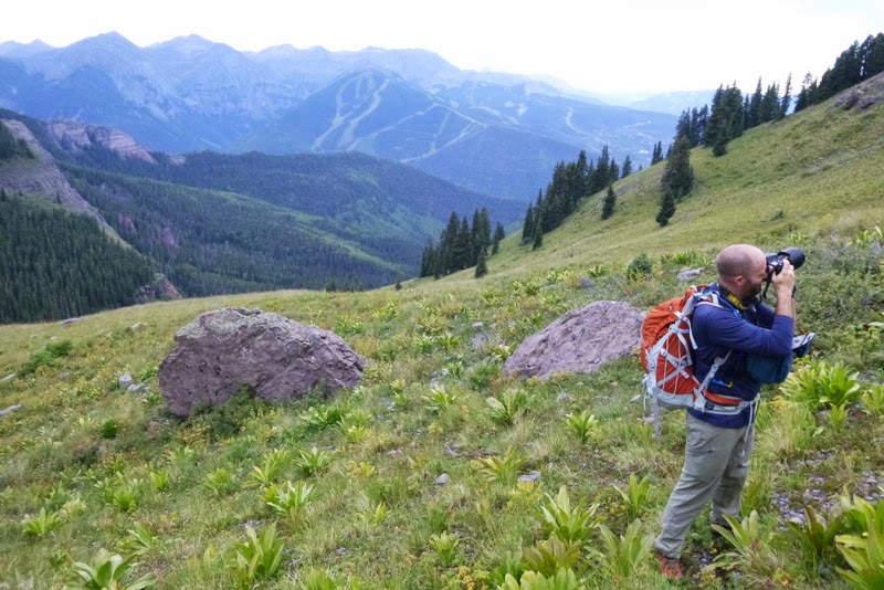
Day 3 - a rest day for me and a climb of North Maroon for Silas. I spent a great deal of the day putzing around with my camera and talking with my friend Todd. We were confronted by a Forest Service Ranger for camping in the wrong location. Apparently the correct site 6 was further back away from the trail than we realized. The sign we camped near said site 6 and was heavily impacted. He forced us to pack up and move to another spot. We were happy to comply. Note - the signage is pretty spotty and not very useful in general. Many camp sites have huge signs saying "restoration in progress, no camping," and others have no signage at all. It is wildly inconsistent and the marked sites are, well, not very well-marked. Noted. Since Silas was away on North Maroon, we had to figure out how to coordinate the move. We packed all of Silas' gear up into his pack and moved to site 8 (which was WAY better, by the way). We came back to site 6 and Silas had just arrived back from North Maroon. Perfect timing! I decided to get some photos of a squirrel that was throwing pine cones on the ground (which is hilarious to watch).
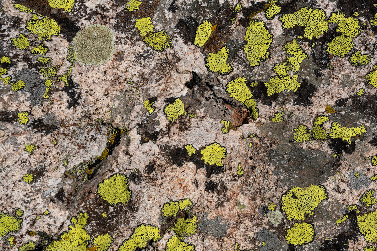
I also decided to get some abstract shots of a rock covered in moss... boring for some, probably, but interesting to me.
And of course, the setting moon was fun to photograph over the Sleeping Sexton.
After we all napped in the rain at site 8, I set-off to photograph the area with my telephoto lens. The foliage was just starting to change color and I really enjoyed phtographing the area.
After the rain, there was a significant waterfall that appeared above us below North Maroon, and it was also fun to photograph.
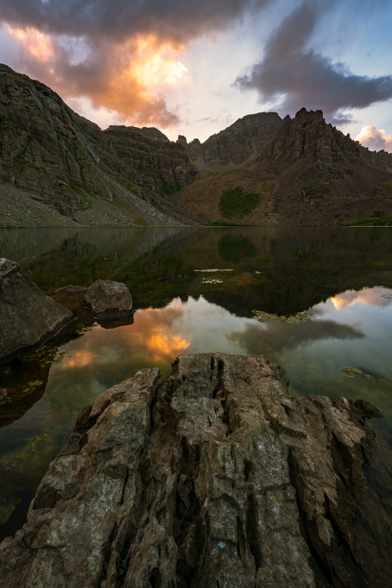
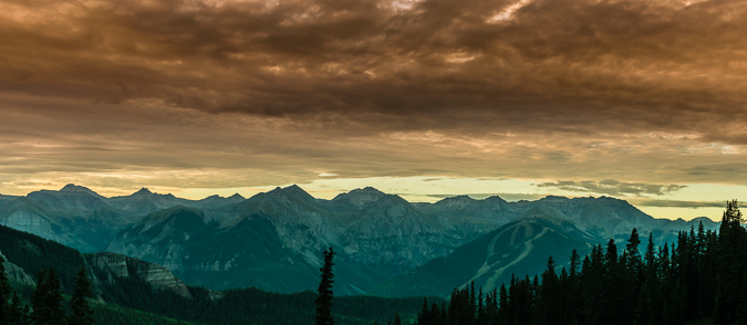
A very large weather system moved into the area around 4 PM and we were glad we were not climbing. I had a vision in my mind of snow being dropped onto Pyramid and Thunder Pyramid during the storm and thought there could be a possibility that the storm would break at sunset and produce some amazing results. I really wanted to commemorate the trip and experience with one last photograph of Pyramid and Thunder Pyramid in these conditions, so I sold Silas on the idea of hiking all the way back up North Maroon's slopes to get a good view of these two peaks at sunset. We hiked in the rain for a couple of hours up the trail for North Maroon, which was pretty miserable. Honestly, who does this?
When we arrived, I stopped at the very long boulder field below North Maroon, which was very wet and slippery. I noticed a climber at the other end of the boulder field who was moving incredibly slowly back down the mountain. He was maybe moving one rock per minute. He was obviously in pain. I later learned his name was Scott and he was from Woodland Park, CO. I yelled out to him.
Matt: "Hey man, are you OK!"
Scott: "Yep, just hurt my ankle and can't put any pressure on it."
Matt: "Do you need any water or Ibuprofen?"
Scott: "I'm good man."
Matt: "Well, I'll wait for you up here to make sure you get down OK."
Scott: "Thanks man, appreciate it."
Silas and I waited below the boulder field for another hour and he still had not come down. I decided to climb back up to the boulder field and found that he was really high above the trail. I went to him and helped him get down to safety, one step at a time. He was badly hurt. We gave him some ibuprofen and wrapped his ankle in an ace bandage and he went on his way down the mountain.
The clouds and light were quite dramatic and I was really holding out hope that the clouds would break for just a minute to light up the peaks with alpenglow.
Alas, my wish was granted! I was so elated! Silas caught the whole thing on video.
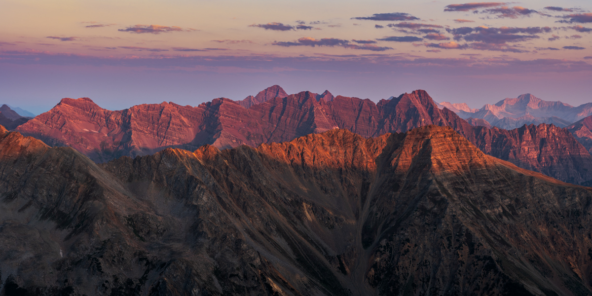
I really loved this scene. Not the best, compositionally, but damn, the light! Pyramid and Thunder Pyramid covered in snow with alpenglow, just as I had envisioned. Yes!
I am really proud of this image. I had the vision. I had the perseverence to try to get it. I was prepared. Execution was good too. Hallelujuah, this is what its all about for landscape photographers!
The light to the north was pretty great too! Looking down on Crater Lake and Maroon Lake was quite a treat.
After sunset, we left. On the way down, we ran into three hunters, a father and two sons who were hunting Mountain goats. They said they saw our injured hiker earlier and he was doing OK. Good! We returned to camp very late and ate a very late dinner and had beers. What a great trip! The next morning, we packed up and head out at 10 AM. Naturally, upon arriving at Maroon Lake, the shit-show of tourists not obeying the Forest Service signs was even worse. I loudly but politely asked several parties to not cross the rope and that they should read the sign. I bet the forest service hates this new system. I can't imagine policing it 24/7.
I think I looked pretty menacing with the plastic helicopter cockpit part we found...
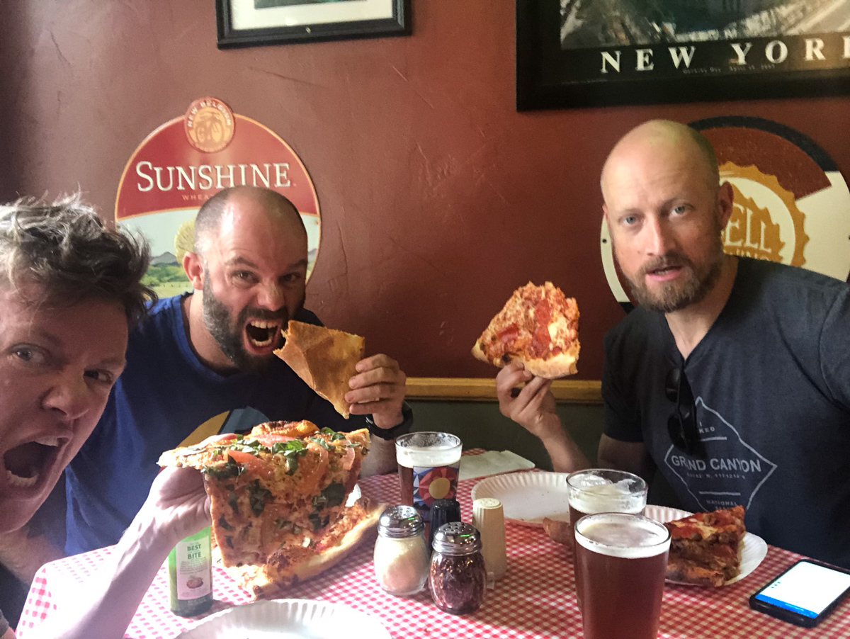
A successful trip deserves a trip for beer and pizza. We stopped at NY Pizza in Aspen for our celebration meal.
Wow, that concludes this report. My final Centennial!
A few thanks are in order -
Thanks to Silas Musick for being such an amazing climbing partner. We celebrated on 14 of those 100 summits together and I consider you my best friend - all because of our mutual passion for mountains and the outdoors. You're a beautiful human.
Thanks to Natalie Moran for taking me up Jagged, Dallas, and Teakettle. You're a fabulous climber and a great person.
Thanks to Terry Matthews (RIP) for accompanying me on my first class 3 climbs in 2008 when I got back into this pursuit. You are missed.
Thanks to Ethan Beute - our climbs on obscure 13ers kept me going - miss you man!
Thanks to Regina Primavera - you're a great friend and it has been fun catching summits with you since 2011.
And lastly, thanks to my parents for getting me going on this crazy journey 35 years ago. The photo Silas posted was actually my first 13er - Fairview Peak - I was 4 yrs old.
I created my little website in 2009 mostly to teach myself how to build one but also to document and share my journey with my friends and family. I know my dad regrets not having something similar to look back on. Hope it’s at least been somewhat useful to others as well.
Next up? I have no idea. I don't think it’s the bi-centennials.
I have some photography projects I want to tackle, including a book of photos of the Centennials...
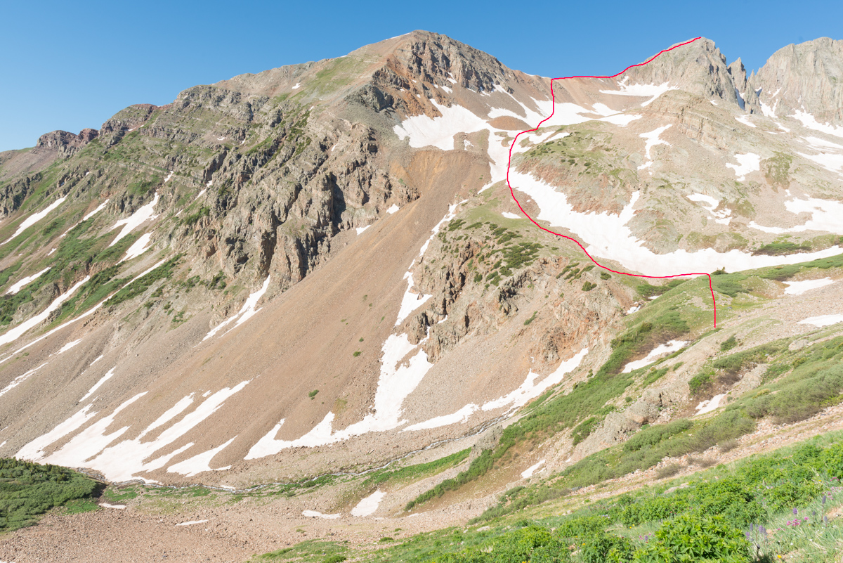
Here is a photo that might help folks see the general route we took:
And a link to the Gaia GPS track:
Cathedral Peak in August - Photographing the Perseid Meteor Shower and Sunrise from the Summit
 Cathedral Peak as seen from Grizzly Peak in 2013
2018 is the year! I WILL complete the quest to climb the highest 100 mountains in Colorado! Cathedral Peak marked #99 and was only one of two peaks standing between me and my dreams. I set off for Aspen at noon on a Saturday. My plan was relatively simple yet ambitious: Backpack to Cathedral Lake, set-up camp, photograph sunset, find a composition for the Perseid Meteor Shower, photograph the Perseid Meteor Shower, sleep (maybe), climb Cathedral Peak in the dark, photograph sunrise from the summit. Seems doable, right? I have made it somewhat of a tradition to photograph the Perseid Meteor Shower whenever I can. Last year's was a total dud due to the moon being full, so I chose not to photograph it; however, the year before I photographed it from the saddle between Pigeon and Turret, which was also ambitious (and quite rewarding). I was hopeful for a similar outcome at Cathedral Lake.
I have been dreading the climb of Cathedral for several years. Most people climb it in early summer when there is ample snow in the incredibly steep couloir leading to the summit saddle. I personally dislike snow climbing, but also did not have high hopes for climbing up that gully when it was all hard dirt and rock; however, I needed this peak and so it was on!
As always, you can see and download my full route and GPS tracks over on the incredible app, Gaia GPS, which I use on my iPhone to plan, track, and follow my routes on these trips. It is absolutely invaluable and worth every cent. I personally love that you have full access to all USGS topo maps and National Geographic Trails Illustrated maps as well. You can use the app while in airplane mode and even save maps for offline use. To get a nice discount on the application, follow this link and you'll also support my efforts to keep this site running.
My full stats for this particular climb, which included summiting Cathedral Peak (13,943 ft.):
- Peaks climbed: 1
- Miles hiked: 8.5
- Time: 5 hours, 23 minutes
- 3,987 ft. elevation gain
For this trip, I decided to pack quite a lot of camera gear (by the way, these are affiliate links and using them helps me pay for this site and to bring you better content):
- Sony A7R2 Camera
- Sony 12-24 f/4 lens
- Zeiss Loxia 21mm f/2.8 lens
- Sony 55mm f/1.8 lens
- Sony 70-300 FE telephoto lens
- Feisol Tournament 3442 tripod
As usual, I used the beta from Gerry Roach's High Thirteener Guidebook. I was still using the 1st edition of the book; however, his new edition is available on Amazon after many years of waiting - rejoice!
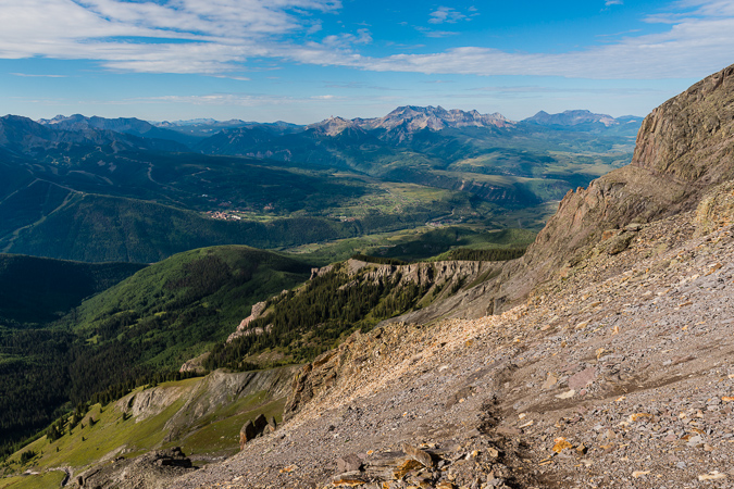
I reached the Cathedral Lake Trailhead at 5 PM. It was not very full and that made me smile. I embarked up the steep trail which Roach describes as unrelenting and pretty much did not stop until I reached the lake. The hike is steep but the trail is great and the scenery is wonderful as well.
As you climb the trail, the view opens up quite a bit across Castle Creek to reveal Ashcroft Mountain.
The fireweed had all grown super tall and looked really eerie.
As I continued up, the eastern flanks of Malamute Peak began to reveal themselves.
The area just before the lake has ample camping and some great sites near the stream. I opted to find a spot a little higher up near some small trees with a wonderful view of Cathedral Peak (center) and Leahy Peak (right).
I set-up my campsite at 6:30 PM and began hydrating my dinner. Knowing I would need a good hour for it to hydrate, I hiked to the lake and found some spots to photograph the sunset from. It was really pretty and I was the only person up there except for a fisherman, who left shortly after I arrived. Being the only soul around at a high mountain lake is equal parts scary and serene.
The sunset looked like it would open up over Cathedral Peak, so I repositioned myself on the eastern shore for some great shots of Cathedral Peak.
The light was bright, intense, and really colorful.
I decided it was time to go back and get ready for bed. I enjoyed one last gaze at the parting light before bed.
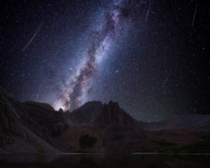
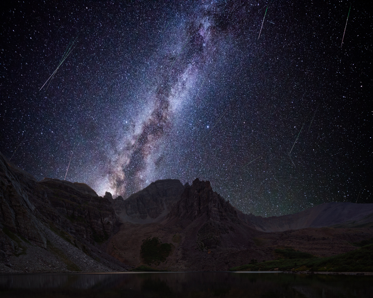
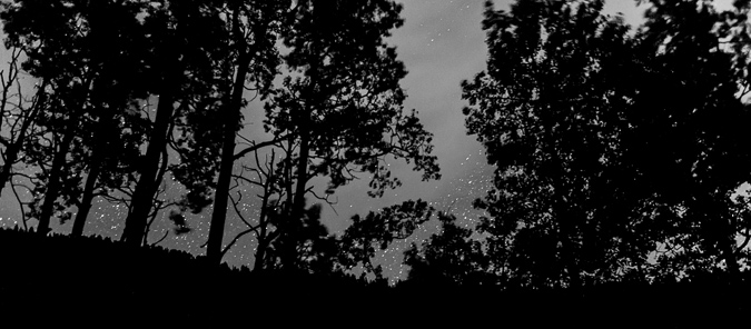
I set my alarm for 1:30 AM so I could photograph the Perseid Meteor Shower. I ended up waking up at 11:30 PM to some strange sounds (maybe just wind). I decided to get up and set-up my camera for the Meteor Shower. The Milky Way was ablaze to the south and I was loving it.
I found a nice compositon including Cathedral Lake and the Milky Way and set-up my camera to shoot on a time-lapse automatically every 31 seconds. I lay on my back and watched the meteors for about an hour or so - it was one of the best displays of the Perseids I could remember. Huge streaks across the sky. It was pitch black - no light from cities, no moon. I decided to leave my camera there all night and get some sleep. I wanted to shoot sunrise from the summit of Cathedral.
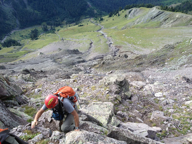
I got up at 3:45 AM, found my camera again, packed it up, and began my journey in the dark up Cathedral, following the description in Roach's book. I was not able to find the "mining trail" he describes until about 500 feet of elevation gain above the lake. I bushwhacked up a steep grassy slope and encountered the great trail heading west. I followed cairns all the way to the base of the infamous gully, where I watched the beginnings of sunrise. The gully itself was atrocious. It was some of the nastiest terrain I can ever recally climbing up. Class 3 loose dirt and rock. Maybe snow climbing would have been fine after-all! Oh well, I suffered up the steep gully and made great time.
The terrain between the saddle and the summit was pretty interesting. It reminded me of Vermillion Peak or Hagerman Peak. It was loose in spots but relatively easy to find good solid holds. Some care was needed to ensure a good route up, but all-in-all I did not find it overly difficult to ascend. I reached the top just in time for sunrise, which was glorious to say the least!
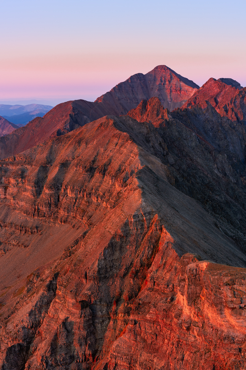
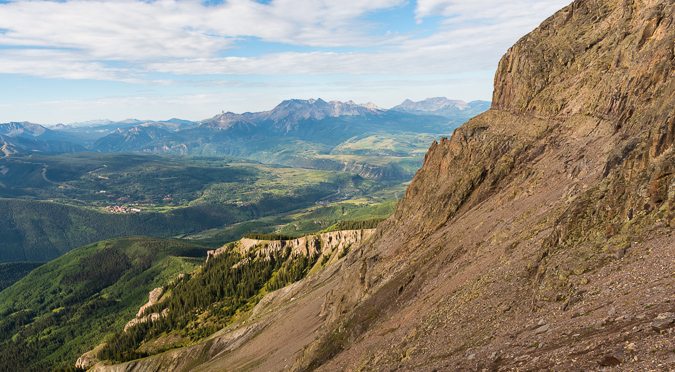
I was so focused on the Elk Mountain 14ers to my west, including the Maroon Bells, Pyramid Peak, and Capitol Peak that I had forgotten about Castle Peak to my south. I caught it in the corner of my eye and my jaw dropped. Castle never looked so good in the early light. So much red!
Of course the Elk Mountain 14ers looked amazing as well.
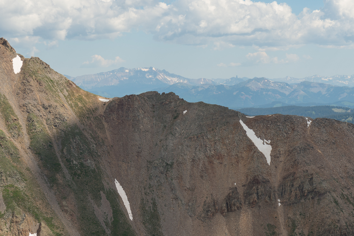
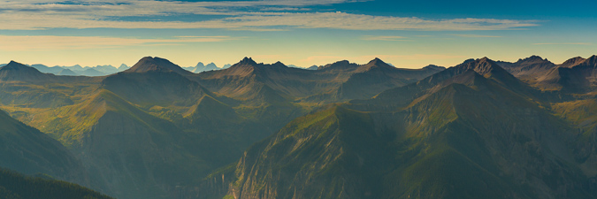
This telephoto rendition showcases all the great peaks, including, from left to right, Maroon Peak, Thunder Pyramid (my last Centennial), North Maroon Peak, Pyramid Peak, and Capitol Peak.
It was a magical display of light and might.
It was maybe not the most incredible display of color that I remember, but it was a damn good sunrise, and I was proud to have photographed another sunrise from the top of a Centennial.
The clouds and haze from the California wildfires added some interesting dynamics as well.
#99 was in the bag! Next up - Thunder Pyramid!
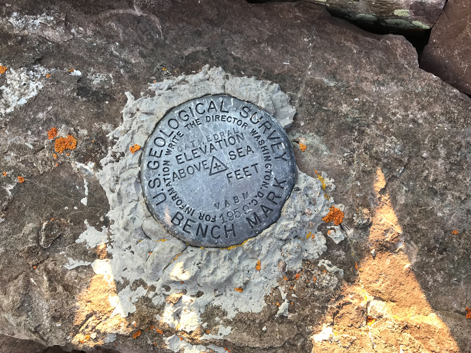
The Cathedral summit marker, looking great after 59 years.
I did not spend a ton of time on the top. I let my friends and family know I had made it to the top and then I made my way down. I reached the gully again in no time and prepared myself for hell.
This next photo is looking back up the gully from just a little ways down. It was so steep, loose, and nasty.
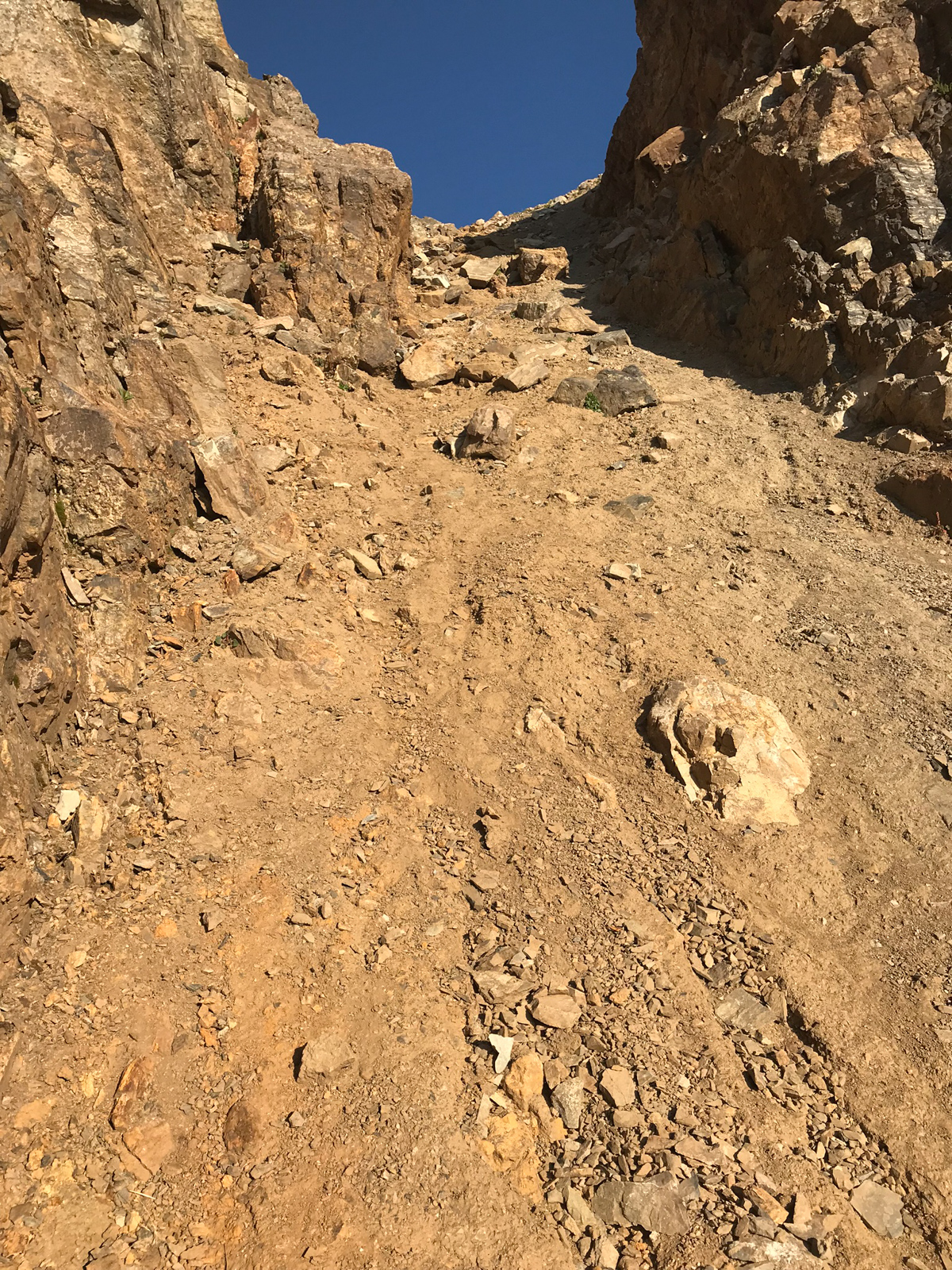
More from the nasty gully, to give you a good sense of what it is like when dry.
I finally reached the bottom of the gully and my feet were sore. What a nasty spot. I don't recommend it.
The next photo shows the highest cairn I was able to locate before the gully, in case anyone needs a good marker for their climb. Going down from here was pretty easy on a well-marked trail on precarious but mostly solid rock and boulder.
Here is a look back towards the start of the gully.
And another view of the gully from a little lower.
I loved the castle-like rock formations here, they were really cool to look at.
The eastern wing of Cathedral was especially impressive, towering over the whole area like some sort of watchman.
I made it back to my campsite at about 9 AM. I felt great about my time and my legs and feet were feeling strong still. The next photo shows a zoomed in view of the gully (right of middle) and shows just how crazy steep it is.
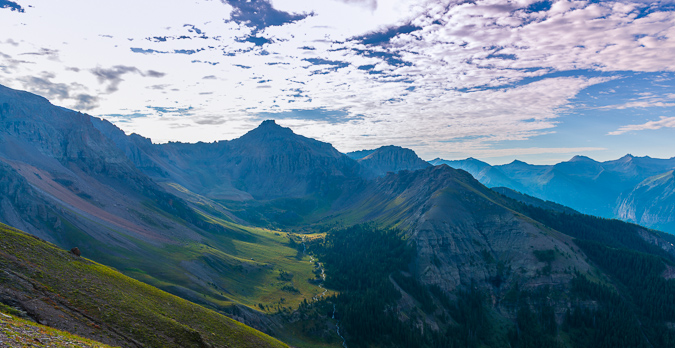
I took one more parting panorama of the area from camp to remember the day.
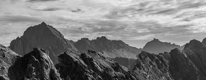
I could not help but get a telephoto black and white shot of the pinnacles east of Cathedral - so impressive!
Farewell Cathedral! Your eastern friend Leahy Peak looks way more inviting! =)
Thanks for reading. I hope you enjoyed my photos and description. One more to go!
Climbing the Crown Jewel of Colorado's Sawatch Range - Ice Mountain & North Apostle

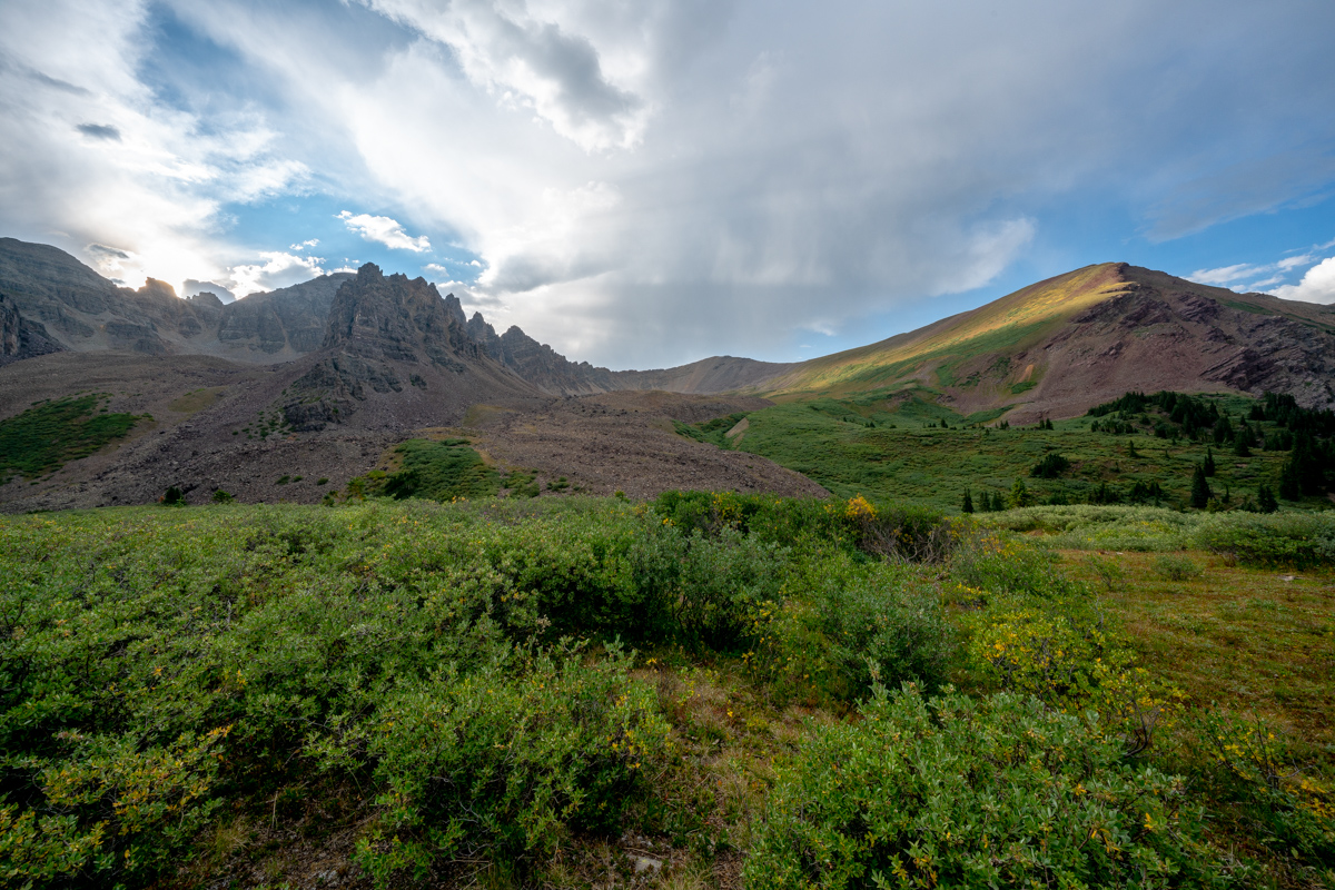
North Apostle and Ice Mountain as seen from Grizzly Peak in 2013.
2018 will be the year that I finish my lifetime goal of climbing the highest 100 mountains in Colorado. Or at least that is what I keep telling myself to stay motivated! Having climbed Dyer Mountain back in May, and Silverheels, Buckskin, and Stewart earlier in June, I found myself faced with only four mountains left to complete my goal: North Apostle, Ice Mountain, Cathedral, and Thunder Pyramid. Having Fridays off of work most of the time, I was faced with some options in terms of climbing - I could leave Friday from Durango, find a camp-site, climb on Saturday, and then drive home; or, I could do something stupid. I went with stupid. My friend Silas (featured in many trip reports here) was climbing Capitol Peak the same weekend and I really wanted to climb that again with him. I decided I would try to squeeze both climbs into one packed weekend, at the last second. So, I packed my car with both backpacking and car camping stuff and left my house in Durango after work on Thursday at 8:30 PM to drive to the trailhead for the Three Apostles. I ended up arriving at the trailhead at 1:00 AM and slept in my car until 3:45 AM, at which point I left the car and began my journey on almost no sleep. Huge mistake...
I've been eyeing the Three Apostles for years. I first admired their incredible stature when I was much younger on camping trips with my parents around Winfield. I remember one particular year going on a camping trip with my parents and my friend Jeremy where we hiked up into the upper basin and could see the Three Apostles - they looked intense! My next foray in seeing them up close and personal was in 2010 when I climbed Huron and Browns with my friend Mike Vetter - I recall being quite impressed with the peaks then as well. My latest encounter with them was watching the sunset from the summit of Grizzly Peak to the northwest of the Three Apostles and seeing a huge rainbow over Taylor Park. That was awesome! That particular trip, I hauled a huge telephoto lens up to the top with me and shot North Apostle and Ice Mountain at sunset. Good times!
As always, you can see and download my full route and GPS tracks over on the incredible app, Gaia GPS, which I use on my iPhone to plan, track, and follow my routes on these trips. It is absolutely invaluable and worth every cent. I personally love that you have full access to all USGS topo maps and National Geographic Trails Illustrated maps as well. You can use the app while in airplane mode and even save maps for offline use. To get a nice discount on the application, follow this link and you'll also support my efforts to keep this site running.
My full stats for this particular climb, which included summiting North Apostle (13,860 ft.) and Ice Mountain (13,961 ft.):
- Peaks climbed: 2
- Miles hiked: 10.8
- Time: 10 hours, 34 minutes
- 3,657 ft. elevation gain
For this trip, I decided to pack quite a lot of camera gear (by the way, these are affiliate links and using them helps me pay for this site and to bring you better content):
I found the trail going up to the Three Apostles to be very straight-forward. I followed the decent trail beta from Gerry Roach's High Thirteener Guidebook. I was still using the 1st edition of the book, which I'm told has some route errors for this mountain; however, his new edition is available on Amazon after many years of waiting - rejoice!
The trail follows the same trail as Huron for a while; however, there are several branches off of the trail to keep note of. Generally, you keep going straight. There are two signs before you are officially on the Trails Illustrated Apostles Trail 1445. I took a picture of one of them on the way down as seen below. I especially enjoyed seeing someone pencil in that if you were at this particular sign, and were climbing Huron, you had gone too far. That's how you know you're on the right trail for the Three Apostles. Having departed my vehicle at around 4 AM in the dark under a full moon, I had optimistically hoped to shoot sunrise from the summit of North Apostle (or nearby). Due to having almost no sleep, this proved impossible. Once I hit treeline, I found my pace slowed significantly.
I reached treeline at about 5:30 AM and the scene really opened up above me. You could make out the Three Apostles easily. It was at this point I realized I was not going to be able to shoot sunrise from the top. Oh well, there were not any clouds anyways, so it would have been a boring image. Having followed the Roach route description as opposed to the 14ers.com route description, I was aiming for a high lake below West Apostle and Ice Mountain. I figured that would be a fantastic spot to get some sunrise shots as well. The trail petered out after treeline and so I was forced to bushwhack through some willows which were quite wet still. Huge mistake again. Have I ever said how much I hate willows? After reaching the end of the willows, I followed the weakness in the drainage east towards a huge cliff band below North Apostle. From the end of there, I followed a steep dirt and rock slope south towards the base of the lake described by Roach. On my Gaia track you can see my ascent as the most southerly part of the route as opposed to my descent which was a little north of the lake.
Above the dirt and rock slope, I found myself in a strange spot. There was a huge rocky and cliffy section between me and the lake. I could try to go around to the south or cut across the rock face for some fun scrambling. I chose the latter and it was fun. I would not recommend this section if it were wet; however, it was fun to navigate and climb on. It was easy class 3 / hard class 2. A good warm-up for Ice Mountain for sure! Having reached the lake, I looked for some spots to take shots at sunrise. There were not a ton of options or time, so I found myself looking north towards La Plata and Huron.
The early light kissed the tip of West Apostle above the small lake and made for a very fun scene to shoot with the Loxia 21 lens. I was wishing for a wider lens for sure, but nothing a two-row panorama stitch could not overcome. The waters were crystal clear and quite still.
I spent some time enjoying the lake and snacking to regain some strength. I was really feeling the fatigue from the lack of sleep and was hopeful that food and water would help.
The light over on La Plata was pretty great too - accentuated by some pretty purple flowers on the ground between the huge boulders that were strewn about below the Three Apostles.
I wanted to take one final shot before leaving the lake and found a nice reflection of the lower sections of North Apostle, which were these awesome cliff bands and spires. Good stuff.
The path up from the lake seemed to be pretty straightforward. I just followed the grassy and rocky slope up near the creek coming down from snow-melt. The slope contoured up towards the base of North Apostle. It seemed that there were two ways to go - through a notch in some rocks next to the south wall of North Apostle or around the notch and around. I chose the notch.
West Apostle in early light
As I climbed up, I stopped to admire the running water under the boulder field. There's something about that experience that always brings a smile to my face. Sometimes the most simple things in nature are the most relaxing and impressive.
I continued up towards the notch below North Apostle and looked back to admire the early morning light that was shining on Harrison Flats to the west. The whole area just looks amazing from here.
As I climbed, there was a lot of rock fall happening on Ice Mountain, caused by mountain goats, likely disturbed by me and my huffing and puffing. I call them jerks in the video, but I'm joking. It should be noted that these goats could pose a huge safety concern for anyone doing the snow climb route of Ice Mountain, so beware!
The rocks above the notch and below the North Apostle / Ice Mountain saddle were absolutely horrific. They were huge boulders, many of which were loose, on steep terrain. Special caution should be taken while climbing to the saddle.
Upon reaching the saddle, a good view of Ice Mountain avails itself and caused me to take pause. It looked really gnarly from this vantage point. Paired with my exhaustion, this view was pretty demoralizing. I was not sure I was going to be able to finish Ice Mountain on this trip. I kept climbing up to North Apostle.
The route from the saddle to the top of North Apostle was quite simple and pretty fun, all things being equal. The east face of North Apostle was pretty intense to look down on. I would hate to take a fall here.
I reached the summit of North Apostle at 8:30 AM and was really tired. The views though - they were amazing. Huron was quite impressive from this vantage point.
I let my friends and family know I was safe on top of North Apostle and took a panorama with my wide angle lens. Huron at far left, Ice Mountain at far right. Lots and lots of 14ers in between.
Huron and La Plata looked really fantastic from North Apostle, and I wanted to make sure I showcased Huron in at least one shot, with the huge valley below it.
I head back down towards the saddle, eyeing Ice Mountain's impressive and dangerous stature the whole time. I was one part excited and one part nervous. The route looked really intense from this spot; however, mountains always look harder than they are...
About halfway down the saddle, I ran into a gentleman named Dempsey Andrews from Denver. He asked if I was planning on doing Ice Mountain and I said that I was. He offered to allow me to join his group - himself and two other gentlemen that were waiting for him on the saddle - Kyle and Jerry. I was excited to run into a group that was also doing Ice Mountain and said I would join them, absolutely! Jerry planned on hanging out on the saddle so it was just Kyle, Dempsey, and I for the ascent of Ice Mountain. They were great climbing partners. Dempsey is an English as a Second Language teacher and Kyle is a financial advisor. Dempsey used to do high alpine rescue and so I felt like we were in good hands for the climb. Fortunately, Dempsey had downloaded the route description from 14ers.com which was very clear to follow compared to the one I found in the 1st edition of Gerry Roach's book. Dempsey lead us up, following cairns the whole way. It was surprisingly excellent rock and a ton of fun.
I found myself taking the rear most of the way up and as you can see above, care was needed to plot our route on loose rocks and boulders. We mostly followed the ridge and then found a nice set of gulleys to climb up towards the end.
The final section of the route before the summit was very difficult class 3 / easy class 4 and reminded me of the Wilsons in the San Juans. There were good foot and hand-holds to be found, but each needed to be tested for stability. We kept our distance between climbers and played it safe.
All in all I really enjoyed Ice Mountain's route here. It was pretty easy to follow and offered up numeous challenges that were fun to tackle.
Kyle ascends the final pitch of Ice Mountain
We reached the summit at 10:00 AM and enjoyed the views. It looked like the weather would hold up for us to get down safely, but we knew that the clouds appeared to be forming some of their awesome lightning jam.
I got a cool shot of Kyle on the very final section before the summit - what a mountain! We enjoyed the summit views, called loved ones, and head out. It was a short stay. The downclimb for the 1st section was facing in and quite slow.
As long as you take your time on the downclimb, it should not be too bad. It is very steep and loose though, so great care should be taken on each step.
As you can see above, the terrain is nasty but really awesome to be in. These are the types of peaks I long for each year. Ice Mountain does not disappoint if you seek exposure and a challenge. We did encounter a small amount of rain above treeline on our way down and some lightning was starting to strike nearby; however, we were able to avoid the storm for the most part. We took a blend of my route up and their route up for our path down and I found it to be very solid - we stayed high and went into the trees southeast of the willows and avoided the willows altogether. Finding the trail again was easy with Gaia GPS and the hike out from here was completely uneventful.
Babcock Peak - A Fabulous 13er Scramble near Durango, Colorado

I moved back to Colorado this past November. I liked Oregon but really missed my Colorado mountains. I landed a pretty fantastic job in Durango and have been working hard over the winter to get back into climbing shape and be ready to go for the summer and fall. The La Plata Mountains are very close to Durango, closer than I thought. A quick 45 minute drive and I was at the trailhead to some of the most impressive climbing in the state - and few even knows it is there. My friend Schuyler and I decided to do Babcock Peak (13,180 ft.), Colorado's 499th highest mountain. This choice was mostly due to how close it was to town and how interesting the approach looked on the map. I had heard that the traverse between Babcock and Spiller was impressive and we figured if it looked good we could try it. This was also our first climb together and we kept it pretty open-ended in terms of our goal for the day. My understanding is that Babcock's true summit is the point just West of the one we climbed to. We decided not to go all the way over there. To check out our full route and GPS file, check out my GaiaGPS track. You can purchase GaiaGPS here and help support the site.
We arrived at the TH at 7:30 AM - a late start by my standards. We were not too concerned with weather and knew that the high start at 10,300 ft. would save us some time. Our plan was to go straight up Tomahawk Basin and gain the east ridge of Babcock. When we arrived, our plan seemed to look like it would make a lot of sense.
Indeed, we just walked up the road until it made sense to turn up the valley. Looking back on Silver Peak from this angle was comforting.
The Tomahawk Basin opened up nicely for us - revealing a ledge system comprised of waterfalls and lots of untrailed terrain - welcome to bushwhacking up an obscure 13er!
I was constantly impressed by the rock formations and the steep crags that presented themselves as we continued up.
The upper basin opened up to reveal an incredible waterfall coming down the basin, all before a series of impressive crags and points at the terminus of the basin.
The huge waterfall coming down out of Tomahawk Basin was impressive - I was already formulating some plans to come back and photograph the falls at night or in the winter. Schuyler had his eye on a route up through the talus field to the right of the waterfall to avoid downclimbing, so that's what we did. It was a rather hideous mess of off-trail climbing on small boulders and rocks mixed with unconsolidated dirt and sand, making for a very frustrating ascent. In retrospect, we would have stayed right up the middle of the valley and up the grassy slopes to the right of the falls.
A view of the nasty rock field we went up and through. Nothing technical, just really frustrating terrain.
As we climbed higher the whole mountain came into view and we were able to better guage our route up - we decided on trying to stay on the snow as much as possible, with our actual route seen below in red.
The snow was very hard for the most part. In retrospect, I would have stayed on it for longer, gaining the ridge only after the snow totally faded. We ended up going straight up a scree field that was not very pleasant.
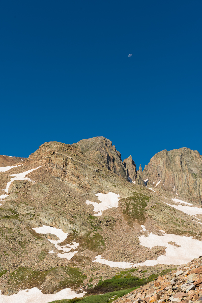
The moon was a nice feature for this climb, adding some interest to my photos and our view above the gnarly pinnacles on Babcock, which impressed us both.
A full on view of Babcock's east face showcased the very nasty terrain we would later find ourselves on.
The upper basin afforded nice views and a small meadow at the terminus of the snow fields.
The summit of Gibbs Peak peaked above the meadow. We both thought the ridge between Gibbs and Babcock looked doable, but it was not on our agenda for the day.
A look back down and across the valley revealed the summit of another obscure La Plata 13er, Diorite Peak, which appeared to have a road going all the way up to the ridge from Tomahawk Basin. We both looked forward to coming back to go up that one.
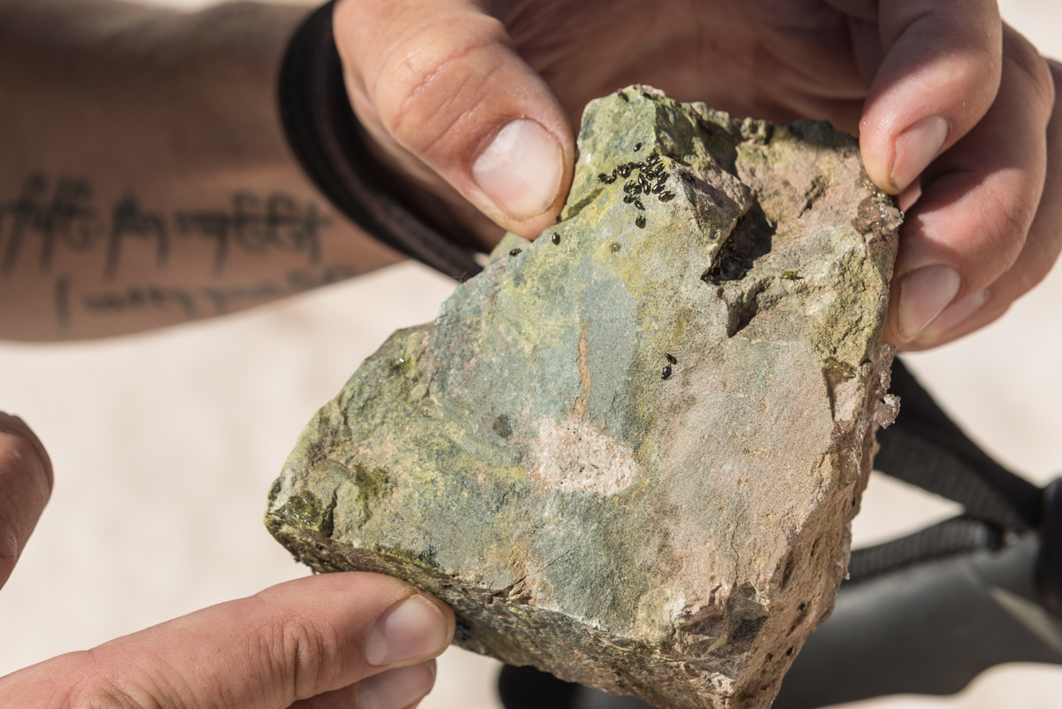
All the way up, we encountered these rocks that were covered in beetle larva, which was pretty interesting.
A view up the last part of the snow ascent before the saddle. This section was quite a slog.
Upon reaching the saddle, our view back across the valley at Gibbs and the top of Lavender (left) was impressive. Later on we saw two people climbing the snow couloir up Gibbs (middle), which looked like quite the challenge!
This is what the terrain near the top of the saddle looked like - nothing too difficult.
We both really enjoyed the view above the Gibbs / Diorite saddle towards the Wilsons and Lizard Head Peak. Scyhuler, being a much more avid rock climber than I, was really excited and is already formulating plans to tackle Lizard Head.
My gaze was more drawn towards Diorite and beyond to Chicaco Basin, the Grenadiers, and the Needles.
The saddle at the base of Babcock presented a nice angle of our final section for the ascent - which was a very nice Class 3+ ridge filled with solid, yet exposed rock.
The crown jewel and highest point of the La Platas, Hesperus, appeared left of Lavender and Gibbs.
Schuyler captured some shots with his phone too :-)
Here is another view of the road going all the way up Diorite. Those old miners were crazy!
A shot of me before our final ascent.
Here is a nice view of what the rock was like up the summit block of Babcock - solid, jagged, and full of awesome.
The exposure was real - here's some perspective looking down the valley to the south.
Schuyler and I celebrated briefly upon reaching the summit - nothing too difficult, but it did appear we were the first of the season. I rate this climb fairly highly based on the terrain and ease of access, coupled with total lack of other people. A really rewarding experience for sure.
Here's me gazing across at the impressive Grenadiers / Needles.
A full 360 degree panorama centered on West Babcock.
Below is a condensed panorama showing Hesperus (left) all the way over to Diorite (right).
My favorite view of all - a cropped version showing the Grenadiers (left) and the Needles (right). I've climbed most of them.
For our route down, we (stupidly) decided to head down another way, down the east face. I'm not sure why either of us thought it was a good idea, but we committed. It was a nasty combination to be sure. Lots of class 5 downclimbing and loose garbage. I would not recommend it.
The shot below does not fully show how bad the terrain really was here. I don't know how many times I need to learn the lesson to come back down the way you came, but I'm hoping this was my last time.
Below is a look back up what we decended. Again, it looks better than it was. We both had on our game faces for this downclimb and were uncomfortable throughout.
That concludes the trip report. Hopefully it was helpful to someone else looking to escape the crowds of the 14ers and enjoy some awesome solitude on a nice class 3+ 13er. A downloadable track and summary of our hike on GPS can be found HERE.
Adventure to Jones Mountain from American Basin

After an amazing day of rigorous hiking which culminated in a successful summit of Half Peak by Sarah Musick and I, we slept at our fantastic campsite in the picturesque valley below Cuba Gulch, near Lake City, Colorado. Instead of taking the longer, more scenic (and steeper) route to Jones Mountain via Cataract Gulch near our campsite, Sarah and I opted to drive over to American Basin and approach Jones Mountain from that side. Usually, climbers looking to summit Jones Mountain approach it from Silverton; however, because Sarah and I were already on the Lake City side of Engineer Pass and were driving a Suburu Forester, we decided to take an alternative route. I had researched our route ahead of time by consulting the out-of-print and quite handy 13er guidebook by Gerry Roach. Upon arrival at the American Basin trailhead for Handies, Sarah and I set-up camp and she decided to quickly hike up Handies since she had never done it before. I decided to stay behind and rest my legs. My ankle was still quite sore from my basketball injury two months prior and my legs were feeling pretty heavy yet from our climb up Half Peak. I spent the afternoon napping by my camera while taking a time-lapse video of wildflowers in American Basin. Upon Sarah's return from Handies we celebrated by opening up some Odell Myrcenary, one of my favorite Imperial IPAs. Good stuff.
After enjoying our beverages, I convinced Sarah to hike up American Basin with me for some photography. The clouds were setting up nicely for sunset and I found a sweet little waterfall which made a nice combination with American Peak in the background. Sarah shot a quick panorama of me setting up a shot in the basin with her phone which depicts the scene quite well I think.
And here's the shot I was setting up to take...
I also decided to hang out past sunset and well into the night in order to get some night photos. I always wanted to get a Milky Way selfie and I thought this spot would be perfect for that shot.
I also set-up for a Milky Way panorama from this spot, relying on the faint light of the moon to light up the hillside.
After freezing my hind quarters off, I decided to head back to camp and hit the sleeping bag for some sleep. Knowing the weather would be great, we decided we would start early enough to get some photographs of the basin at sunrise, but not so early that we would be hiking in the dark. Our route took us up the main Handies Peak trail and then off-route for most of the rest of the day. After hiking about 1/4 of the way up Handies, we split off the trail and started our leisurely stroll up the fragile tundra and wildflowers below American Peak. As the sun began to rise, American Peak began to light up with sweet alpenglow.
The view of UN 13,535 behind us wasn't so bad either...
After enjoying the awesome sunrise, we began to head up the un-trailed section to the west saddle of American Peak. Our target was the lighter colored rocks as seen below. We planned to just bushwhack our way up the side of the mountain.
The climb was not too bad - the hardest section was the loose scree and dirt just below the saddle.
We were quite excited to reach the saddle and get our first glimpses of Jones Mountain.
Our route took us up a very faint trail to the ridge between American Peak (left) and Jones Mountain (right). The hiking was pretty easy going.
Once we were between Jones and American the views opened up a bit and we could see just how rugged Jones looked from this vantage. The summit of Jones is seen at the far right.
We headed down (and then up again)...
Upon reaching the summit of Jones Mountain, we ran into another hiker and his dog. My mind was blown when I realized that the other hiker was Mike Megorden, a friend of mine from high school! We played on the high school football team together. Pretty small world!
Sarah and I celebrated our 16th summit together with views of the Grenadiers and Needles behind us. What an amazing view. Oh, how I had missed this part of Colorado!
I set-up my tripod and shot some panoramas using my telephoto lens. The air was still a bit hazy, which added some interesting tones to the photos. Looking south.
Looking south-east.
Looking east. You can see the rugged ridgeline of American Peak.
Looking north east - featuring Uncompahgre and Wetterhorn.
Looking north.
Looking north-west.
Zoomed in on Uncompahgre and Wetterhorn. I think this one would look pretty nice printed large.
After enjoying the views we decided to head back down. We were contemplating American Peak and would need to make a decision when we hit the American - Jones ridge. The weather was looking 50/50.
A glimpse sideways at Jones' north face reveals how rugged it really is.
I was pretty amazed at how great the flowers still looked for this time of year. Here's a shot of some alpine sunflowers with Jones in the background.
Sarah and I rested at the ridge and decided not to take on American Peak - the weather was starting to look a bit questionable; however, the tundra was quite inviting for nap-time.
Sarah and I took our time heading back, enjoying the great scenery on the way.
Back on the American Basin side, we ran into a huge field of wildflowers which I had to stop and take photos of. I really want to go back and get this same shot at sunset or sunrise someday. Here's a shot Sarah took of me composing my photo.
And the crown jewel shot of the day - a mix of awesome wildflowers with the shoulder of Handies Peak in the background at the right. American Basin truly is one of the best spots in Colorado.
Sarah and I got back to our campsite and packed up. We decided to drive back to Lake City and up Nellie Creek for our next adventure: Uncompahgre Peak. I had done Uncompahgre back in 2000 with my dad, but was excited to see if I could get some photos at sunrise from the top. We cracked open some more tasty Odell brews and prepared for our next adventure...
I hope you enjoyed following along for this adventure up Jones Mountain. Next up: Colorado 14er Uncompahgre.
Climbing Dallas Peak - Roped Up Above Telluride Colorado
August 30, 2013
Distance: 11.5 miles (according to GPS)
Elevation: ~5,700 ft (according to GPS)
Time: 10.5 hrs (4.50 am to 3.20 pm)
Team: Rick McBee, Ben, Matt Payne and Natalie Moran
I suppose I never dreamed of climbing Dallas Peak. First viewing it's full stature from the summit of Mount Sneffels in 2010, I was immediately struck by how intimidating the peak appeared and how overwhelmed I was with a sense of fear and surrender. I'm pretty sure my exact words were, "F*!$ that!" :-)
Fast forward three years and a few climbs later and my attitude towards difficult mountaineering feats has shifted quite a bit. Peaks like Dallas are a now a hearty and welcome challenge in my quest for the highest 100 mountains of Colorado. Ever since reading about Dallas as a boy, I've been fascinated with the technical aspects of how to summit it. When you're a kid, everything looks a lot harder than it really is, and this is especially true of mountains. My mountaineering hero, my dad Ray, never did make it to the top of Dallas, having deferred his quest for the highest 100 for a middle-aged devotion to my baseball career, which surely made him father of the year multiple years running. Knowing Dallas was never completed by Ray made it even more magical and impossible in my mind, just as I had thought of Vestal's Wham Ridge before I also completed it successfully in 2010. Exacerbating my Dallas Peak magical thinking was its extremely short-lived climbing history. The thing has quite simply not been climbed a whole lot. As Rosebrough puts it:
"Interest was renewed in Dallas Peak in 1976 when Spencer Swanger made a solo climb of the peak, which was the last of the hundred highest peaks in Colorado which he had not climbed. Swanger felt that of the nearly 300 climbs he had made, 'perhaps Dallas had been the toughest.' Indeed, only two ascents of Dallas have been recorded before Spencer Swanger's, Don McBride and Everett Long in 1934; and Stuart Krebs in 1956." - Robert Rosebrough - The San Juan Mountains - A Climbing and Hiking Guide.
So, when I received an email from Rick McBee about climbing Dallas and Teakettle on Labor Day weekend, I immediately responded with a prompt "I'm all in." Rick and I became acquainted with each other last year when he sent me a message after I completed the 14ers. He purchased several of my photographs for his company after seeing my shots from my Pyramid Peak and Maroon Peak trip report. I knew Rick as a fellow 14er completer and a very awesome dude. He had also named another accomplished mountaineer, Natalie Moran, as being a part of the climbing party, so my confidence in our success was very high. I had heard great things about Natalie from other 14ers.com members and so I felt great about our odds. The plan was to meet at the Mill Creek Trailhead above Telluride on Thursday night and climb Dallas on Friday morning. After Dallas Peak, we'd head over to Ouray and climb Teakettle Mountain on Saturday. Both mountains demanded the use of ropes and a keen ability for rappelling, neither of which being things that I am an expert in. I warned Rick of this and he assured me it was not a problem at all.
I debated a great deal as to which camera lens or lenses to bring for this trip, knowing I would be doing some technical climbing and quite a bit of tricky maneuvering on shaky terrain. I eventually decided to bring the heavier yet versatile Nikon 24-70 f/2.8 attached to my D800. Strapping the camera and lens to my chest vis-a-vis my Lowepro Toploader would not be too difficult, and I could always opt to throw the camera bag into my backpack for the roped sections. Note and shameless disclaimer: those are affiliate links above, so if you like to shop at B+H and want to help keep the site running, please consider using them.
The drive to Telluride was totally uneventful minus some construction on Highway 50 between Gunnison and Montrose. My last stint through Montrose led me to a Denny's which was not exactly the most vegetarian-friendly establishment. I regretted not doing more research, again, and opted for a trip to Subway before heading to Telluride from Montrose. The trip began well, as I caught up on my email while eating dinner to learn I had won tickets to see Bill Burr at the Pikes Peak Center. Woohoo! A good omen indeed. Per usual Centennial procedure, I consulted Gerry Roach's "Colorado's Thirteeners" book for directions on how to find the trailhead. The description provided by Roach was quite accurate, taking me up an un-marked road exactly 1.9 miles east of the Highway 145 turn-off for Telluride. So far so good. My Subaru Forester made it up the hill without incident and I found both Rick and Natalie's vehicles parked on the side of the road near the end of the Mill Creek Road. I parked my car and introduced myself to Rick and his friend Ben, who was joining us for Dallas. Natalie was already fast asleep in her Forester. I decided to sleep next to them in front of my car, so I would have to test the sleepability of my Forester another night. The stars were out, but only for a brief moment as clouds rolled into the valley.
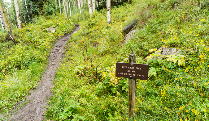
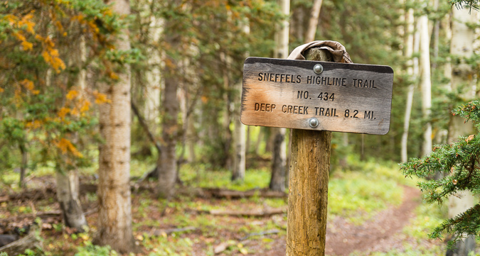
We all woke up at 4:30 AM for a 5 AM start. I introduced myself to Natalie, after having exchanged several private messages with her over the past couple of years on the 14ers.com forum. I knew that Natalie was from Russia, so it was quite awesome to hear her accent. You see, as my wife will attest, I have a thing for accents. They intrigue me, and I love listening to people talk with them. We began our hike up the trail and were immediately stumped by a marked split in the trail, a common occurrence when you begin hikes in the dark. Fortunately or unfortunately, depending on your outlook on the accuracy and usefulness of Roach's route descriptions, Natalie had brought a copy of the route description from Roach's book, which clearly stated to take a left at the signed trail junction, which we eventually did after some debate. Here's a photo of that trail junction taken later in the day on our waydown, which is clearly marked as the Deep Creek Trail.
From this junction, Roach writes that you need to hike another .7 miles through three switchbacks to a meadow at 10,000 ft. and then west through the meadow. For some reason we thought there would be another trail to take after finding the meadow; however, that was our misunderstanding. We found the large meadow in the dark, which continued west and then north. A heavy layer of clouds still obscured our views. We knew we were looking for the Sneffels Highline Trail after reaching a ridge at 10,600 ft. We found this trail without any issues as well, but were confused quite a bit in the dark before finding and turning right onto the marked trail junction as depicted below.
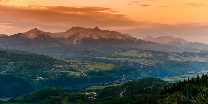
The views from the Sneffels Highline Trail were divine in the early morning light, showcasing amazing scenes of the Wilson Peak group to the southwest of us.
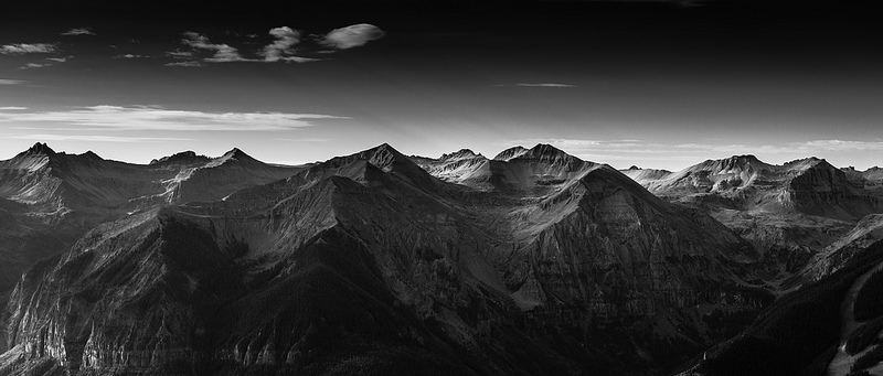
The light hitting the mountains above Telluride was absolutely sublime, and made for quite the stunning black and white image.
We followed up the trail through seven switchbacks as described by Roach and then found ourselves wondering when to start climbing up the slopes of Dallas. We found the trail quite easy to follow but often questioned our location and direction, having to consult GPS and map quite often before agreeing on our next course of action.
As the trail wrapped up and around the southern flank of Dallas, views to the north and west continued to wow us as the morning progressed. We were making great time, taking minimal breaks. I tried to stay back a little so I could get some good photos of the route heading up and of our awesome party.
Rick and Ben were setting the pace and keeping us on the right path, with an occasional team discussion about our next moves. Man, it was great having competent mountaineers on this trip. Rick was a strong leader, and Ben was a true champ.
The sky was pretty overcast most of the morning, but that did not stop the sun from lighting up the San Juan peaks above Telluride, across from us to the south.
We continued up the Sneffels Highline trail and enjoyed our views to the south very much. It was a very calm morning, and we were holding onto hope that the weather would improve and that our day would be marked with success on Dallas.
After losing a little elevation and crossing a small creek, the trail wraps around to the south and west and then across a large grassy area below Dallas, where we began eye-balling our route up to the first cliff bands on Dallas' southern flank, shown as a white band in the photo below.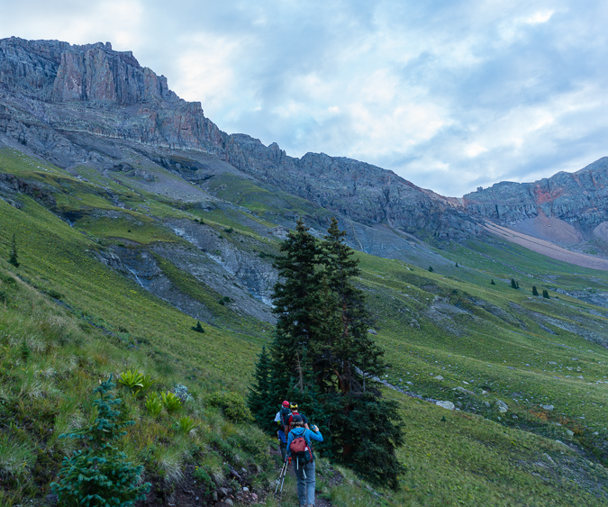
We left the trail at stream coming down from Dallas and fanned out to ascend the very steep grassy slope up to Dallas' cliffs.
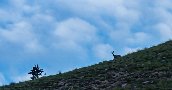
As we climbed, a deer was seen above us on a ridge. I did not have a telephoto lens with me, so this is heavily cropped from the D800 (about 100%).
Natalie sneaked a photo of me taking that shot. It was great having some people other than me taking photos!
Telluride was still looking great in this photo of Natalie as we continued up the steep grassy hillside.
And of course Lizard Head, Mount Wilson, El Diente and Wilson Peak (left to right) looked amazing across the valley from us.
Ben volunteered to take a shot of me heading up with my camera, with the great light behind us. Thanks Ben!
Mount Emma was also looking amazing as we ascended to the cliff bands, with early sun behind.
The lower section of this part of the climb was pretty straight forward, albeit rather steep. There was good rock and grass to grip with our boots, and the larger rocks were quite avoidable through here. We found this part of the climb to be relatively simple with little to no route-finding needed. There were numerous areas that had a clear trail identified all the way up to the cliff bands. We stopped a few times to catch our breath and take in the views.
We were a very strong group, so stops were not very frequent. Also, for not climbing together before, we were quite friendly and the group's conversations were very enjoyable. Rick carried the rope while I did the heavy lifting with the camera. Ben and Rick wore their harnesses all the way up, while Natalie and I opted to leave those in our packs until they were needed later.
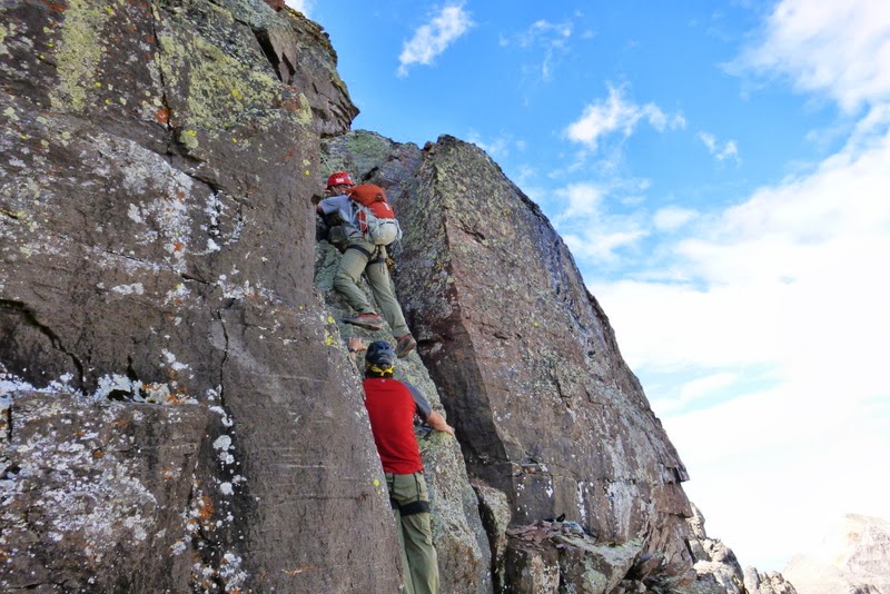
We continued up the easier section without any issues. When we reached the first set of cliff bands, we were a little unsure where to go until some cairns revealed themselves to us and the route up past the cliff bands to the left became obvious. Also, the climbing become much more exciting as we entered some very fun class 3 sections of rock ledges.
Here's a shot of me heading up the class 3 section, taken by Rick. You can also see the general area we came from, having left the trail about where the trees end near the bottom of the rock gully far below.
As we continued up the lengthy class 3 section, the light below Mount Emma improved, illuminating the awesome stream coming down from above.
We found the climbing in this area to be very fun and enjoyable, with only the occasional loose section of rock. Natalie was a wicked climber and did a wonderful job of surveying the route.
Dallas was quite imposing as we reached higher and higher to the base of the peak.
And damn, the light over on the Wilson's was spectacular in the early morning sun.
The terrain got a little more tricky as we kept heading higher on the southern flank of Dallas, forcing us to find fun and entertaining routes up the mostly solid rock. Here's Natalie powering up one of the final sections of this part of the route.
Once up to the end of the cliff band, the route evened out quite a bit and lead us to the west to a notch referred to as 13,000 ft. notch. Rick led the way.
The route heading up to the notch was very straight-forward, we just followed the cliff band and up a boulder field on a very well-established trail.
A look back on the route we took up to the notch.
As we rounded the corner a bit, the route to the notch became even more apparent - stay as far left as possible without climbing straight up a wall.
We stopped just below the notch to enjoy the views.
The frequent rain over the past few months really greened-up the mountain-sides. Vestal and Arrow were just coming into view in the distance (left middle).
A look back at the Wilson Peak/Mount Wilson massif shows the trail we followed up to the notch.
As we reached the notch and rounded the corner to head up the west face of Dallas, Sneffels and Teakettle came into view, filling us all with a sense of excitement and glory.
Once the notch is reached, the fun begins. We immediately began working our way up a fairly obvious route towards Dallas' summit towers above through loose dirt and rocks.
Teakettle was looking quite awesome. I was savoring it already. I was wishing I had a longer lens to get a nice zoomed-in look at the handle of the kettle, but a super-cropped shot from the 24-70 would have to do.
 Climbing up this section was pretty straight-forward, but quite loose. I could see this being a challenging section if there was snow on the ground still or if significant rain had happened prior to the climb. There seemed to be a feint trail all the way up to the class 4 section on the west face. The trail led us up this loose gully that was directly against the face of the peak, and then over some ledges to the west.
Once over the ledge system we reached what was clearly the class 4 section. To our left was an impassable chimney and to our right was a huge drop-off into the basin between Dallas and Sneffels. We worked our way up to the base of the class 4 section and mentally prepared for the steep rocks that awaited us above.
Finding the class 4 section was not hard, but locating a route up it was quite the challenge! I love class 4, personally, so I was very happy to find this section, as I had mostly forgotten about it from the route descriptions I had read. A look back down where we came up showed just how steep the west face was, but it was certainly nothing too hard, in my opinion.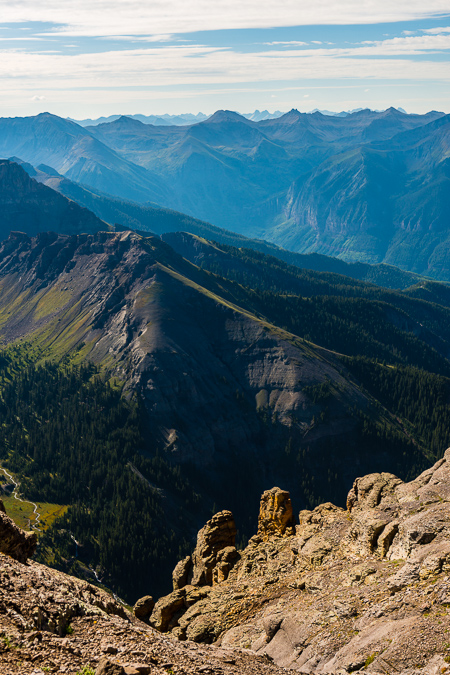
Approaching the class 4 section was not hard, but it was strewn with a lot of loose garbage.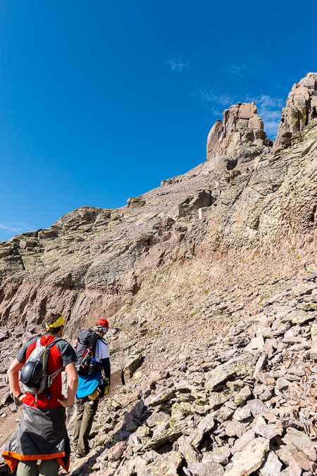
I kept my position as caboose and Natalie fired off some shots of me coming up the class 4 section, which I found to be quite exposed but very solid.
I continued to enjoy the views of Sneffels as we continued up the side of Dallas.
We found the class 4 anchor station, which we figured some people used to rappel down the class 4 on the way off the mountain.
At this point, the route became looser and steeper, but nothing overwhelming in nature. We followed the loose scree up to the first crux below the summit towers.
A look back towards Sneffels revealed some awesome hoodoos on the ridge. What a cool geologic playground.
Almost to the first crux, Ben and I stop to revel in the San Juan glory behind us.
We reached the first crux, which was quite obvious and marked at its base with a cairn. This chimney looked very challenging and I was wondering how I would get up it with my camera on my chest.
Thinking that would not work out so well, I opted to put my camera bag away and head up the same way as the rest of the group. The chimney was low class 5, for sure.
I found ample but difficult handholds on the left side of the chimney and worked my way up to the first ledge seen just above Ben's yellow bandana above.
From this ledge, the route becomes a little less obvious, and the footing is somewhat unstable due to the slope of the rock you are standing on; however, I decided to head to the left through an awkwardly diagonal weakness between rocks.
We did not rope up for this short section, but I think some parties might benefit from a rope at this spot for some added security and peace of mind.
Natalie captured a photo of me coming up the small chimney from above. 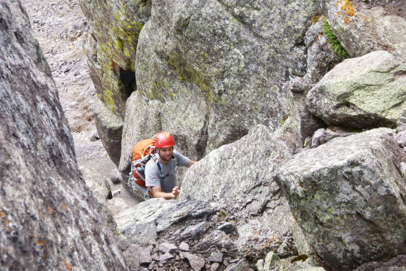
A view from above, shot by Rick:
 |
 |
Here's another view looking up from the bottom, showing the general line you take to reach the top of the chimney.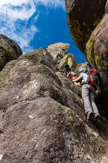
We also found an anchor at the top of the 1st crux and figured it was used to top rope the chimney. Photo by Natalie.
Once past the chimney, we were a little perplexed as to where to go next. Ben and Rick study the route in this photo from Natalie.
The route was not obvious at all. Roach describes down-climbing from here, but we found no such need or desire. The only way that looked even do-able was a ledge system going up and around the north face of Dallas, which had dramatic exposure as seen in this photo snapped by Natalie. Would you downclimb here? No - thanks though Roach.
Following a lightly worn area of rock up a small series of ledges proved to be the best bet.
At least the views were still holding up.
We found it difficult to find the summit pitch, but some sleuthing by yours truly discovered a dirt gully leading up to a ledge which was at the base of the summit pitch, which looked quite challenging. Rick set-up his rope and got down to business as soon as Ben arrived to belay.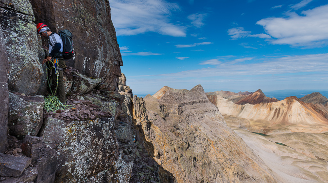
Here is another view of the dirt gully leading up to the summit pitch.
Rick placed only one cam for protection before reaching a belay ledge about 30 ft. above. Our route went right over the first boulder and then up to the right.
After watching Rick tear up the face to the belay station, I took one last look over at Sneffels and Blue Lake before mentally preparing for the ascent up the face. Rock climbing is not really my area of expertise, with only a few other forays into the alpine roped climbing arena in my past. Ben ensured I was tied in correctly and helped clean some mud off my boots.
Natalie got one last photo of me before my first alpine ascent in several years. Adrenaline started pumping.
A look up revealed my route. Nothing too crazy, right? That's Rick perched up there with the white hat barely showing. Oh, and hey, an appearance by the moon.
Up we go into the crazy class 5 crux. I found it pretty tough in muddy mountaineering boots, but managed to find some solid footholds with the help of Ben's finger pointing out some spots for me to try. Photo by Natalie.
A patient and watchful Rick watched from above. I'm not sure if I should be happy or disturbed he got photos of me while belaying. All is well that ends well. All joking aside, Rick was an awesome leader.
Once up the 1st big boulder, climibing became quite a bit easier.
After I unclipped, Rick threw the rope down to Ben.
Ben topped out with ease and enjoyed the views of Sneffels while Natalie roped up.
Natalie made it up to the belay station without any issues and Rick continued up the route. We found the next section to be a bit easier.
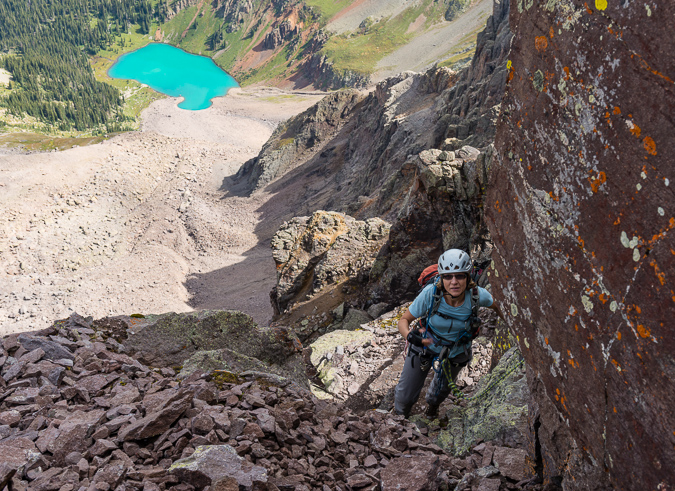
Rick went first and got to the top within about a minute. He setup a belay and I went 2nd, deciding to clip in for added security. The final section was exposed but there was a lot more handholds and footholds to choose from and it felt very low class 5, perhaps class 4. I reached the top of Dallas and was overwhelmed with joy. What an amazing climb! Natalie came next, and I was able to document her topping out beneath Rick's "meat anchor."
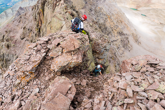
Natalie was just as excited to get to the top as I was.
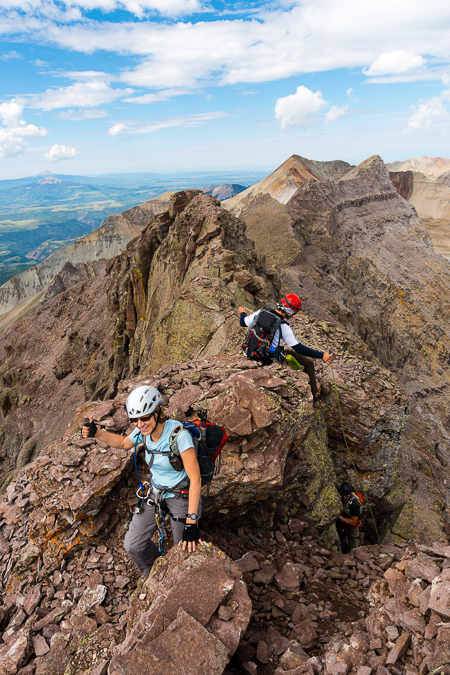
The views from Dallas were expansive and incredible. Blue Lake was awash in light. This panorama is pretty huge. In the full resolution version, you can see all of the buildings at Telluride and make out people on top of Sneffels. Click on it to go to my photography gallery.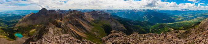
I was all smiles on top of the world. Only 18 more Centennials to go!
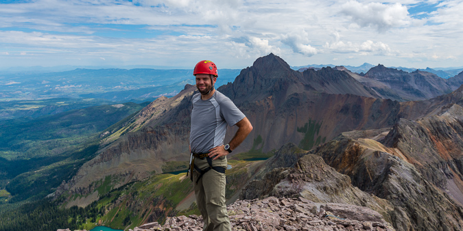
Natalie got a great shot of me after I fired off my summit panorama.
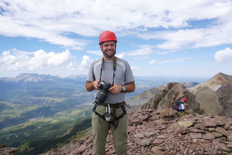
After enjoying some lunch and watching the storms build to the west, we decided to get a group photo and prepare for the rappel off the top.
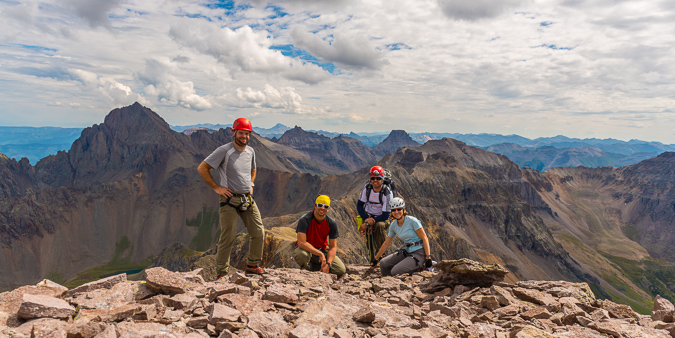
Rick set up the rappel and everyone gave me a needed refresher on rappelling. Rick went first and I went second. Setting up the rappel for this was a bit tricky. Natalie let me borrow some cord to anchor myself to the anchor and then I got onto the final ledge and roped up. We had about a 90 foot rappel off the west face of Dallas, which contained some interesting rappelling features. First of all, as soon as you step off the edge, the rock inverts and you're off to the races. Second of all, you have to aim for a hole between a giant car-sized chockstone below, about 60 ft down. Natalie got an awesome shot of me moving into the first part of the rappel.
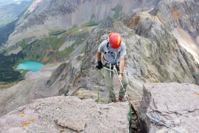
I think the rappel was even more heart-pumping than the climb up. Don't get me wrong, I really enjoy rappelling, but it had been at least two years since my last rappel and I was hanging off the side of a huge mountain. Amazing stuff.
Once I popped through the hole below, I was ectatic. I photographed the others coming down through - here's Natalie.
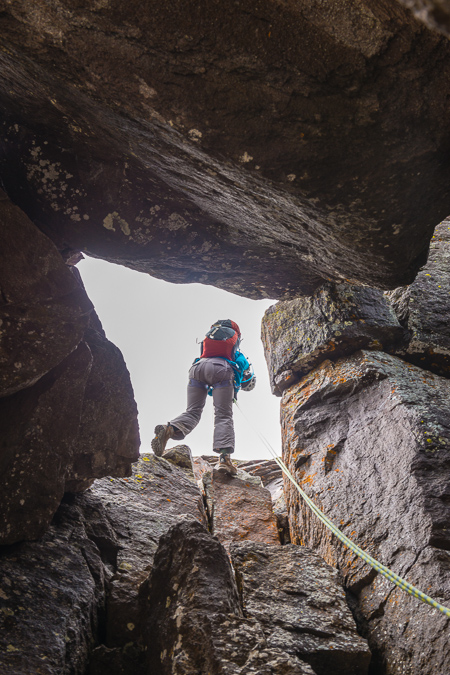
Our fearless leader awaited us below.
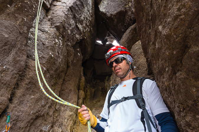
Another view of the hole we rappelled through, this time Ben coming down.
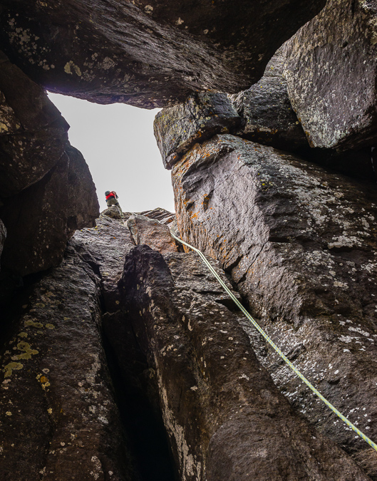
After the rappel, we head down pretty fast. I took a nice tumble on the class 3 section on the south slopes and got a few cuts, nothing too crazy. We made it down to tree-line just as rain began to move in.
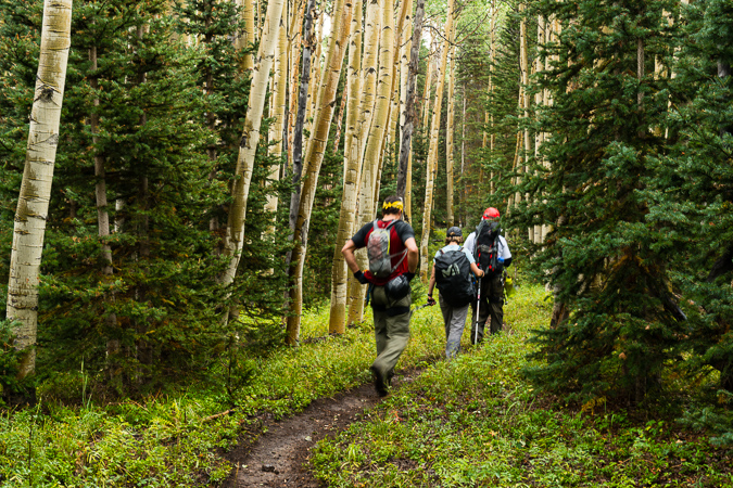
We reached the infamous meadow that Roach refers to and I decided to get a parting shot of Dallas above.
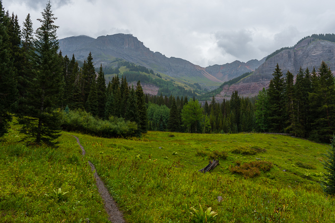
Back at the parking lot, we conspired for our plan of attack on Teakettle for the following day.
Overall, I would rate Dallas Peak as one of the hardest Centennials (highest 100 mountains in Colorado). The long, steep approach coupled with the challenging route-finding and intense class 5 climbing as well as the bomber rappel make this one of the most demanding peaks in Colorado. So far, I think Dallas would be rated as the hardest mountain I've climbed to date. As far as route-finding goes, don't rely to heavily on Roach. We found his descriptions somewhat lacking, especially on the upper section of the route after the 1st crux. Study our photos carefully and you should have no problems finding your way if you should choose to attempt Dallas. I would highly encourage other climbers to use Natalie's GPX file and reference her trip report as well. Here's a map and a rough hand-drawn route to reference as well.
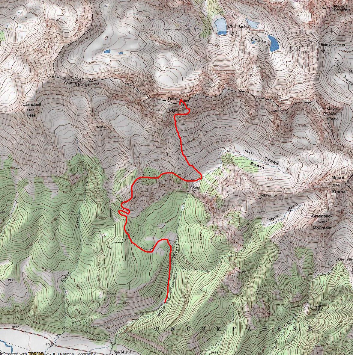
For more information on travel and lodging in and around Telluride, check out this site, full of great information.
Lastly, I want to thank my amazing climbing partners, Rick, Natalie and Ben. These three were amazing to climb with and I could not be more happy with how our climb went. Next up, Teakettle...
Perseid Meteor Shower at Ice Lake Basin and a climb of Vermillion Peak
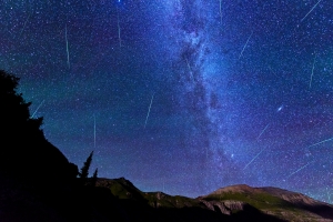
When the dates for the 2013 Perseid Meteor Shower were released, I knew I wanted to schedule some time in a very remote location to capitolize on the opportunity to capture as many meteor shower photos as possible. I did a little research and took a look at my remaining Colorado Centennials that were left to climb and enthusiastically declared that the Ice Lake Basin would be the perfect location. I knew that the trip would be amazing for a photographer, but perhaps boring for someone that is not into photography. I reached out to my friend Ryan Fonkert to see if he would be interested in joining me on a tour-de-Ice-Lake-Basin to shoot the Perseids and to climb Vermillion Peak. Without any hesitation he said he would join me.
Photographing meteor showers has only recently been something I've wanted to do, and my first successful foray into that realm of photography was back in December 2012 for the Gemind Meteor Shower, where I was able to come away with this photo:

Ice Lake Basin has long been on my radar as a location to visit. Ideally, I wanted to visit the area during the peak of wildflower season due to the idyllic photograpy opportunities afforded at the upper Ice Lake. Unfortunately, the Perseid Meteor Shower falls in mid-August, so this time would have to mostly be a scouting mission for wildflower-style photos.
Ryan and I carved out a chunk of time on our calendars to coincide with the Perseid Meteor Shower peak; we went with Sunday, August 11th through Wednesday, August 14th, knowing the Perseids would peak on Monday night, but also allowing us some flexibility in case of weather or other uncontrollable variables. We made preparations to spend three nights at 11,000 ft and higher, with weather forecasts showing significant rain and/or snow. Sunday afternoon we gathered at my house and departed for the long journey from Colorado Springs to Silverton via Highway 50. I was particularly excited for this trip for a billion reasons, one main reason being that Ryan and I had a ton of interests and world views in common. We were both atheists, both photography geeks, both vegetarians, and both fairly liberal in our political beliefs (don't hold it against us). It was going to be great to be able to chat about all of those awesome topics while camped in one of Colorado's premeir backpacking destinations.
We stopped in Montrose for dinner and wound up at Denny's. How sad for two vegetarians. I'm going to have to do more research before the next time I pass through Montrose needing food. The waitress looked at me really oddly when I asked her to withhold the giant sausage that came with my breakfast skillet, but the food was decent enough and the high sodium would probably be a benefit for the hike in. Since both Ryan and I were mostly heading in to do major photography work, our packs were insanely heavy. I was carrying a similar load as to what I had taken up Grizzly Peak a few months prior, with the additon of a couple more lenses and some large filters for my Nikon 14-24 lens.
Ryan and I were able to reach the turn-off for the South Mineral Creek Trailhead, located just two miles north of Silverton on Highway 550 at around 9 PM. We opted for the short-cut along the Clear Lake Road as described in Roach, which shaves off about a mile and a half total for the hike in and out of the Ice Lake Basin. We loaded up our packs (mine was just over 60 pounds) and head out. We were immediately greeted by the loud and insane waterfall described in Roach, which was highly enjoyable to cross beneath in the dark with 60 pounds on my back.
Here is a full list of photography equipment that I brought on this trip and the approximate weight of each item. I purchased a new tripod and ballhead for this trip alone, because my other tripod, while solid, was quite heavy. The new tripod and ballhead weighed less than half as the old setup, which helped some on weight, no doubt.
| Item | Weight (lbs) |
| Feisol Tournament CT-3442 Tripod w/ Photo Clam Pro Gold II Easy PQR Ballhead | 3.3 |
| Nikon D800 DSLR w/ Kirk L-Bracket | 2.8 |
| Nikon 14-24 f/2.8 Lens | 2.0 |
| Nikon 24-70 f/2.8 Lens | 2.0 |
| Nikon 50mm f/1.4 D Lens | 0.5 |
| Nikon 105mm f/2.8 D Micro Lens | 1.5 |
| Fotodiox Wonderpano Filter Kit w/ 5-stop ND filter & 6x8 grad ND for Nikon 14-24 lens | 2.0 |
| Nikon 300mm f/4 D Lens | 3.0 |
| 1.4x Teleconverter | 0.5 |
| Total | 17.6 |
The skies were quite clear on the hike in and we were thinkng we would be afforded some great opportunities to capture some meteor photos on the very first night; however, mother nature had other thoughts in mind. The hike in was quite uneventful until we reached what we believed was the lower Ice Lake Basin. I took out my very bright Brinkman light, which I use for light painting of distant foregrounds for astrophotography. The light was able to show us the area and we headed towards the very upper section of the lower basin. After some wandering in the dark, we stumbled upon an amazing campsite right next to the creek and a huge waterfall nestled at the very edge of the basin. The campsite was equipped with a ready-made bear-bag tree and someone had even salvaged some old mining equipment to form a nice metal bench next to the fire-ring, which we never did use. We setup our camp in the dark quickly so that we could venture out to photograph some meteors; however, by the time we finished setting-up, clouds had already moved into the basin, obscuring our view of the stars above. I was able to get one kind of cool photo of the night skies the first night while utilizing the Brinkman light to illuminate a distant mountain-top to our north east.
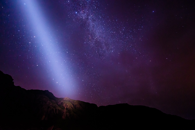
After a failed attempt of photographing the night sky, we decided to hit the sack and see what the next day would bring. We awoke pretty early and the sky was already filling with dark clouds. Sure enough, the sound of thunder came early, around 9 AM and we were more or less stuck to our camp area for the duration of the day. Not that we were complaining though, Ice Lake Basin is a pretty great place to be "stuck" for the day. We had pockets of sunshine and decent weather, so we kept going out around the basin for short photography hikes and then back to camp when weather became nasty. This yielded both Ryan and I many opportunities to capture some great images, especially of the ubiquitous waterfalls that were in the lower basin. It was one of the most awesome places I had ever camped, and I am eager to return, no question.
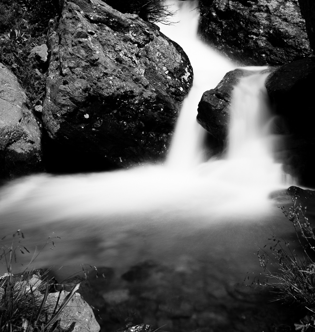
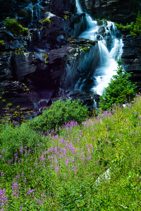 As I mentioned before, our campsite was nestled against the headwall of the upper basin and was directly below a huge series of waterfalls that terminated in a huge field of wildflowers. It was really quite the scene and kept our minds off of the occasional thunder we would hear above. I took advantage of my 9-stop ND filter for taking photos of the waterfall and enjoyed the challenge of the changing light. There were endless opportunities to take photos of the waterfalls and I think I could have probably spent an entire day looking for a better composition or angle. I know Ryan came away with some real stunners too.
Ryan ventured off across the basin to photograph his own waterfalls while I tended to the huge one behind our campsite.
I tried a variety of spots near our campsite and ventured quite closely to the incredible series of waterfalls that came from the upper basin just above us to the west. I don't generally processing in black and white a lot, so I decided to shoot for black and white instead of color for the waterfalls, focusing more on the available light vs. the colors in the area. It proved to be a great way to study the subject and yielded some fairly good results I think. I loved the textures and lines that intertwined between both the rocks and the moving water and really loved how the ND filter treated the scene with a silky smooth aura.
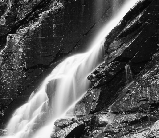
Black and White waterfalls taken with a 9-stop ND filter - a study in light and texture.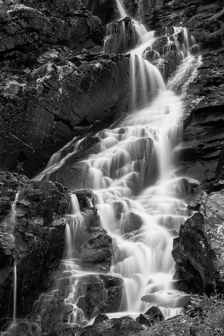
Ryan and I had a lot of time to kill due to the less-than-stellar weather in the basin, so we took turns taking shots of each other. Here's Ryan sporting his Sony and Minolta equipment and myself rocking the Nikon gear on the new tripod.
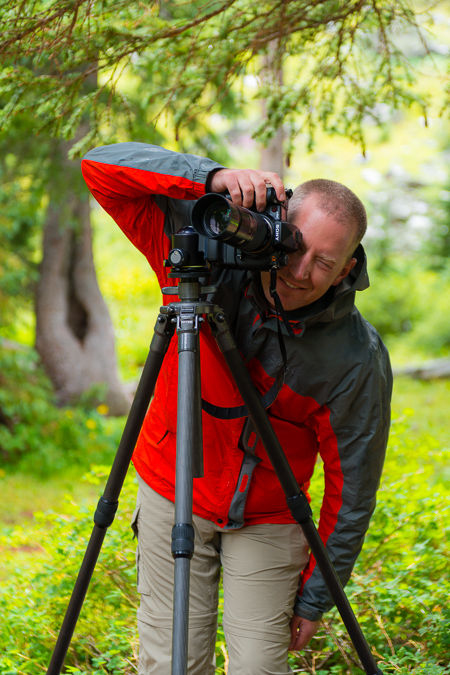 |
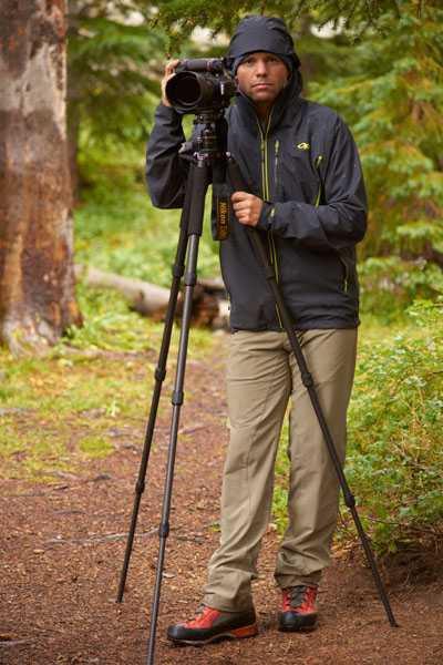 |
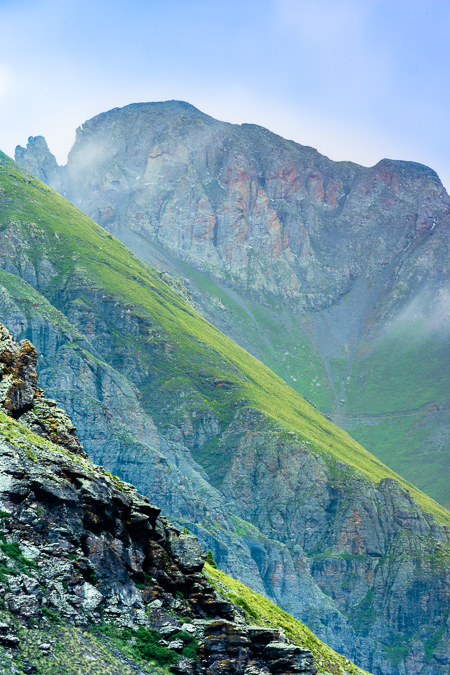
The "on again-off again" weather was both annoying and awesome. On one hand, it kept us close to camp, but on the other hand, it kept bringing in some interesting light and photography subjects to keep us busy. The heavy moisture in the air had created a lot of cool fog-like features in the valley below. Water vapor would rise up from the valley and up into the mountains across the valley from us. As we watched the weather continually change, the temperature kept fluctuating as well, keeping us on our toes and in and out of various layers. It also gave us some opportunity to widdle down on the over-abundance of food we both brought into the valley with us.
Even though the peak of wildflower season had passed, I was quite impressed with the quanitity and quality of wildflowers in the lower basin. I spotted all kinds of amazing flowers, including the Indian Paintbrush, Rocky Mountain Columbine, Mountain Bluebells, Parry's Primrose, Rose Crown, and more. I felt pretty happy to have brought the 105mm macro lens as I'd always wanted to get a nice macro shot of an Indian Paintbrush, so I ventured off to find the best one near our campsite. I found a few good subjects close-by and captured a few decent shots of one.
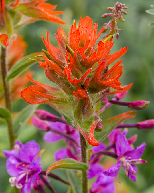
As the light shifted and the day progressed, I kept my eyes on a huge field of purple wildflowers up the hill from us. The sun shifted perfectly and I ran up to get some photos there. I was even lucky enough to get a rainbow in the photo, which was a huge bonus, no doubt. The field also looked out into the distance at one of the more impressive peaks of the area - Sultan Mountain.
As the storms passed over, I grabbed a self-photo from the wildflower field. What a peaceful place.
At this point, Ryan joined up with me from the area he was photographing from near the huge string of skinnier waterfalls across the basin from our campsite. He told me I could probably get some awesome shots over there with my ND filter, so I headed that direction, but not before he fired off a hero shot of me carrying my gear.
I headed on over to the fast-moving waterfall system up the hill from us and found some amazing scenery there - wildflowers galore with a raging waterfall, including more of those purple flowers and some Columbine as well.
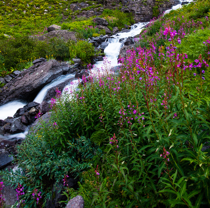
I had to climb onto a really precarious island with cliffs and waterfalls on each side to get this shot of these magnificent Columbine.
I headed on back down towards camp and noticed the light continue to improve through sunset. I decided this would be the perfect opportunity to finally get to use my Fotodiox Wonderpana Filter system for the Nikon 14-24. As you may or may not know, the Nikon 14-24 is probably the best full-frame wide angle lens you can get, but it has one major flaw - it is unable to take filters since the lens hood is built into the lens. To compensate for this, you have to get elaborate and complicated filter systems if you want to use filters on this amazing lens. Filters are pretty important for certain applications like the highly dynamic light at sunrise or sunset, where the sky is very bright but the foreground is dark. To adjust for this, you use what are called graduated neutral density filters which basically are dark on top and clear at the bottom, allowing you to expose for the foreground and still get a perfect exposure on the brighter sky. This worked out pefectly for this sunset shot I took from the stream.
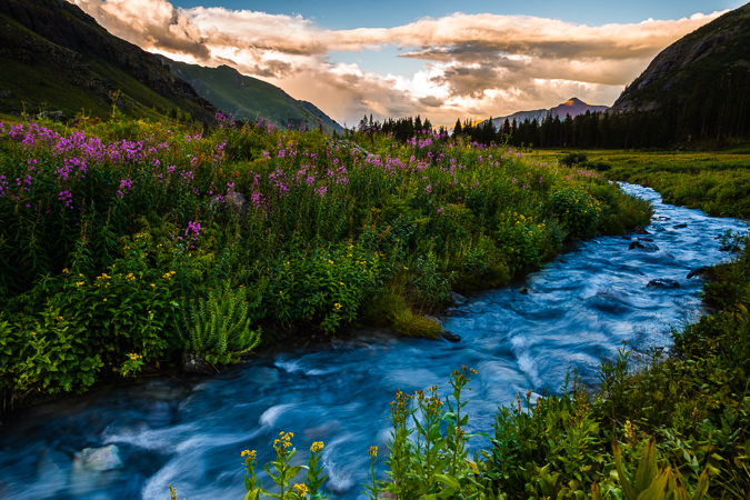
After getting some dinner and packing some of our things away, we kept a close eye on the clouds above, knowing that this second night would be the peak of the meteor shower. The clouds began to clear out, so we decided to head up into the upper basin and find a good spot to get shots of the Perseids. The hike up to Ice Lake from our campsite was pretty easy and finding the lake was no problem at all, even in the dark. As we set-up for our photos, we began to get nervous as the clouds began to return and we could see lightning in the distance to our north and west. Not good! Either way, I wanted a few shots from this area at night, so I set-up my tripod and got a few photos. The moon had not quite set yet but was behind some clouds, which made for a wicked silhouette of Golden Horn.
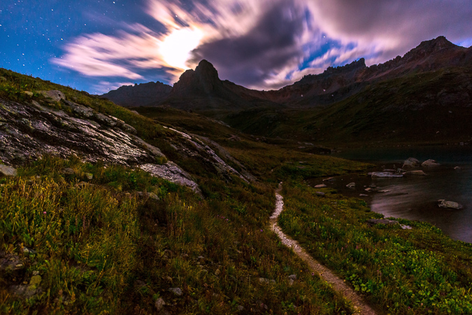
Additionally, the Milky Way made a brief appearance as well with the moon lighting up the passing clouds above.
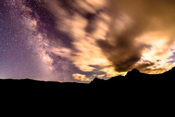
Having seen some lightning and not really knowing how our luck would last, we decided to make the safe decision and head back down towards our campsite, which was very frustrating. I was hoping to setup at the shores of the lake for my meteor shower photos, so I was a bit disappointed; however, about halfway back down from the upper basin we noticed that the clouds had decided to dissipate, so we found a safe and acceptable spot with a nice clear view to the north and east where the Perseid Meteor Shower was radiating from. We setup our tripods and started the fun of doing a long series over several hours to capture as many meteors as possible. The moon was still high enough to light up the foreground too, so it made for a fairly decent spot to get the meteors from. I was quite pleased with my results, netting 19 meteors in total.
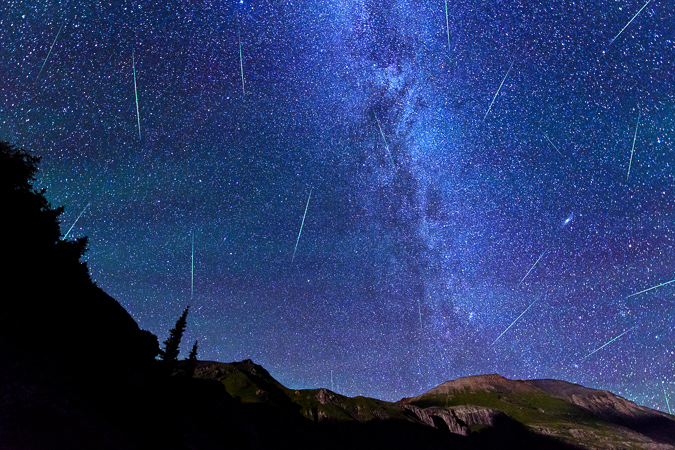
After freezing our butts off for a couple hours, we began to pack up our things, but not before I attempted a vertical panorama from horizon to horizon of the Milky Way. Before I was able to get this shot, I noticed that my lens was covered in condensation, which was a real bummer. I wondered how long it had been this way. I went into my camera to see and only a few shots were ruined. The temperature change from having the camera in my chest pack during the hike up and the very cold night must have caused the condensation - lesson learned!
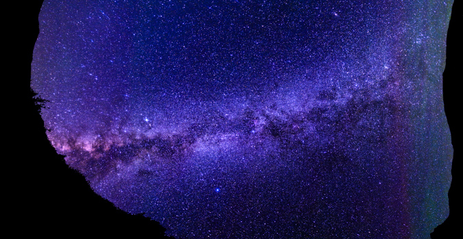
We head back down to our campsite without incident (other than some super cold toes) and went to sleep, prepared to attempt Vermillion Peak in the morning.
We got up a little later in the morning than I'm normally used to for summit attempts, but we were up really late taking photos of the meteor shower. It is always a challenge for me to balance my desires for mountaineering and my desires for photography. While they make quite a synergistic pair, they also sometimes compete with each other, mostly because of the time factor. We made it up to Ice Lake and were blown away at the beauty of this magnificent lake. I've never seen a bluer lake in all of my life.
I already knew I wanted to come back to the lake another time of year and get sunrise photos with wildflowers. It was just the most insane spot!
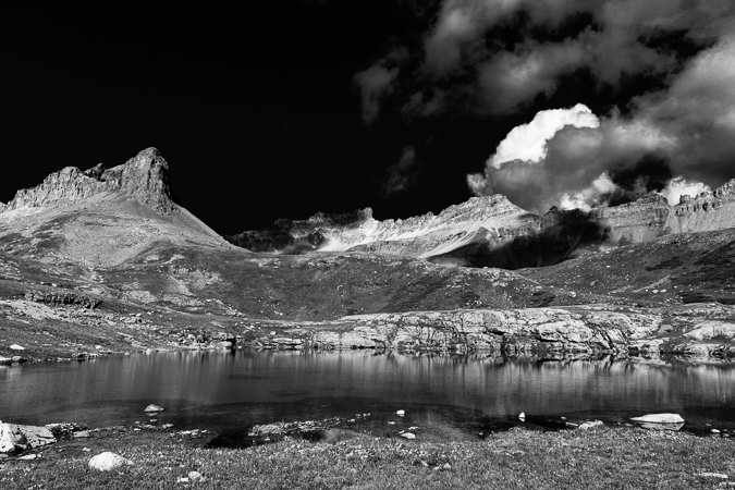
We found another small lake on our way up towards Vermillion and it was surrounded by wildflowers, including this nice Rose Crown as seen in the bottom left corner. Golden Horn made a nice reflection in the lake, and we could finally begin to make out Vermillion behind it.
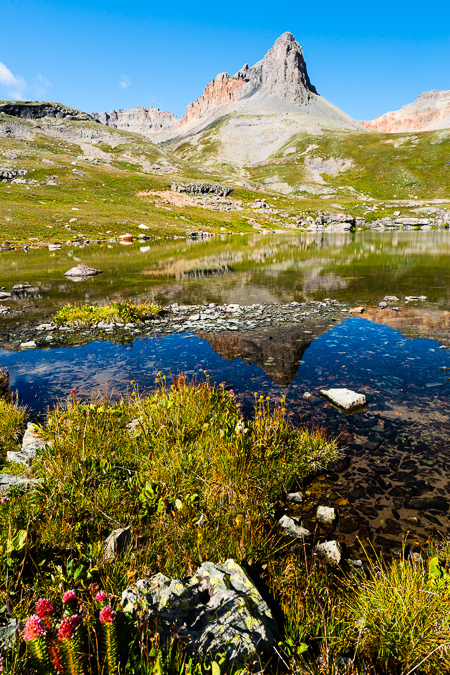
The trail ascended up into the upper basin towards Fuller Lake and the views back down at Ice Lake were intense. I was still blown away by the blue hues in the lake.
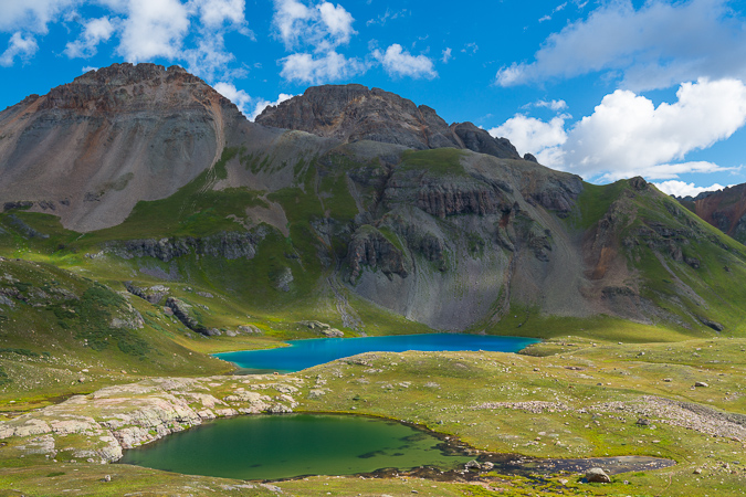
Climbing further up the trail provided some great views of Golden Horn, which demanded a great deal of respect. The naming of Golden Horn was quite apt, as the sides of it were quite golden indeed.
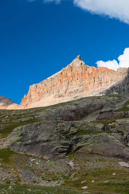 |
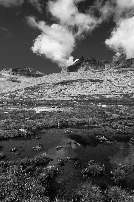 |
As we got further up the basin, we found yet another pond with Fuller Peak (left) and Vermillion (right) towering above. In addition, there was a really interesting building up there, or at least the remains of one. We speculated as to what the purpose of the building was, settling on the thought that it was probably used up into the middle of the last century for miners.
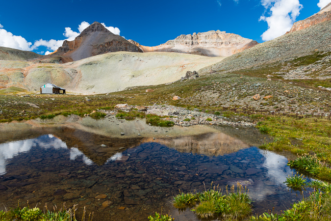
The building was in pretty good condition, with an intact roof and even some old bed springs still inside.
A look back over at Golden Horn revealed that weather seemed to be moving in, but it still seemed pretty spotty. We noted the weather and kept moving up the basin, weaving up a short boulder field above the structure to find a nicely worn trail with numerous cairns.
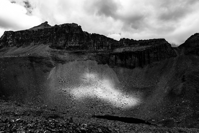
We could make out the nicely worn trail heading up to the saddle between Fuller and Vermillion, and kept heading in that direction.
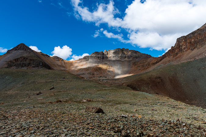
The trail brought us up a nice rocky bench towards Vermillion and was a very pleasant hike up. The clouds continued to hold, so we kept on trucking. A look back at Ryan showed I was keeping a pretty good pace. Ryan indicated to me to keep going at my own speed, so I did.
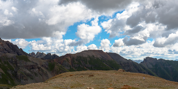
We reached a small stone fortress near the end of the trail and stopped to put on some rain gear as light graupel had begun to come down. The weather still seemed OK but I must admit I was getting a bit nervous. We continued up and lost the trail at the base of Fuller, so we began to weave across a large loose boulder field, which proved to be a huge pain in the butt to cross.
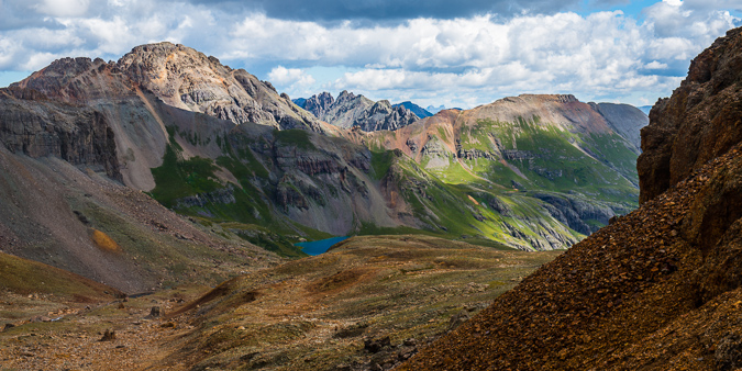
Once we were able to get through the loose and physically rigorous boulder/scree fest, we found ourselves looking down and across at the proper trail. Oh well! We made our way across the boulders to the trail without any issues.
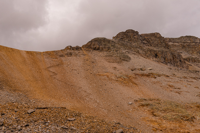
I was able to quickly make it up the saddle - my legs were feeling really great despite the lack of recent climbing I had done this year. From the saddle, I could easily make out a lot of mountains in the area, including the famous Wilsons, the distant Grenadiers and a really awesome looking peak to the south west that was covered in small bits of snow from the recent storms.
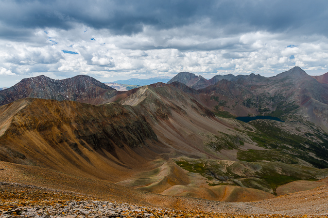
A look over at Fuller proved it was not a very long distance from the saddle, and I made tentative plans to come back and grab that peak if time and weather permitted after Vermillion. Looking back down at Ice Lake revealed Ryan's position about a quarter of the way up the trail to the saddle and all of the lakes we had passed throughout the day's journey. What an amazing view it was.
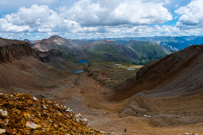
In the distance to the east I could now make out Uncompahgre and Wetterhorn, which is always a nice treat!
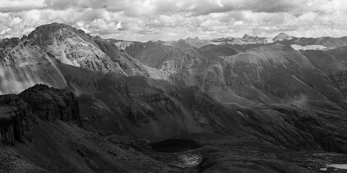
From the saddle, the trail leads up the back side of Vermillion. The trail is very well-worn and easy to follow. The rock on the back side was also very interesting.
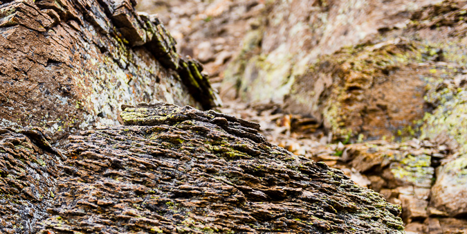
A look back down towards the saddle showed just how worn and accessible the trail really was. It was also awesome seeing the Grenadiers in the distance above the ridge.
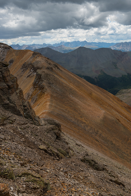
I reached an obvious end to the trail which had wrapped around the back side of Vermillion on a series of ledges and realized that it was time to head up a steep gully and onto the upper section to the summit, which was all fairly obvious to me at this point.
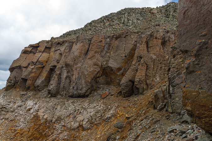
Once I reached the top of the golden gully, I looked back and down towards the awesome snow-covered mountain, which I later realized was one of the many mountains in Colorado named Grizzly.
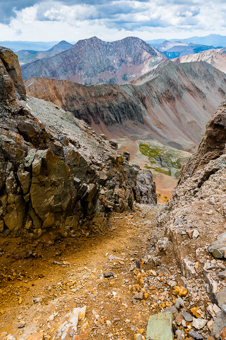
You could also make out Engineer Mountain beyond Grizzly to the south. I was able to reach the summit without any issues and was amazed at all of the green rocks on the summit. I guess it is pretty obvious why the mountain was named Vermillon.
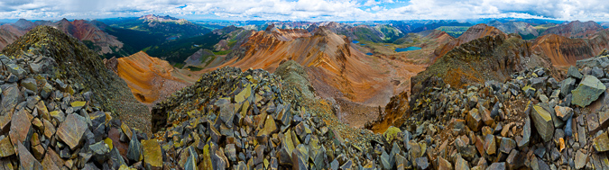
I posed for a few self-portraits using my tripod while I watched the weather nervously. The view of Golden Horn, Pilot Knob (just to my right), Sneffels (in the distance) and other notable San Juan giants was pretty killer from Vermillion.
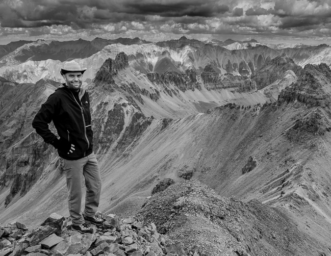
I snapped off one more set of panoramas.
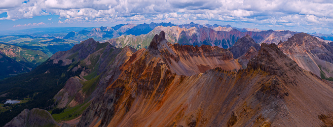
A look to the west caught my attention. Out of nowhere a giant storm had developed, with what appeared to be significant precipitation. I hastily packed my things and head back down towards the saddle. I ran into Ryan about halfway back to the saddle, where he had decided to give-up due to fatigue. The storm passed us to the south, fortunately, as seen below.
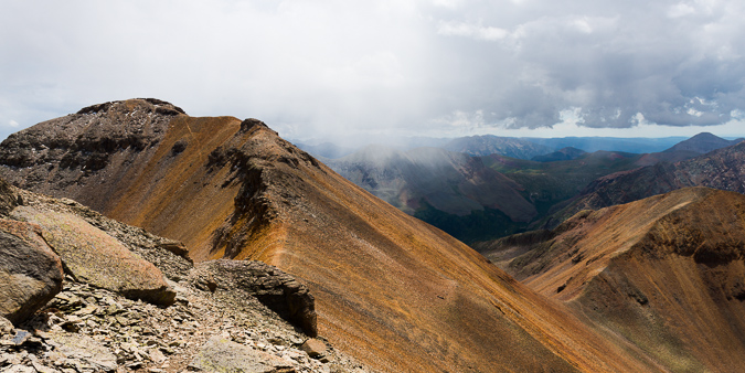
I reached the saddle fairly quickly and told Ryan I was going to head up and get Fuller really quickly. I made short order of Fully, ascending in just 10 minutes. From there, I was able to survey the basin again, with some interesting views back down towards Ice Lake and back at Vermillion.
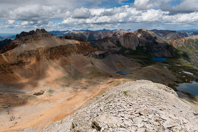
On my way back down to the saddle, I was momentarily pleased with the bright colors and contrast between the red rocks on Fuller and the green vegetation below at Lake Hope, which rested at the foot of San Miguel Peak to the west.
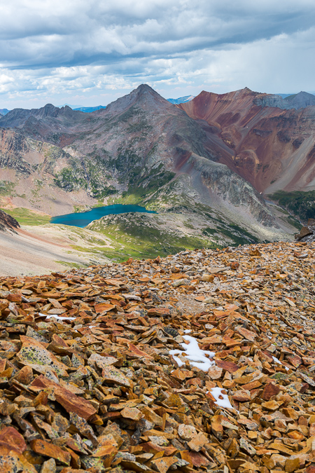
I rejoined Ryan at the saddle and we made it back over below the rock shelter that sat beneath Fuller in no time at all.
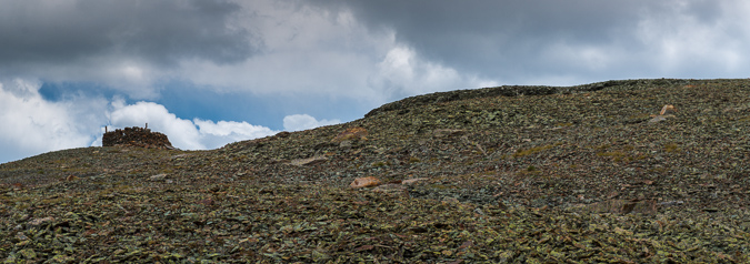
A look back at Vermillion showed Ryan and the scope of the peak we had just came down from.
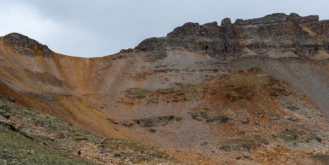
Ryan and I were amazed at just how much old mining equipment was just left up there. We saw lots of large tubing strewn about the mountain and even this handy wheelbarrow that looked to be quite old.
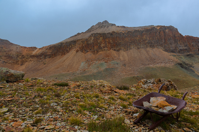
Coming down the basin was not a problem and the weather cooperated to our surprise and glee. Ryan and I took frequent stops to take photos of the area.
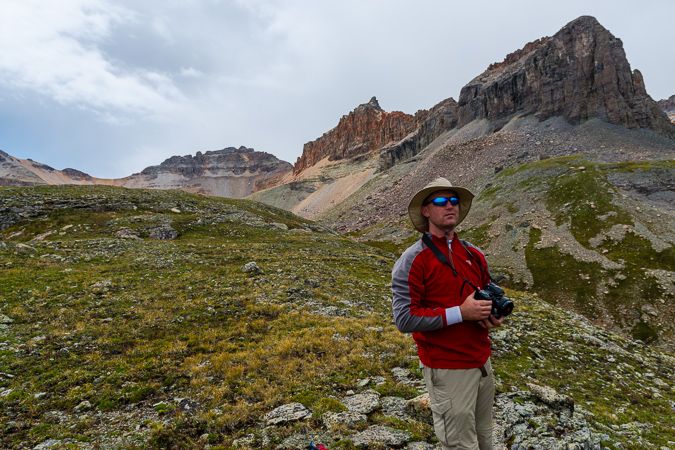
On the way down I found a very small pond with a large boulder in it that made for a nice landscape scene with Vermillion and Golden Horn reflected in the pool.
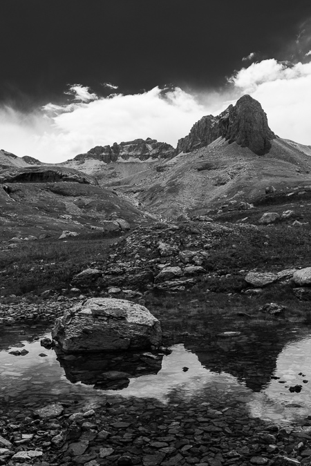
Once back down at Ice Lake itself, we stopped for some quick photos. I found some Rose Crowns and did a little focus stacking to get both the flowers and the distant peaks in focus.
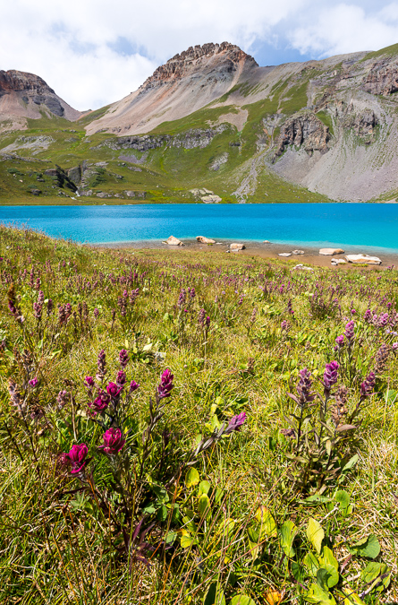
You can really see how this basin would be incredible when the flowers are at their peak. I also found some interesting rocks on the shore to photograph from, and Ryan was able to get a photo of me perched on one of the rocks preparing for a shot.
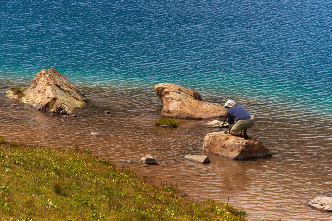
And here's the shot I was composing.
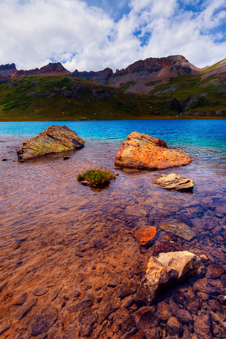
Once we finished up at the lake we head back down the trail towards camp. We found a great vantage point where we could see Sultan Mountain and the lower Ice Lake.
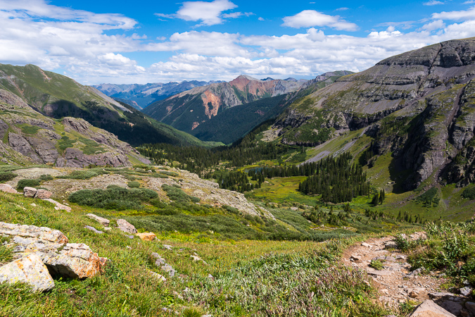
Here is a map of where we were at and what routes we took on the various days.
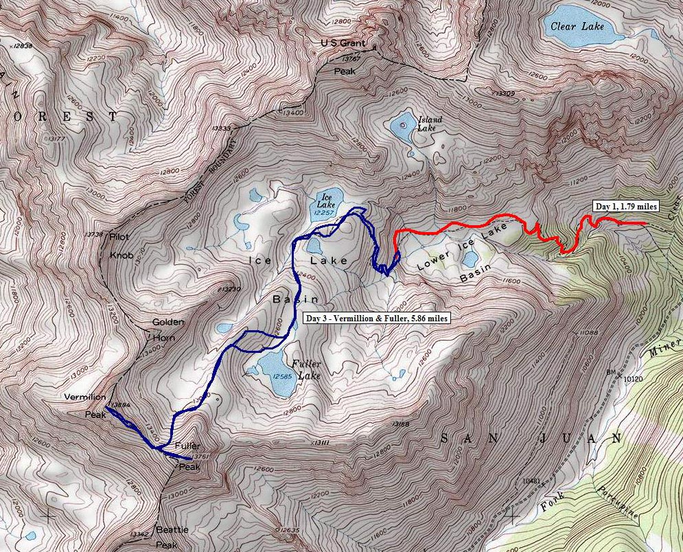
As sunset arrived in the lower basin where we were camped, I could not help but notice the great light. Sure enough, the sunset hit the clouds just right and made for a nice light show.
 Having one more night in the basin was quite the blessing. The night sky was quite clear on this last night and it made for some great star viewing. I decided to put together a few different star trails, this first one taken looking almost straight up at the sky. The stars form small looking meteors using a special processing technique.
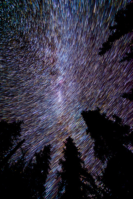
I really enjoy doing star trails with trees in the foreground. I love how the stars weave in and out of the trees.
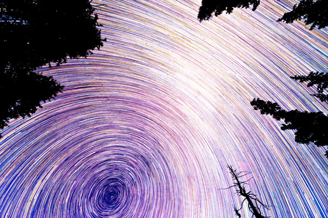
The following morning was pretty calm as we packed up. There were several marmots out and about that we could photograph while we packed and it made for a nice break between tasks.
We hiked out and ran into a couple that were camped across from us in the basin. It turned out that the woman knew one of my friends that I reguarly climb with - such a small world. It was nice talking with you Becky!
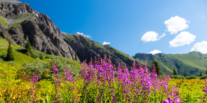
Almost back to the car and we ran into that awesome waterfall again. I had to stop and get a parting shot of it using the 9-stop ND filter.
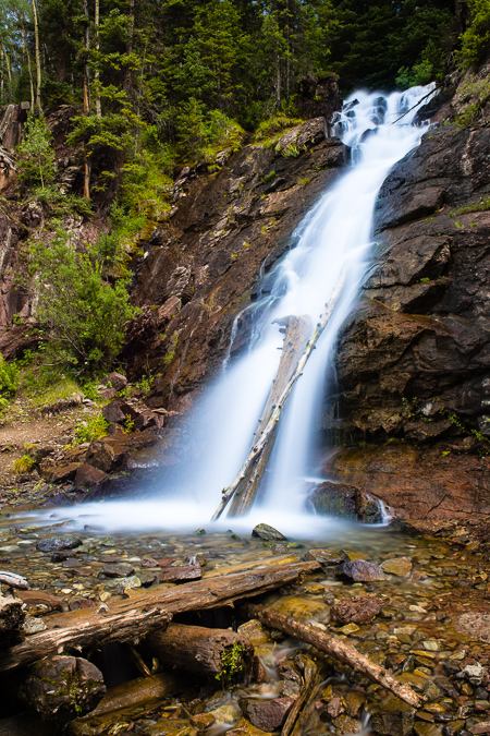
On the drive out we noticed some really cool cliff bands in the basin as well, so we had to stop to get photos of that too. It is amazing where nature will allow trees to grow.
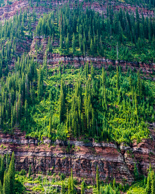
We stopped in Silverton for lunch and found a very nice restaurant called the Teller House. We were served some very tasty vegeterian burritos from their friendly staff, who filled our Odell Cutthroat Porter frequently. On the drive home, we bumped into a massive storm cell that was east of Canon City. It was one of the most impressive storm clouds I'd seen in awhile. We also learned that Manitou Springs had severe flooding while we were gone, due to the Waldo Canyon Burn Scar. What a memorable summer it had become.
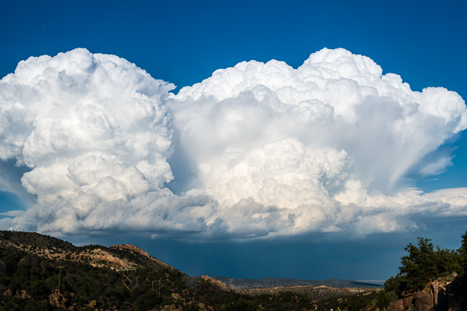
Lastly, I put together a short time-lapse video from the lower Ice Lake Basin. The first two sequences were created in-camera on my Nikon D800 and the Milky Way sequence was built using iMovie and still images. My friend Nicole Buetti allowed me to use her music for my video. Stay tuned for more time-lapse movies featuring Nicole's amazing music later this year! To hear more of her music, go check out her website!
Scaling Colorado's Highest 13er - Grizzly Peak at Sunset
Climbing mountains in solo-mode is therapy for me. While I have often espoused a deep belief that climbing mountains solo is a safety concern, there are times when the benefits outweigh the risks. I'm not sure that this particlar climb qualifies; however, I must admit, this was a truly wonderful experience that I will never regret. I decided somewhat at the last minute to take Friday off of work and climb a 13er. Having only 20 or so Centennials left to complete my quest of the highest 100 in Colorado, I have been getting more motivated to tackle the mountains left.
Grizzly Peak had always intrigued me. It is one of the few Centennials not visible from a paved road (I am fairly confident of this) and has a very remote status. Grizzly Peak is nestled deep in a valley just west of the summit of Independence Pass between Leadville and Aspen and is the most western Centennial in the Sawatch Range. There are tremendous views of the Elk Mountains from Grizzly Peak, including Pyramid Peak, the Maroon Bells, Snowmass Mountain and Capitol Peak. Grizzly Peak also carries with it the distinction of being the highest of 7 mountains in Colorado named Grizzly and the highest ranked 13er at 13,988 ft. (Sunlight Spire is higher, but is not ranked - for more on this issue see this article).
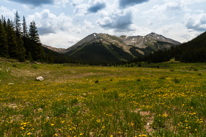
Since I would be climbing by myself, I knew I would have as much time as I needed to take photos and do some crazy photography projects from or near the summit. I chose the west route of Grizzly due to the very short length of the climb, which was very appealing for weather purposes. The plan was to drive the road to the base of the mountain Friday morning, climb the mountain, take photos of sunset from the top, and stay on the top as long as possible for a shot of the Milky Way and to do some star trails photography. According to Roach's 13er guidebook, the road is open all the way to the very base of the mountain, leaving only about 2 miles of hiking to the summit. When I reached Grizzly Reservoir, the road was closed at this point, which meant I had to add another 2 miles both ways to my hike. This was not a huge deal, but it certainly made me re-think my plan.
Being that I had nutty plans to do some extensive photography work from the summit, I packed quite heavily. I was carrying the following photography gear with me:
| Item | Weight (lbs) |
| Gitzo Carbon Fiber Tripod w/ Arca Swiss Ballhead | 6.4 |
| Nikon D800 DSLR w/ Arca Swiss Plate | 2.8 |
| Nikon 14-24 f/2.8 Lens | 2.0 |
| Nikon 24-70 f/2.8 Lens | 2.0 |
| Nikon 50mm f/1.4 D Lens | 0.5 |
| Nikon 300mm f/4 D Lens | 3.0 |
| 1.4x Teleconverter | 0.5 |
| Total | 17.2 |
I'm not especially proud of carrying all of this weight up a steep mountain, but I certainly don't regret doing it.
After I parked my Jeep near the Grizzly Reservoir campground, I head out with a pack full of camera gear and fresh legs at about 1 PM. This is not a very typical start time for me, and probably not highly recommended due to weather concerns, but I figured I would play it safe and keep an eye above for the hike in. For any photographers reading this, I decided to stick with the 24-70 f/2.8 as my walk-about lens, which worked out fairly well. The round-trip stats for this hike are 8 miles w/ 3,500 ft. of elevation gain.
The view from the road was fantastic. Lower, but very rugged 13ers adorned the valley and made for quite a nice sight on the hike in.
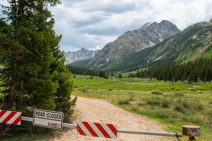
I certainly enjoyed the view but was keeping an eye on developing thunderstorms above.
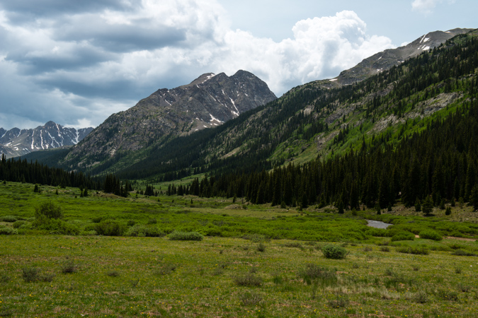
I'm usually not a fan of hiking on a road, but I could not really complain with the view I had, plus I had the Nerdist podcast to keep me entertained.
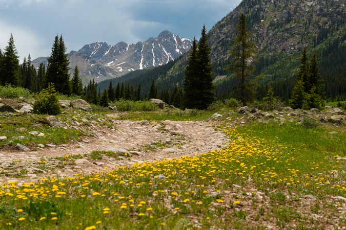
On the hike in, I was able to find some Columbine flowers growing in a small open field, making for a fun photography experiment. One thing I have been wanting to try to do is a technique called focus stacking, which allows a photographer to capture a very sharp photograph that is really the combination of multiple photographs taken at various focal points. I tried that out on these columbine flowers, which worked pretty well considering the wind was blowing (which makes focus stacking almost impossible).
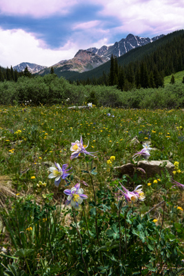
I was looking for a gully cut into the side of the mountain to my left (east), which would be my entrance point for the Grizzly Peak ascent. The mountain has no trail and is basically a steep slog up a very pretty, wild, but generally straight forward gully going up, up, up. Before reaching the gully, the rain started to come down a little, so I stopped to get a photo at this beaver pond before putting my camera away and heading up the gully.
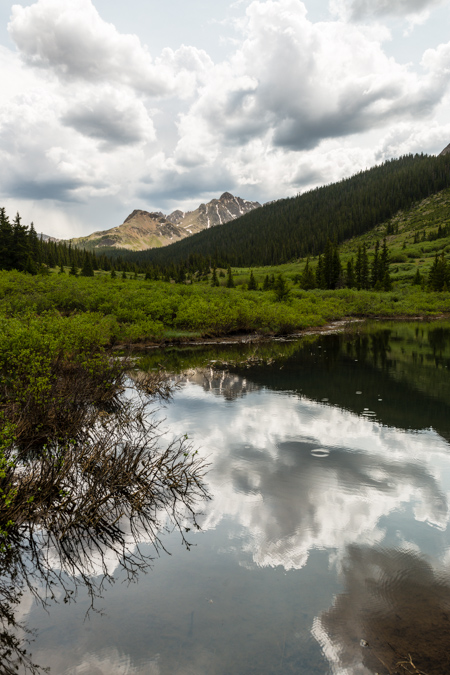
While small rain was coming down, I decided to keep my camera bag packed in my main pack to make it easier and to give me some peace of mind. As such, I was unable to take any photographs with my camera until the rain totally left and I was about a quarter of the way up Grizzly via the gully. I stopped to snap a set of photos to be later stitched into a panorama, looking west across the valley towards Truro and several un-named 13ers.
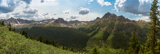
A look up at the terrain revealed just the sloggy mess I was climbing up. It was quite steep and somewhat difficult to navigate through all of the small pine trees, willow trees and rocks. I just had to pick my way up and take frequent rest breaks (I was carrying a lot of weight, haha). The Nerdist podcast of Rick Moranis made the slog a lot less painful, although my laughter probably drove wildlife away.
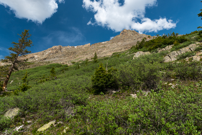
As I continued up Grizzly, the storms seemed to subside, and I was feeling a lot more comfortable about the hike up and eventual stay on the summit. A look back down the gully showed the way up and I could now see the road I hiked up from the North (right).
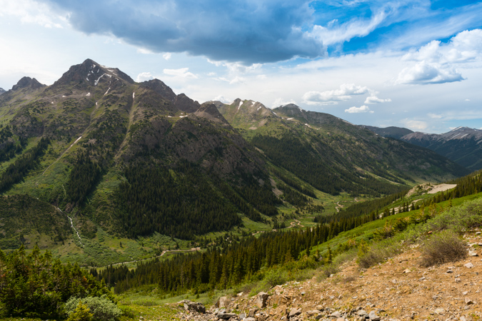
Once above treeline, the gully was pretty obvious in terms of where to go. It was mostly rock and dirt with wildflowers and boulders strewn about.
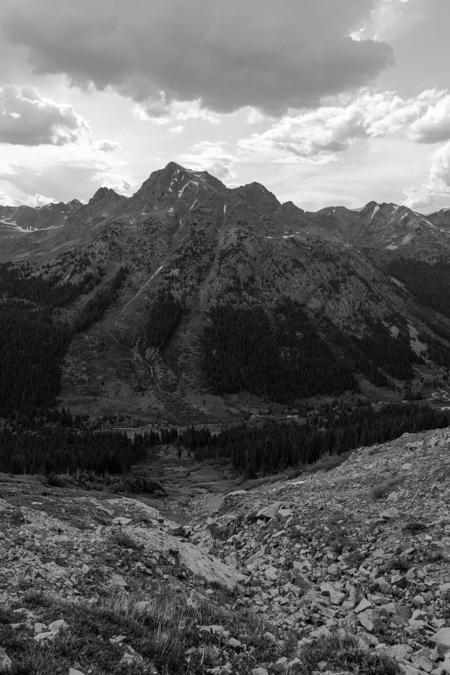
The views were pretty enjoyable in all directions. Despite some wind, I really could not complain.
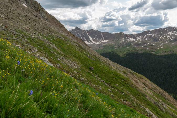
The 13ers to the west kept me looking back quite often, and the wildflowers were just too cool. They were all over the place, even above treeline, which is always awesome. I probably could have made it up the mountain in a lot less time, but I took the time to take some quality photos. This is another focus-stacked image making it so the very close flower in the foreground could be in focus as well as the distant peaks.
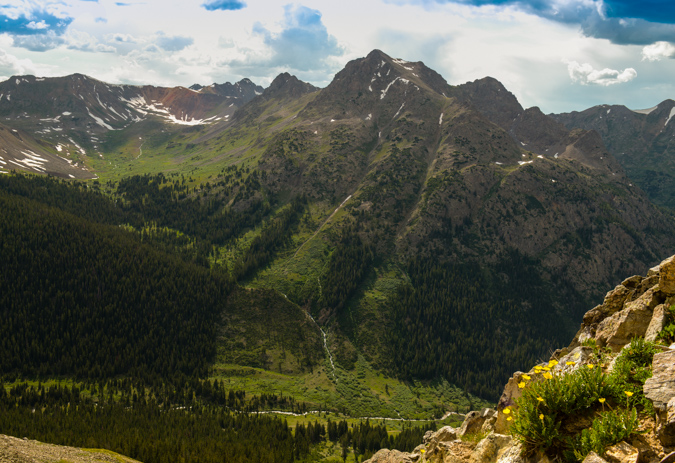
As I continued up, views of the Elk Mountains (specifically, Castle Peak) began to materialize above the horizon to the west beneath some virga coming from some small storm clouds.
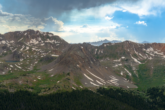
I was not worried about the weather yet - the clouds were pretty small and my new expansive views to the west indicated I should be in the clear for the remainder of the day. At this point, the climb became progressively more difficult for my weary legs. The weight of the photography equipment was really kicking my rear end and I had to take more and more breaks. The terrain was also much more difficult - not technically, but physically demanding. There were more boulder fields to contend with and the dreaded scree that takes you downhill one step for every two you take. As such, I decided to pack away my camera again so I could focus on the hike and make sure I did not fall. I finally was able to reach the saddle between Grizzly Peak and Garfield Peak as the light from the impending sunset was starting to generate some magic on the valleys below to the west and east. Seriously, if you've never done a sunset climb before, you need to - it is simply one of the most amazing experiences you can have in the high country.
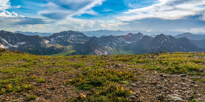
While the weather to the west was looking fabulous, the weather to the south and east was starting to look kind of nasty. I was not too concerned yet, but was keeping watch. One benefit of carrying a 5 lb tripod up a mountain is that you can do self-portraits. Here's one looking south and east towards Garfield Peak and Taylor Park (not visible).
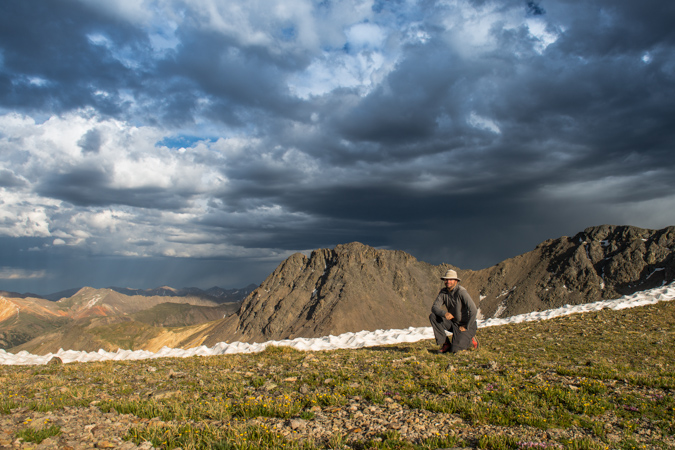
I also decided it might be fun to do a very large vertical panoramic showcasing the sky from the saddle, looking South-West-North. To the north (right) would be the summit of Grizzly Peak itself.
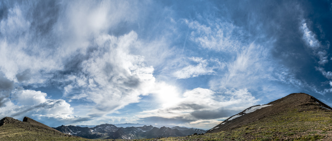
After about 20 more minutes of climbing, I was able to reach the summit of Grizzly Peak. I was greeted by an incredible view to the east and south, which included the Three Apostles and an amazing rainbow just shy of Taylor Park, where a huge thunderstorm was brewing.
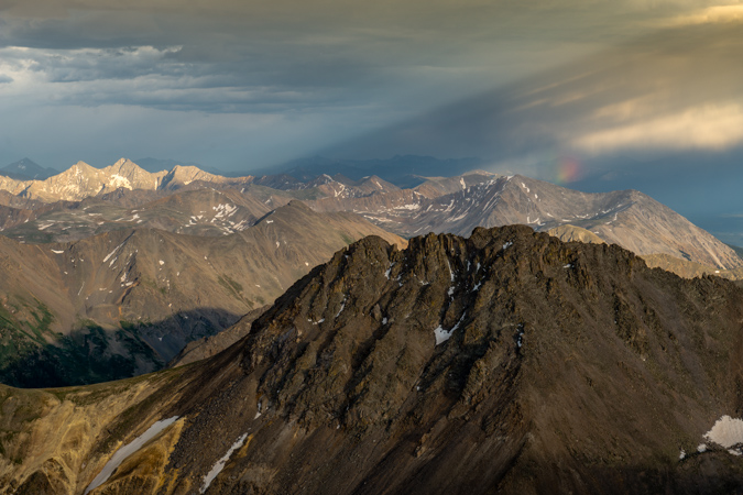
It was pretty awesome to be on top of the Continental Divide before sunset. The views were great, and that sweet rainbow stuck around for quite a long time to the northeast. The light from the sun was hitting the clouds over Taylor Park and causing some interesting streaks to appear. I signed the summit register, which was last signed by a guy I had read a trip report of from the day before. He had made a tribute to Steve Gladbach, a very accomplished and famous Colorado mountaineer who had just perished on Thunder Pyramid. I decided to also sign the book as "For Steve." I think Steve's passing weighed on every mountaineer's mind heavily, including mine. I never did get a chance to meet Steve, but we exchanged several cordial and thought-provoking messages over on 14ers.com regarding my morbid articles I write about the mountaineering deaths each year. Steve wrote a very eloquent and thoughtful post about death over there a few years ago and it always stuck in my mind. I even remember responding to his post saying that "heaven forbid you die in the mountains..." and yet - he eventually did. Steve had conquered the goals I have set for myself and I had always looked up to him, not only as an accomplished mountaineer but as a very amazing person. There are countless stories of his selfless acts and I felt a solo climb a nice tribute to his life.
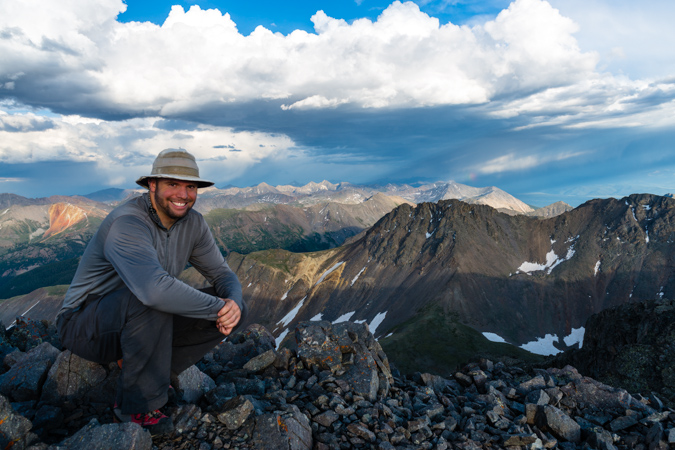
As I enjoyed the last few minutes of sunlight, I had to take advantage of my somewhat foolish decision to haul up my 300mm lens, which weighs 3 pounds on its own. I wanted to get some zoomed in shots of Ice Mountain, Pyramid Peak, the Maroon Bells and Snowmass Mountain using the 300 and a 1.4 Teleconverter, which gave me an effective focal length of 420mm.
Castle and Conundrum were looking freaking awesome, with some crazy sunset light surrounding it. Thanks to Michael Colson for the correction!
Snowmass Mountain was also looking wicked with the sunset light, giving the photo a very layered feel in black and white.
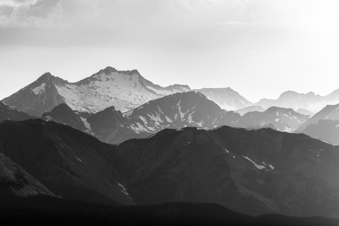
As the light continued to approach the magical photographic Golden Hour, I had some fun playing with different photos.
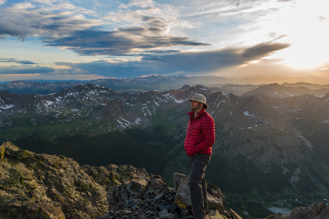
I also stitched together a massive 360 summit pano centered on the sun. This photo, being taken with the Nikon D800, is a massive file. If printed at native resolution (no loss of quality), it would span 30 feet wide. I'd love to see that. If I have time later, I'll work on an interactive 360 file so you can see this thing at a bigger resolution and zoom in.
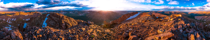
The sun went behind some clouds but then created some nice god beams coming down near Mt. Sopris.
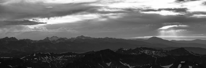
Then the sun reappeared and allowed me to snap off this photo which I think looks kind of like a Colorado flag.
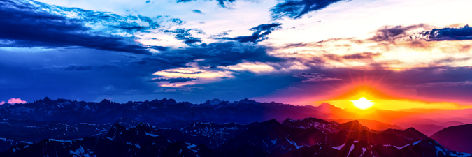
A look back to the east revealed some magic also. The light was very soft and colorful, showcasing the grand scale of La Plata Peak (left), Colorado's 5th highest mountain.

Sunset from the Continental Divide - an awesome experience. I took some artistic liberties on this next photo...
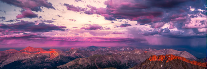
As the sun dipped below the horizon, and stood and watched the magic fade.
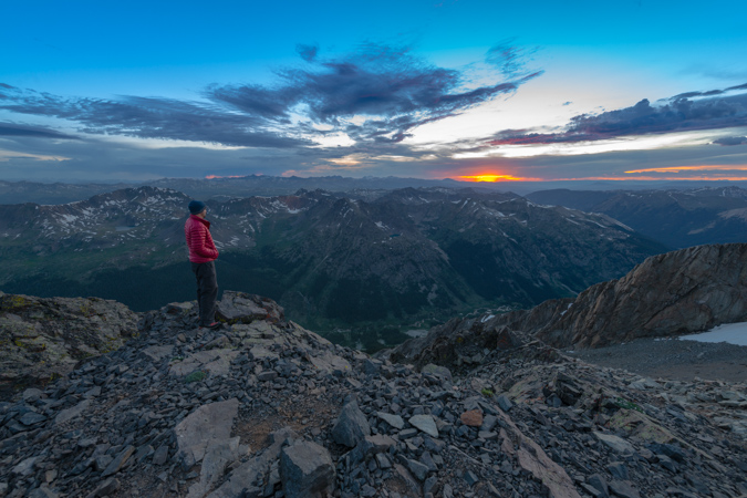
At this point, I had to make a decision. Watching the clouds to my east and south, I was getting a little nervous about the prospect of staying on top of the mountain to photograph the night sky. I was really motivated to do so, but I did not feel like it was a risk worth taking. While climbing down the mountain in the dark did not appeal to me, getting struck by lightning was even less appealing. I decided to pack up the gear and head down. The hike down was an adventure to say the least. It became quite dark very quickly, as there was no moon. I found myself in some sketchy spots where I had no recollection of that route from the hike in. I took my time and was very deliberate about each step. I was able to ride down a scree field a ways using some scree-skiing techniques and from there it was pretty much a boulder/snowfield/cliff/willow dodging fest. Downclimbing in the dark without a trail - not recommended - AT ALL. Hahahaha! It was certainly not the safest mountain climbing experience...
After reaching the road at 11 PM, I was rewarded with some insane views of the Milky Way. I set-up for some shots of the Milky Way and to my huge surprise, was able to also capture the Northern Lights! This next shot is a panoramic looking north-east-south. I just can't believe I got the Northern Lights - so awesome.
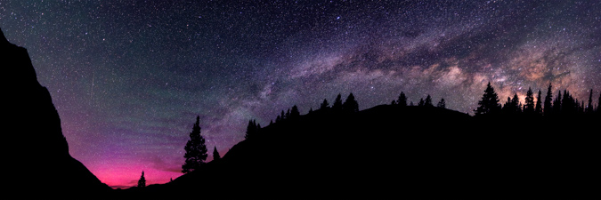
My final shot is me laying in the grass with my head-lamp, gazing into the night sky.
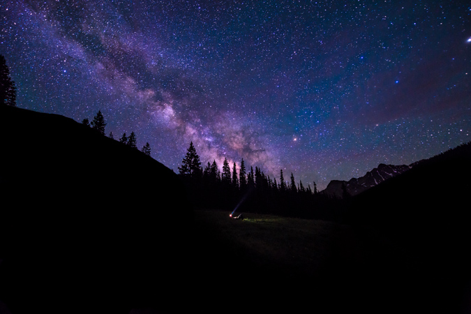
I slept under the stars at my Jeep back at the Reservoir after a long but enjoyable hike out in the dark and drove home to Colorado Springs early the next morning. What a great trip!
If you enjoyed my photos, please consider purchasing a print for your home or office. You can visit my gallery for a full showcase of my photography - if there are any photos from this trip you are specifically interested in, please do contact me.
A Mad Scramble in the Sangres - Mount Adams and UN 13,580
Mount Adams is one of the last mountains in the top 100 in the Sangre de Cristo Range that I've yet to climb. It has always drawn my attention on other hikes in the area, and I had hopes of climbing it this spring. Instead, I opted to climb California Peak with Ethan, which was a great hike. Originally, I had planned to climb Pyramid Peak this weekend; however, none of my climbing partners had crampons, so we decided to hit Mount Adams instead. I had always read great things about climbing Mount Adams, and Gerry Roach has the west ridge route marked as a classic climb. Since I have more or less always agreed with Roach's ratings for "classic climbs," I figured that it would be the best way to climb it. So, Ethan and I agreed to take the west ridge route instead of the standard route. Feel free to read more about Roach's 13'er guidebook HERE.
This was particularly exciting since I have wanted to go back to Willow Lake for awhile now. Willow Lake is truly a magical place, and should be designated as a wilderness area, in all honesty. The lake is pristine, with a giant waterfall at its head. Additionally, it is surrounded by some of the most rugged and aesthetically remarkable mountains in Colorado, including Kit Carson Peak, Challenger Point, Columbia Point, Crestone Peak and Crestone Needle, not to mention Mount Adams!
Mount Adams is the 66th highest ranked summit in Colorado, sitting at 13,931 ft. 69 more feet and it would be climbed much more frequently, not that Ethan and I are complaining that we didn't see another soul on the summit...
Looking at the maps while driving over, Ethan and I also thought it might be fun to tack on another peak or two while we were out, so we decided that once we reached the summit of Adams, we would evaluate the conditions and how we felt and then decide on the next steps.
The drive over to the town of Crestone was remarkably unremarkable except for two incredible details. First, the pizza at Amicas in Salida was incredible, as usual. Second, the sunset as we were leaving Salida was insane. We drove out of town, heading west into Poncha Springs, and decided we HAD to pull over and take photos of this rediculous sunset. For my photos, I opted to do a minor HDR treatment since the foreground was quite interesting -we had stopped just in front of a huge grassy area used for cattle to pasture on. The results were stunning, with the sunsetting directly behind Mount Shavano.
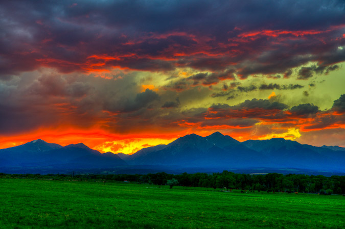
Here's a zoomed-out version of the same scene, which I personally prefer.
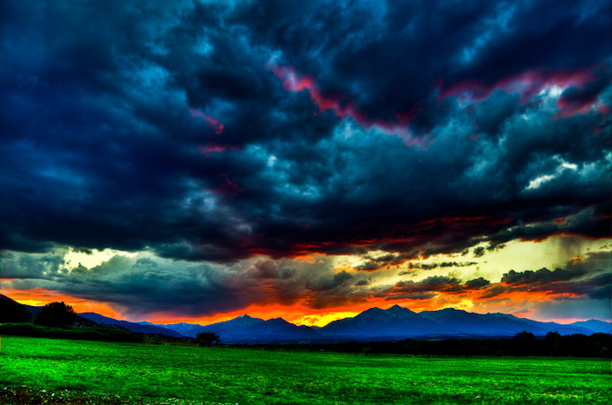
We arrived at the Willow Lake trailhead around 10 PM, set-up Ethan's tent, and hit the sack, with our alarm set for 2 AM. We wanted to ensure that we had enough time to reach the summit of Adams before the weather hit. As soon as the alarm went off, we packed up quickly and hit the trail. The hike was an interesting one since there was a full moon and because we did not get a ton of sleep. Nevertheless, we hiked quickly and reached the base of Willow Lake within 2.5 hours.
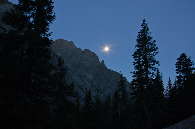
The full moon made for some pretty fun photography opportunities, although photographing the moon is always a big challenge unless you have a really nice zoom lens. Most photos you will see of the moon and of a scene are two images layered as one, since it is literally impossible to photograph the moon and your foreground without either overexposing the moon (like above) or underexposing your foreground. Anyways, seeing Willow Lake again was great. We rested there for a good 30 minutes and took some photos. The waterfall was just as awesome as I had remembered it to be.
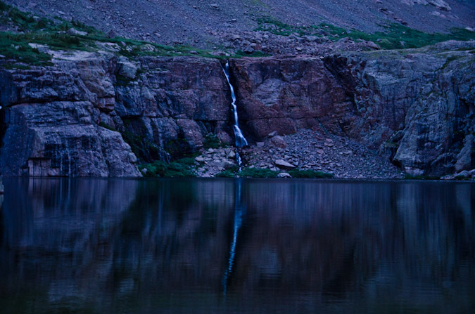
We saw lots of tents on the way up, probably 15 total. Lots of people were up here to climb the 14ers. We were the only group doing Mount Adams though. We gained the trail to the left of the lake and began to ascend above the lake in quick order, stopping every once in awhile to get some photos.
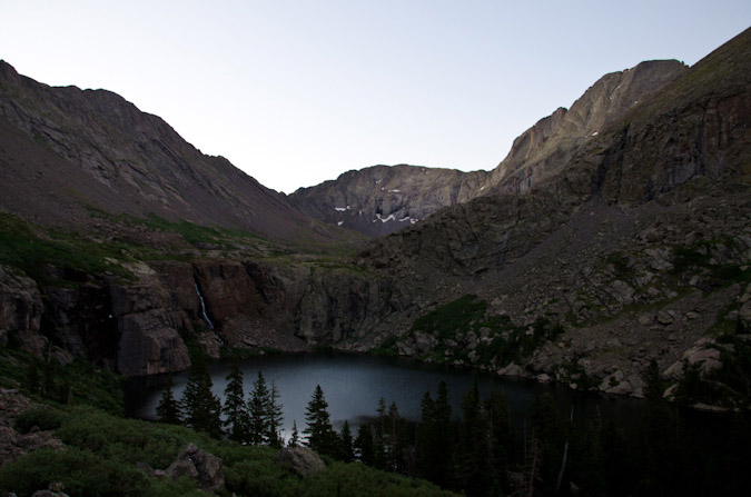
Before we knew it, we had gone too far and were nearly at the head of the lake near the waterfall. While we knew we were somewhat off-route, we decided to get into a good position to get photos of the sunrise and the full moon over Willow Lake.
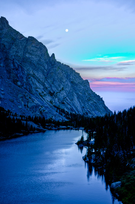
We then turned sharply south to gain elevation into the small basin beneath Mount Adams. Since there is no trail up there, we just followed beneath the termination of a large cliff wall that led into the area, looking back from time to time to catch the sunlight on Kit Carson Peak.
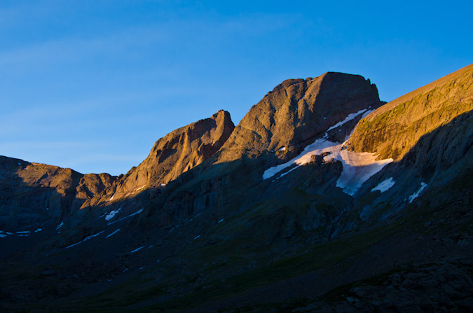
I've always like the geology of this area, which is comprised of clastic sedimentary rocks, which appear as large pebbles that are cemented together. These rocks sometimes erode, to leave behind some really interesting features. For more information on Crestone Conglomerate, check out this interesting website.
As we gained the basin, we could not help but notice the amazing hues cast onto Willow Lake by the sun hitting the southern aspects of Challenger Point.
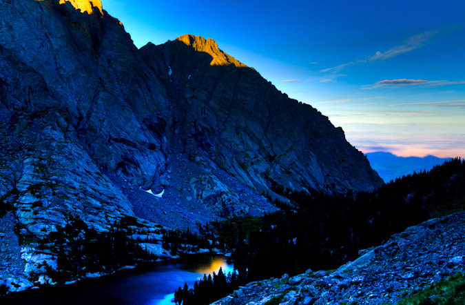
Indeed, the alpenglow on KIt Carson Peak and Challenger Point were quite impressive, and coupled with the moon and the lake it made for a perfect scene to hone my HDR skills. If you've ever wondered how to do HDR, you can do like I did, and read about it a ton, or watch this perfectly succinct tutorial from Trey Ratcliff.
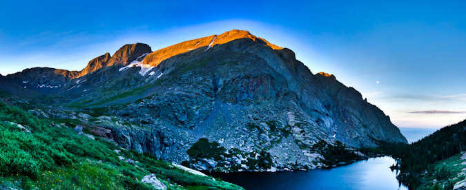
We kept on hiking up into the basin towards Mount Adams and stumbled upon a pair of really nice looking ponds. The ponds were surrounding by wildflowers and separated by a huge jutting rock feature, which made for quite a lovely subject for an HDR panoramic. Additionally, the clouds were insane, and continued to be all day long.
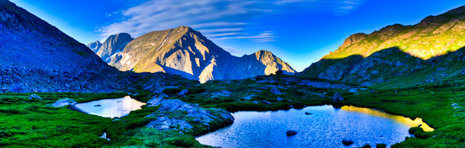
After a few more minutes, Mount Adams finally came into view for the first time.
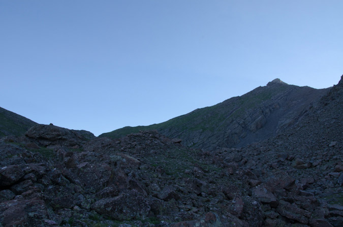
The route seemed quite straight-forward to us, so we opted to just follow a rock gully up towards the ridge, which was strewn with all sorts of wildflowers.
|
|
|
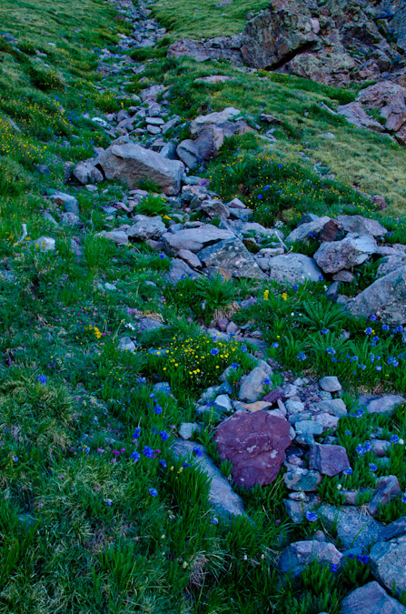
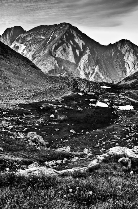
Ethan was a superb photography this day - he captured many many photos of me throughout the journey, all of which I really enjoyed his perspective and composition on.
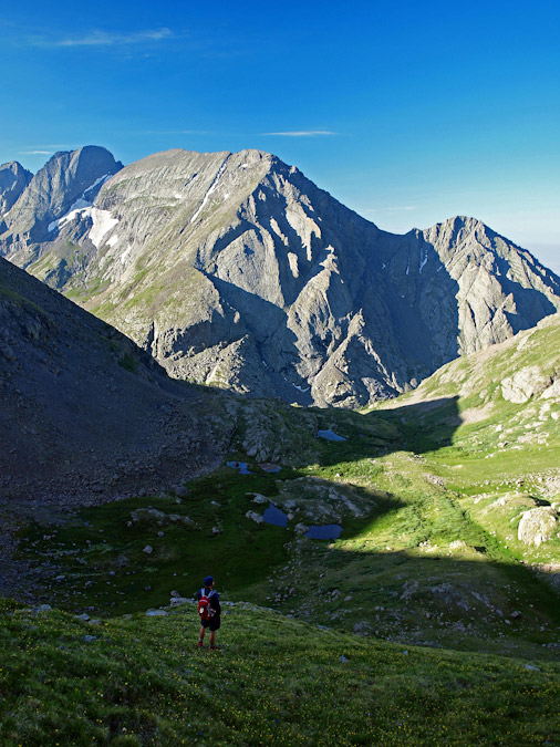
We finally gained the ridge!
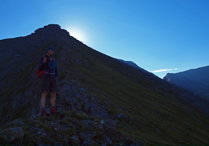
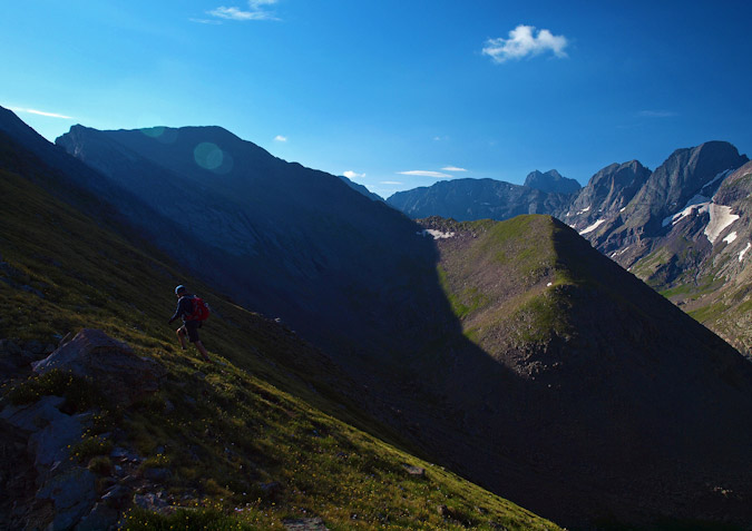
We were able to look down at South Crestone Lake and some 'miniture' Crestone Needle looking mountains.
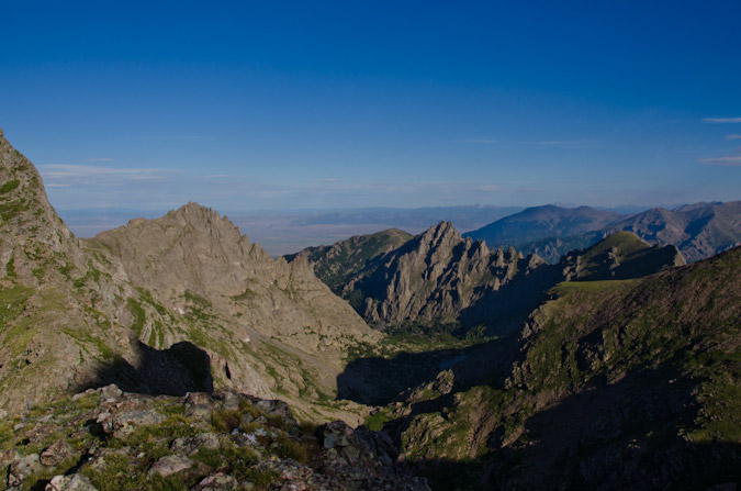
As we continued up, Crestone Peak came into view, and eventually Crestone Needle as well.
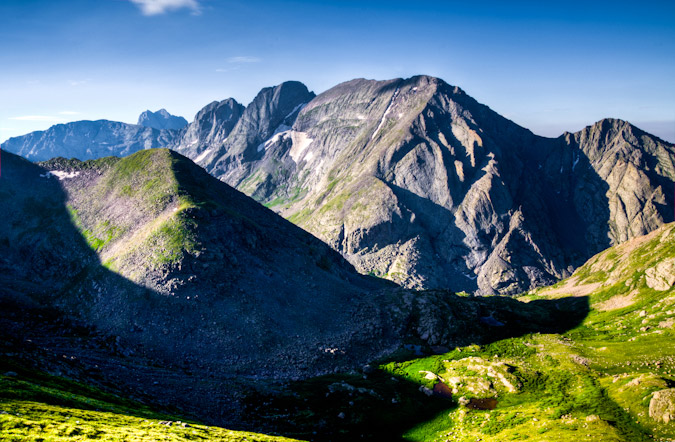
The wildflowers on Mount Adams were amazing.
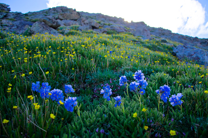
|
|
|
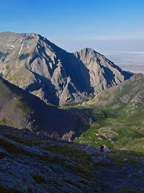
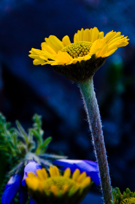
And the route up the west ridge was fabulous. In some sections, it really reminded me of Crestone Needle, just not as steep. The same type of rocks made for some enjoyable route-finding. I shall hereby dub Mount Adams, "Baby Crestone Needle." The similarities in the rock were remarkable.
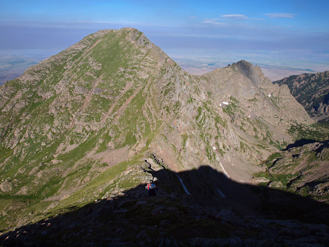
The clouds continued to look awesome, and so I was able to get this photo of Ethan gaining the ridge higher up.
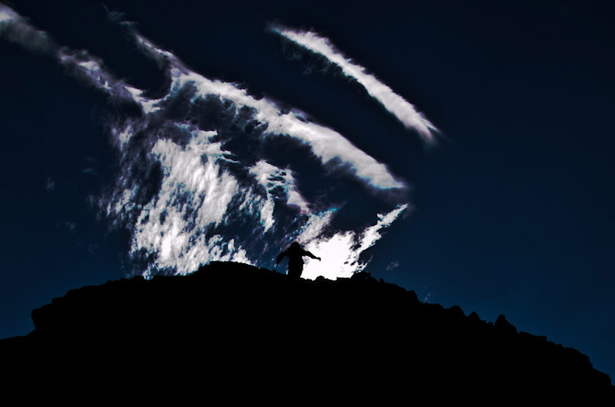
I was also able to get a really nice panoramic photo of Ethan gaining the ridge with the nutty clouds behind him. Click to see a larger version.
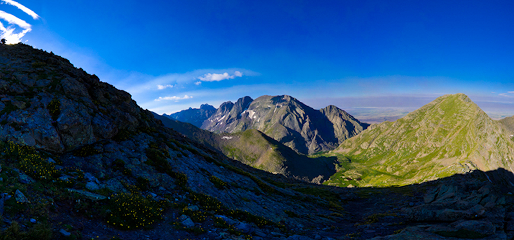
Check out this cloud - it looks like its going to eat my soul - thanks Ethan!
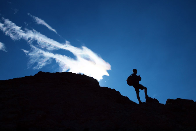
We stopped frequently to shoot photos. This is an all too familiar scene - me shooting photos of flowers. Thanks for catching me in the act, Ethan!
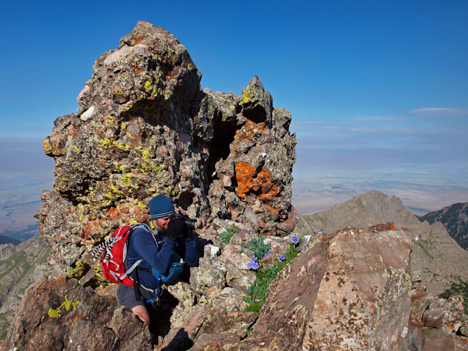
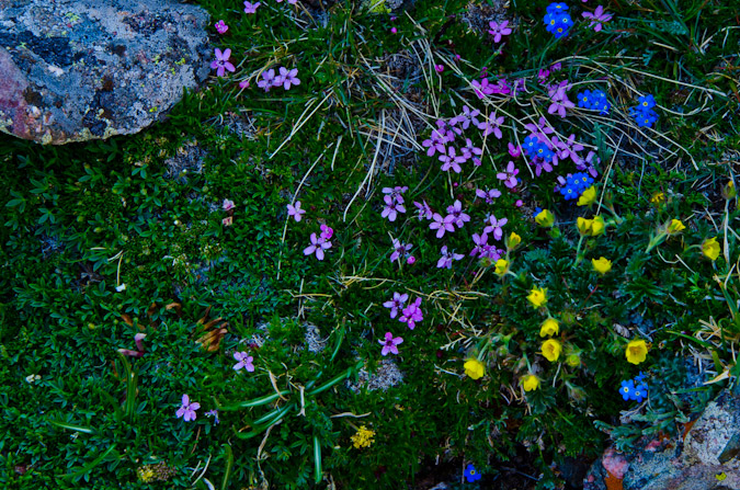
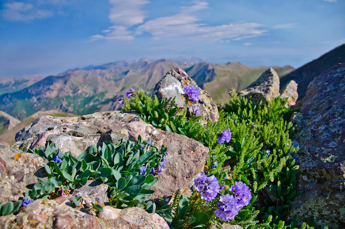
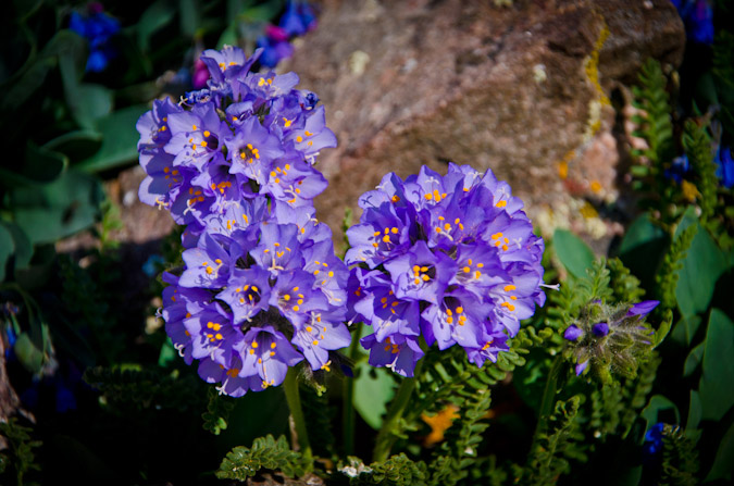
We kept on truckin' up to the summit block, which proved to have some enjoyable class 3 options if one so chose, so we did.
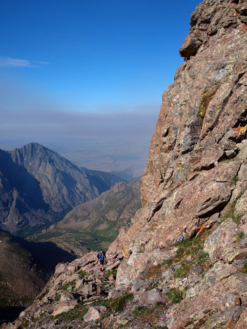
Finally, we reached the summit and took a congratulatory summit shot using Ethan's camera on self-timer.
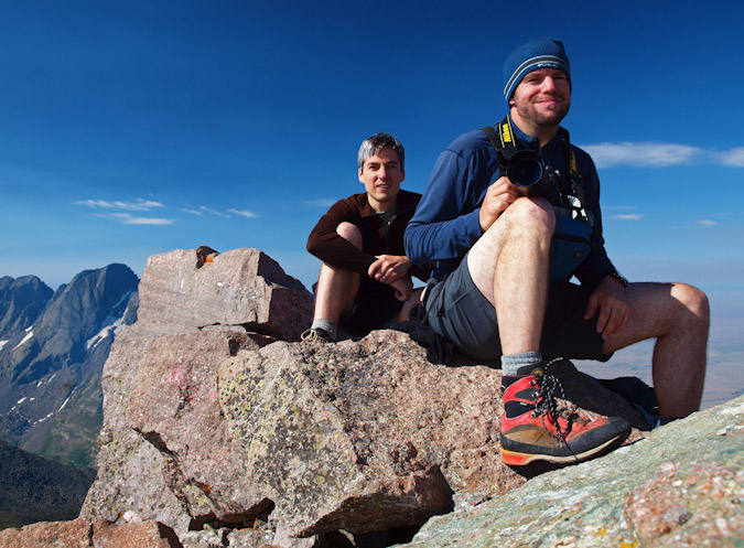
Mount Adams was a great climb, for sure. The summit was superb, with excellent views in all directions.
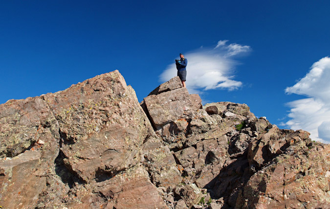
We also had some insane smoke appear out of nowhere in the valleys around us, and before we knew it, the smoke was gone. It was truly odd. It was almost as if the valley below was on fire and then put out before we knew it. A look to the north revealed some crazy looking clouds over Rito Alto, Venable and Comanche.
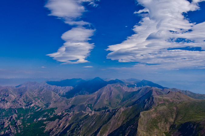
We also found an awesome spot with a great vantage point for a celebration pose. We took advantage and marvelled at the sheer depth below us from where we stood.
|
|
|
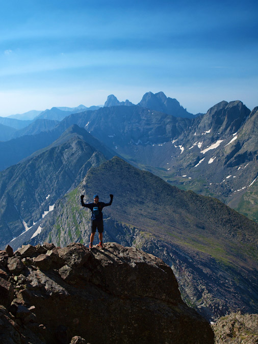
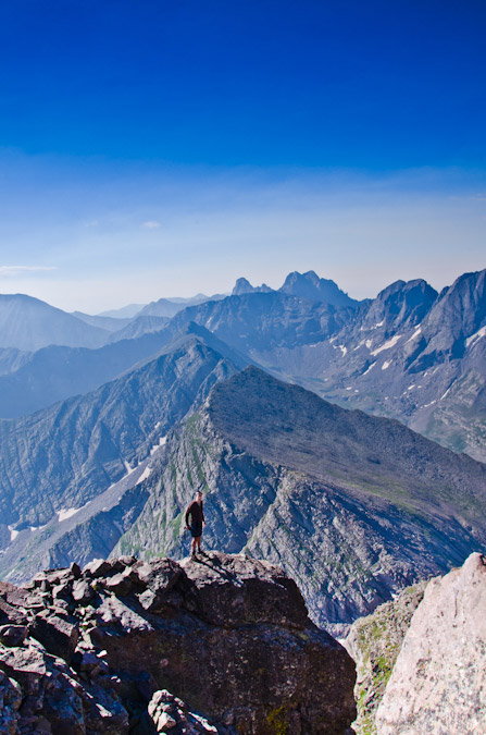
Naturally, my focus was on Crestone Needle and Crestone Peak, two of my favorite mountains in Colorado. They are so distinguishable and quite honestly some of the freakishly looking peaks there are in Colorado. In fact, Crestone Needle ranks just 4th on the "Most Impressive" list (for ranked peaks) that is based on the work of David Metzler and the ORS/RORS scales.
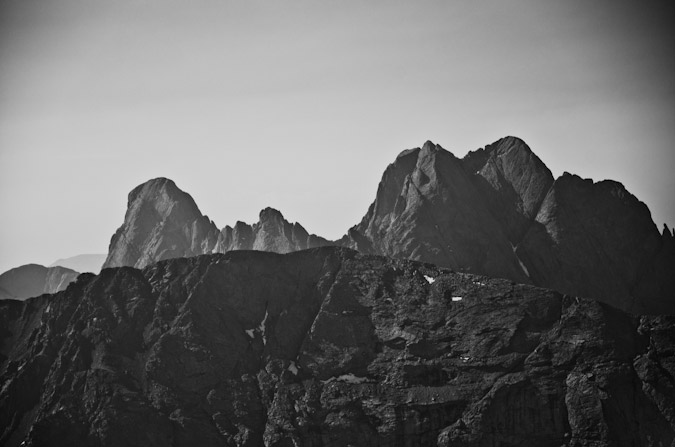
A view to the east revealed Fluted Peak (far left), Horn Peak (left, in distance) and the Horn Lakes below. UN 13,580 (ranked 201) was directly south, with UN 13,541 and Obstruction Peak and Humboldt behind. Additionally, Crestone Needle and Crestone Peak stood out like sore thumbs with Columbia Point, Kit Carson Peak and Challenger Point all towering over the basin below.
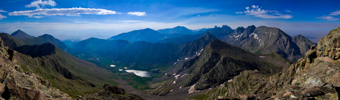
A closer look at the 14ers of the area. Left to right - Crestone Needle, Crestone Peak, Columbia Point (13er, ranked 56th), Kit Carson Peak and Challenger Point.
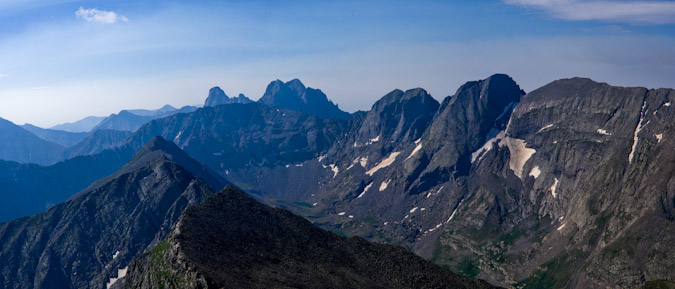
Ethan was loving the views and the clouds.
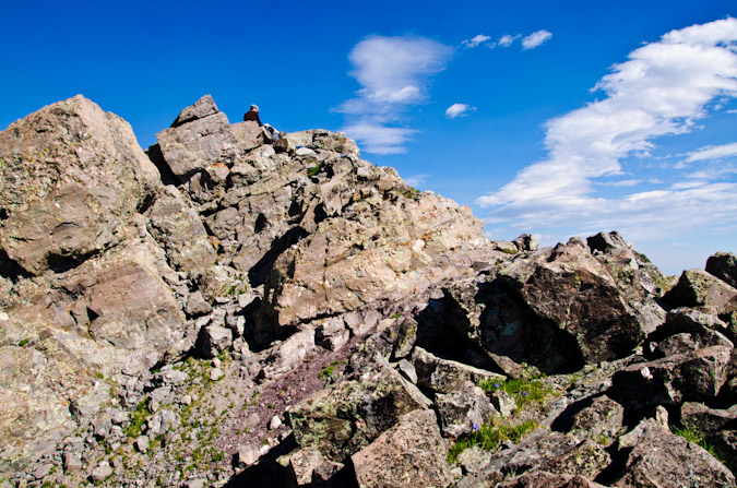
And so was I...
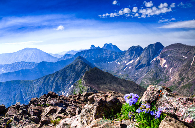
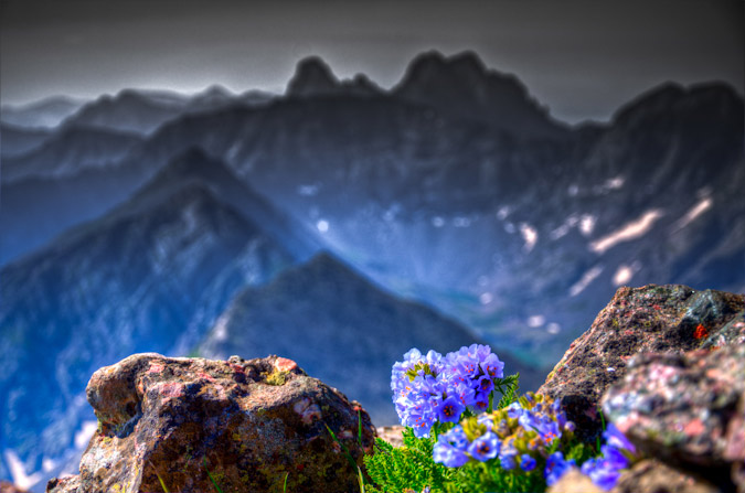
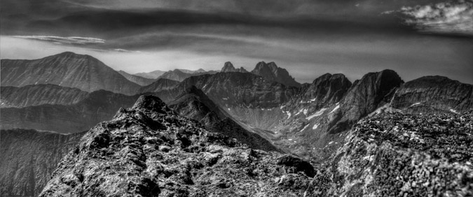
Alas - a perfect summit does not last forever, so we decided to head south towards UN 13,580 and beyond to see what we could accomplish. The dramatic nature of the cliffs to our left kept us on our toes and in amazement for quite a long distance.
|
|
|
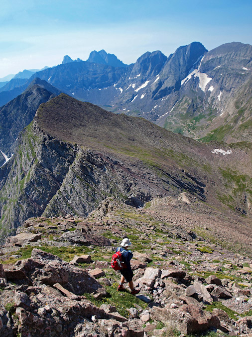
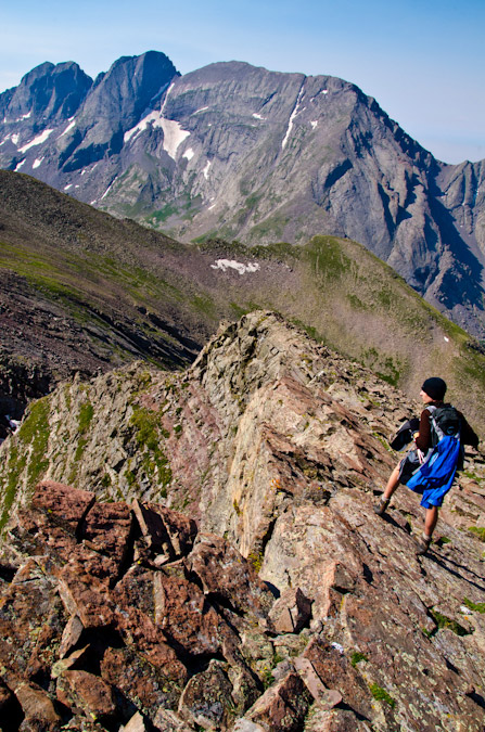
Also, the traverse over to 13,580 proved to offer some really fun challenges, including this class 3 manuever above a hugely exposed section.
But it also offered some fun boulder scrambling on very solid rock.
UN 13,580 was not too far from us, and the views kept us from moving too quickly.
The rock was all totally solid, but in places it was awkward walking on slanted slopes of what felt like giant fissures in the earth.
|
|
|
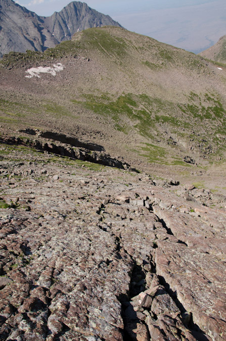
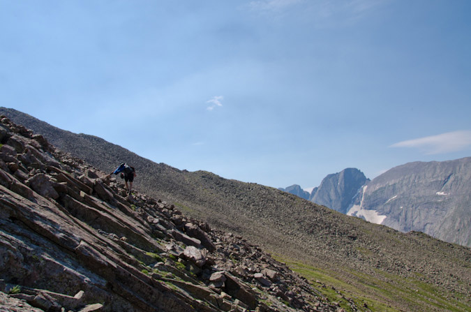
A look back at Mount Adams...
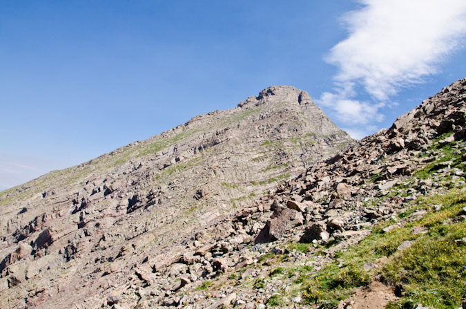
We finally reached the summit of UN 13,580 and enjoyed as what Gerry Roach describes on page 155 as "a startling view of Horn Lake." I don't disagree with Roach one bit on this detail, but what I do disagree with him on is that he describes UN 13,580 as a bi-centennial, meaning it is in the top 200 in Colorado ranked by elevation. According to my list, it is ranked 201 and just shy of that mark. When I built my database, I ranked mountains in the following order:
- By elevation
- By prominence
- By isolation
- By name
So, if two mountains had the same elevation and prominence, the mountain with more isolation is ranked higher. This seemed like the most fair way to rank mountains that had very similar characteristics. I am not sure how Roach or any others rank them.
Subsequently, according to my database, which is based almost entirely off of data compiled by John Kirk of Listsofjohn.com, Clark Peak, a 13er in the Elk Range, is also sitting at 13,580 ft. Additionally, it has the exact same prominence as UN 13,580, making them tied in most regards. The mountain with more isolation (Clark Peak) gets ranked higher.
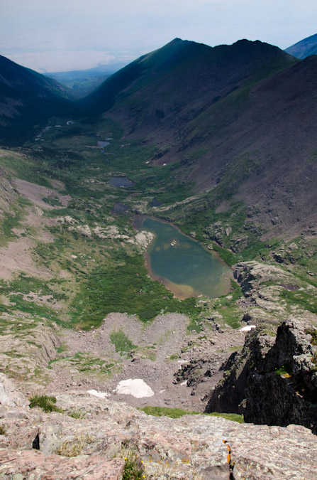
Sorry to get on that soap-box... here's a self-timer of Ethan and I on UN 13,580.
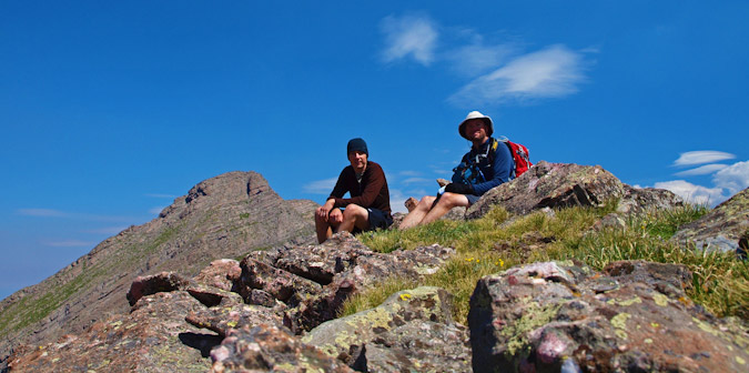
And Ethan with the Crestones in the background...
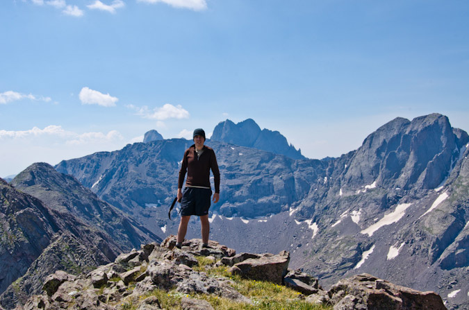
With me enjoying the "startling views."
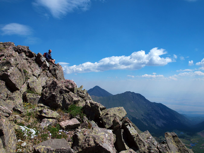
It was really cool signing the summit register for this rarely climbed peak. At the top of the register was Gerry and Jennifer Roach, followed later by John Kirk (of ListsofJohn fame), Susan Joy Paul (a regular on 14ers.com and a Facebook friend), and Doug Hatfield, another regular 14ers.com contributor who quoted on the summit register, "100/100 in Custer County," meaning, this was the last ranked peak in this county that he needed to finish. Quite an accomplishment!
Naturally, the Crestones just kept my gaze for much of our time resting on UN 13,580, so I decided to get some more HDR shots, as well as a non-HDR shot.
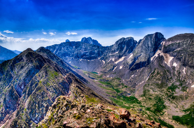
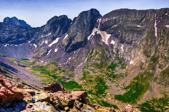
We decided to keep going along the ridge to see where it would take us. Much to our surprise, a lone goat crested the ridge to greet us below to the south.
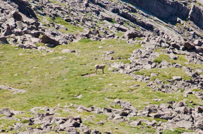
"We're gonna climb that one now?"
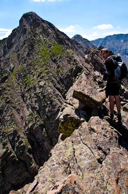
Unfortunately, the storm clouds starting building to the west, so we opted to bail at the first opportunity. Since there's no trails in this terrain, we had to do some heavy route-finding. This ended up being quite enjoyable and challenging, and afforded us with plenty of class 4 down-climbing opportunities.
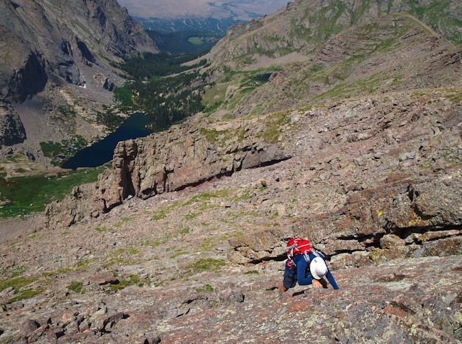
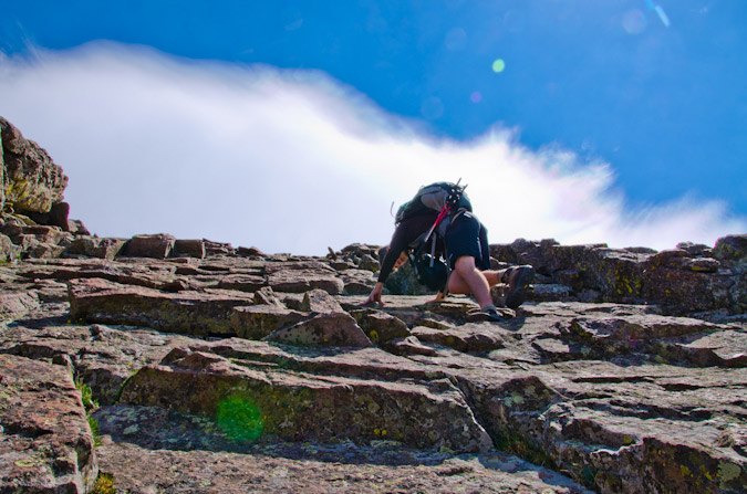
We found a crazy gully just below the first set of slabs we had down-climbed, and decided that the terrain on the other side of this mini-ridge below the gully looked much better as an exit. Unfortunately, the gully was loose and chossy, with eroded garbage and hardened mud. It was a real nightmare to downclimb. I went first, and faced-in for many sections. I kicked down tons of loose debris and tested every hold. It was quite a mess. Once I was down, I yelled up to Ethan that I was clear. Ethan had a bit more trouble, mostly because he was schlepping his trekking poles on his pack still (I opted to not bring any), and his camera bag was not of the LowePro Toploader variety that I have grown to love. His bag got into his way and he had to stop and re-pack the whole thing into his main pack. Almost down, Ethan had a few more moves left. He faced in and placed all of his weight on his feet, which were being held by what appeared to be a very solid and large boulder. Ethan shifted his weight to another rock, and as he did, the rock he was just standing on crumbled and disintegrated, causing huge blocks to go down the rest of the gully and down the mountain. Ethan was quite lucky. Here's some views of the nasty gully:
|
|
|
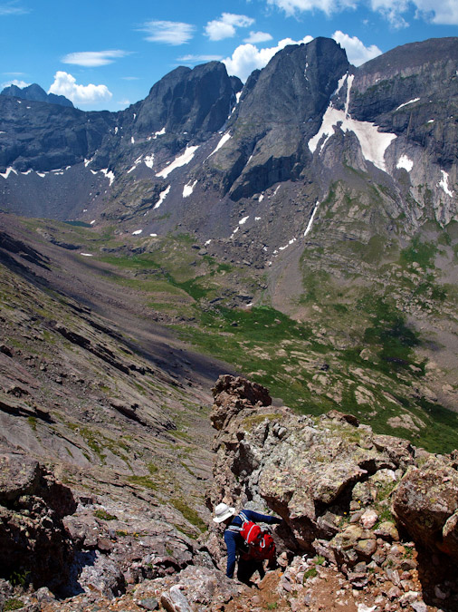
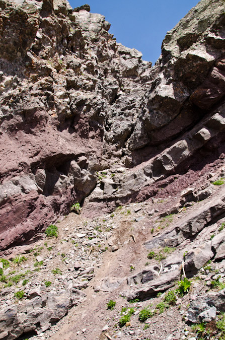
After the lame gully, we were greeted by a series of steep ledges that had interesting holds, probably rated at class 3 or 4.
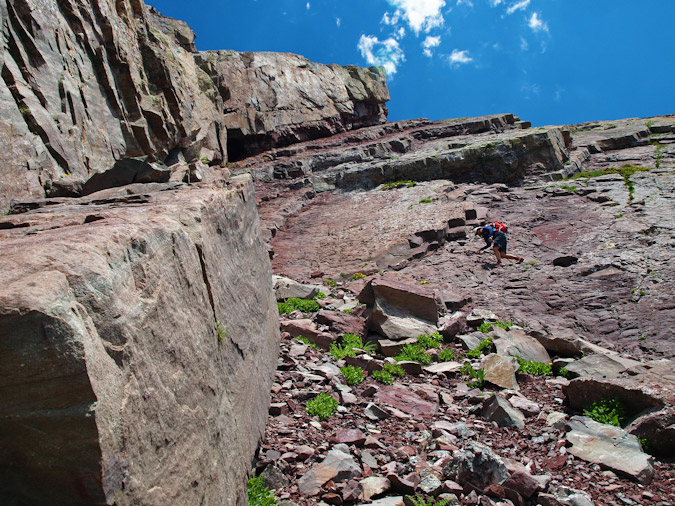
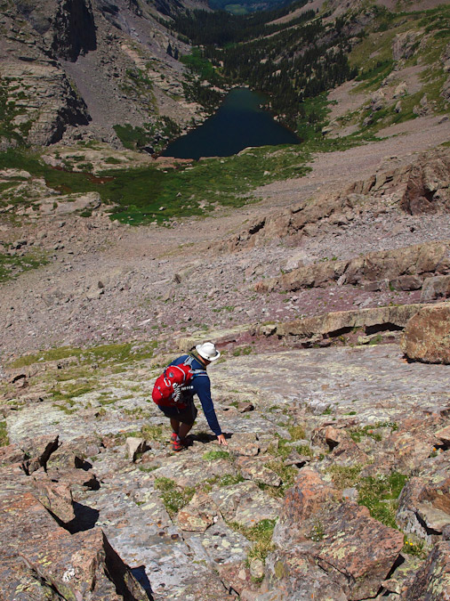
A look back up the ledges:
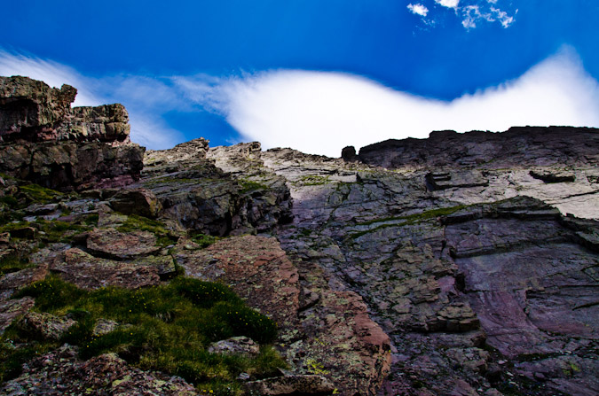
And over to Kit Carson and Challenger...
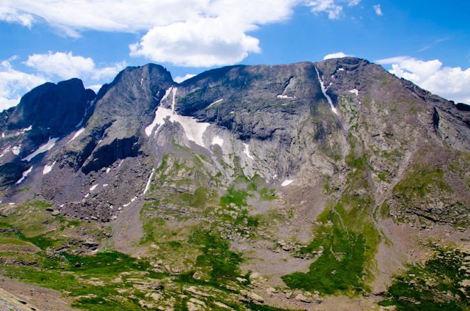
We descended this section pretty quickly, having to shift directions a few times due to the bands of ledges terminating a few times. I rested a few minutes at the base of the boulder field we came down and found a new friend.
The columbine flowers were really nice too!
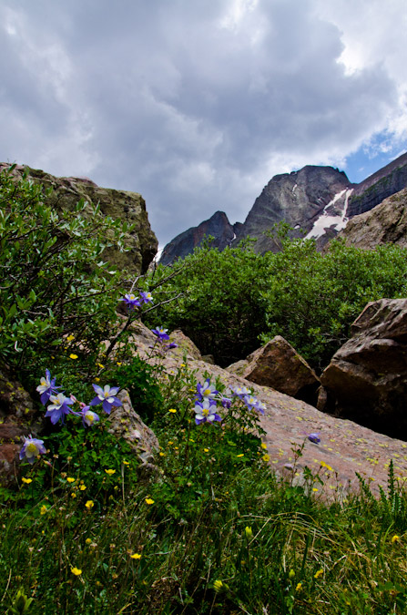
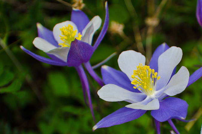
Another look back up the insanity we down-climbed...
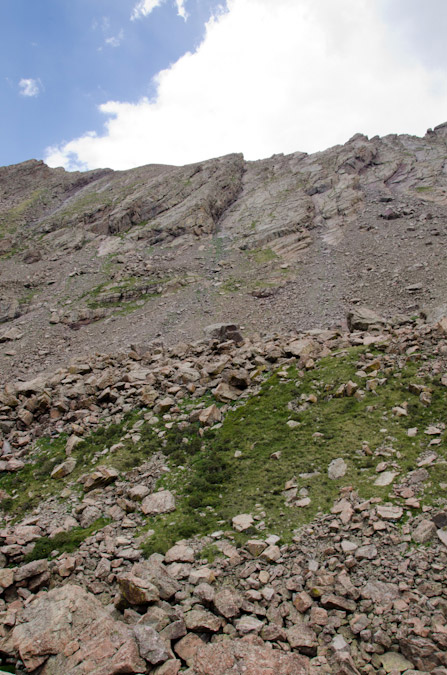
We re-joined the trail that leads up to Challenger Point and headed towards the waterfalls above Willow Lake.
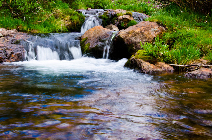
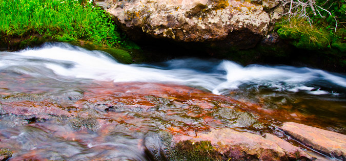
Which were quite amazing!
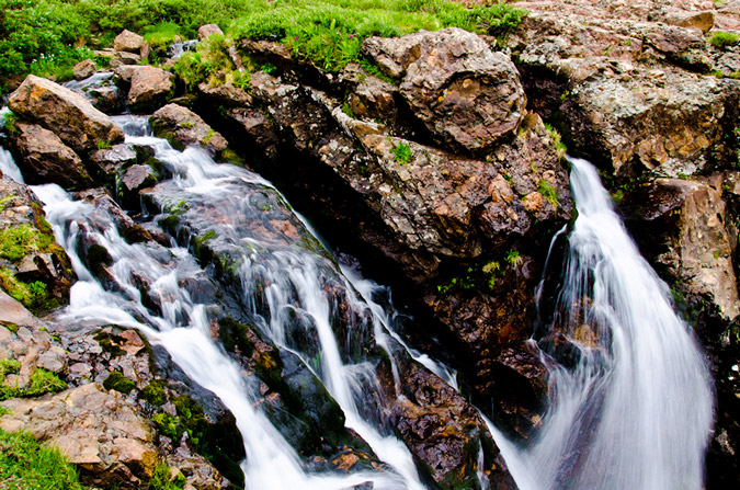
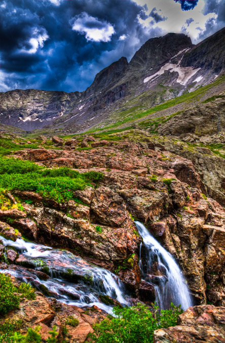
Finally, we made it back around and to the lake in short order.
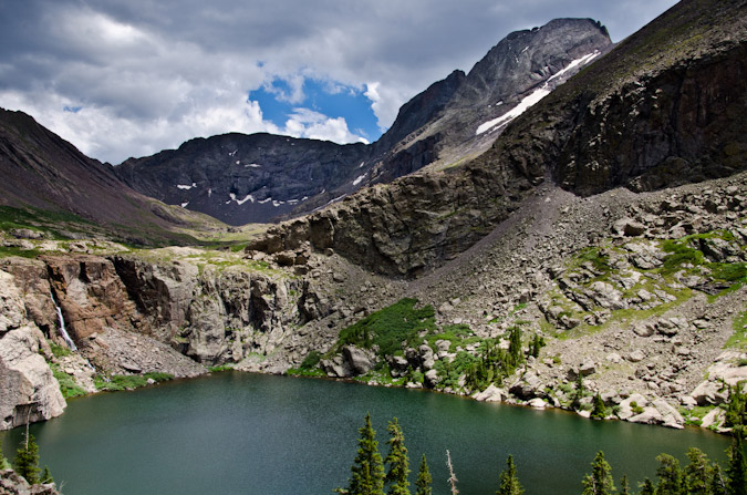
When I was here in 2009, I took a panoramic photo series from the lake, which included the waterfall and a really interesting rock in the lake. I always regretted that photo because it cut the top off of Challenger Point. Not this time!
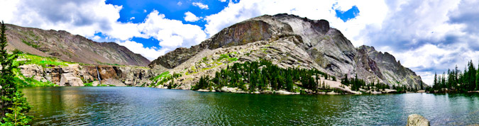
Also, we stopped below the lake to get some amazing shots of the lower waterfall near the trail.
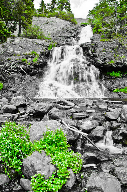
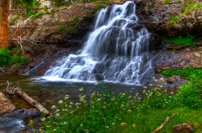
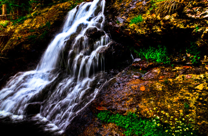
The hike out was pretty uneventful after the waterfalls, except of course for the insane amount of switchbacks on the lower trail. We made it back to the car at 4 PM on the nose, just 14 hours after we started...
|
|
|
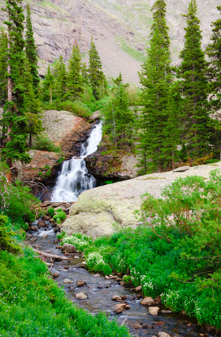
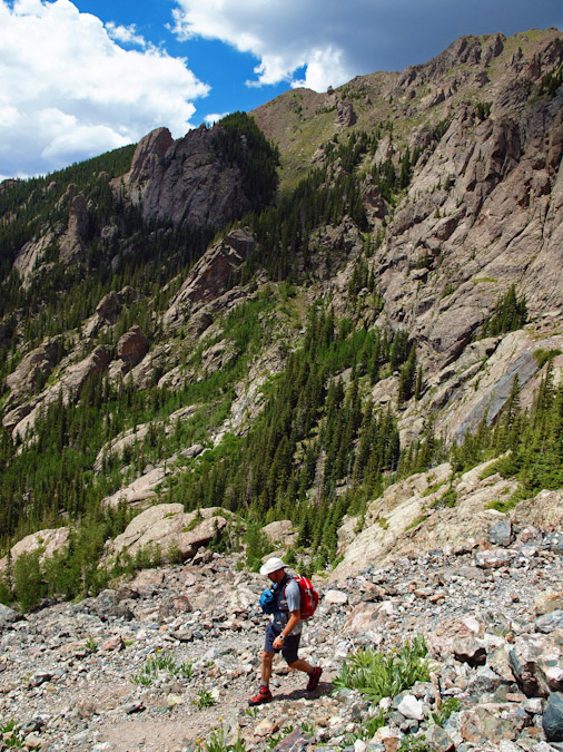
Here's a look at the map, showing our route and elevation profile. Feel free to click on each to see larger versions.
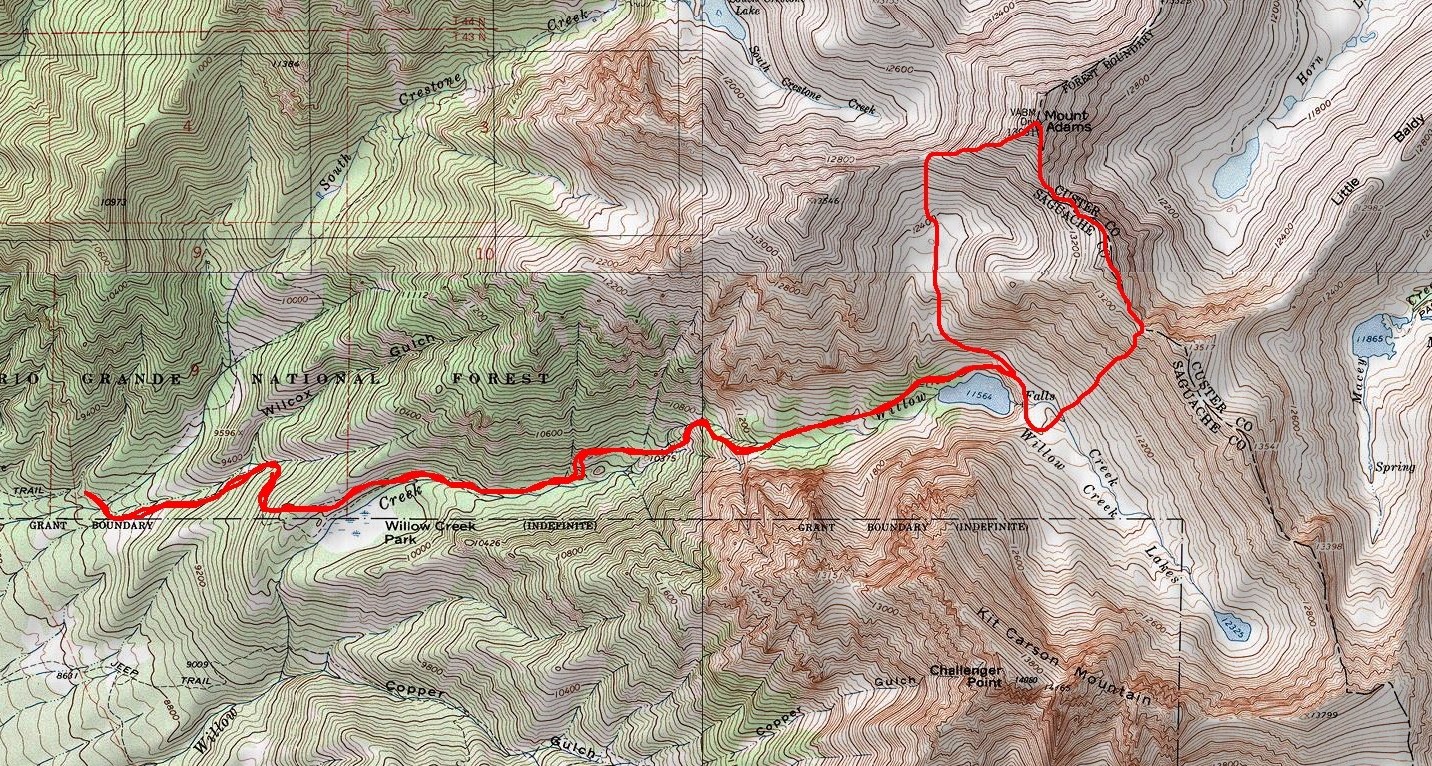
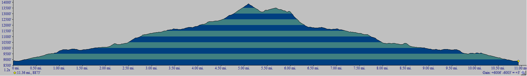
As always, if you liked this report, please feel free to follow 100summits on Twitter or Facebook! Also, if you're planning on doing any online shopping and if you enjoyed the content, please help keep the site going by using the links on this page to help fund the site. And last but not least, if you are interested in purchasing photography from me, please take a moment to read this page for more details. Thanks for stopping by!
Traver Peak in Winter

Traver Peak is a high un-ranked 13er (13,852 ft) in the Tenmile Range just one valley north of the Kite Lake basin, which includes the popular 14ers Lincoln, Democrat and Bross. The valley which Traver calls home is also home of one of the highest 100 summits in Colorado, Clinton Peak, Wheeler Mountain and another un-ranked peak, McNamee Peak. My original plan was to summit Traver Peak, traverse over to McNamee and finish off on top of Clinton Peak...
Since my wife and I had plans for Saturday, I decided to hike on Sunday. My friend Regina had to work, and my other friend, Ethan, had plans with his family, so I put a call out to other climbers on 14ers.com to see if anyone would be interested in giving Traver et. al. a go. Soon, Ryan Marsters (Monster5) from 14ers.com responded that he would join me for the hike. I had never met Ryan before, but we had exchanged several messages last year concerning an incident he was part of on Ellingwood Point where a hiker he was with had an epilectic seizure, and subsequently dislocated her shoulder, forcing Ryan to spend the night with her on the side of a 14er through a thunderstorm.
Anyways, I left my house in Colorado Springs at 4:15 AM to meet up with Ryan at 6:15 at Montgomery Reservoir, which is located just up Highway 9 from the second highest incoroporated town in America, Alma.
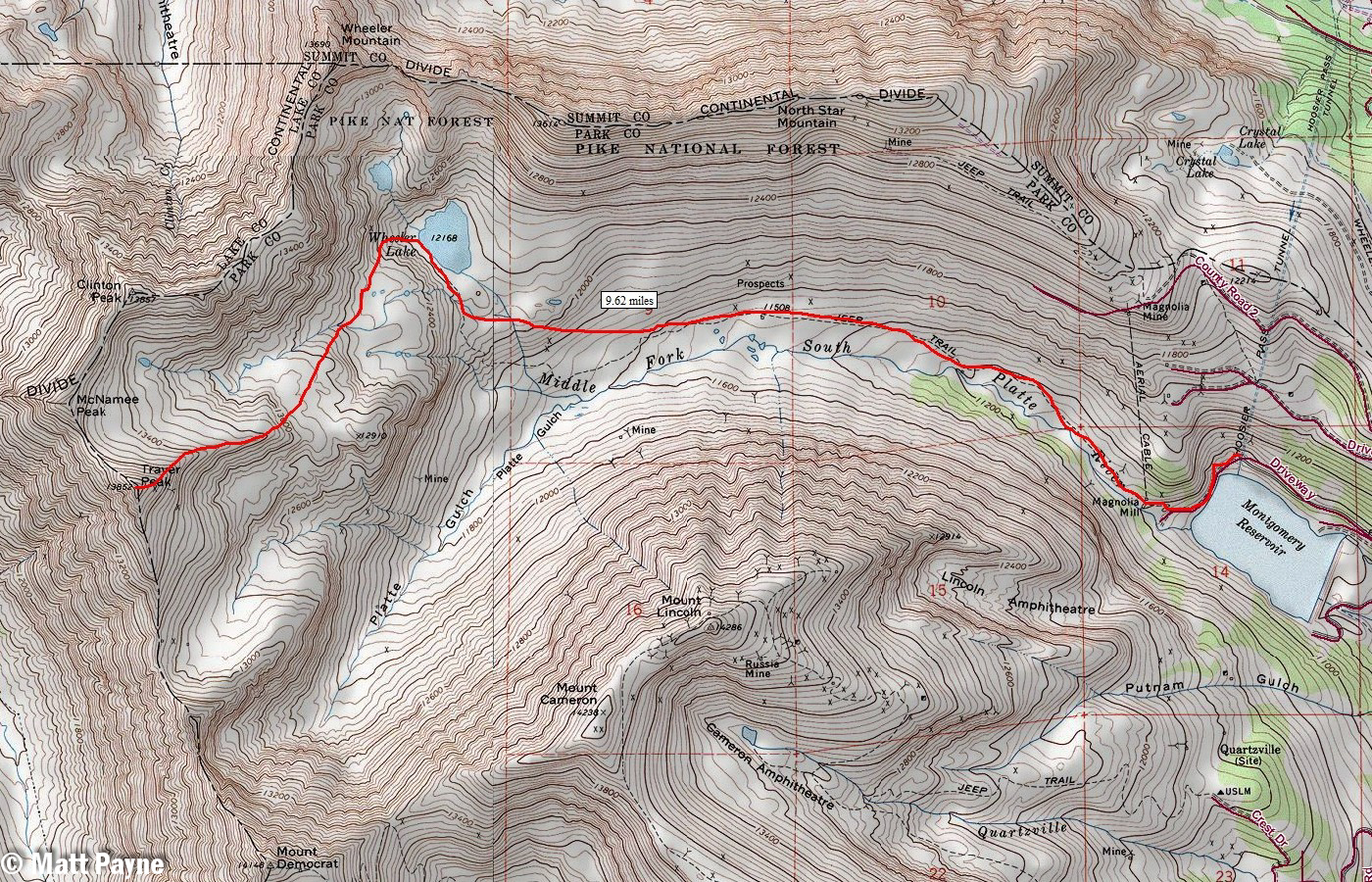
A map of our route up Traver Peak. Click to enlarge.
All in all, we traveled a total of 9.62 miles round-trip and gained 3,000 feet of elevation on snowshoes to conquer this rarely-summited 13er.
I arrived at the reservoir at 6:20 AM and hustled to get ready to hike. The sun had not quite risen yet, but the area was nicely lit by the early morning light.
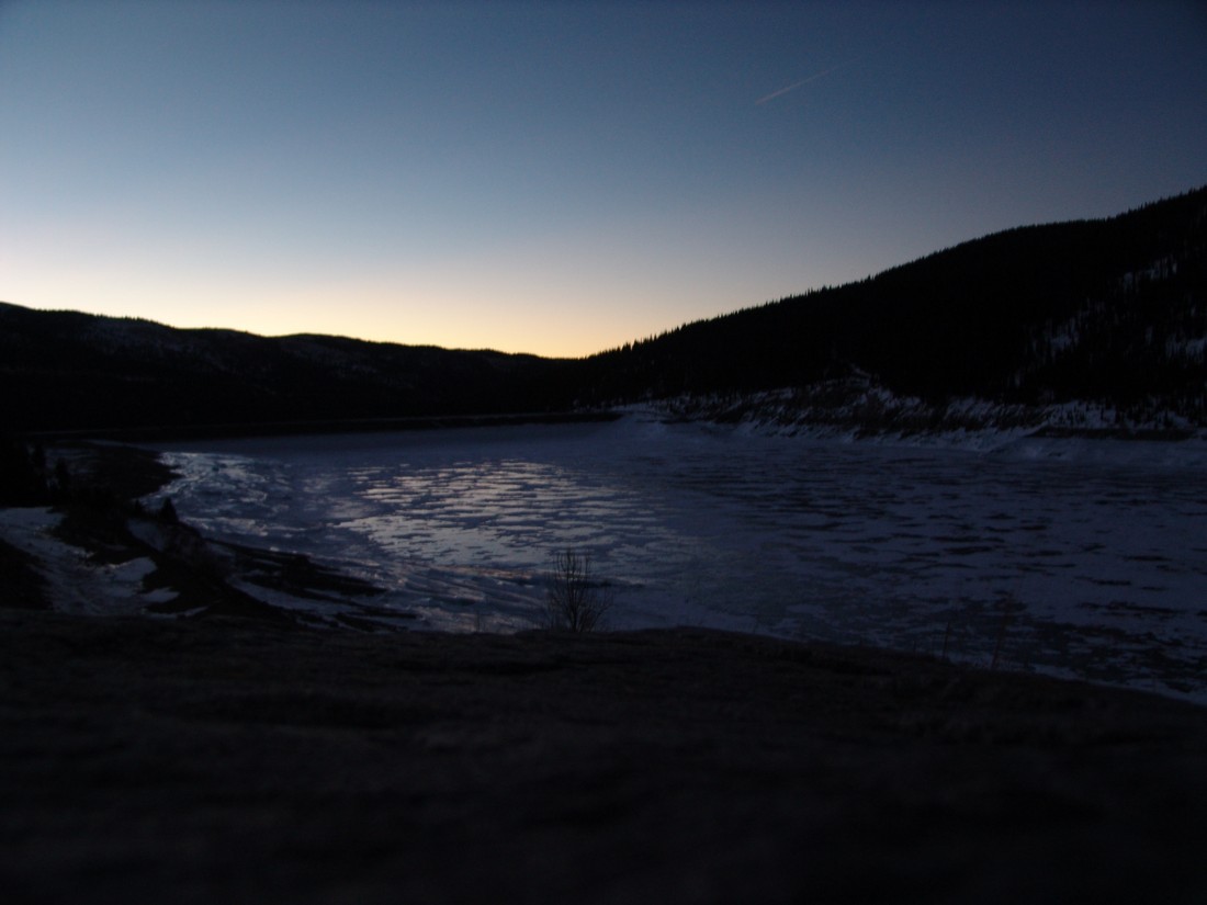
Montgomery Reservoir.
Ryan and I began hiking at about 6:30 AM and made our way up the snowy trail in quick order. Excellent views of the Lincoln Ampitheatre were available as well - it would appear to be a really awesome place to go ice climbing if you were so inclined.
We were able to manage without snowshoes until about a 1/4 of a mile into the hike, right at the base of an old abandoned mine, the snow became too deep and powdery to continue in boots only. We were postholing up to our hips. So, on went the snowshoes for the duration of the hike up. The snow further up the basin was quite hardened, and the wind was blowing quite a lot, which made for some really neat effects on the ground - it was like a dust storm only with snow.
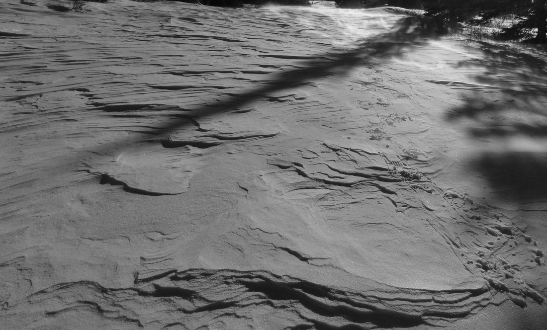
Ryan proved to be a very quick hiker. I felt pretty out of shape for some reason (must be all those holiday calories catching up with me), but I managed to keep up for the most part. It also helped that Ryan was 21-years-old, a good 11 years younger than me. Hehe.
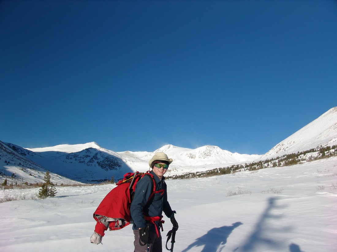
Ryan Marsters - adventurer, geologic engineering student, and hiker extrordinaire.
Views of North Star Mountain were available throughout the day. I had heard a lot of good things about that mountain for winter hiking, and I think it would be a pretty easy one to do on another day.
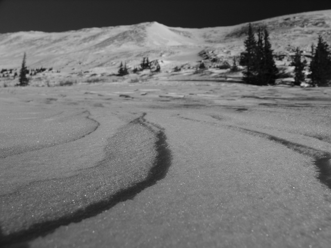
The snow continued to be blown about by the strong winds, which seemed to gust up to 40 or 50 miles per hour throughout the day. Even though the tempurature was around 20-30 degrees, it was still pretty chilly if your skin was exposed to the wind. The blowing snow made for some cool photo opportunities. Also, the snow acted like sand, and it reminded me of the Great Sand Dunes at times.
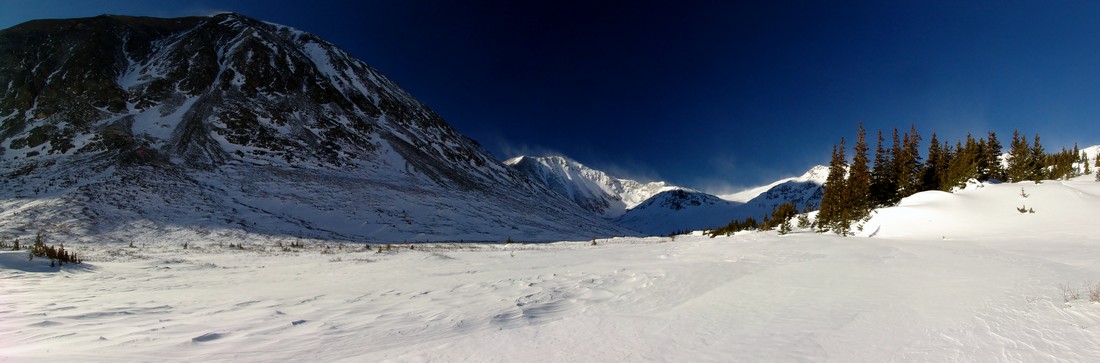
Excellent views of Silverheels Mountain were also available for much of the morning, and it looked pretty wind-blown, confirming reports from a friend of mine, Jason Wichman (who by the way runs a cool photography business), that Silverheels looks quite doable currently.
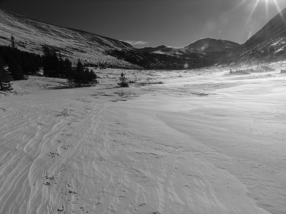
Silverheels looking good in mid-winter (right of center).
The hike up into the basin was quite a haul in snowshoes, so we stopped frequently to take breaks and enjoy the views.
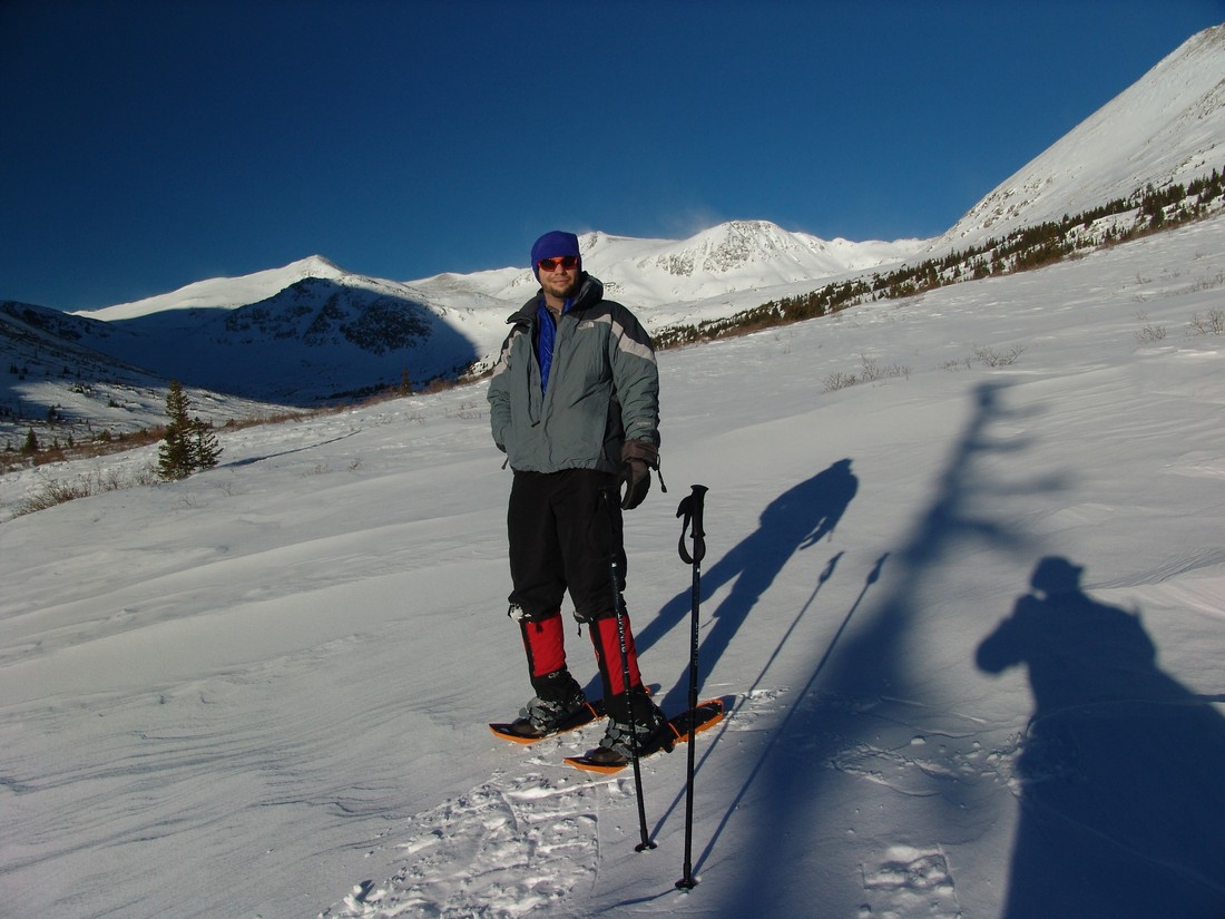
Matt Payne stops to admire the views on the way up to Traver Peak.
I was impressed with the performance of my MSR Lightning Ascent snowshoes for the most part. The heel ascenders really make a difference when hiking up the steep sections, no doubt. If you want to learn more about those shoes, I wrote a review about them.
As we gained more elevation, the terrain became steeper. The snow conditions on the ground became inconsistent, and we were finding ourselves stepping on hard snow one step and soft snow the next, which made for interesting travelling conditions. I could not imagine doing this without snowshoes, but I think skis might be more effective. I might have to give that s shot someday when I have money to buy skiis.
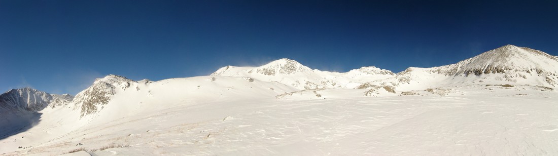
The basin below Wheeler Lake.
We made our way up towards where Wheeler Lake is supposed to be, and of course we found it to be covered completely in snow. It was a pretty location, and I would recommend you check it out when you get a chance. I will probably return sometime in the summer to see the area, because it seems that it would be pretty amazing! The whole basin is surrounded by high peaks in all directions. Can't beat that!
For the most part, the snow on the mountain had a sugary consistency, as seen below:
Once we reached Wheeler Lake, we evaluated the avalanche conditions and agreed that the best route up would be to head to the top of the basin and then up a gully that was the least steep and presented the least amount of avalanche terrain. Once we reached the top of this section, we found ourselevs at the base of Traver and the rest of the peaks in the area. Before heading up Traver, I snapped off this 360 degree pano, highlighting Traver Peak at far left, McNamee, Clinton (the snowy one at center), Quandary, Lincoln and Democrat (far right).

The route up Traver was very straight-forward. We kept our snowshoes on for the extra traction up the mixed rock-and-snow terrain that Traver offered.
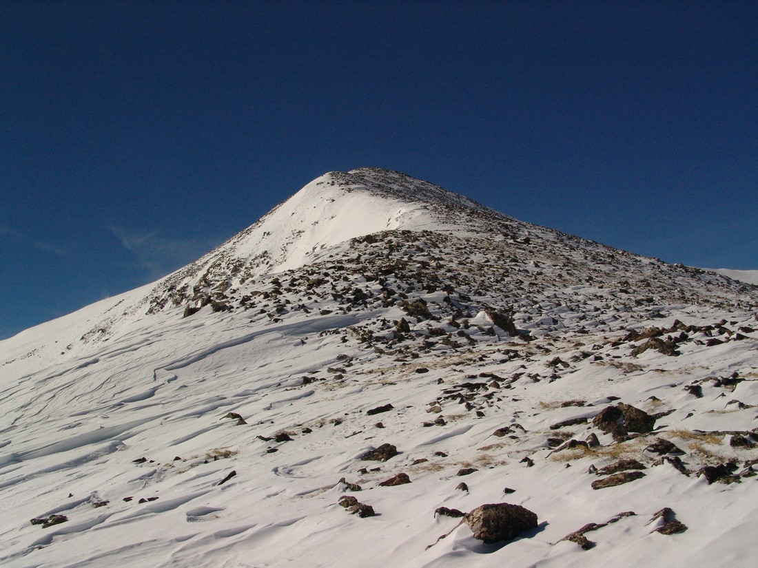
Traver Peak.
As we climbed, views of Democrat and Buckskin were very welcomed. The whole valley instilled a sense of peace within me. Something about being up high in the bright white snow, with wind rushing around - breaking the silence... it was calming.
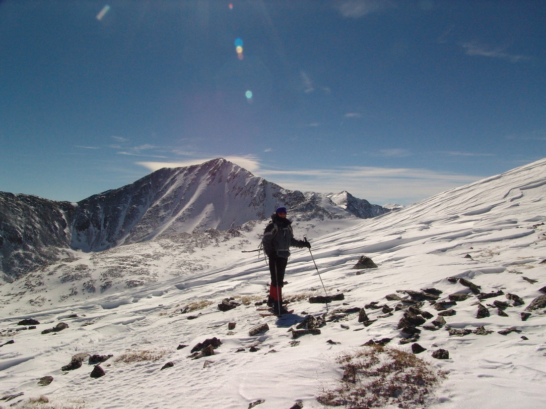
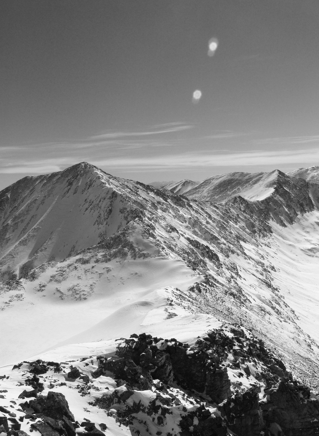
Democrat and Buckskin looking fine in February.
We both finally reached the top of Traver at 12:30 PM and hung out on top for about 30 minutes, taking photos, snacking and discussing all things related to the awesome beauty that laid before our eyes. I was really impressed by the view from Traver - it does not disappoint! The views of Lincoln and Democrat were superb, but what really impressed me was how well you could make out the Collegiates over in the Sawatch Range as well as Mount of the Holy Cross. Additionally, the Gore Range really stood out to the north of us - and we both commented about wanting to go there to enjoy the class 4 climbing offered by that secluded range.

The Sawatch Range.
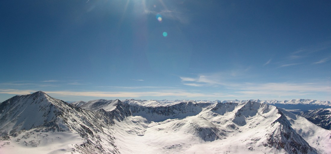
Democrat, Buckskin and the Sawatch Range.
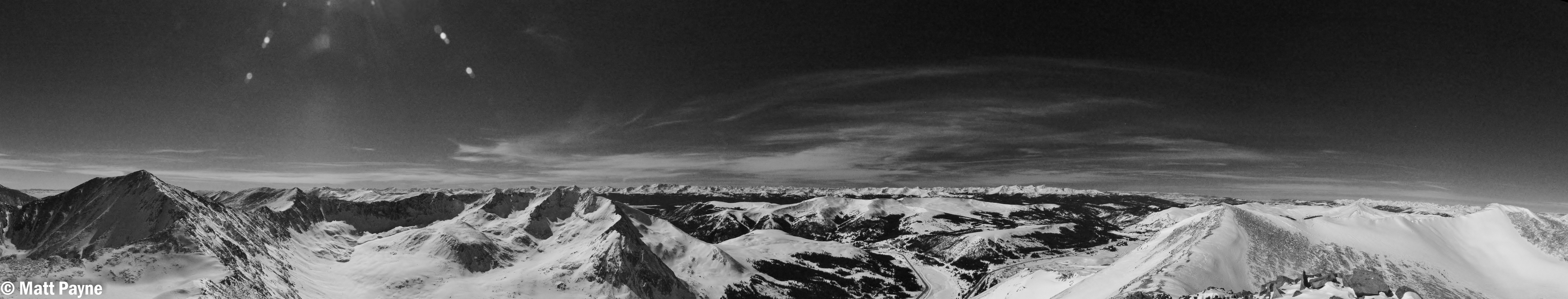
Black and White view of the Sawatch Range.
Views of the Elk Mountains were pretty good too - Snowmass and Capitol stood out pretty nicely. Holy Cross is seen at far right:
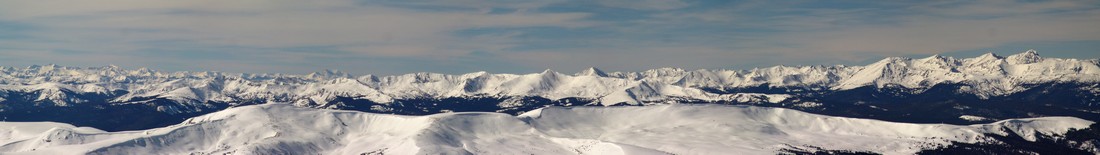
Obligatory 360 degree summit pano:
Ryan captured this photo of me being goofy on the summit:
We started to plan to head over to McNamee and Clinton, but my legs were starting to cramp up so we opted to head down instead since it was already 1 PM. In retrospect, I regret this decision because of how close those two mountains are to where we were at; however, now it gives me an excuse to go back to this really nice valley.
So, Ryan and I took off the snowshoes and headed back down. As soon as we reached the area just above the gully I spoke about before, we had to put our snowshoes back on. The snow was a bit heavier in the afternoon after soaking up the sun, so the going was a little rough. We sunk into the snow a bit more than I would have liked, but we still made great time. It was a tiring affair. Here's a shot Ryan took of me after we made it down the gully:
We finally made it back down to the trailhead at 4 PM, making the entire trip 9.5 hours. I highly recommend this hike to anyone looking to get out this winter! Thanks for reading!
If you find these trip reports useful, you can always follow 100summits.com on Facebook or Twitter to stay updated.